Old Maps of Pleasant Grove, Alabama
Explore 53 old maps of Pleasant Grove, spanning from 1889 to today. These high-resolution historic maps reveal how streets, neighborhoods, landmarks, and natural features evolved over time — perfect for genealogy, metal detecting, research, and local history exploration.
What you can do with these maps:
- See how Pleasant Grove changed over time: Compare historical maps to modern-day views to trace roads, homesites, rail lines & more.
- View detailed metadata: Each map includes creators, publishers, year, scale, and archive source.
- Overlay maps with satellite & LiDAR: Visualize the past alongside modern tools to explore terrain & human change.
- Trusted historical sources: Maps sourced from the USGS, Library of Congress, and other archives.
- Access maps your way: View online, download high-res files, or order prints for personal or research use.
Start exploring old maps of Pleasant Grove to uncover forgotten places, hidden landmarks, and the deep history beneath your feet.
Pleasant Grove, AL maps
(53)- 1889 Map of Birmingham
 1889 Birmingham1889 Print · USGSIn the late nineteenth century, the Iron City was a growing urban core surrounded by intensive extraction sites and river crossings. Trace early industrial footprints at the Pratt Mines, Sloss Quarry, and the Old Irondale Furnace.
 - 1890 Map of Bessemer
 1890 Bessemer1890 Print · USGSCentral Alabama emerges as an industrial powerhouse in the late nineteenth century as railroads weave through the ridges of Jefferson and Shelby counties. Genealogists and historians can trace the early footprints of Bessemer, the iron operations at Sloss, and remote landmarks like Woods Ferry.
 - 1892 Map of Birmingham
 1892 Birmingham1892 Print · USGSBirmingham and the surrounding iron district emerge in the late nineteenth century as a hub of heavy industry and rail expansion. Trace the early footprints of the Sloss Mine, locate river crossings like Doss Ferry, and find family-named landmarks like Hanby Mill.
 - 1892 Map of Bessemer
 1892 Bessemer1892 Print · USGSCentral Alabama was at its industrial peak in the late nineteenth century as railroads and iron mines transformed the ridges south of Birmingham. Genealogists and researchers can trace the early foundations of Bessemer, the operations at Smith Mine, and rural crossings like Nunley's Ford.2 unique versions available
 - 1893 Map of Jasper
 1893 Jasper1893 Print · USGSNorthern Alabama’s coal and timber country comes into focus in the 1890s as railroads began to penetrate the river valleys. Genealogists and historians can trace family-named river crossings like Miller Ferry and Baltimore Ford or early industry at Gamble Mines.5 unique versions available
 - 1895 Map of Birmingham
 1895 Birmingham1895 Print · USGSBirmingham at the peak of its industrial boom is captured here as the city’s rail and mining networks spread through the surrounding valleys. Researchers can trace early iron production at Old Irondale Furnace or locate family roots at Doss Ferry and Pratt Mines.2 unique versions available
 - 1899 Map of Brookwood
 1899 Brookwood1899 Print · USGSCentral Alabama at the close of the nineteenth century is a landscape of growing mining towns and vital river crossings. Trace the early industrial rail lines like the Birmingham Mineral R. R. and locate family landmarks such as Weaver Mill, Pratt Ferry, and Providence Ch.4 unique versions available
 - 1904 Map of Birmingham Coal District, 1967 Print
 1904 Birmingham Coal District1967 Print · USGSJefferson County’s coal-mining heritage is captured here at the start of the twentieth century, showing a landscape defined by industry and iron. Genealogists can trace family roots through coal-camp settlements like Blossburg, Pratt City, and Ensley, or locate old landmarks like Orphans Chapel and Banner Mines.
 - 1905 Map of Bessemer Iron District
 1905 Bessemer Iron District1905 Print · USGSJefferson County was at the peak of its iron-mining boom at the turn of the century, centered on the dense rail networks of Bessemer. Genealogists and industrial historians can trace old residential pockets like Wylam and Brighton alongside the Spaulding Mine and numerous rural river crossings.3 unique versions available
 - 1906 Map of Birmingham Special
 1906 Birmingham Special1906 Print · USGSJefferson County’s coal and rail boom is in full swing on this 1906 sheet, revealing the early industrial footprint of the Birmingham district. Trace the foundations of mining towns like Brookside, find family roots at Mt Olive Church, or locate vanished operations like Banner Mines and Ono PO.4 unique versions available
 - 1907 Map of Birmingham
 1907 Birmingham1907 Print · USGSJefferson and Blount counties are shown in the early twentieth century as the industrial heart of Alabama was taking shape. Genealogists can trace family roots through named landmarks like Box Schoolhouse, Watson PO, and the coal works at Watts Mines.5 unique versions available
 - 1907 Map of Bessemer Special
 1907 Bessemer Special1907 Print · USGSJefferson County industrial development is at its peak in the first decade of the century, centered on the heavy rail networks of the Jones Valley. Genealogists and historians can trace early community centers like Hopewell Church and Canaan Church alongside mining sites at Redding and Ware.4 unique versions available
 - 1927 Map of Adger
 1927 Adger1927 Print · USGSThe industrial heart of Alabama comes alive in the late twenties, showing the intersection of mining and rail. Genealogists can trace family roots at Concord Ch, Connellsville Mine, and the early settlement at Tannehill.
 - 1932 Map of Yolande, 1964 Print
 1932 Yolande1964 Print · USGSThe industrial corridor southwest of Birmingham comes alive in this survey of the early thirties, where coal and iron roots run deep. Trace the rail lines serving Gilmore Mines and Connellsville or locate family sites near McCalla and Yolande.
 - 1935 Map of Port Birmingham
 1935 Port Birmingham1935 Print · USGSThe coal and power corridor of the Black Warrior River is captured here in the mid-1930s, showing a landscape defined by mines and industrial camps. Genealogists can locate family sites at Pennsylvania Camp, Satterfield Cem, or the Barney Mine community.
 - 1935 Map of Yolande
 1935 Yolande1935 Print · USGSThe Jefferson and Tuscaloosa county line was a hub of coal production and rail activity in the 1930s. Researchers can trace the layout of mining communities like Yolande and Johns or locate family roots at Dogwood Ch and Kniss Store.3 unique versions available
 - 1938 Map of Port Birmingham
 1938 Port Birmingham1938 Print · USGSThe river-and-rail industry of the Black Warrior coalfields is captured here in the late 1930s. Genealogists and historians can trace the foundations of local commerce at Port Birmingham and locate vanished river crossings like Underwood Ferry or the Atwood Ferry.4 unique versions available
 - 1953 Map of Birmingham, 1964 Print
 1953 Birmingham1964 Print · USGSCentral Alabama at mid-century shows a landscape defined by industrial expansion and the iron-rich ridges surrounding Birmingham. Researchers can trace the extensive rail networks of the L & N RR or locate historic federal sites like the Anniston Ordnance Depot.4 unique versions available
 - 1956 Map of Birmingham
 1956 Birmingham1956 Print · USGSCentral Alabama in the mid-fifties exhibits a landscape of growing cities and deep-rooted industrial corridors. Genealogists and historians can trace the development of suburban Mountain Brook or locate regional hubs like Sylacauga and Jasper.
 - 1957 Map of Birmingham
 1957 Birmingham1957 Print · USGSNorth-Central Alabama in the mid-fifties is an industrial powerhouse centered on the steel valleys and sprawling iron ridges. Genealogists and historians can trace the rail-linked growth of Birmingham and Tuscaloosa, or locate rural landmarks like Talladega College and the Anniston Ordnance Depot.
 - 1959 Map of Bessemer, 1960 Print
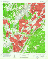 1959 Bessemer1960 Print · USGSThe industrial heart of Jefferson County thrives at mid-century, defined by a dense intersection of heavy rail and emerging suburbs. Researchers can trace the footprints of Miles Memorial College and historic sites like Cedar Hill Cemetery or Brighton High Sch.5 unique versions available
 - 1959 Map of Adamsville, 1960 Print
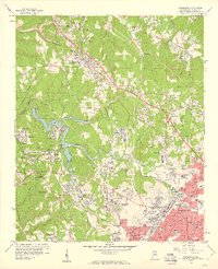 1959 Adamsville1960 Print · USGSWestern Jefferson County in the late fifties shows a landscape defined by the coal industry and early suburban growth. Genealogists and researchers can trace family roots through numerous local landmarks like Crumley Chapel, Mulga Mine, and Glasgow Hill Cem.4 unique versions available
 - 1971 Map of Sylvan Springs, 1973 Print
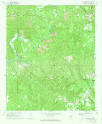 1971 Sylvan Springs1973 Print · USGSJefferson County in the early seventies shows an active landscape of river commerce and coal extraction along the Locust Fork. Researchers can trace the industrial rail networks of the Birmingham Southern or locate family sites like Atwood Cem and Powhatan.3 unique versions available
 - 1975 Map of Yolande NE, 1977 Print
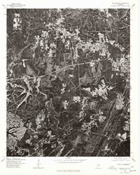 1975 Yolande NE1977 Print · USGSJefferson County’s industrial and residential fringes come into sharp focus in the mid-1970s. Researchers can trace the development of Hueytown and Virginia, or follow the winding path of Valley Creek through the wooded hills.
 - 1975 Map of Adamsville, 1977 Print
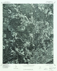 1975 Adamsville1977 Print · USGSBirmingham and its northwestern suburbs are captured in high-detail aerial imagery during the mid-seventies. Local researchers can trace the growth of the city core in Birmingham and examine the early suburban patterns developing around Adamsville.
Showing maps 1-25 of 53
Top cities near Pleasant Grove
- Birmingham historical maps
- Hoover historical maps
- Hoover historical maps
- Vestavia Hills historical maps
- Homewood historical maps
- Bessemer historical maps
See more
Top neighborhoods of Pleasant Grove
- Cottage Hill historical maps
- Highland Forest historical maps
- Pleasant Acres historical maps
- Pleasant Grove Estates historical maps
- Cedarbrook Forest historical maps
Frequently asked questions
- What are the different types of historical maps available for Pleasant Grove?
- What is the oldest map of Pleasant Grove?
- Where can I purchase historical maps of Pleasant Grove for my home or office?
- Where can I download high-res historical maps of Pleasant Grove?
- Are there historical topographic maps available for Pleasant Grove?
- Is there historical aerial imagery available for Pleasant Grove?
- Where are historical maps of Pleasant Grove sourced from?