Old Maps of Whale Pass, Alaska
Explore 7 old maps of Whale Pass, spanning from 1949 to today. These high-resolution historic maps reveal how streets, neighborhoods, landmarks, and natural features evolved over time — perfect for genealogy, metal detecting, research, and local history exploration.
What you can do with these maps:
- See how Whale Pass changed over time: Compare historical maps to modern-day views to trace roads, homesites, rail lines & more.
- View detailed metadata: Each map includes creators, publishers, year, scale, and archive source.
- Overlay maps with satellite & LiDAR: Visualize the past alongside modern tools to explore terrain & human change.
- Trusted historical sources: Maps sourced from the USGS, Library of Congress, and other archives.
- Access maps your way: View online, download high-res files, or order prints for personal or research use.
Start exploring old maps of Whale Pass to uncover forgotten places, hidden landmarks, and the deep history beneath your feet.
Whale Pass, AK maps
(7)- 1949 Map of Petersburg A-4, 1964 Print
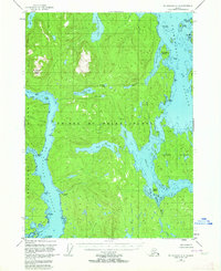 1949 Petersburg A-41964 Print · USGSSoutheast Alaska's intricate coastline and dense forests are captured here at mid-century, before the development of modern road systems. Researchers can trace the waterborne paths through Whale Passage or locate the site of Camp Taylor (Aband).3 unique versions available
 - 1952 Map of Petersburg, 1953 Print
 1952 Petersburg1953 Print · USGSSoutheast Alaska's intricate Alexander Archipelago comes to life in the early fifties, documenting a landscape of remote island settlements and maritime corridors. Genealogists and historians can trace coastal life in Petersburg and Wrangell, or locate early industry at Shakan and regional Mines.5 unique versions available
 - 1953 Map of Petersburg A-4, 1954 Print
 1953 Petersburg A-41954 Print · USGSSoutheast Alaska's intricate Alexander Archipelago is captured here in the early fifties, showing the water-dependent landscape of the Tongass National Forest. Researchers can trace the coastal site of Camp Taylor (Aband) or locate landmarks like El Capitan Peak and Neck Lake.2 unique versions available
 - 1960 Map of Petersburg, 1966 Print
 1960 Petersburg1966 Print · USGSSoutheast Alaska's maritime landscape is captured here in the mid-1900s, showcasing the intricate island networks of the Alexander Archipelago. Researchers can trace historic shorelines and island settlements from Petersburg and Kake to the Wrangell Cemetery and the Stikine River.3 unique versions available
 - 1994 Map of Petersburg A-4, 1998 Print
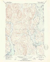
 1994 Petersburg A-41998 Print · USGSPrince of Wales Island and the Tongass National Forest are shown in the 1990s as the timber industry and wilderness management shaped the coast. Researchers can trace land use near Whale Pass, El Capitan Work Center, and Camp Taylor (Site).
 - 2017 Map of Petersburg A-4 SE, 2017 Print
 2017 Petersburg A-4 SE2017 Print · USGSCovers Whale Pass, including Unorganized Borough, Prince of Wales-Hyder, and other nearby areas
 - 2021 Map of Petersburg A-4 SE, 2021 Print
 2021 Petersburg A-4 SE2021 Print · USGSThe Prince of Wales Island coastline comes into focus in this recent survey, showcasing the maritime community and its surrounding timberlands. Trace the local geography around Whale Pass, from the shores of Neck Lake to the trails of the Sarkar Canoe Route Trl.
End of results
Showing maps 1-7 of 7
Top cities near Whale Pass
Frequently asked questions
- What are the different types of historical maps available for Whale Pass?
- What is the oldest map of Whale Pass?
- Where can I purchase historical maps of Whale Pass for my home or office?
- Where can I download high-res historical maps of Whale Pass?
- Are there historical topographic maps available for Whale Pass?
- Is there historical aerial imagery available for Whale Pass?
- Where are historical maps of Whale Pass sourced from?