Old Maps of Tag, Arkansas
Explore 16 old maps of Tag, spanning from 1889 to today. These high-resolution historic maps reveal how streets, neighborhoods, landmarks, and natural features evolved over time — perfect for genealogy, metal detecting, research, and local history exploration.
What you can do with these maps:
- See how Tag changed over time: Compare historical maps to modern-day views to trace roads, homesites, rail lines & more.
- View detailed metadata: Each map includes creators, publishers, year, scale, and archive source.
- Overlay maps with satellite & LiDAR: Visualize the past alongside modern tools to explore terrain & human change.
- Trusted historical sources: Maps sourced from the USGS, Library of Congress, and other archives.
- Access maps your way: View online, download high-res files, or order prints for personal or research use.
Start exploring old maps of Tag to uncover forgotten places, hidden landmarks, and the deep history beneath your feet.
Tag, AR maps
(16)- 1889 Map of Treat
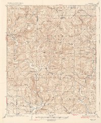
 1889 Treat1889 Print · USGSInland Pope County is shown in this rare nineteenth-century advance sheet during the early geological survey of the state. Researchers can trace the original topography around the Laurel settlement and family-named landmarks like Evans Hill and Levi Br.
 - 1932 Map of Treat, 1972 Print
 1932 Treat1972 Print · USGSThe Arkansas Ozarks come alive in this early 1930s survey of the Piney Creek highlands. Researchers can trace rural life through numerous one-room schools like Ross Sch and remote outposts like Sand Gap Felsor PO or Fort Douglas.
 - 1934 Map of Treat
 1934 Treat1934 Print · USGSPope County highlands during the early thirties show a rugged network of forest outposts and mountain schools. Researchers can trace the layout of community sites like Sand Gap Pelsor PO, Ross Sch, and the Fairview Fire Tower.3 unique versions available
 - 1956 Map of Russellville
 1956 Russellville1956 Print · USGSThe Arkansas River valley and the surrounding Boston Mountains are captured here in the mid-fifties, showing a landscape of small timber towns and new reservoirs. Genealogists can trace family roots through upland settlements like Pelsor and Witts Springs or locate the campus of Arkansas Polytechnic College.2 unique versions available
 - 1964 Map of Russellville
 1964 Russellville1964 Print · USGSMid-century Central Arkansas is defined here by the river-valley towns and the surrounding mountain ranges before the full expansion of the interstate system. Genealogists and historians can trace rail-town development along the Missouri Pacific Railroad and locate landmarks like Arkansas Polytechnic College or Petit Jean State Park.
 - 1974 Map of Treat SE, 1975 Print
 1974 Treat SE1975 Print · USGSNorthern Pope County's timbered hills and rural clearings are captured in this mid-1970s aerial survey. Researchers can trace the winding course of the North Fork Illinois Bayou and locate the small settlement of Simpson.
 - 1977 Map of Russellville
 1977 Russellville1977 Print · USGSThe Arkansas River Valley and surrounding Ozark Mountains are documented here during a period of significant postwar growth and infrastructure development. Genealogists and researchers can locate family landmarks such as Mount Carmel Cem, St Josephs Church, and several remote Coal Mine sites along the Missouri Pacific RR line.
 - 1980 Map of Simpson
 1980 Simpson1980 Print · USGSThe Ozark highlands of Pope County appear here in the late seventies, showing a landscape of deep timber and winding bayous. Researchers can locate remote family burials at Oak Grove Cem and Sherman Cem or trace old tracks through Moccasin Gap.2 unique versions available
 - 1983 Map of Fly Gap Mountain
 1983 Fly Gap Mountain1983 Print · USGSThe high Ozarks in the early eighties were a landscape of deep river valleys and isolated mountain gaps. Researchers can locate remote settlements like Venus and Cass, or trace family sites at Oark Cem, White Rock Cem, and the Pelsor Post Office.
 - 1984 Map of Russellville
 1984 Russellville1984 Print · USGSThe Arkansas River valley was undergoing significant change in the 1950s as transportation and water management reshaped the region from Russellville to Conway. Researchers can trace the era's rail networks like the Missouri Pacific RR and explore landmarks like Magazine Mountain and Petit Jean State Park.
 - 1992 Map of Russellville, 1993 Print
 1992 Russellville1993 Print · USGSCentral Arkansas in the early nineties shows a landscape defined by the Arkansas River valley and the surrounding national forests. Trace the development of river towns like Russellville and Dardanelle alongside landmarks such as Lake Dardanelle and Magazine Mtn.
 - 2011 Map of Simpson, 2011 Print
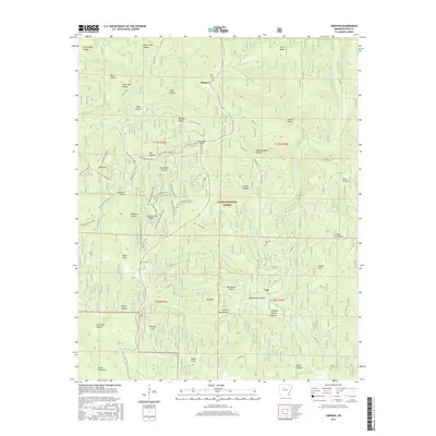
 2011 Simpson2011 Print · USGSCovers Tag, including Simpson, Pope County, and other nearby areas
 - 2014 Map of Simpson, 2014 Print
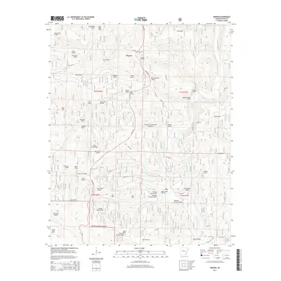 2014 Simpson2014 Print · USGSCovers Tag, including Simpson, Pope County, and other nearby areas
 - 2017 Map of Simpson, 2017 Print
 2017 Simpson2017 Print · USGSCovers Tag, including Simpson, Pope County, and other nearby areas
 - 2020 Map of Simpson, 2020 Print
 2020 Simpson2020 Print · USGSCovers Tag, including Simpson, Pope County, and other nearby areas
 - 2024 Map of Simpson, 2024 Print
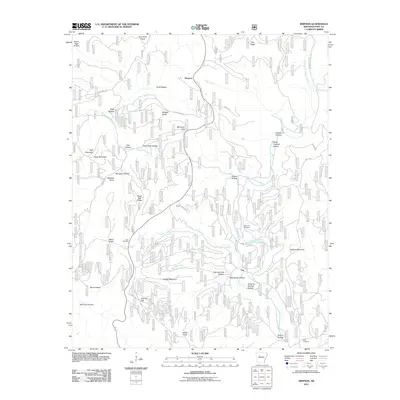
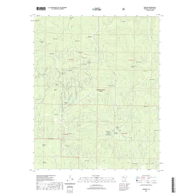
 2024 Simpson2024 Print · USGSPope County’s upland terrain is documented in this recent survey of the Ozark National Forest near Simpson. Researchers can trace local history through family landmarks like Bates Knob and several remote burial sites including Oak Grove Cem and Sherman Cem.
End of results
Showing maps 1-16 of 16
Top cities near Tag
Frequently asked questions
- What are the different types of historical maps available for Tag?
- What is the oldest map of Tag?
- Where can I purchase historical maps of Tag for my home or office?
- Where can I download high-res historical maps of Tag?
- Are there historical topographic maps available for Tag?
- Is there historical aerial imagery available for Tag?
- Where are historical maps of Tag sourced from?