Old Maps of Lake Balboa Neighborhood Council District, Los Angeles
Explore 31 old maps of Lake Balboa Neighborhood Council District, spanning from 1894 to today. These high-resolution historic maps reveal how streets, neighborhoods, landmarks, and natural features evolved over time — perfect for genealogy, metal detecting, research, and local history exploration.
What you can do with these maps:
- See how Lake Balboa Neighborhood Council District changed over time: Compare historical maps to modern-day views to trace roads, homesites, rail lines & more.
- View detailed metadata: Each map includes creators, publishers, year, scale, and archive source.
- Overlay maps with satellite & LiDAR: Visualize the past alongside modern tools to explore terrain & human change.
- Trusted historical sources: Maps sourced from the USGS, Library of Congress, and other archives.
- Access maps your way: View online, download high-res files, or order prints for personal or research use.
Start exploring old maps of Lake Balboa Neighborhood Council District to uncover forgotten places, hidden landmarks, and the deep history beneath your feet.
Lake Balboa Neighborhood Council District, Los Angeles maps
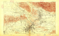
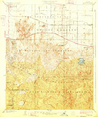
(31)- 1894 Map of Los Angeles
 1894 Los Angeles1894 Print · USGSCovers Lake Balboa Neighborhood Council District, including Los Angeles, Glendale, and other nearby areas2 unique versions available
 - 1896 Map of Santa Monica
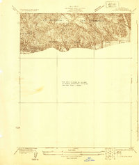
 1896 Santa Monica1896 Print · USGSCovers Lake Balboa Neighborhood Council District, including Los Angeles, Glendale, and other nearby areas
 - 1898 Map of Santa Monica
 1898 Santa Monica1898 Print · USGSCovers Lake Balboa Neighborhood Council District, including Los Angeles, Glendale, and other nearby areas
 - 1900 Map of Los Angeles
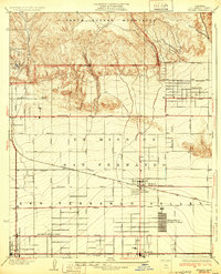
 1900 Los Angeles1900 Print · USGSCovers Lake Balboa Neighborhood Council District, including Los Angeles, Glendale, and other nearby areas8 unique versions available
 - 1901 Map of Southern California Sheet No. 1
 1901 Southern California Sheet No. 11901 Print · USGSCovers Lake Balboa Neighborhood Council District, including Los Angeles, Long Beach, and other nearby areas11 unique versions available
 - 1902 Map of Santa Monica
 1902 Santa Monica1902 Print · USGSCovers Lake Balboa Neighborhood Council District, including Los Angeles, Glendale, and other nearby areas4 unique versions available
 - 1903 Map of Calabasas
 1903 Calabasas1903 Print · USGSCovers Lake Balboa Neighborhood Council District, including Los Angeles, Simi Valley, and other nearby areas9 unique versions available
 - 1903 Map of Camulos
 1903 Camulos1903 Print · USGSCovers Lake Balboa Neighborhood Council District, including Los Angeles, Santa Clarita, and other nearby areas5 unique versions available
 - 1904 Map of Southern California Sheet No. 1, 1905 Print
 1904 Southern California Sheet No. 11905 Print · USGSCovers Lake Balboa Neighborhood Council District, including Los Angeles, Long Beach, and other nearby areas3 unique versions available
 - 1920 Map of Santa Monica
 1920 Santa Monica1920 Print · USGSCovers Lake Balboa Neighborhood Council District, including Los Angeles, Glendale, and other nearby areas
 - 1921 Map of Santa Monica
 1921 Santa Monica1921 Print · USGSCovers Lake Balboa Neighborhood Council District, including Los Angeles, Glendale, and other nearby areas3 unique versions available
 - 1924 Map of Van Nuys
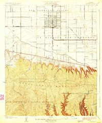
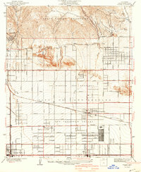
 1924 Van Nuys1924 Print · USGSCovers Lake Balboa Neighborhood Council District, including Los Angeles, Beverly Hills, and other nearby areas
 - 1926 Map of Van Nuys
 1926 Van Nuys1926 Print · USGSCovers Lake Balboa Neighborhood Council District, including Los Angeles, Beverly Hills, and other nearby areas4 unique versions available
 - 1927 Map of Pacoima
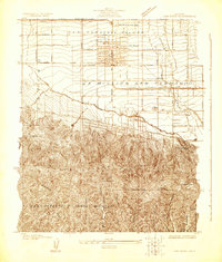
 1927 Pacoima1927 Print · USGSCovers Lake Balboa Neighborhood Council District, including Los Angeles, San Fernando, and other nearby areas4 unique versions available
 - 1928 Map of Zelzah
 1928 Zelzah1928 Print · USGSCovers Lake Balboa Neighborhood Council District, including Los Angeles, Deer Lake Highlands, and other nearby areas
 - 1928 Map of Reseda
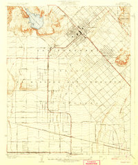
 1928 Reseda1928 Print · USGSCovers Lake Balboa Neighborhood Council District, including Los Angeles, Topanga, and other nearby areas4 unique versions available
 - 1929 Map of Zelzah
 1929 Zelzah1929 Print · USGSCovers Lake Balboa Neighborhood Council District, including Los Angeles, Deer Lake Highlands, and other nearby areas
 - 1932 Map of Zelzah
 1932 Zelzah1932 Print · USGSCovers Lake Balboa Neighborhood Council District, including Los Angeles, Deer Lake Highlands, and other nearby areas
 - 1941 Map of Zelzah
 1941 Zelzah1941 Print · USGSCovers Lake Balboa Neighborhood Council District, including Los Angeles, Deer Lake Highlands, and other nearby areas2 unique versions available
 - 1944 Map of Calabasas
 1944 Calabasas1944 Print · USGSCovers Lake Balboa Neighborhood Council District, including Los Angeles, Simi Valley, and other nearby areas
 - 1949 Map of Los Angeles
 1949 Los Angeles1949 Print · USGSCovers Lake Balboa Neighborhood Council District, including Los Angeles, Oxnard, and other nearby areas3 unique versions available
 - 1952 Map of Canoga Park, 1954 Print
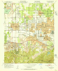 1952 Canoga Park1954 Print · USGSCovers Lake Balboa Neighborhood Council District, including Los Angeles, Calabasas, and other nearby areas7 unique versions available
 - 1953 Map of Van Nuys, 1955 Print
 1953 Van Nuys1955 Print · USGSCovers Lake Balboa Neighborhood Council District, including Los Angeles, Los Angeles County, and other nearby areas2 unique versions available
 - 1955 Map of Los Angeles
 1955 Los Angeles1955 Print · USGSCovers Lake Balboa Neighborhood Council District, including Los Angeles, Oxnard, and other nearby areas
 - 1959 Map of Los Angeles
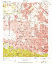
 1959 Los Angeles1959 Print · USGSCovers Lake Balboa Neighborhood Council District, including Los Angeles, Oxnard, and other nearby areas3 unique versions available
Showing maps 1-25 of 31
Frequently asked questions
- What are the different types of historical maps available for Lake Balboa Neighborhood Council District?
- What is the oldest map of Lake Balboa Neighborhood Council District?
- Where can I purchase historical maps of Lake Balboa Neighborhood Council District for my home or office?
- Where can I download high-res historical maps of Lake Balboa Neighborhood Council District?
- Are there historical topographic maps available for Lake Balboa Neighborhood Council District?
- Is there historical aerial imagery available for Lake Balboa Neighborhood Council District?
- Where are historical maps of Lake Balboa Neighborhood Council District sourced from?