Old Maps of Rialto, California
Explore 33 old maps of Rialto, spanning from 1896 to today. These high-resolution historic maps reveal how streets, neighborhoods, landmarks, and natural features evolved over time — perfect for genealogy, metal detecting, research, and local history exploration.
What you can do with these maps:
- See how Rialto changed over time: Compare historical maps to modern-day views to trace roads, homesites, rail lines & more.
- View detailed metadata: Each map includes creators, publishers, year, scale, and archive source.
- Overlay maps with satellite & LiDAR: Visualize the past alongside modern tools to explore terrain & human change.
- Trusted historical sources: Maps sourced from the USGS, Library of Congress, and other archives.
- Access maps your way: View online, download high-res files, or order prints for personal or research use.
Start exploring old maps of Rialto to uncover forgotten places, hidden landmarks, and the deep history beneath your feet.
Rialto, CA maps
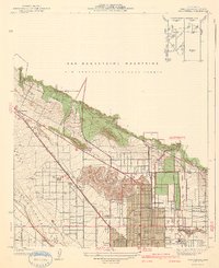
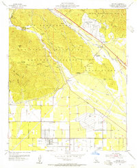
(33)- 1896 Map of San Bernardino
 1896 San Bernardino1896 Print · USGSCovers Rialto, including Riverside, Fontana, and other nearby areas
 - 1898 Map of San Bernardino
 1898 San Bernardino1898 Print · USGSCovers Rialto, including Riverside, Fontana, and other nearby areas
 - 1901 Map of Southern California Sheet No. 1
 1901 Southern California Sheet No. 11901 Print · USGSCovers Rialto, including Los Angeles, Long Beach, and other nearby areas6 unique versions available
 - 1901 Map of San Bernardino
 1901 San Bernardino1901 Print · USGSCovers Rialto, including Riverside, Fontana, and other nearby areas8 unique versions available
 - 1904 Map of Southern California Sheet No. 1, 1905 Print
 1904 Southern California Sheet No. 11905 Print · USGSCovers Rialto, including Los Angeles, Long Beach, and other nearby areas2 unique versions available
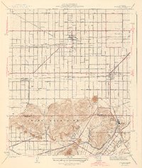
 - 1936 Map of Devore
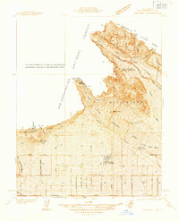 1936 Devore1936 Print · USGSCovers Rialto, including Fontana, Rancho Cucamonga, and other nearby areas
 - 1936 Map of Arrowhead
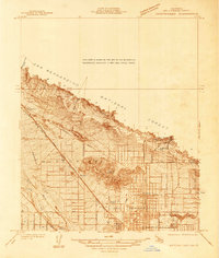 1936 Arrowhead1936 Print · USGSCovers Rialto, including Highland, Muscoy, and other nearby areas
 - 1938 Map of Colton
 1938 Colton1938 Print · USGSCovers Rialto, including Riverside, Jurupa Valley, and other nearby areas
 - 1941 Map of Devore
 1941 Devore1941 Print · USGSCovers Rialto, including Fontana, Rancho Cucamonga, and other nearby areas2 unique versions available
 - 1941 Map of Arrowhead
 1941 Arrowhead1941 Print · USGSCovers Rialto, including Highland, Muscoy, and other nearby areas2 unique versions available
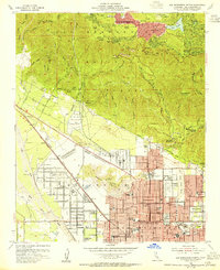
 - 1942 Map of San Bernardino
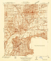
 1942 San Bernardino1942 Print · USGSCovers Rialto, including Riverside, Fontana, and other nearby areas
 - 1943 Map of Fontana
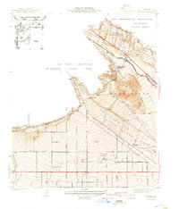
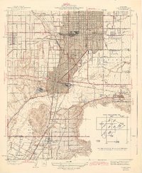
 1943 Fontana1943 Print · USGSCovers Rialto, including Riverside, Fontana, and other nearby areas3 unique versions available
 - 1943 Map of Colton
 1943 Colton1943 Print · USGSCovers Rialto, including Riverside, Jurupa Valley, and other nearby areas2 unique versions available
 - 1953 Map of San Bernardino
 1953 San Bernardino1953 Print · USGSCovers Rialto, including Riverside, Fontana, and other nearby areas2 unique versions available
 - 1953 Map of Fontana, 1955 Print
 1953 Fontana1955 Print · USGSCovers Rialto, including Riverside, Fontana, and other nearby areas2 unique versions available
 - 1954 Map of Devore, 1955 Print
 1954 Devore1955 Print · USGSCovers Rialto, including Fontana, Rancho Cucamonga, and other nearby areas2 unique versions available
 - 1954 Map of San Bernardino North, 1955 Print
 1954 San Bernardino North1955 Print · USGSCovers Rialto, including Highland, Muscoy, and other nearby areas2 unique versions available
 - 1954 Map of San Bernardino South, 1955 Print
 1954 San Bernardino South1955 Print · USGSCovers Rialto, including Riverside, Jurupa Valley, and other nearby areas2 unique versions available
 - 1954 Map of San Bernardino, 1959 Print
 1954 San Bernardino1959 Print · USGSCovers Rialto, including Riverside, Fontana, and other nearby areas2 unique versions available
 - 1956 Map of San Bernardino
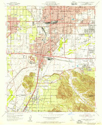
 1956 San Bernardino1956 Print · USGSCovers Rialto, including Riverside, Fontana, and other nearby areas
 - 1957 Map of San Bernardino
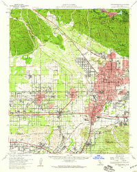
 1957 San Bernardino1957 Print · USGSCovers Rialto, including Riverside, Fontana, and other nearby areas
 - 1958 Map of San Bernardino, 1975 Print
 1958 San Bernardino1975 Print · USGSCovers Rialto, including Riverside, Fontana, and other nearby areas
 - 1959 Map of San Bernardino
 1959 San Bernardino1959 Print · USGSCovers Rialto, including Riverside, Fontana, and other nearby areas
 - 1966 Map of San Bernardino
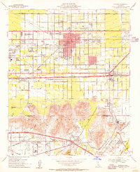
 1966 San Bernardino1966 Print · USGSCovers Rialto, including Riverside, Fontana, and other nearby areas
 - 1966 Map of Devore, 1968 Print
 1966 Devore1968 Print · USGSCovers Rialto, including Fontana, Rancho Cucamonga, and other nearby areas6 unique versions available
Showing maps 1-25 of 33
Top cities near Rialto
- Riverside historical maps
- Fontana historical maps
- Moreno Valley historical maps
- Ontario historical maps
- Rancho Cucamonga historical maps
- Corona historical maps
See more
Top neighborhoods of Rialto
Frequently asked questions
- What are the different types of historical maps available for Rialto?
- What is the oldest map of Rialto?
- Where can I purchase historical maps of Rialto for my home or office?
- Where can I download high-res historical maps of Rialto?
- Are there historical topographic maps available for Rialto?
- Is there historical aerial imagery available for Rialto?
- Where are historical maps of Rialto sourced from?