Old Maps of Loveland, Colorado
Explore 43 old maps of Loveland, spanning from 1902 to today. These high-resolution historic maps reveal how streets, neighborhoods, landmarks, and natural features evolved over time — perfect for genealogy, metal detecting, research, and local history exploration.
What you can do with these maps:
- See how Loveland changed over time: Compare historical maps to modern-day views to trace roads, homesites, rail lines & more.
- View detailed metadata: Each map includes creators, publishers, year, scale, and archive source.
- Overlay maps with satellite & LiDAR: Visualize the past alongside modern tools to explore terrain & human change.
- Trusted historical sources: Maps sourced from the USGS, Library of Congress, and other archives.
- Access maps your way: View online, download high-res files, or order prints for personal or research use.
Start exploring old maps of Loveland to uncover forgotten places, hidden landmarks, and the deep history beneath your feet.
Loveland, CO maps
(43)- 1902 Map of Greeley
 1902 Greeley1902 Print · USGSThe northern Colorado plains come alive in this survey of the South Platte and Cache la Poudre river valleys. Researchers can trace early railroad expansion and irrigation networks while locating specific homesteads like Klugs Ranch and old coal operations such as the Black Prince Coal Mine.4 unique versions available
 - 1906 Map of Loveland, 1954 Print
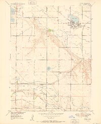
 1906 Loveland1954 Print · USGSThe Colorado plains meet the Front Range in the early 1900s, showing a landscape transformed by early irrigation and rail. Genealogists can trace family names across Loveland and Berthoud or locate rural sites like Masonville and Benson Lake.5 unique versions available
 - 1908 Map of Loveland
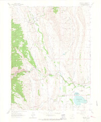
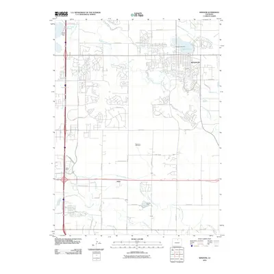
 1908 Loveland1908 Print · USGSThe Front Range foothills of Larimer County come alive in this early 1900s survey, showing a landscape transformed by water engineering and rail. Trace the original irrigation lines like Louden Ditch and find early industrial sites like the Plaster Mill.7 unique versions available
 - 1950 Map of Windsor
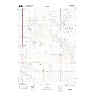
 1950 Windsor1950 Print · USGSWindsor and the surrounding plains of Weld and Larimer Counties appear here in the mid-twentieth century as a thriving agricultural and rail corridor. Researchers can trace the layout of small rail stops like Kelim and Officer or locate rural landmarks like Oklahoma School and Jeffers Sch.8 unique versions available
 - 1954 Map of Greeley, 1966 Print
 1954 Greeley1966 Print · USGSNorthern Colorado transitions from high-alpine peaks to the irrigated South Platte valley during this mid-century period of growth. Genealogists and historians can trace rail-connected hubs like Greeley and Longmont alongside landmarks like Horsetooth Reservoir and Estes Park.3 unique versions available
 - 1957 Map of Greeley
 1957 Greeley1957 Print · USGSNorthern Colorado in the mid-fifties is captured here as the agricultural plains of Weld County meet the high peaks of the Front Range. Genealogists and historians can trace rail-linked towns like Keenesburg and Roggen or locate early water features such as Boyd Lake and Fossil Creek Reservoir.
 - 1958 Map of Greeley
 1958 Greeley1958 Print · USGSNorthern Colorado and the high peaks of the Front Range appear here in the mid-fifties as the region's agricultural and rail networks were fully established. Genealogists can locate family homes near Virginia Dale, Waverly, or Kuner, and trace the path of the Union Pacific Railroad through Greeley.
 - 1960 Map of Berthoud, 1963 Print
 1960 Berthoud1963 Print · USGSNorthern Colorado's agricultural heartland comes into focus in the early sixties, showing the vital irrigation networks surrounding Berthoud. Trace family roots at Greenlawn Cem or locate early landmarks like Campion Academy and the Old Berthoud Sch.9 unique versions available
 - 1960 Map of Loveland, 1965 Print
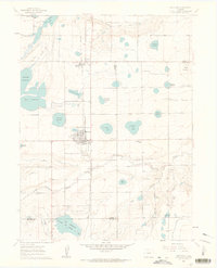
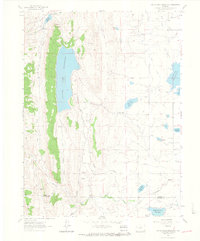
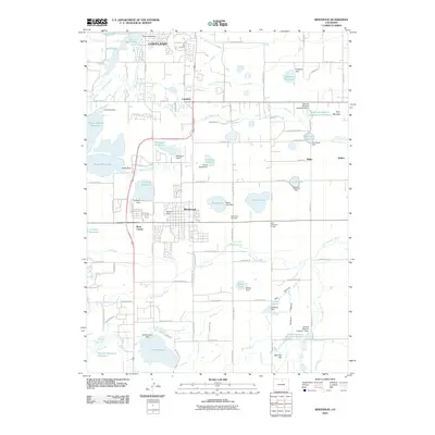
 1960 Loveland1965 Print · USGSMid-century Larimer County comes to life in this detailed map of the Loveland area and its extensive reservoir system. Researchers can trace the industrial footprint of the Sugar Refinery or locate family sites near Lakeside Cem and Trilby Corner.
 - 1961 Map of Greeley
 1961 Greeley1961 Print · USGSNorthern Colorado's transition from high mountain peaks to irrigated plains is captured here just as the post-war population boom reached the Front Range. Researchers can trace early water infrastructure and rail lines like the Great Western RR connecting sugar beet hubs from Fort Collins to Greeley.
 - 1961 Map of Masonville, 1973 Print
 1961 Masonville1973 Print · USGSIn the foothills of Larimer County during the early sixties and seventies, this area shows a landscape defined by water engineering and stone quarrying. Genealogists and local historians can trace family-named landmarks like Buckhorn Community Ch, the Big Thompson Sch, and the original Masonville Post Office.
 - 1962 Map of Loveland, 1963 Print
 1962 Loveland1963 Print · USGSLoveland and the surrounding Larimer County lakes are captured here in the early sixties, showing a landscape defined by water and rail. Researchers can trace the lines of the Great Western railroad, locate the Sugar Refinery, or find rural landmarks like Trilby Corner and Mt Hope Sch.4 unique versions available
 - 1962 Map of Masonville, 1964 Print
 1962 Masonville1964 Print · USGSThe Masonville area in the early sixties showcases a complex intersection of mountain foothills and high-plains irrigation. Genealogists and local historians can locate the Masonville Community Ch, Big Thompson Sch, and traces of early industry at various Quarries.6 unique versions available
 - 1962 Map of Carter Lake Reservoir, 1964 Print
 1962 Carter Lake Reservoir1964 Print · USGSLarimer County and the northern edge of Boulder County are captured in the early sixties as a center of water storage and power. Researchers can trace mid-century industrial features like the Flatiron Powerplant, old quarries, and the Pack Trail near Lonetree Reservoir.3 unique versions available
 - 1964 Map of Greeley
 1964 Greeley1964 Print · USGSThe Front Range corridor and high peaks of the Rockies appear here in the mid-1960s, showing the intersection of mountain wilderness and plains agriculture. Trace the rail routes of the Great Western RR or locate landmarks like Longs Peak and Horsetooth Reservoir.
 - 1965 Map of Greeley
 1965 Greeley1965 Print · USGSNorthern Colorado in the mid-sixties shows a landscape defined by high mountain summits and the growing irrigation networks of the plains. Genealogists and historians can trace rail-side towns like Wellington or follow the early tracks of the Union Pacific Railroad past Longs Peak.
 - 1982 Map of Greeley, 1983 Print
 1982 Greeley1983 Print · USGSNorth-central Colorado is shown in the early eighties as a thriving hub of river-valley agriculture and energy production. Researchers can trace the water-rights history and rail networks connecting Greeley to the Spindle Oil Field and Fort Lupton.
 - 1984 Map of Estes Park
 1984 Estes Park1984 Print · USGSThe northern Front Range and high peaks come into focus during the mid-eighties, showing the intersection of mountain wilderness and urban expansion. Trace the rail lines of the Union Pacific, the shores of Lake Granby, and historic mountain towns like Gold Hill or Eldora.3 unique versions available
 - 2010 Map of Windsor, 2010 Print
 2010 Windsor2010 Print · USGSCovers Loveland, including Fort Collins, Greeley, and other nearby areas
 - 2010 Map of Carter Lake Reservoir, 2010 Print
 2010 Carter Lake Reservoir2010 Print · USGSCovers Loveland, including Berthoud, Larimer County, and other nearby areas
 - 2010 Map of Berthoud, 2010 Print
 2010 Berthoud2010 Print · USGSCovers Loveland, including Berthoud, Berts Corner, and other nearby areas
 - 2010 Map of Loveland, 2010 Print
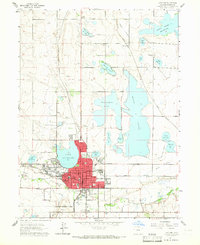
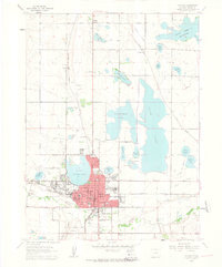
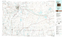
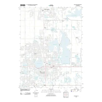 2010 Loveland2010 Print · USGSCovers Loveland, including Fort Collins, Browns Corner, and other nearby areas
 - 2011 Map of Masonville, 2011 Print
 2011 Masonville2011 Print · USGSCovers Loveland, including Fort Collins, Little Dam, and other nearby areas
 - 2013 Map of Masonville, 2013 Print
 2013 Masonville2013 Print · USGSCovers Loveland, including Fort Collins, Little Dam, and other nearby areas
 - 2013 Map of Windsor, 2013 Print
 2013 Windsor2013 Print · USGSCovers Loveland, including Fort Collins, Greeley, and other nearby areas
Showing maps 1-25 of 43
Top cities near Loveland
- Fort Collins historical maps
- Greeley historical maps
- Longmont historical maps
- Windsor historical maps
- Johnstown historical maps
- Severance historical maps
See more
Top neighborhoods of Loveland
- Kings Corner historical maps
- Browns Corner historical maps
- The Foundry Plaza historical maps
- Waterfront historical maps
- Emerald Glen historical maps
- Hunter's Run historical maps
See more
Frequently asked questions
- What are the different types of historical maps available for Loveland?
- What is the oldest map of Loveland?
- Where can I purchase historical maps of Loveland for my home or office?
- Where can I download high-res historical maps of Loveland?
- Are there historical topographic maps available for Loveland?
- Is there historical aerial imagery available for Loveland?
- Where are historical maps of Loveland sourced from?