Old Maps of Kincaid Hills, Alachua County
Explore 14 old maps of Kincaid Hills, spanning from 1890 to today. These high-resolution historic maps reveal how streets, neighborhoods, landmarks, and natural features evolved over time — perfect for genealogy, metal detecting, research, and local history exploration.
What you can do with these maps:
- See how Kincaid Hills changed over time: Compare historical maps to modern-day views to trace roads, homesites, rail lines & more.
- View detailed metadata: Each map includes creators, publishers, year, scale, and archive source.
- Overlay maps with satellite & LiDAR: Visualize the past alongside modern tools to explore terrain & human change.
- Trusted historical sources: Maps sourced from the USGS, Library of Congress, and other archives.
- Access maps your way: View online, download high-res files, or order prints for personal or research use.
Start exploring old maps of Kincaid Hills to uncover forgotten places, hidden landmarks, and the deep history beneath your feet.
Kincaid Hills, Alachua County maps
(14)- 1890 Map of Arredondo, 1955 Print
 1890 Arredondo1955 Print · USGSAlachua County at the end of the nineteenth century shows a landscape where iron rails were rapidly connecting old prairie settlements. Genealogists and historians can trace the early rail stops at Arredondo, locate the distinctive Devils Mill Hopper, and see the early layout of Gainesville.2 unique versions available
 - 1892 Map of Arredondo
 1892 Arredondo1892 Print · USGSAlachua County is captured here in the late nineteenth century as a hub of early Florida rail commerce. Genealogists and historians can trace the foundations of Gainesville and smaller rural communities such as Arredondo, Stewartville, and Micanopy.
 - 1894 Map of Arredondo
 1894 Arredondo1894 Print · USGSAlachua County at the close of the nineteenth century is defined by its new rail junctions and expansive, shifting wet prairies. Researchers can trace the early footprints of Gainesville or locate vanished sites near Arredondo, Kanapaha, and the banks of Levy Lake.6 unique versions available
 - 1954 Map of Gainesville, 1965 Print
 1954 Gainesville1965 Print · USGSMid-century North Central Florida comes into focus as a landscape of timber, rails, and river towns along the Gulf. Trace family roots in established centers like Gainesville or follow the path of the Suwannee River to the coastal docks of Cedar Key.3 unique versions available
 - 1958 Map of Gainesville
 1958 Gainesville1958 Print · USGSNorth Central Florida’s rail and river networks are frozen in time just before the interstate era. Genealogists and historians can trace the paths of the Atlantic Coast Line through Gainesville or locate coastal settlements like Steinhatchee and Cedar Key.
 - 1959 Map of Gainesville
 1959 Gainesville1959 Print · USGSNorth Florida in the mid-fifties is seen here from the Gulf coast to the inland lakes, showing the rail-and-river network before modern highways dominated. Researchers can trace the paths of the Seaboard Air Line through towns like Chiefland and Micanopy, or explore the coastal inlets of Waccasassa Bay.
 - 1966 Map of Gainesville East, 1967 Print
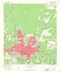 1966 Gainesville East1967 Print · USGSGainesville is shown during a period of significant mid-century growth, as the university and residential developments expand into the surrounding pine lands and bays. Researchers can trace the footprints of Sunland Training Center, Lincoln High Sch, and old rail lines like the Seaboard Coast Line.4 unique versions available
 - 1981 Map of Gainesville, 1982 Print
 1981 Gainesville1982 Print · USGSGainesville and its surrounding North Central Florida counties are captured in the early eighties, showcasing a mix of university growth and rural agriculture. Genealogists and historians can trace small settlements like Arredondo, Wacahoota, and Island Grove alongside major rail lines like the Seaboard Coast Line.2 unique versions available
 - 1994 Map of Gainesville East, 2000 Print
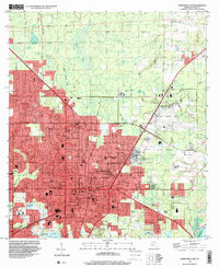 1994 Gainesville East2000 Print · USGSGainesville and the University of Florida are captured in the mid-nineties as the city expanded toward the edges of the Florida wetlands. Researchers can trace institutional history at the Sunland Training Center or locate family roots near Hillcrest Memorial Cemetery and Daysville.
 - 2012 Map of Gainesville East, 2012 Print
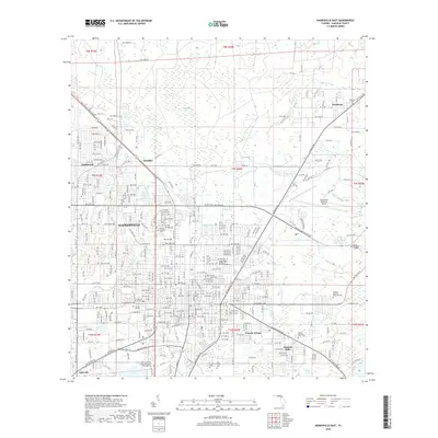
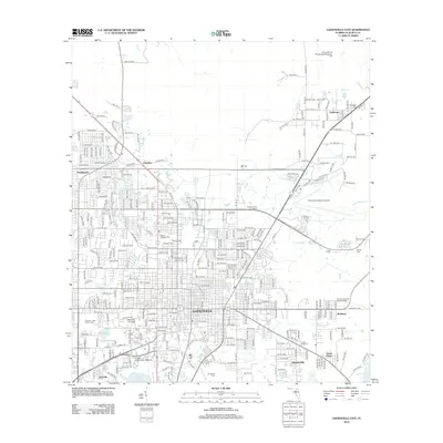 2012 Gainesville East2012 Print · USGSCovers Kincaid Hills, including Gainesville, Fairbanks, and other nearby areas
 - 2015 Map of Gainesville East, 2015 Print
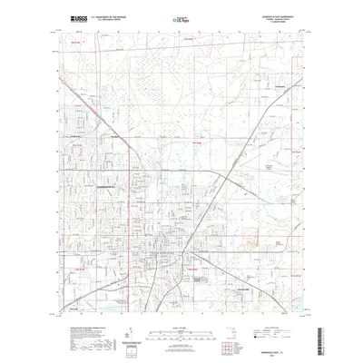
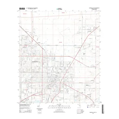 2015 Gainesville East2015 Print · USGSCovers Kincaid Hills, including Gainesville, Fairbanks, and other nearby areas
 - 2018 Map of Gainesville East, 2018 Print
 2018 Gainesville East2018 Print · USGSCovers Kincaid Hills, including Gainesville, Fairbanks, and other nearby areas
 - 2021 Map of Gainesville East, 2021 Print
 2021 Gainesville East2021 Print · USGSCovers Kincaid Hills, including Gainesville, Fairbanks, and other nearby areas
 - 2024 Map of Gainesville East, 2024 Print
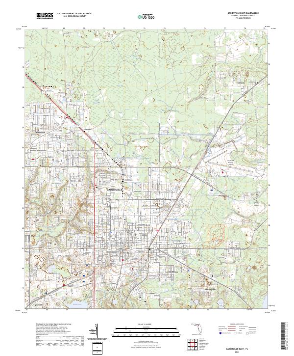 2024 Gainesville East2024 Print · USGSGainesville and its eastern suburbs are shown here in the 2020s, capturing the balance between academic growth and Florida's natural wetlands. Researchers can trace the legacy of local families through Fairbanks Cem or explore the geography of Hogtown Prairie and Gum Root Swamp.
End of results
Showing maps 1-14 of 14
Frequently asked questions
- What are the different types of historical maps available for Kincaid Hills?
- What is the oldest map of Kincaid Hills?
- Where can I purchase historical maps of Kincaid Hills for my home or office?
- Where can I download high-res historical maps of Kincaid Hills?
- Are there historical topographic maps available for Kincaid Hills?
- Is there historical aerial imagery available for Kincaid Hills?
- Where are historical maps of Kincaid Hills sourced from?