Old Maps of Plantation, Islamorada
Explore 8 old maps of Plantation, spanning from 1971 to today. These high-resolution historic maps reveal how streets, neighborhoods, landmarks, and natural features evolved over time — perfect for genealogy, metal detecting, research, and local history exploration.
What you can do with these maps:
- See how Plantation changed over time: Compare historical maps to modern-day views to trace roads, homesites, rail lines & more.
- View detailed metadata: Each map includes creators, publishers, year, scale, and archive source.
- Overlay maps with satellite & LiDAR: Visualize the past alongside modern tools to explore terrain & human change.
- Trusted historical sources: Maps sourced from the USGS, Library of Congress, and other archives.
- Access maps your way: View online, download high-res files, or order prints for personal or research use.
Start exploring old maps of Plantation to uncover forgotten places, hidden landmarks, and the deep history beneath your feet.
Plantation, Islamorada maps
(8)- 1971 Map of Plantation Key, 1973 Print
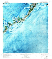 1971 Plantation Key1973 Print · USGSThe upper Florida Keys are captured in detail during the early seventies, showcasing a landscape of coral keys and narrow maritime channels. Genealogists and historians can trace the early footprints of Islamorada, the Coast Guard Sta, and Coral Shores Sch.2 unique versions available
 - 1983 Map of Islamorada, 1984 Print
 1983 Islamorada1984 Print · USGSThe Florida Keys at the start of the 1980s show a delicate balance of tourism and preservation along the Overseas Highway. Researchers can trace the development of island communities like Islamorada and Layton, or locate landmarks such as the Long Key Viaduct and Indian Key.
 - 1989 Map of Key West, 1990 Print
 1989 Key West1990 Print · USGSThe Florida Keys at the end of the eighties reveal a complex maritime network of coral islands, military outposts, and protected wilderness. Researchers can trace the Overseas Highway across the Sevenmile Bridge and locate features like the U S Naval Air Station Key West and the National Key Deer Refuge.
 - 2012 Map of Plantation Key, 2012 Print
 2012 Plantation Key2012 Print · USGSCovers Plantation, including Islamorada, Plantation Key Colony, and other nearby areas
 - 2015 Map of Plantation Key, 2015 Print
 2015 Plantation Key2015 Print · USGSCovers Plantation, including Islamorada, Plantation Key Colony, and other nearby areas
 - 2018 Map of Plantation Key, 2018 Print
 2018 Plantation Key2018 Print · USGSCovers Plantation, including Islamorada, Plantation Key Colony, and other nearby areas
 - 2021 Map of Plantation Key, 2021 Print
 2021 Plantation Key2021 Print · USGSCovers Plantation, including Islamorada, Plantation Key Colony, and other nearby areas
 - 2024 Map of Plantation Key, 2024 Print
 2024 Plantation Key2024 Print · USGSThe Florida Keys at the southern tip of the peninsula are mapped here in detail, showcasing the settlements and coral reefs of Monroe County. Researchers can trace the path of the Old Overseas Highway across Plantation Key or locate the Plantation Key Government Center.
End of results
Showing maps 1-8 of 8
Top cities near Plantation
Frequently asked questions
- What are the different types of historical maps available for Plantation?
- What is the oldest map of Plantation?
- Where can I purchase historical maps of Plantation for my home or office?
- Where can I download high-res historical maps of Plantation?
- Are there historical topographic maps available for Plantation?
- Is there historical aerial imagery available for Plantation?
- Where are historical maps of Plantation sourced from?