Old Maps of Valparaiso, Florida
Explore 46 old maps of Valparaiso, spanning from 1934 to today. These high-resolution historic maps reveal how streets, neighborhoods, landmarks, and natural features evolved over time — perfect for genealogy, metal detecting, research, and local history exploration.
What you can do with these maps:
- See how Valparaiso changed over time: Compare historical maps to modern-day views to trace roads, homesites, rail lines & more.
- View detailed metadata: Each map includes creators, publishers, year, scale, and archive source.
- Overlay maps with satellite & LiDAR: Visualize the past alongside modern tools to explore terrain & human change.
- Trusted historical sources: Maps sourced from the USGS, Library of Congress, and other archives.
- Access maps your way: View online, download high-res files, or order prints for personal or research use.
Start exploring old maps of Valparaiso to uncover forgotten places, hidden landmarks, and the deep history beneath your feet.
Valparaiso, FL maps
(46)- 1934 Map of Holt
 1934 Holt1934 Print · USGSOkaloosa County at the height of the Great Depression was defined by the massive Choctawhatchee National Forest and the early timber industry. Researchers can trace the path of the Louisville and Nashville Railroad and locate vanished sites like Keyser Mill, TURPENTINE CAMP, and Antioch Ch.
 - 1934 Map of Niceville
 1934 Niceville1934 Print · USGSThe Florida Panhandle in the mid-thirties reveals a landscape of tidal bayous and managed pine forests. Researchers can trace early infrastructure like the Bolton Turpentine Still, State Convict Camp No 12, and the path of the Old Spanish Trail.
 - 1935 Map of Villa Tasso
 1935 Villa Tasso1935 Print · USGSThe Florida Panhandle's coast appears here in the mid-1930s, showing a landscape of federal forests and burgeoning recreation. You can trace early sites like Postls Resort, the State 4H Club Camp, and the extensive Moreno Point Military Reservation.
 - 1936 Map of Niceville
 1936 Niceville1936 Print · USGSThe Okaloosa and Walton County line area is documented here in the mid-1930s, showing the transition from northern rail towns to coastal settlements. You can trace early family landmarks and infrastructure like Early Cem, Spencer Flats, and the Ramer Lookout Tower.4 unique versions available
 - 1937 Map of Holt
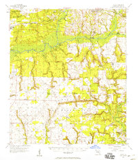
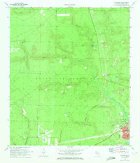
 1937 Holt1937 Print · USGSNorth Florida’s pine woods and river landings are captured in the mid-1930s, just as modern forestry and rail networks were maturing. Genealogists can trace old routes like the Nashville Trail or locate early industrial sites such as Bowser Mill and the Tar Plant.4 unique versions available
 - 1938 Map of Mary Esther
 1938 Mary Esther1938 Print · USGSThe Florida Panhandle coastline appears in the mid-1930s as a landscape of federal forests and quiet waterfront settlements. You can trace the early footprints of Fort Walton and Mary Esther, or locate forestry landmarks like the Pinchot Lookout Tower.4 unique versions available
 - 1938 Map of Villa Tasso
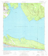
 1938 Villa Tasso1938 Print · USGSChoctawhatchee Bay and the Emerald Coast appear here in the mid-1930s, showing a landscape defined by military land and national forest. Trace early development in Valparaiso or follow the Gulf Coast Highway past coastal gems like Stewart Lake and Topsail Hill.4 unique versions available
 - 1956 Map of Niceville
 1956 Niceville1956 Print · USGSCoastal Okaloosa and Walton Counties are shown in the mid-fifties as the military and aviation presence expanded around the Choctawhatchee Bay. Genealogists and historians can locate early airstrips like Pierce Field, the rail stop at Deerland, and local landmarks like Mt Sinai Ch.3 unique versions available
 - 1956 Map of Fort Walton Beach, 1958 Print
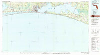
 1956 Fort Walton Beach1958 Print · USGSCoastal Florida is caught in a moment of mid-century military and maritime expansion along the Choctawhatchee Bay. Researchers can trace the early streets of Fort Walton Beach and Destin, or locate the Oakland Heights Sch and the winding U. S. Government Railroad.2 unique versions available
 - 1956 Map of Holt, 1958 Print
 1956 Holt1958 Print · USGSThe Florida Panhandle in the 1950s showcases the emergence of a major military landscape alongside historic river settlements. Genealogists and historians can trace family landmarks like Beulah Cem and Cox Cem or follow the routes of the Spanish Trail and Louisville & Nashville Railroad.2 unique versions available
 - 1956 Map of Villa Tasso, 1958 Print
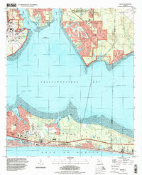
 1956 Villa Tasso1958 Print · USGSCoastal Walton and Okaloosa counties appear in the mid-fifties, showing the peninsula and bay before the rise of modern high-rise development. Genealogists and local historians can trace the early layout of Destin and find isolated landmarks like Villa Tasso, Topsail Hill, and the Destin School.2 unique versions available
 - 1957 Map of Pensacola, 1967 Print
 1957 Pensacola1967 Print · USGSThe Florida Panhandle and Alabama coast are seen here at the height of the Cold War, showcasing a unique mix of military aviation and emerging beach tourism. Genealogists and local historians can trace legacy sites like Old Corry Field, the lumber town of Bagdad, and the coastal reaches of Santa Rosa Island.3 unique versions available
 - 1959 Map of Pensacola
 1959 Pensacola1959 Print · USGSThe Florida Panhandle and Alabama coast come alive in this late fifties survey of military aviation and maritime life. Genealogists can trace family roots in Bagdad, Loxley, and Milton while mapping the rails of the Louisville and Nashville.
 - 1960 Map of Pensacola
 1960 Pensacola1960 Print · USGSThe Florida Panhandle and Alabama's eastern shore are shown during a period of rapid military and coastal growth. Genealogists and historians can trace the mid-century footprints of Warrington, the Pensacola NAS (Chevalier), and the Blackwater River timber lands.
 - 1970 Map of Niceville, 1972 Print
 1970 Niceville1972 Print · USGSNiceville and Valparaiso are shown here at the start of the 1970s, shaped by the waters of Boggy Bayou and the expansion of Eglin Air Force Base. Trace local history through Rocky Cem, Pinecrest Community Ch, and the old Claypit sites.4 unique versions available
 - 1970 Map of Destin, 1972 Print
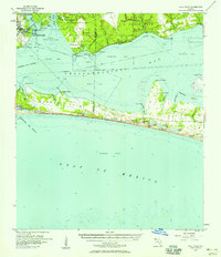
 1970 Destin1972 Print · USGSThe Florida Panhandle's Emerald Coast is captured here in the early seventies, showing a transitioning landscape of military installations and quiet fishing villages. Researchers can trace the layout of early Destin, the grounds of Eglin Air Force Base, and local landmarks like the Destin Sch.3 unique versions available
 - 1970 Map of Valparaiso, 1972 Print
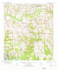
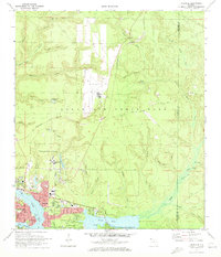
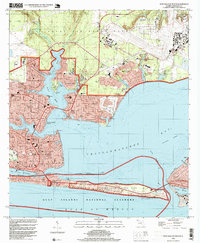
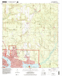
 1970 Valparaiso1972 Print · USGSValparaiso and Niceville border the extensive Eglin military reservation during the early seventies. Researchers can trace the path of the U S Government Railroad, identify remote sites like Aux Field No 5, and locate old burial grounds such as the Cem near Juniper Creek.4 unique versions available
 - 1970 Map of Fort Walton Beach, 1972 Print
 1970 Fort Walton Beach1972 Print · USGSFort Walton Beach and the surrounding bayous were entering a period of significant coastal development and military expansion during the early seventies. Trace the growth of Eglin Village, locate the US Government Railroad, and explore the shoreline from Destin to Santa Rosa Island.4 unique versions available
 - 1978 Map of Fort Walton Beach, 1980 Print
 1978 Fort Walton Beach1980 Print · USGSThe Florida Panhandle in the late seventies reveals a landscape defined by the growth of Eglin Air Force Base and the shoreline of Choctawhatchee Bay. Genealogists and historians can trace the early footprints of Fort Walton Beach, Destin, and remote coastal outposts like Point Washington.2 unique versions available
 - 1978 Map of Crestview, 1982 Print
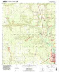
 1978 Crestview1982 Print · USGSThe Florida Panhandle and southern Alabama borderlands appear here in the late seventies as the military and timber industries shaped the landscape. Genealogists can trace family roots through small settlements like Cannon Town or Svea, and locate old sites like Aux Field No 4 (Abandoned).2 unique versions available
 - 1994 Map of Fort Walton Beach, 1999 Print
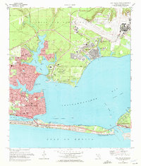
 1994 Fort Walton Beach1999 Print · USGSThe Florida Panhandle in the mid-1990s reveals a landscape of massive military installations and thriving coastal towns. Researchers can trace development patterns around Fort Walton Beach and Destin, or locate local landmarks like Choctawhatchee High Sch and Camp Pinchot.
 - 1994 Map of Valparaiso, 1999 Print
 1994 Valparaiso1999 Print · USGSThe Florida Panhandle near the turn of the millennium is defined by the massive Eglin Air Force Base and its relationship with neighboring coastal towns. Researchers can trace military aviation history through Aux Field No 4 (Abandoned) or find family history at Sweeney Cem near the banks of Turkey Creek.
 - 1994 Map of Destin, 1999 Print
 1994 Destin1999 Print · USGSChoctawhatchee Bay and the Emerald Coast appear here as they were in the mid-1990s, when tourism and military operations shaped the landscape. Genealogists and historians can trace the development of Destin, locate the Destin Sch, and explore the northern settlements of Niceville and Seminole.
 - 1994 Map of Niceville, 1999 Print
 1994 Niceville1999 Print · USGSCoastal Okaloosa County is shown in the mid-1990s as the communities of Niceville and Valparaiso expanded around the bayous. Researchers can find local landmarks like Okaloosa Walton Jr College, Sunset Cem, and the Pinecrest Community.
 - 2012 Map of Destin, 2012 Print
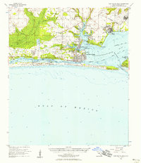
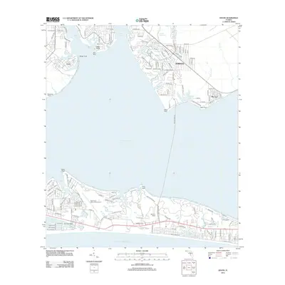 2012 Destin2012 Print · USGSCovers Valparaiso, including Destin, Villa Tasso, and other nearby areas
Showing maps 1-25 of 46
Top cities near Valparaiso
- Crestview historical maps
- Fort Walton Beach historical maps
- Destin historical maps
- Niceville historical maps
- Miramar Beach historical maps
- Mary Esther historical maps
See more
Top neighborhoods of Valparaiso
Frequently asked questions
- What are the different types of historical maps available for Valparaiso?
- What is the oldest map of Valparaiso?
- Where can I purchase historical maps of Valparaiso for my home or office?
- Where can I download high-res historical maps of Valparaiso?
- Are there historical topographic maps available for Valparaiso?
- Is there historical aerial imagery available for Valparaiso?
- Where are historical maps of Valparaiso sourced from?