Old Maps of Coffee County, Georgia
Explore 122 old maps of Coffee County, spanning from 1953 to today. These high-resolution historic maps reveal how streets, neighborhoods, landmarks, and natural features evolved over time — perfect for genealogy, metal detecting, research, and local history exploration.
What you can do with these maps:
- See how Coffee County changed over time: Compare historical maps to modern-day views to trace roads, homesites, rail lines & more.
- View detailed metadata: Each map includes creators, publishers, year, scale, and archive source.
- Overlay maps with satellite & LiDAR: Visualize the past alongside modern tools to explore terrain & human change.
- Trusted historical sources: Maps sourced from the USGS, Library of Congress, and other archives.
- Access maps your way: View online, download high-res files, or order prints for personal or research use.
Start exploring old maps of Coffee County to uncover forgotten places, hidden landmarks, and the deep history beneath your feet.
Coffee County, GA maps
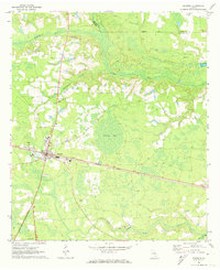
(122)- 1953 Map of Waycross, 1967 Print
 1953 Waycross1967 Print · USGSSouth Georgia's agricultural and rail heartland is captured here in the mid-1950s, showing a vast network of timber and farming towns. Researchers can trace the rail lines connecting Waycross and Tifton or locate landmarks like Jefferson Davis State Park and Lake Blackshear.2 unique versions available
 - 1958 Map of Waycross
 1958 Waycross1958 Print · USGSSoutheast Georgia in the late fifties remains a landscape of deep river basins and vital rail junctions. Genealogists and historians can trace family-named landmarks and rural hubs like Union Church, South Georgia College, and the sprawling Okefenokee Swamp.2 unique versions available
 - 1971 Map of Douglas North, 1974 Print
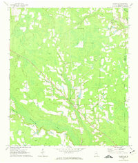
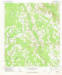
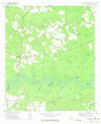
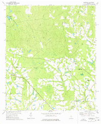
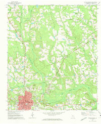 1971 Douglas North1974 Print · USGSCoffee County in the early seventies shows a landscape shaped by the Seaboard Coast Line rail corridor and the winding Seventeen Mile River. Genealogists and historians can trace local landmarks like Harrel Cem Ch, Pickerton, and Eastside Sch.2 unique versions available
 - 1971 Map of Douglas South, 1974 Print
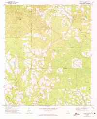
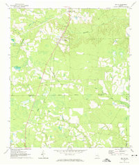
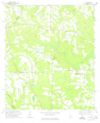
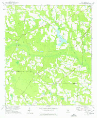
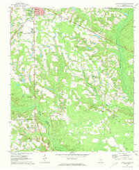 1971 Douglas South1974 Print · USGSSoutheast Georgia's timber and transit corridor comes into focus during the early seventies, centered on the growing community of Douglas. Genealogists can locate family landmarks such as Morman Cem, Tanner Ch, and the grounds of South Georgia College.2 unique versions available
 - 1971 Map of Nicholls, 1974 Print
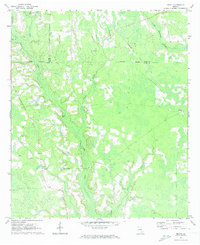
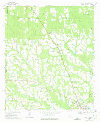
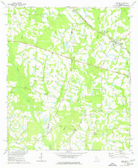
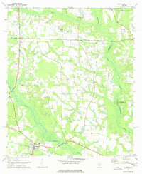
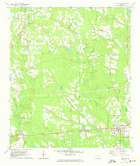 1971 Nicholls1974 Print · USGSCoastal plain Georgia thrives as a rail and timber hub in the early seventies, centered on the busy junction of the Seaboard Coast Line. Researchers can locate historic rural congregations at Sand Hill Ch or trace family lineage through Kirkland Cem and Rinson Cem.2 unique versions available
 - 1971 Map of Snipesville, 1974 Print
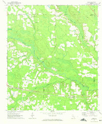
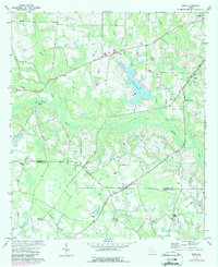
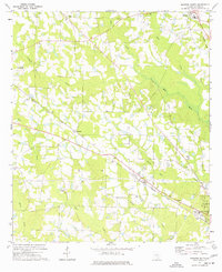
 1971 Snipesville1974 Print · USGSJeff Davis and Coffee Counties come to life in the early seventies, centered on the Ocmulgee River corridor. Genealogists and local historians can locate rural landmarks like Snipesville, the Hall Cem, and several riverfront sites including Haddock Landing.2 unique versions available
 - 1971 Map of Wilsonville, 1974 Print
 1971 Wilsonville1974 Print · USGSCoffee County and Ware County meet in this rural Georgia landscape during the early 1970s, as the Seventeen Mile River meanders through the pine-filled lowlands. Genealogists and local historians can trace family locations through several rural landmarks, including Little Geneva Cem, Forest Grove Ch, and the settlement at Wilsonville.
 - 1971 Map of Broxton NE, 1974 Print
 1971 Broxton NE1974 Print · USGSCoastal plain agriculture and rural church life define this area on the Coffee and Jeff Davis county line in the early 1970s. Trace old property boundaries and family landmarks like Williams Cem, Providence Ch, and the waters of Rock Falls.2 unique versions available
 - 1971 Map of Beach, 1974 Print
 1971 Beach1974 Print · USGSSoutheast Georgia's rural timber and farm country comes into focus in the early 1970s as the rail and road networks connected small parish communities. Genealogists and local historians can trace family land near Bickley, Grace Chapel, and several local sites like Bagley Cem.2 unique versions available
 - 1971 Map of Axson, 1974 Print
 1971 Axson1974 Print · USGSSoutheast Georgia’s wiregrass country is documented here in the early 1970s, as the Seaboard Coast Line railroad linked timber and agricultural outposts. Researchers can trace the lineage of small communities through sites like Stokesville, Axson Cem, and Taylor Chapel.
 - 1971 Map of Pearson, 1974 Print
 1971 Pearson1974 Print · USGSPearson and the surrounding Georgia coastal plain are captured here in the early 1970s as the regional rail and road networks intersected. Researchers can trace family history through local landmarks like Kight Cem, Refuge Ch, and Mt Zion Ch.2 unique versions available
 - 1971 Map of Sessoms, 1974 Print
 1971 Sessoms1974 Print · USGSBacon and Coffee County lands are captured here in the early seventies, centered on the Seaboard Coast Line railroad. Genealogists can trace family landmarks like Mercer Cem, Patterson Cem, and the community at Sessoms.2 unique versions available
 - 1971 Map of Denton, 1974 Print
 1971 Denton1974 Print · USGSDenton and its South Georgia surroundings appear in the early 1970s as a landscape defined by the diagonal path of the Central of Georgia railroad. Researchers can trace rural life through landmarks like Wilcox Cemetery and local community centers like Burkett Church.2 unique versions available
 - 1972 Map of Broxton North, 1975 Print
 1972 Broxton North1975 Print · USGSCoffee County agriculture and rail life are on full display in the early seventies, centered on the town of Broxton. Family historians can trace rural church and cemetery locations like Benjamin Chapel Cem, De Berry Ch, and the settlement at Pridgen.
 - 1972 Map of Jacksonville, 1975 Print
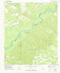
 1972 Jacksonville1975 Print · USGSThe Ocmulgee River corridor in the early 1970s reveals a landscape of winding backwaters and established rural communities on the Telfair-Coffee county line. Researchers can locate family landmarks and church sites such as Wilcox Cem, Mt Carmel Ch, and the crossing at Jacksonville Ferry Bridge.2 unique versions available
 - 1972 Map of Lax, 1977 Print
 1972 Lax1977 Print · USGSCoastal plain agricultural life in the early seventies centered on small communities and river bottomlands. Genealogists can trace family roots through numerous local landmarks like St Johns Ch, Beulah Ch, and the settlement of Lax.2 unique versions available
 - 1972 Map of Ambrose, 1977 Print
 1972 Ambrose1977 Print · USGSThe rural landscapes of Coffee and Irwin Counties come into focus in the early 1970s as the Seaboard Coast Line railroad passes through Ambrose and Wray. Genealogists can trace family roots at New Hope Ch, Satilla Ch, and through landmarks like Smith Cem.
 - 1972 Map of Mora, 1987 Print
 1972 Mora1987 Print · USGSThe Coffee and Atkinson county line in the early 1970s features a rural landscape defined by the Satilla River and the SOU railroad. Genealogists can locate old family-named sites such as Mora, Oberry, and Hebron Ch.
 - 1977 Map of Osierfield
 1977 Osierfield1977 Print · USGSOsierfield and the surrounding Georgia timberlands are captured here in the 1970s as the Seaboard Coast Line railroad shaped local life. Researchers can trace rural church and family history through sites like Macedonia Ch and Tucker Cem.2 unique versions available
 - 1977 Map of Mora
 1977 Mora1977 Print · USGSThe rural border of Coffee and Atkinson Counties in the late seventies is characterized by the Satilla River and the Central of Georgia rail line. Genealogists can locate family sites near Mora, Oberry, and country churches like Arnie Ch.
 - 1977 Map of Alapaha
 1977 Alapaha1977 Print · USGSBerrien County and the surrounding river lands are captured here in the mid-seventies, centered on the railroad town of Alapaha. Genealogists and historians can trace numerous rural congregations, from Glory Ch and New Bethel Ch to the riverside St Lukes Ch.
 - 1977 Map of Broxton South
 1977 Broxton South1977 Print · USGSCoffee County in the late seventies reveals a rural landscape defined by the Seaboard Coast Line and small farming hubs. Genealogists can locate several family landmarks, including Day Cem, Salem Ch, and the old community at Bushnell.
 - 1978 Map of Waycross, 1982 Print
 1978 Waycross1982 Print · USGSSoutheast Georgia in the late seventies is a landscape of vast wetlands and busy rail junctions. Genealogists and local historians can trace the Seaboard Coast Line through rural stops like Millwood and Pearson or locate family sites near the Okefenokee Swamp.
 - 1979 Map of Moultrie, 1980 Print
 1979 Moultrie1980 Print · USGSSouth Georgia’s agricultural heartland is documented here in the late 1970s, showcasing the intricate rail and river networks of Colquitt and Tift Counties. Researchers can trace historic settlements along the Georgia Northern railroad or locate landmarks like Spence Air Force Auxiliary Field and Banks Lake.2 unique versions available
 - 1979 Map of Hazlehurst, 1980 Print
 1979 Hazlehurst1980 Print · USGSSoutheast Georgia in the late seventies is defined by the convergence of major rail lines and river basins in Jeff Davis and Appling counties. Genealogists and local historians can trace the development of Hazlehurst and Baxley alongside features like the Pine Grove Pipeline and the Altamaha River wetlands.
Showing maps 1-25 of 122
Top cities of Coffee County
Frequently asked questions
- What are the different types of historical maps available for Coffee County?
- What is the oldest map of Coffee County?
- Where can I purchase historical maps of Coffee County for my home or office?
- Where can I download high-res historical maps of Coffee County?
- Are there historical topographic maps available for Coffee County?
- Is there historical aerial imagery available for Coffee County?
- Where are historical maps of Coffee County sourced from?