Old Maps of Dooly County, Georgia
Explore 95 old maps of Dooly County, spanning from 1955 to today. These high-resolution historic maps reveal how streets, neighborhoods, landmarks, and natural features evolved over time — perfect for genealogy, metal detecting, research, and local history exploration.
What you can do with these maps:
- See how Dooly County changed over time: Compare historical maps to modern-day views to trace roads, homesites, rail lines & more.
- View detailed metadata: Each map includes creators, publishers, year, scale, and archive source.
- Overlay maps with satellite & LiDAR: Visualize the past alongside modern tools to explore terrain & human change.
- Trusted historical sources: Maps sourced from the USGS, Library of Congress, and other archives.
- Access maps your way: View online, download high-res files, or order prints for personal or research use.
Start exploring old maps of Dooly County to uncover forgotten places, hidden landmarks, and the deep history beneath your feet.
Dooly County, GA maps
(95)- 1955 Map of Phenix City, 1964 Print
 1955 Phenix City1964 Print · USGSPost-war Alabama and Georgia meet along the Chattahoochee River as industry and military installations expand. Trace the rail lines of the Central of Georgia through towns like Opelika, Tuskegee, and Alexander City.3 unique versions available
 - 1956 Map of Perry, 1957 Print
 1956 Perry1957 Print · USGSCentral Georgia in the mid-fifties is captured here as a thriving agricultural and rail corridor between the Ocmulgee and the Flint. Researchers can trace the layout of legacy communities like Perry and Unadilla, as well as numerous rural landmarks like Kings Chapel Sch and Macedonia Ch.2 unique versions available
 - 1957 Map of Phenix City
 1957 Phenix City1957 Print · USGSThe Alabama-Georgia borderlands are captured here in the mid-fifties, centered on the bustling river crossing at Phenix City and Columbus. Researchers can trace the mid-century footprint of the Fort Benning Military Reservation or locate smaller textile and railroad towns like Langdale and Camp Hill.
 - 1957 Map of Macon
 1957 Macon1957 Print · USGSMid-century Georgia comes into focus as the river-and-rail economy shifts toward a new era of aviation and highway travel. Trace family roots and vanished landmarks across the Ocmulgee River valley from Macon to the onion fields of Vidalia.
 - 1958 Map of Macon
 1958 Macon1958 Print · USGSMiddle Georgia during the late fifties shows the post-war expansion of Warner Robins alongside the deep-rooted rail hubs of the Central of Georgia line. Researchers can trace the river-bound boundaries of numerous counties and find local landmarks like Veterans Memorial Hospital and Robins AFB.
 - 1958 Map of Phenix City
 1958 Phenix City1958 Print · USGSThe Alabama-Georgia borderlands thrive during the late fifties, anchored by the river-driven industry of Columbus and Phenix City. Researchers can trace the mid-century footprints of Fort Benning, Auburn, and the textile towns of Fairfax and Lanett.
 - 1964 Map of Macon
 1964 Macon1964 Print · USGSCentral Georgia in the mid-sixties is defined by its major river valleys and a booming military presence. Genealogists and historians can trace the growth of Warner Robins near Robins AFB or locate smaller rural junctions like Allentown and Jeffersonville along the historic Southern railroad lines.2 unique versions available
 - 1971 Map of Pineview West, 1974 Print
 1971 Pineview West1974 Print · USGSWilcox County and the surrounding Georgia countryside are captured here in the early 1970s, showcasing a landscape of small crossroads and creek-side farms. Researchers can trace the Old Railroad Grade and locate numerous rural landmarks like Antioch Ch, Tippettville, and Pope City.
 - 1971 Map of Pineview NW, 1974 Print
 1971 Pineview NW1974 Print · USGSThe rural Dooly County landscape in the early seventies centers on the town of Unadilla and its rail connections. Researchers can trace local genealogy through numerous country churches and cemeteries, including Poplar Springs Ch, Mars Hill Ch, and the area around Pocosin Pond.2 unique versions available
 - 1971 Map of Pineview SW, 1974 Print
 1971 Pineview SW1974 Print · USGSCentral Georgia's agricultural landscape at the start of the seventies reveals a tight-knit network of rural congregations and family cemeteries. Genealogists can trace roots at Smyrna Ch and Sharon Ch or locate the old community of Tremont.
 - 1971 Map of Henderson, 1975 Print
 1971 Henderson1975 Print · USGSHouston and Dooly County farmlands are captured here in the early 1970s, showcasing a landscape of rural congregations and small family-named settlements. You can trace local roots through numerous landmarks like Shiloh Cem, New Poplar Spring Ch, and the community of Henderson.
 - 1971 Map of Pinehurst, 1975 Print
 1971 Pinehurst1975 Print · USGSDooly County in the early seventies shows a landscape of established rail towns and rural farming communities connected by two major rail lines. Genealogists can trace family names and local sites from Pinehurst and Lilly to the Old Mt Zion Ch and Evergreen Cem.2 unique versions available
 - 1972 Map of Byromville, 1974 Print
 1972 Byromville1974 Print · USGSDooly County agriculture and rail life are well-documented here in the early 1970s as the rail line still serves the rural corridor. Genealogists can locate several remote country churches and schools, including Vance Sch, Bethlehem Ch, and the Hepzibah Cem.
 - 1972 Map of Drayton, 1974 Print
 1972 Drayton1974 Print · USGSDooly County during the early seventies is mapped here as the Flint River expands into the backwaters of northern Lake Blackshear. Genealogists and local historians can locate rural landmarks like Macedonia Ch, Collier Cem, and the river crossing at Luther Storey Bridge.2 unique versions available
 - 1972 Map of Marshallville SW, 1974 Print
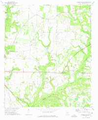 1972 Marshallville SW1974 Print · USGSMacon and Dooly counties are captured here in the early 1970s, showing a landscape defined by creek valleys and rural crossroads. Researchers can trace the Seaboard Coast Line and find numerous community hubs like Spalding, Five Points, and Zion Grove Ch.
 - 1972 Map of Methvins, 1975 Print
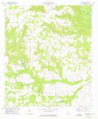 1972 Methvins1975 Print · USGSSumter County farmland and creek bottoms appear in detail in the early 1970s. Researchers can locate community anchors like Union Grove Ch and Bethel Ch, or trace the winding course of the Flint River near Methvins.2 unique versions available
 - 1972 Map of Finleyson West, 1975 Print
 1972 Finleyson West1975 Print · USGSPulaski County at the start of the seventies reveals a rural landscape shaped by cotton fields, creek branches, and community-centered parishes. Researchers can trace family roots through several local landmarks like Belleview Ch, Pulaski High, and New Hope Ch.
 - 1972 Map of Vienna, 1975 Print
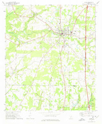 1972 Vienna1975 Print · USGSDooly County at the start of the 1970s shows a landscape of growing highway transit and deep-rooted rural communities. Trace the intersection of the Southern railroad and Interstate 75 near Vienna, or locate local landmarks like Mt Pleasant Ch and the Drive-in Theater.
 - 1972 Map of Pennington, 1975 Print
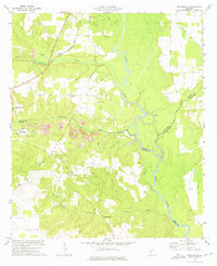 1972 Pennington1975 Print · USGSMacon and Sumter counties meet along the winding Flint River in the early 1970s, as industrial mining reshapes the rural landscape. Genealogists and historians can trace family sites like Tolen Cem or explore the grounds of Chamblis Mill and the Indian Mounds.
 - 1973 Map of Klondike, 1977 Print
 1973 Klondike1977 Print · USGSPulaski and Houston Counties were characterized by small farm communities and river-bound creek systems in the early 1970s. Researchers can trace the Old Railroad Grade or locate family roots near Klondike, Macedonia Ch, and the Ocmulgee River.
 - 1973 Map of Unadilla, 1977 Print
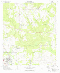 1973 Unadilla1977 Print · USGSDooly and Houston Counties are captured in the early 1970s, showcasing a landscape of established rail towns and family farmsteads. Researchers can trace local roots at Means Lane Cem, Southside Sch, and the quiet crossroads of Grovania.
 - 1977 Map of Hawkinsville
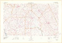 1977 Hawkinsville1977 Print · USGSSouth Georgia’s agricultural and rail heartland is meticulously documented during the late seventies. Researchers can trace family ties and transit routes through old depots and towns like Unadilla, Pineview, and Hawkinsville along the Ocmulgee River.
 - 1978 Map of Hawkinsville, 1979 Print
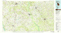 1978 Hawkinsville1979 Print · USGSMiddle Georgia's agricultural and rail heartland is captured here in the late seventies, showing the vital connections between the Ocmulgee River and the rural plains. Genealogists and historians can trace family locations near Vienna, Hawkinsville, or along the tracks of the Southern railroad.
 - 1981 Map of Americus, 1982 Print
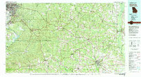 1981 Americus1982 Print · USGSWest Georgia and East Alabama appear here during the early 1980s, showcasing the transition from military reservation to agricultural heartland. Researchers can trace the Central of Georgia rail lines through towns like Plains, Ellaville, and the historic site of Andersonville.
 - 1988 Map of Macon, 1989 Print
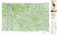 1988 Macon1989 Print · USGSCentral Georgia is captured during the late eighties, showing the expansive river systems and growing urban hubs of the regional interior. Genealogists and historians can trace the paths of the Central of Georgia Railroad and locate communities like Warner Robbins, Dublin, and Sandersville.
Showing maps 1-25 of 95
Top cities of Dooly County
- Unadilla historical maps
- Vienna historical maps
- Byromville historical maps
- Pinehurst historical maps
- Lilly historical maps
- Dooling historical maps
Frequently asked questions
- What are the different types of historical maps available for Dooly County?
- What is the oldest map of Dooly County?
- Where can I purchase historical maps of Dooly County for my home or office?
- Where can I download high-res historical maps of Dooly County?
- Are there historical topographic maps available for Dooly County?
- Is there historical aerial imagery available for Dooly County?
- Where are historical maps of Dooly County sourced from?