Old Maps of Uvalda, Georgia
Explore 17 old maps of Uvalda, spanning from 1957 to today. These high-resolution historic maps reveal how streets, neighborhoods, landmarks, and natural features evolved over time — perfect for genealogy, metal detecting, research, and local history exploration.
What you can do with these maps:
- See how Uvalda changed over time: Compare historical maps to modern-day views to trace roads, homesites, rail lines & more.
- View detailed metadata: Each map includes creators, publishers, year, scale, and archive source.
- Overlay maps with satellite & LiDAR: Visualize the past alongside modern tools to explore terrain & human change.
- Trusted historical sources: Maps sourced from the USGS, Library of Congress, and other archives.
- Access maps your way: View online, download high-res files, or order prints for personal or research use.
Start exploring old maps of Uvalda to uncover forgotten places, hidden landmarks, and the deep history beneath your feet.
Uvalda, GA maps
(17)- 1957 Map of Macon
 1957 Macon1957 Print · USGSMid-century Georgia comes into focus as the river-and-rail economy shifts toward a new era of aviation and highway travel. Trace family roots and vanished landmarks across the Ocmulgee River valley from Macon to the onion fields of Vidalia.
 - 1958 Map of Macon
 1958 Macon1958 Print · USGSMiddle Georgia during the late fifties shows the post-war expansion of Warner Robins alongside the deep-rooted rail hubs of the Central of Georgia line. Researchers can trace the river-bound boundaries of numerous counties and find local landmarks like Veterans Memorial Hospital and Robins AFB.
 - 1964 Map of Macon
 1964 Macon1964 Print · USGSCentral Georgia in the mid-sixties is defined by its major river valleys and a booming military presence. Genealogists and historians can trace the growth of Warner Robins near Robins AFB or locate smaller rural junctions like Allentown and Jeffersonville along the historic Southern railroad lines.2 unique versions available
 - 1970 Map of Alston, 1973 Print
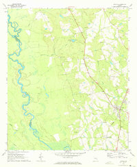
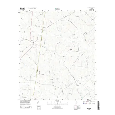
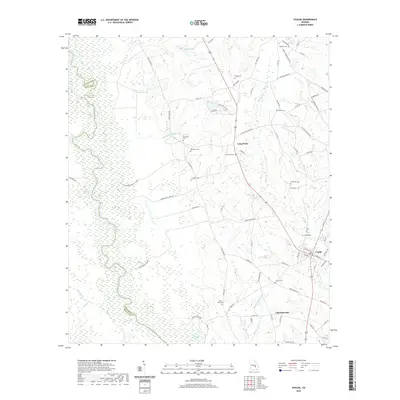
 1970 Alston1973 Print · USGSSoutheast Georgia's rural timber and farm country comes into focus in the 1970s, as the Central of Georgia rail line passes through Alston and Uvalda. Genealogists can trace family roots at Galbreath Cem, Mt Calvary Ch, and Old Cedar Crossing Cem.
 - 1970 Map of Uvalda, 1973 Print
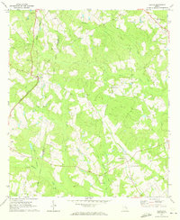
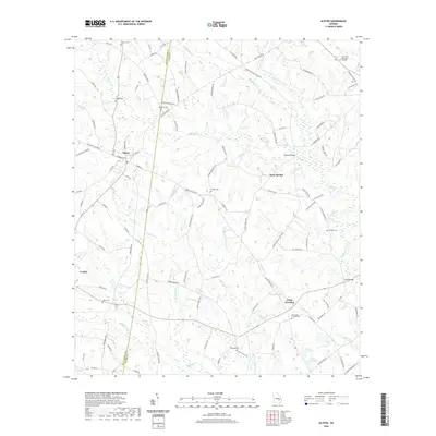
 1970 Uvalda1973 Print · USGSThe Oconee River basin in the early 1970s is shown here as a landscape of river-bottom wetlands and rural communities. Genealogists can trace family names through numerous local burial sites like McGregor Cem, Conner Cem, and the settlement at Uvalda.3 unique versions available
 - 1979 Map of Vidalia, 1980 Print
 1979 Vidalia1980 Print · USGSSoutheast Georgia in the late 1970s is a landscape of river-bend settlements and crossing rail lines. Researchers can trace family roots and land patterns through several towns like Vidalia, Soperton, and Mount Vernon, or locate regional landmarks like the State Prison.2 unique versions available
 - 1988 Map of Macon, 1989 Print
 1988 Macon1989 Print · USGSCentral Georgia is captured during the late eighties, showing the expansive river systems and growing urban hubs of the regional interior. Genealogists and historians can trace the paths of the Central of Georgia Railroad and locate communities like Warner Robbins, Dublin, and Sandersville.
 - 2011 Map of Uvalda, 2011 Print
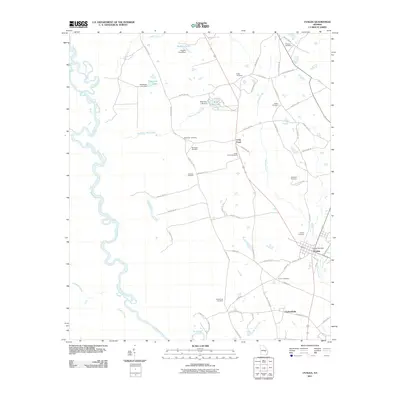 2011 Uvalda2011 Print · USGSCovers Uvalda, including Charlotteville, Long Pond, and other nearby areas
 - 2011 Map of Alston, 2011 Print
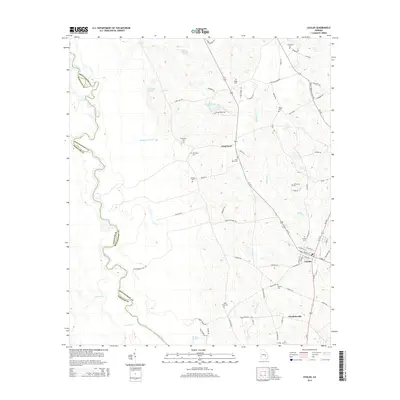
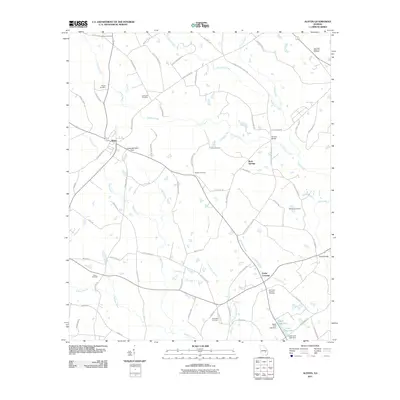 2011 Alston2011 Print · USGSCovers Uvalda, including Alston, Rock Springs, and other nearby areas
 - 2014 Map of Alston, 2014 Print
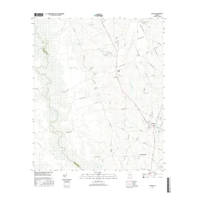
 2014 Alston2014 Print · USGSCovers Uvalda, including Alston, Rock Springs, and other nearby areas
 - 2014 Map of Uvalda, 2014 Print
 2014 Uvalda2014 Print · USGSCovers Uvalda, including Charlotteville, Long Pond, and other nearby areas
 - 2017 Map of Uvalda, 2017 Print
 2017 Uvalda2017 Print · USGSCovers Uvalda, including Charlotteville, Long Pond, and other nearby areas
 - 2017 Map of Alston, 2017 Print
 2017 Alston2017 Print · USGSCovers Uvalda, including Alston, Rock Springs, and other nearby areas
 - 2020 Map of Alston, 2020 Print
 2020 Alston2020 Print · USGSCovers Uvalda, including Alston, Rock Springs, and other nearby areas
 - 2020 Map of Uvalda, 2020 Print
 2020 Uvalda2020 Print · USGSCovers Uvalda, including Charlotteville, Long Pond, and other nearby areas
 - 2024 Map of Alston, 2024 Print
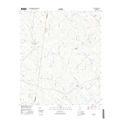
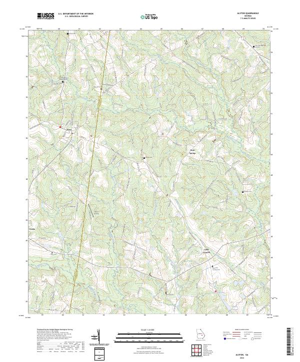 2024 Alston2024 Print · USGSThe borderlands of Montgomery and Toombs counties are captured here in the early 2020s, showcasing a rural landscape of scattered communities and creek-fed lowlands. Researchers can trace family history through numerous local sites like Old Cedar Crossing Cem, Galbreath Cem, and the town sites of Alston and Uvalda.
 - 2024 Map of Uvalda, 2024 Print
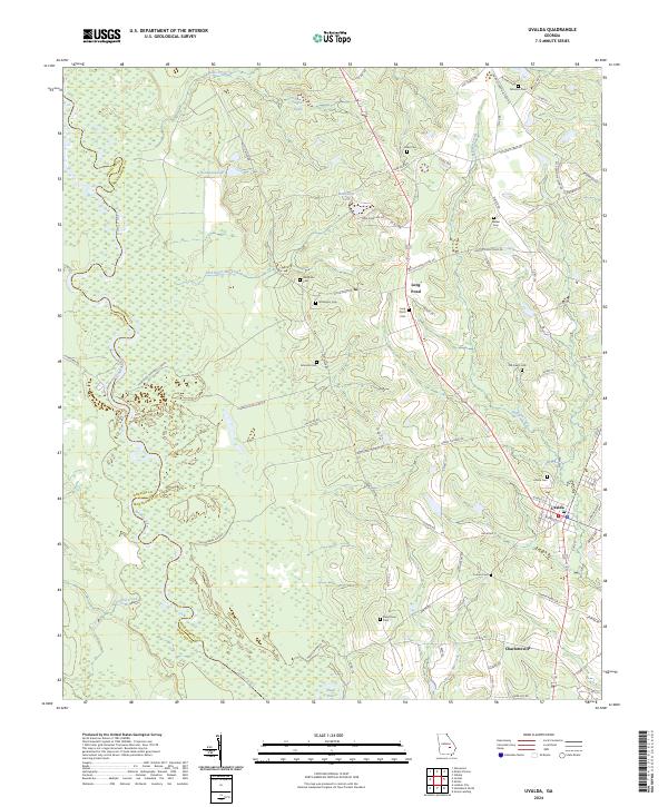 2024 Uvalda2024 Print · USGSThe Oconee River corridor in Montgomery County comes into focus in this contemporary survey, showing the agricultural and riverine landscape. Genealogists can locate family burial sites like Walker Cem and McAllister Cem near the settlements of Uvalda and Charlotteville.
End of results
Showing maps 1-17 of 17
Top cities near Uvalda
- Lyons historical maps
- Hazlehurst historical maps
- Mount Vernon historical maps
- Lumber City historical maps
- Glenwood historical maps
- Ailey historical maps
See more
Frequently asked questions
- What are the different types of historical maps available for Uvalda?
- What is the oldest map of Uvalda?
- Where can I purchase historical maps of Uvalda for my home or office?
- Where can I download high-res historical maps of Uvalda?
- Are there historical topographic maps available for Uvalda?
- Is there historical aerial imagery available for Uvalda?
- Where are historical maps of Uvalda sourced from?