Old Maps of Mililani Mauka, Honolulu County
Explore 12 old maps of Mililani Mauka, spanning from 1954 to today. These high-resolution historic maps reveal how streets, neighborhoods, landmarks, and natural features evolved over time — perfect for genealogy, metal detecting, research, and local history exploration.
What you can do with these maps:
- See how Mililani Mauka changed over time: Compare historical maps to modern-day views to trace roads, homesites, rail lines & more.
- View detailed metadata: Each map includes creators, publishers, year, scale, and archive source.
- Overlay maps with satellite & LiDAR: Visualize the past alongside modern tools to explore terrain & human change.
- Trusted historical sources: Maps sourced from the USGS, Library of Congress, and other archives.
- Access maps your way: View online, download high-res files, or order prints for personal or research use.
Start exploring old maps of Mililani Mauka to uncover forgotten places, hidden landmarks, and the deep history beneath your feet.
Mililani Mauka, Honolulu County maps
(12)- 1954 Map of Oahu
 1954 Oahu1954 Print · USGSMid-century Oahu is caught between its plantation roots and its growing role as a Pacific military hub. Trace the OR and L Co rail lines and explore the 1950s footprints of Pearl Harbor, Libbyville, and Waipahu.
 - 1954 Map of Waipahu, 1956 Print
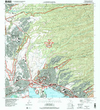
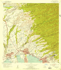 1954 Waipahu1956 Print · USGSOahu's south-central coastline and plantation interior are documented in the mid-fifties during a period of industrial and military growth. Genealogists and historians can trace rail lines like the Oahu Railway and industry sites like the Sugar Refinery and Waipio Camp A.
 - 1959 Map of Waipahu, 1961 Print
 1959 Waipahu1961 Print · USGSCentral Oahu in the late fifties reveals a landscape defined by sugar plantations, pineapple research, and massive military installations. Researchers can trace the water network of the Waiahole Ditch, find the old Sugar Refinery, and locate the Kipapa Airfield near Waipio Acres.
 - 1961 Map of Oahu
 1961 Oahu1961 Print · USGSOahu's strategic landscape is captured here during the early statehood era, showing the balance between burgeoning urban centers and massive military installations. Trace the path of the Oahu Railway and Land Co or locate historical sites like Schofield Barracks and Punchbowl Hill.
 - 1965 Map of Oahu
 1965 Oahu1965 Print · USGSOahu in the mid-sixties reveals a landscape defined by significant military installations and growing coastal communities. Researchers can trace the infrastructure of Pearl Harbor, Schofield Barracks, and landmarks like Diamond Head.2 unique versions available
 - 1968 Map of Waipahu, 1971 Print
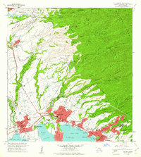
 1968 Waipahu1971 Print · USGSThe northern shores of Pearl Harbor were undergoing a massive suburban transformation in the late sixties as new communities like Mililani Town emerged. Genealogists and historians can trace the foundations of modern Oahu through the Sugar Mill, Kalaauo Spring, and numerous local schools like August Ahrens Sch.
 - 1970 Map of Oahu, 1973 Print
 1970 Oahu1973 Print · USGSOahu was entering a new era of suburban and military expansion in the early seventies. Trace the growth of Mililani Town and Pearl City, or locate historic sites like Schofield Barracks and Diamond Head State Monument.2 unique versions available
 - 1983 Map of Waipahu, 1984 Print
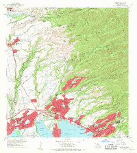
 1983 Waipahu1984 Print · USGSOahu's central corridor underwent rapid transformation in the early eighties as new residential developments climbed the ridges above Pearl Harbor. Trace the growth of Mililani Town and Pearl City alongside landmarks like Aloha Stadium and Keaiwa Heiau State Park.
 - 1998 Map of Waipahu, 2000 Print
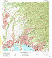
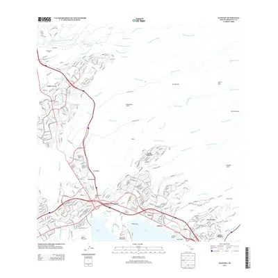
 1998 Waipahu2000 Print · USGSThe O'ahu central corridor is captured here at the end of the century, showing the dense development between the mountains and the sea. Researchers can trace the layout of Mililani Town, the Wheeler Air Force Base, and PEARL HARBOR.
 - 2013 Map of Waipahu, 2013 Print
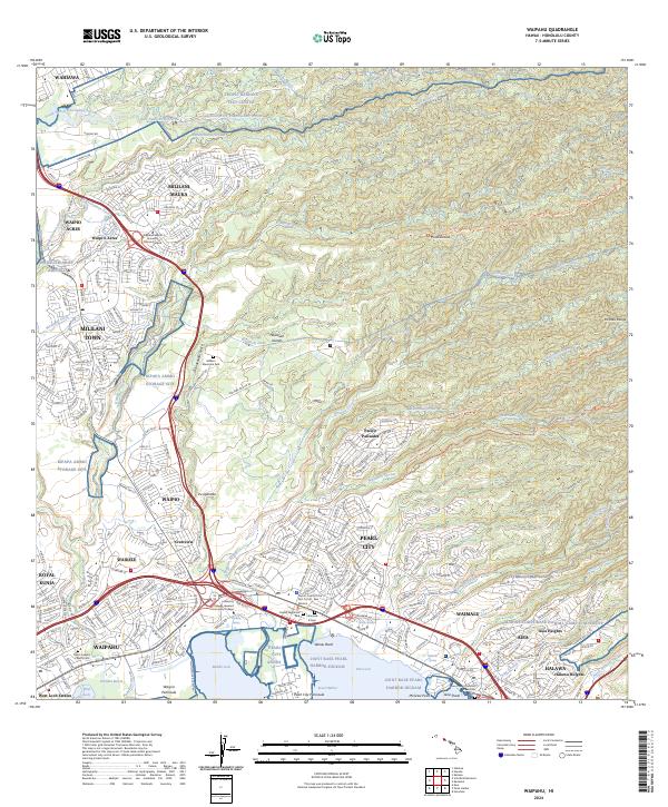
 2013 Waipahu2013 Print · USGSCovers Mililani Mauka, including Waipahu, Mililani, and other nearby areas
 - 2017 Map of Waipahu, 2017 Print
 2017 Waipahu2017 Print · USGSCovers Mililani Mauka, including Waipahu, Mililani, and other nearby areas
 - 2024 Map of Waipahu, 2024 Print
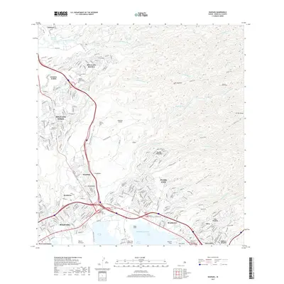
 2024 Waipahu2024 Print · USGSThe northern shores of Pearl Harbor meet the residential and military heart of O'ahu in the early twenty-first century. Genealogists and historians can trace local landmarks like Saint Josephs Church Cem, Wheeler Army Airfield, and the Waiahole Ditch.
End of results
Showing maps 1-12 of 12
Frequently asked questions
- What are the different types of historical maps available for Mililani Mauka?
- What is the oldest map of Mililani Mauka?
- Where can I purchase historical maps of Mililani Mauka for my home or office?
- Where can I download high-res historical maps of Mililani Mauka?
- Are there historical topographic maps available for Mililani Mauka?
- Is there historical aerial imagery available for Mililani Mauka?
- Where are historical maps of Mililani Mauka sourced from?