Old Maps of Waianae, Hawaii
Explore 12 old maps of Waianae, spanning from 1954 to today. These high-resolution historic maps reveal how streets, neighborhoods, landmarks, and natural features evolved over time — perfect for genealogy, metal detecting, research, and local history exploration.
What you can do with these maps:
- See how Waianae changed over time: Compare historical maps to modern-day views to trace roads, homesites, rail lines & more.
- View detailed metadata: Each map includes creators, publishers, year, scale, and archive source.
- Overlay maps with satellite & LiDAR: Visualize the past alongside modern tools to explore terrain & human change.
- Trusted historical sources: Maps sourced from the USGS, Library of Congress, and other archives.
- Access maps your way: View online, download high-res files, or order prints for personal or research use.
Start exploring old maps of Waianae to uncover forgotten places, hidden landmarks, and the deep history beneath your feet.
Waianae, HI maps
(12)- 1954 Map of Oahu
 1954 Oahu1954 Print · USGSMid-century Oahu is caught between its plantation roots and its growing role as a Pacific military hub. Trace the OR and L Co rail lines and explore the 1950s footprints of Pearl Harbor, Libbyville, and Waipahu.
 - 1954 Map of Waianae, 1955 Print
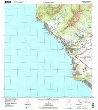
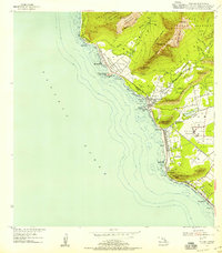 1954 Waianae1955 Print · USGSThe leeward coast of Oahu is captured here in the mid-fifties, showing the development of coastal communities between the sea and the rugged heights. Genealogists and historians can trace Waianae Homesteads and significant cultural sites like Kaneaki Heiau.
 - 1961 Map of Oahu
 1961 Oahu1961 Print · USGSOahu's strategic landscape is captured here during the early statehood era, showing the balance between burgeoning urban centers and massive military installations. Trace the path of the Oahu Railway and Land Co or locate historical sites like Schofield Barracks and Punchbowl Hill.
 - 1963 Map of Waianae, 1965 Print
 1963 Waianae1965 Print · USGSThe Leeward Coast of Oahu comes alive in the early sixties as local homesteads and ancient sites meet expanding military reservations. Trace family roots and land divisions in Lualualei Homesteads or locate historical landmarks like Kaneaki Heiau and St Johns.2 unique versions available
 - 1965 Map of Oahu
 1965 Oahu1965 Print · USGSOahu in the mid-sixties reveals a landscape defined by significant military installations and growing coastal communities. Researchers can trace the infrastructure of Pearl Harbor, Schofield Barracks, and landmarks like Diamond Head.2 unique versions available
 - 1970 Map of Oahu, 1973 Print
 1970 Oahu1973 Print · USGSOahu was entering a new era of suburban and military expansion in the early seventies. Trace the growth of Mililani Town and Pearl City, or locate historic sites like Schofield Barracks and Diamond Head State Monument.2 unique versions available
 - 1977 Map of Waianae, 1984 Print
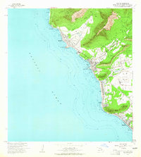
 1977 Waianae1984 Print · USGSOahu's leeward coast comes into sharp focus during the late seventies, showing the residential and agricultural landscape of the era. Genealogists and local historians can trace property layouts and coastal development in Waianae, Makaha, and Nanakuli.
 - 1983 Map of Waianae
 1983 Waianae1983 Print · USGSThe leeward Oahu coast in the early eighties shows a dense network of homesteads and ancient Hawaiian sites. You can trace cultural landmarks like Kaneaki Heiau and the Kuilioloa Heiau (Site) alongside the Waianae Homesteads.2 unique versions available
 - 1998 Map of Waianae, 2000 Print
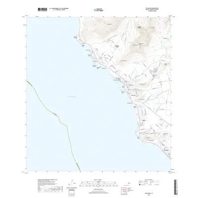
 1998 Waianae2000 Print · USGSThe Leeward Coast of Oahu comes alive in the late nineties, showing the vital connection between the shoreline and the deep interior valleys. Trace family history through the Wai'anae Homesteads, locate the Naval Transmitting Facility, or find local landmarks like Pōka'ī Bay.
 - 2013 Map of Waianae, 2013 Print
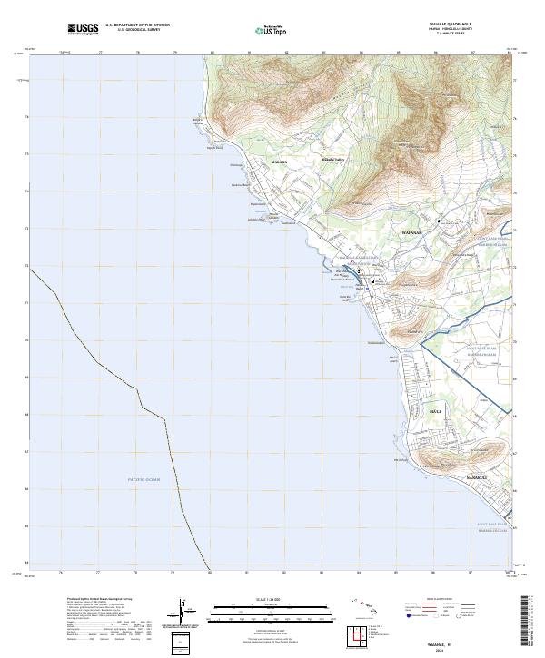
 2013 Waianae2013 Print · USGSCovers Waianae, including Waiʻanae, Nānākuli, and other nearby areas
 - 2017 Map of Waianae, 2017 Print
 2017 Waianae2017 Print · USGSCovers Waianae, including Waiʻanae, Nānākuli, and other nearby areas
 - 2024 Map of Waianae, 2024 Print
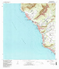
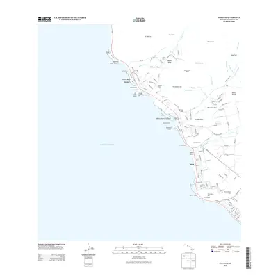
 2024 Waianae2024 Print · USGSThe leeward coast of O‘ahu is documented here in the early twenty-first century, showing the integration of military lands and residential valleys. Researchers can locate family burial sites at Sacred Heart Catholic Cem or trace water infrastructure like the Mikilua Flume.
End of results
Showing maps 1-12 of 12
Top cities near Waianae
- Waipahu historical maps
- Mililani historical maps
- Pearl City historical maps
- Kapolei historical maps
- Ewa Beach historical maps
- Waiʻanae historical maps
See more
Top neighborhoods of Waianae
Frequently asked questions
- What are the different types of historical maps available for Waianae?
- What is the oldest map of Waianae?
- Where can I purchase historical maps of Waianae for my home or office?
- Where can I download high-res historical maps of Waianae?
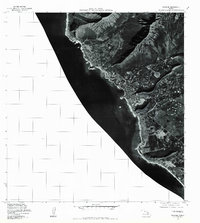
- Are there historical topographic maps available for Waianae?
- Is there historical aerial imagery available for Waianae?
- Where are historical maps of Waianae sourced from?