Old Maps of Lansing, Iowa
Explore 27 old maps of Lansing, spanning from 1903 to today. These high-resolution historic maps reveal how streets, neighborhoods, landmarks, and natural features evolved over time — perfect for genealogy, metal detecting, research, and local history exploration.
What you can do with these maps:
- See how Lansing changed over time: Compare historical maps to modern-day views to trace roads, homesites, rail lines & more.
- View detailed metadata: Each map includes creators, publishers, year, scale, and archive source.
- Overlay maps with satellite & LiDAR: Visualize the past alongside modern tools to explore terrain & human change.
- Trusted historical sources: Maps sourced from the USGS, Library of Congress, and other archives.
- Access maps your way: View online, download high-res files, or order prints for personal or research use.
Start exploring old maps of Lansing to uncover forgotten places, hidden landmarks, and the deep history beneath your feet.
Lansing, IA maps
(27)- 1903 Map of Waukon
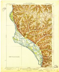
 1903 Waukon1903 Print · USGSThe Upper Mississippi River valley comes alive in the early 1900s, showing a landscape of steep bluffs, river landings, and early rail lines. You can trace the path of the Chicago Milwaukee and St. Paul RR to the county seat at Waukon or find old riverfront points like Harpers Ferry and Lansing.5 unique versions available
 - 1929 Map of Ferryville, 1957 Print
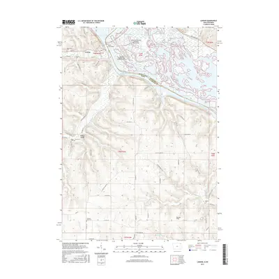
 1929 Ferryville1957 Print · USGSThe riverfront and ridge-top communities of Crawford and Vernon counties are captured here in the late 1920s before major lock and dam construction. Genealogists can locate family landmarks such as Freeman Church, Redmound School, and the riverside tracks of the Chicago Burlington and Quincy Railroad.2 unique versions available
 - 1932 Map of Ferryville
 1932 Ferryville1932 Print · USGSThe Mississippi River bottoms and the ridge-and-hollow country of western Wisconsin are captured here in the early 1930s. Genealogists can trace family farm locations near dozens of rural landmarks like Redmound School, Freeman Church, and Battle Slough.
 - 1958 Map of La Crosse, 1979 Print
 1958 La Crosse1979 Print · USGSThe Driftless Area of Wisconsin and Iowa is captured here during the late seventies, showing the intricate river valleys and ridge-top settlements. Genealogists and historians can trace the rail corridors of the Soo Line or locate landmarks like Grandad Bluff and Effigy Mounds National Monument.2 unique versions available
 - 1961 Map of La Crosse
 1961 La Crosse1961 Print · USGSThe Driftless Area at the start of the 1960s reveals a complex network of river towns and rail lines along the Mississippi River. Genealogists and historians can trace old settlements like New Amsterdam and Wyattville or locate major landmarks like Camp McCoy Military Reservation and Effigy Mounds National Monument.
 - 1965 Map of La Crosse
 1965 La Crosse1965 Print · USGSThe Driftless Area and the Upper Mississippi valley are captured here during a period of steady mid-century growth. Researchers can trace the rail lines of the Chicago and North Western or locate riverfront sites like Effigy Mounds National Monument and the Camp McCoy Military Reservation.
 - 1966 Map of Ferryville, 1968 Print
 1966 Ferryville1968 Print · USGSThe Mississippi River valley in the mid-sixties is shown in detail, capturing the intricate sloughs and ridges along the Wisconsin and Iowa border. Researchers can trace the riverfront rail lines and find small upland landmarks like Red Mound, Retreat, and Walnut Mound Cem.2 unique versions available
 - 1968 Map of Church, 1970 Print
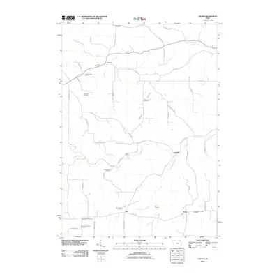
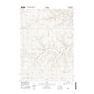
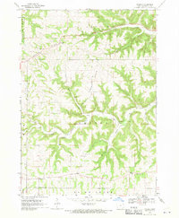 1968 Church1970 Print · USGSAllamakee County’s high ridges and creek valleys are documented here in the late sixties, showing a landscape defined by farming and faith. Genealogists can trace family roots through several specific sites including Old West Paint Creek Ch, Lansing Ridge Cem, and the village of Church.2 unique versions available
 - 1976 Map of La Crosse
 1976 La Crosse1976 Print · USGSThe Driftless Area and Mississippi River valley are captured here in the mid-seventies, showing a landscape of deep coulees and river commerce. Genealogists can trace family footprints from La Crosse to smaller hamlets like Newburg Corners and Witoka.
 - 1983 Map of De Soto
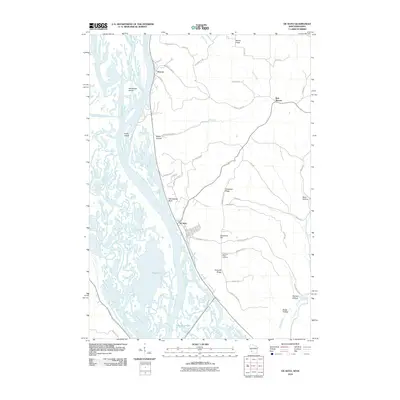
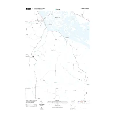
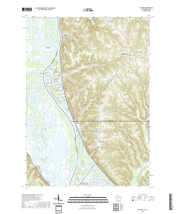
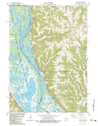 1983 De Soto1983 Print · USGSThe riverfront settlements of De Soto and Victory sit at the base of dramatic bluffs in the early 1980s. Researchers can trace the dual rail lines of the Burlington Northern and Chicago Milwaukee St Paul and Pacific or find rural landmarks like Lawrence Ridge Cem.
 - 1983 Map of Lansing
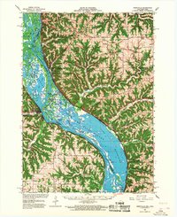
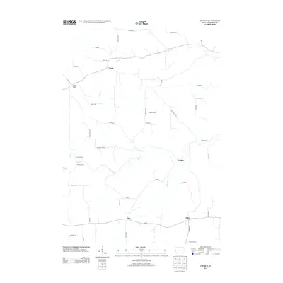
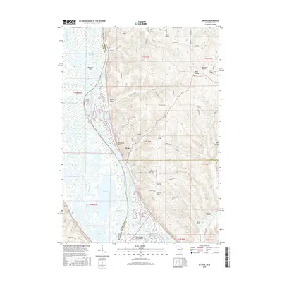
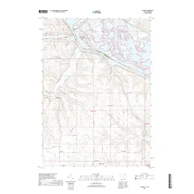
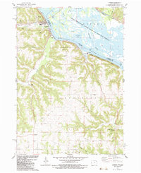 1983 Lansing1983 Print · USGSThe riverfront at Lansing and the bluffs of Allamakee County come alive in this early 1980s portrait of the Mississippi. Researchers can trace rural genealogy at Oak Hill Cem or find local landmarks like Thompson Corner and Wexford.
 - 1985 Map of Decorah
 1985 Decorah1985 Print · USGSNortheast Iowa and western Wisconsin in the mid-eighties show a landscape of high bluffs and river valleys shaped by the Upper Iowa and Mississippi Rivers. Genealogists and historians can trace the paths of the Chicago Milwaukee St Paul and Pacific railroad or locate the National Cemetery and the ancient earthworks at Effigy Mounds National Monument.2 unique versions available
 - 2010 Map of Church, 2010 Print
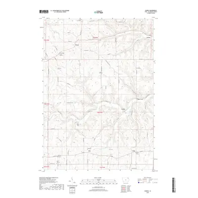
 2010 Church2010 Print · USGSCovers Lansing, including Lyndale, Dalby, and other nearby areas
 - 2010 Map of De Soto, 2010 Print
 2010 De Soto2010 Print · USGSCovers Lansing, including De Soto, Freeman, and other nearby areas
 - 2010 Map of Lansing, 2010 Print
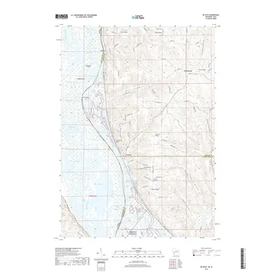
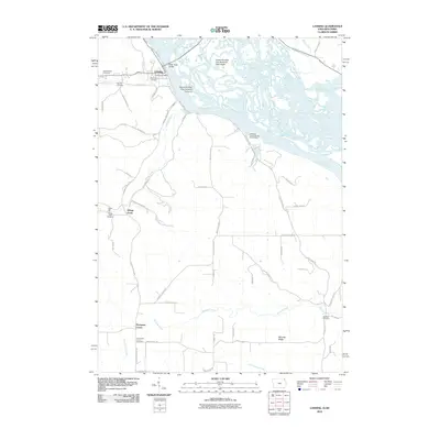 2010 Lansing2010 Print · USGSCovers Lansing, including Thompson Corner, Village Creek, and other nearby areas
 - 2013 Map of Church, 2013 Print
 2013 Church2013 Print · USGSCovers Lansing, including Lyndale, Dalby, and other nearby areas
 - 2013 Map of Lansing, 2013 Print
 2013 Lansing2013 Print · USGSCovers Lansing, including Thompson Corner, Village Creek, and other nearby areas
 - 2013 Map of De Soto, 2013 Print
 2013 De Soto2013 Print · USGSCovers Lansing, including De Soto, Freeman, and other nearby areas
 - 2015 Map of Church, 2015 Print
 2015 Church2015 Print · USGSCovers Lansing, including Lyndale, Dalby, and other nearby areas
 - 2015 Map of De Soto, 2015 Print
 2015 De Soto2015 Print · USGSCovers Lansing, including De Soto, Freeman, and other nearby areas
 - 2015 Map of Lansing, 2015 Print
 2015 Lansing2015 Print · USGSCovers Lansing, including Thompson Corner, Village Creek, and other nearby areas
 - 2018 Map of De Soto, 2018 Print
 2018 De Soto2018 Print · USGSCovers Lansing, including De Soto, Freeman, and other nearby areas
 - 2018 Map of Church, 2018 Print
 2018 Church2018 Print · USGSCovers Lansing, including Lyndale, Dalby, and other nearby areas
 - 2018 Map of Lansing, 2018 Print
 2018 Lansing2018 Print · USGSCovers Lansing, including Thompson Corner, Village Creek, and other nearby areas
 - 2022 Map of De Soto, 2022 Print
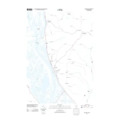
 2022 De Soto2022 Print · USGSThe riverfront and high ridges of the Upper Mississippi Valley are shown here in the 2020s, highlighting the complex water networks and upland settlements. Trace local family history at Lawrence Ridge Cem or explore the river terrain near De Soto and Victory.
Showing maps 1-25 of 27
Top cities near Lansing
- Seneca historical maps
- New Albin historical maps
- Eastman historical maps
- Harpers Ferry historical maps
- Genoa historical maps
- De Soto historical maps
See more
Frequently asked questions
- What are the different types of historical maps available for Lansing?
- What is the oldest map of Lansing?
- Where can I purchase historical maps of Lansing for my home or office?
- Where can I download high-res historical maps of Lansing?
- Are there historical topographic maps available for Lansing?
- Is there historical aerial imagery available for Lansing?
- Where are historical maps of Lansing sourced from?