Old Maps of Black Hawk County, Iowa
Explore 124 old maps of Black Hawk County, spanning from 1954 to today. These high-resolution historic maps reveal how streets, neighborhoods, landmarks, and natural features evolved over time — perfect for genealogy, metal detecting, research, and local history exploration.
What you can do with these maps:
- See how Black Hawk County changed over time: Compare historical maps to modern-day views to trace roads, homesites, rail lines & more.
- View detailed metadata: Each map includes creators, publishers, year, scale, and archive source.
- Overlay maps with satellite & LiDAR: Visualize the past alongside modern tools to explore terrain & human change.
- Trusted historical sources: Maps sourced from the USGS, Library of Congress, and other archives.
- Access maps your way: View online, download high-res files, or order prints for personal or research use.
Start exploring old maps of Black Hawk County to uncover forgotten places, hidden landmarks, and the deep history beneath your feet.
Black Hawk County, IA maps
(124)- 1954 Map of Waterloo, 1968 Print
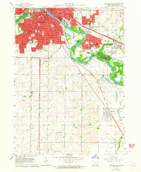
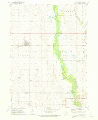
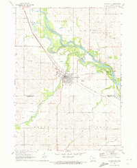
 1954 Waterloo1968 Print · USGSCentral Iowa at the height of its mid-century agricultural and rail boom features the growing hubs of Waterloo and Cedar Falls. Genealogists and researchers can trace the rail corridors of the Chicago Great Western and find local landmarks like Iowa State College and Brushy Ridge.4 unique versions available
 - 1955 Map of Waterloo
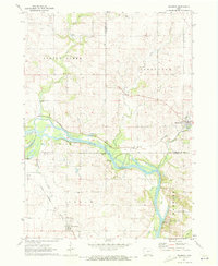
 1955 Waterloo1955 Print · USGSCentral Iowa in the mid-fifties presents a dense landscape of rail-connected farming towns and growing river cities. Researchers can trace ancestral roots and old transport routes through Waterloo, Marshalltown, and Ames, while locating rural Cemeteries and local Quarries.2 unique versions available
 - 1963 Map of Buckingham, 1964 Print
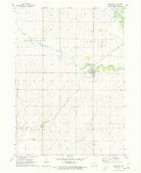
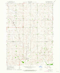 1963 Buckingham1964 Print · USGSThe rural agricultural landscape of Black Hawk and Tama counties is captured here in the early sixties. Researchers can trace the Chicago and North Western rail line and locate community landmarks like Buckingham, Voorhies, and Blessing Ch.2 unique versions available
 - 1963 Map of Waverly, 1964 Print
 1963 Waverly1964 Print · USGSBremer County's river-driven development is captured here in the early sixties, centered on the growing campus of Wartburg College. Researchers can trace old rail lines like the Illinois Central or locate family plots in Harlington Cemetery and Newell Cem.3 unique versions available
 - 1963 Map of Denver, 1964 Print
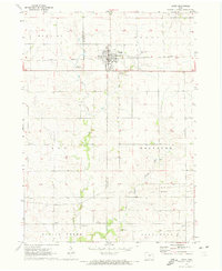
 1963 Denver1964 Print · USGSThe rural border of Bremer and Black Hawk Counties comes alive in this mid-century survey as Denver begins to expand. Local researchers can trace family landmarks and early infrastructure including Pioneer Cem, St Pauls Ch, and the Chicago Great Western rail line.2 unique versions available
 - 1963 Map of Hudson, 1964 Print
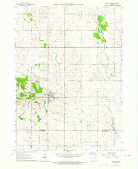
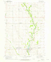
 1963 Hudson1964 Print · USGSThe rural landscape around Hudson and the Waterloo outskirts comes to life in this early 1960s survey. Researchers can trace the Chicago Great Western rail line and locate landmarks like Mt Olive Cemetery and Cedar Falls Junction.2 unique versions available
 - 1963 Map of Waterloo South, 1964 Print
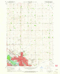
 1963 Waterloo South1964 Print · USGSMid-century Black Hawk County comes alive in this survey of the riverfront industrial and residential sprawl. Genealogists and local historians can trace family roots through numerous burial grounds like Elmwood Cemetery or locate vanished landmarks like the Flyers Airport and Drive-in Theater.3 unique versions available
 - 1963 Map of Eagle Center, 1964 Print
 1963 Eagle Center1964 Print · USGSIn the early 1960s, this agricultural region at the junction of Black Hawk and Tama counties maintained a network of small community centers. Genealogists can trace family footprints through sites like Township Cem, Geneseo Ch, and St Mary Sch.2 unique versions available
 - 1963 Map of Cedar Falls, 1965 Print
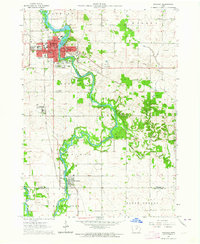
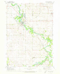
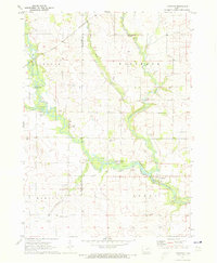
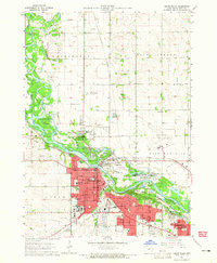 1963 Cedar Falls1965 Print · USGSThe Cedar River valley was undergoing significant post-war expansion in the early sixties as industrial Waterloo and academic Cedar Falls grew together. Researchers can trace the mid-century campus of the State Teachers College or locate family plots at Greenwood Cemetery and Highland Cem.4 unique versions available
 - 1963 Map of Waterloo North, 1965 Print
 1963 Waterloo North1965 Print · USGSWaterloo and its northern townships are shown in the early 1960s as the city expanded toward the Mount Vernon and Bennington lines. Genealogists can locate numerous local landmarks including Fairview Cemetery, Krieg School, and the County Home.2 unique versions available
 - 1971 Map of Readlyn, 1973 Print
 1971 Readlyn1973 Print · USGSBremer County's rural townships and river bends are captured here in the early 1970s. Genealogists and local historians can trace the family-named landmarks of Readlyn and Gresham, alongside rural sites like St Matthews Ch and the Wapsipinicon River.
 - 1971 Map of Zaneta, 1973 Print
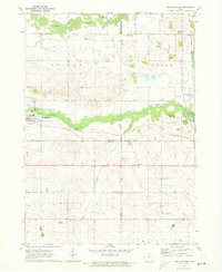
 1971 Zaneta1973 Print · USGSThe rural border of Grundy and Black Hawk Counties is captured here in the early seventies, showcasing a landscape of fertile creek bottoms and rail-side settlements. Researchers can locate family landmarks like St Marys Cemetery, the crossroads at Fredsville, and the Zaneta rail stop.
 - 1971 Map of Shell Rock, 1973 Print
 1971 Shell Rock1973 Print · USGSButler County's river valleys were well-established rail and recreation hubs in the early seventies. Genealogists and local historians can trace the paths of the Chicago Rock Island and Pacific railroad through Shell Rock or locate the Waverly Junction Cem.
 - 1971 Map of Gilbertville, 1973 Print
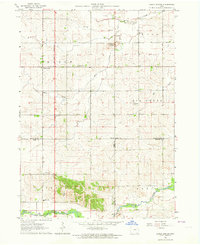
 1971 Gilbertville1973 Print · USGSBlack Hawk County comes into focus in the early seventies as the agricultural and industrial landscape around Gilbertville is meticulously recorded. Researchers can trace the paths of the Illinois Central railroad and locate local landmarks like the Township Cem and Raymar.
 - 1971 Map of La Porte City, 1973 Print
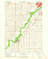
 1971 La Porte City1973 Print · USGSThe Cedar River valley in the early seventies shows a landscape defined by rail transport and river recreation. Researchers can trace family history through several rural burial sites, including Westview Cemetery, Antioch Cem, and the tracks of the Chicago Rock Island and Pacific railroad.
 - 1971 Map of Brandon, 1973 Print
 1971 Brandon1973 Print · USGSThe Cedar River valley near the tri-county junction of Black Hawk, Buchanan, and Benton is captured here in the early 1970s. Trace the rural landscape through landmarks like Spring Creek Cem, the Fish Farm, and the Mt Auburn Bridge.2 unique versions available
 - 1971 Map of Dunkerton, 1973 Print
 1971 Dunkerton1973 Print · USGSDunkerton and the surrounding Iowa farmlands are captured in the early seventies, showcasing a landscape defined by the Chicago and North Western rail line and local creek systems. Researchers can locate family landmarks like Fairview-Lester Cem, St Francis Ch, and the small community of Dewar.
 - 1971 Map of Reinbeck, 1973 Print
 1971 Reinbeck1973 Print · USGSAgricultural life in Grundy and Tama counties reached a mid-century peak as railroads still connected the prairie townships. Genealogists and historians can trace family plots at Amity Cem and Lincoln Cem, or follow the rail lines through Reinbeck and Dinsdale.
 - 1971 Map of Fairbank, 1973 Print
 1971 Fairbank1973 Print · USGSNortheast Iowa farmland at the start of the 1970s is centered here on the crossing of the Little Wapsipinicon River and the Chicago and North Western railroad. Genealogists can trace family roots at Immaculate Conception Cem and St Peter Cem or explore the old layout of Fairbank.
 - 1971 Map of Littleton, 1973 Print
 1971 Littleton1973 Print · USGSThe river valleys of Buchanan and Black Hawk counties are captured here in the early seventies, centered on the village of Littleton. Genealogists and researchers can trace a wealth of local landmarks including Amish Cem, Barclay Cem, and the old Brown Sch.
 - 1971 Map of Jesup, 1973 Print
 1971 Jesup1973 Print · USGSMidwestern prairie life is captured here in the early seventies, detailing the county line communities between Black Hawk and Buchanan. Genealogists can locate family sites near St Athanasius Cem, the old Townhall, or rural settlements like Jubilee and Shady Grove.
 - 1971 Map of New Hartford, 1973 Print
 1971 New Hartford1973 Print · USGSThe Butler and Black Hawk county lines meet near New Hartford during the early seventies, showcasing a classic Iowa landscape of rail-fed towns and river bottoms. Genealogists can locate several local burial sites like Hillcrest Cem and Fairfield Cem along the farm roads.
 - 1984 Map of Marshalltown, 1985 Print
 1984 Marshalltown1985 Print · USGSMid-Iowa's agricultural landscape and river corridors come alive in the mid-eighties as the Cedar River connects industrial hubs and small farm towns. Trace the tracks of the CHICAGO AND NORTHWESTERN or locate local landmarks like Union Grove State Park and Cedar Falls Junction.2 unique versions available
 - 1984 Map of Waverly, 1985 Print
 1984 Waverly1985 Print · USGSNortheast Iowa in the mid-eighties shows a robust network of river towns and rail corridors connecting agricultural centers. Researchers can trace family sites near Garden of Memories Cem or follow the Chicago and North Western line through Janesville and Waverly.2 unique versions available
 - 2010 Map of Buckingham, 2010 Print
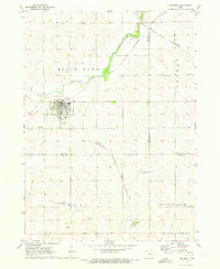
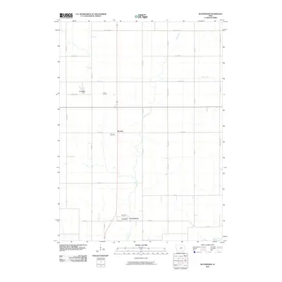 2010 Buckingham2010 Print · USGSCovers Black Hawk County, including Buckingham, Voorhies, and other nearby areas
Showing maps 1-25 of 124
Top cities of Black Hawk County
- Waterloo historical maps
- Cedar Falls historical maps
- Evansdale historical maps
- Hudson historical maps
- La Porte City historical maps
- Elk Run Heights historical maps
See more
Frequently asked questions
- What are the different types of historical maps available for Black Hawk County?
- What is the oldest map of Black Hawk County?
- Where can I purchase historical maps of Black Hawk County for my home or office?
- Where can I download high-res historical maps of Black Hawk County?
- Are there historical topographic maps available for Black Hawk County?
- Is there historical aerial imagery available for Black Hawk County?
- Where are historical maps of Black Hawk County sourced from?