Old Maps of Girard, Kansas
Explore 20 old maps of Girard, spanning from 1884 to today. These high-resolution historic maps reveal how streets, neighborhoods, landmarks, and natural features evolved over time — perfect for genealogy, metal detecting, research, and local history exploration.
What you can do with these maps:
- See how Girard changed over time: Compare historical maps to modern-day views to trace roads, homesites, rail lines & more.
- View detailed metadata: Each map includes creators, publishers, year, scale, and archive source.
- Overlay maps with satellite & LiDAR: Visualize the past alongside modern tools to explore terrain & human change.
- Trusted historical sources: Maps sourced from the USGS, Library of Congress, and other archives.
- Access maps your way: View online, download high-res files, or order prints for personal or research use.
Start exploring old maps of Girard to uncover forgotten places, hidden landmarks, and the deep history beneath your feet.
Girard, KS maps
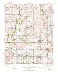
(20)- 1884 Map of Fort Scott, 1954 Print
 1884 Fort Scott1954 Print · USGSCovers Girard, including Fort Scott, Arma, and other nearby areas
 - 1886 Map of Joplin
 1886 Joplin1886 Print · USGSCovers Girard, including Joplin, Pittsburg, and other nearby areas
 - 1886 Map of Fort Scott
 1886 Fort Scott1886 Print · USGSCovers Girard, including Fort Scott, Arma, and other nearby areas
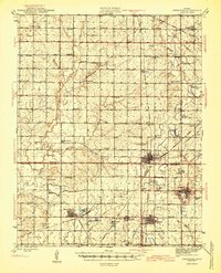
 - 1893 Map of Fort Scott
 1893 Fort Scott1893 Print · USGSCovers Girard, including Fort Scott, Arma, and other nearby areas7 unique versions available
 - 1894 Map of Joplin
 1894 Joplin1894 Print · USGSCovers Girard, including Joplin, Pittsburg, and other nearby areas6 unique versions available
 - 1943 Map of Cherokee, 1972 Print
 1943 Cherokee1972 Print · USGSCovers Girard, including Weir, Cherokee, and other nearby areas
 - 1945 Map of Cherokee
 1945 Cherokee1945 Print · USGSCovers Girard, including Weir, Cherokee, and other nearby areas2 unique versions available
 - 1947 Map of Joplin, 1954 Print
 1947 Joplin1954 Print · USGSCovers Girard, including Joplin, Pittsburg, and other nearby areas
 - 1948 Map of Girard, 1963 Print
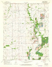
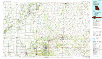
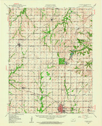 1948 Girard1963 Print · USGSCovers Girard, including Hepler, Greenbush, and other nearby areas
 - 1949 Map of Girard
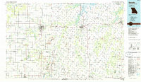
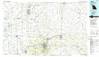
 1949 Girard1949 Print · USGSCovers Girard, including Hepler, Greenbush, and other nearby areas2 unique versions available
 - 1949 Map of Joplin
 1949 Joplin1949 Print · USGSCovers Girard, including Joplin, Pittsburg, and other nearby areas
 - 1954 Map of Joplin, 1967 Print
 1954 Joplin1967 Print · USGSCovers Girard, including Joplin, Pittsburg, and other nearby areas3 unique versions available
 - 1958 Map of Joplin
 1958 Joplin1958 Print · USGSCovers Girard, including Joplin, Pittsburg, and other nearby areas
 - 1959 Map of Joplin
 1959 Joplin1959 Print · USGSCovers Girard, including Joplin, Pittsburg, and other nearby areas
 - 1964 Map of Radley
 1964 Radley1964 Print · USGSCovers Girard, including Filler, South Radley, and other nearby areas2 unique versions available
 - 1964 Map of Girard, 1965 Print
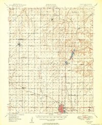
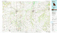
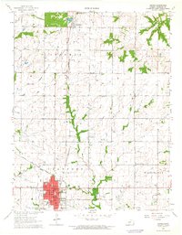 1964 Girard1965 Print · USGSCovers Girard, including Ringo, Farlington, and other nearby areas
 - 1986 Map of Nevada
 1986 Nevada1986 Print · USGSCovers Girard, including Nevada, Fort Scott, and other nearby areas
 - 1986 Map of Joplin
 1986 Joplin1986 Print · USGSCovers Girard, including Joplin, Pittsburg, and other nearby areas
 - 1991 Map of Joplin
 1991 Joplin1991 Print · USGSCovers Girard, including Joplin, Pittsburg, and other nearby areas
 - 1991 Map of Nevada
 1991 Nevada1991 Print · USGSCovers Girard, including Nevada, Fort Scott, and other nearby areas
End of results
Showing maps 1-20 of 20
Top cities near Girard
- Pittsburg historical maps
- Frontenac historical maps
- Arma historical maps
- Weir historical maps
- Cherokee historical maps
- Mulberry historical maps
See more
Frequently asked questions
- What are the different types of historical maps available for Girard?
- What is the oldest map of Girard?
- Where can I purchase historical maps of Girard for my home or office?
- Where can I download high-res historical maps of Girard?
- Are there historical topographic maps available for Girard?
- Is there historical aerial imagery available for Girard?
- Where are historical maps of Girard sourced from?