Old Maps of Butler, Kentucky
Explore 20 old maps of Butler, spanning from 1929 to today. These high-resolution historic maps reveal how streets, neighborhoods, landmarks, and natural features evolved over time — perfect for genealogy, metal detecting, research, and local history exploration.
What you can do with these maps:
- See how Butler changed over time: Compare historical maps to modern-day views to trace roads, homesites, rail lines & more.
- View detailed metadata: Each map includes creators, publishers, year, scale, and archive source.
- Overlay maps with satellite & LiDAR: Visualize the past alongside modern tools to explore terrain & human change.
- Trusted historical sources: Maps sourced from the USGS, Library of Congress, and other archives.
- Access maps your way: View online, download high-res files, or order prints for personal or research use.
Start exploring old maps of Butler to uncover forgotten places, hidden landmarks, and the deep history beneath your feet.
Butler, KY maps
(20)- 1929 Map of Alexandria
 1929 Alexandria1929 Print · USGSNorthern Kentucky and the Ohio River border appear here in the late twenties as a bustling landscape of ridge-top farms and river-valley rail towns. Genealogists can trace family roots through numerous local landmarks like Oak Island Ch, Grants Lick, and the many rural schools such as Carthage Sch.
 - 1936 Map of Alexandria
 1936 Alexandria1936 Print · USGSNorthern Kentucky and the Ohio River valley appear here in the mid-1930s, showing a landscape defined by sharp river bends and rural rail stops. Researchers can trace historic schools and parish centers like Sts Peter and Paul Sch, the winding Licking Valley Highway, and the riverside operations at Gubser Mill.2 unique versions available
 - 1953 Map of Butler, 1955 Print
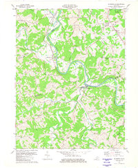
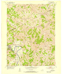 1953 Butler1955 Print · USGSThe Licking River valley in the early fifties shows a rugged landscape of winding ridges and railroad-dependent towns. Trace family roots at Butler Cem or Mt Auburn Cem, and locate rural landmarks like Fisher Tabernacle and Peach Grove.
 - 1953 Map of De Mossville, 1955 Print
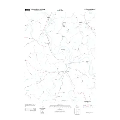
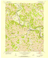 1953 De Mossville1955 Print · USGSThe Licking River valley in the early fifties was a landscape of tight-knit rail communities and upland farms where Kenton, Campbell, and Pendleton counties meet. Genealogists can trace family footprints at Smith Cem, DeMossville, and country churches like Oak Island Ch.
 - 1956 Map of Louisville, 1971 Print
 1956 Louisville1971 Print · USGSThe Ohio River valley and the Kentucky Bluegrass are captured here during a period of rapid mid-century growth and industrial activity. Genealogists and historians can trace rail-centered towns and military land use at Fort Knox and the Jefferson Proving Ground.2 unique versions available
 - 1961 Map of De Mossville, 1963 Print
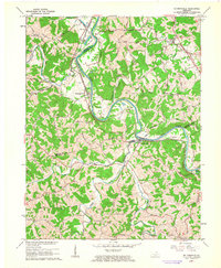 1961 De Mossville1963 Print · USGSThe Licking River valley was defined by its winding waters and the Louisville and Nashville rail line in the early sixties. Genealogists can trace family names at Caldwell Cem or locate the rural hubs of De Mossville and Morning View.
 - 1964 Map of Louisville
 1964 Louisville1964 Print · USGSThe Ohio River valley and Kentucky Bluegrass are captured in the mid-1960s, showing a region balanced between industrial growth and its agrarian roots. Genealogists and historians can trace the development of county seats like Shelbyville and Paris, or locate established institutions such as Georgetown College and Bernheim Forest.
 - 1981 Map of Butler, 1982 Print
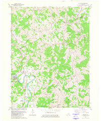 1981 Butler1982 Print · USGSThe Licking River valley in northern Kentucky was a landscape of small river towns and family farms in the early eighties. Genealogists can trace family roots through sites like Butler Cem, Plum Creek Ch, and the historic Louisville and Nashville rail corridor.
 - 1981 Map of De Mossville, 1982 Print
 1981 De Mossville1982 Print · USGSIn the early eighties, this Northern Kentucky hill country remained a landscape of winding river valleys and ridge-top roads. Genealogists can trace family roots at Caldwell Cem or Smith Cem and locate historic community centers like Morning View and St Marys Ch.
 - 1986 Map of Falmouth
 1986 Falmouth1986 Print · USGSNorthern Kentucky and the Ohio River valley are shown here in the mid-1980s, highlighting the region's complex river-and-rail geography. Genealogists and researchers can trace the roads connecting Big Bone Lick, Zion Church, and river towns like Falmouth and Augusta.2 unique versions available
 - 2010 Map of De Mossville, 2010 Print
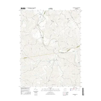
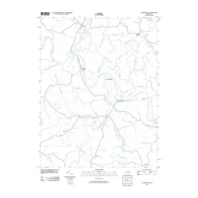 2010 De Mossville2010 Print · USGSCovers Butler, including Caldwell, Morning View, and other nearby areas
 - 2010 Map of Butler, 2010 Print
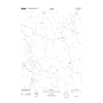
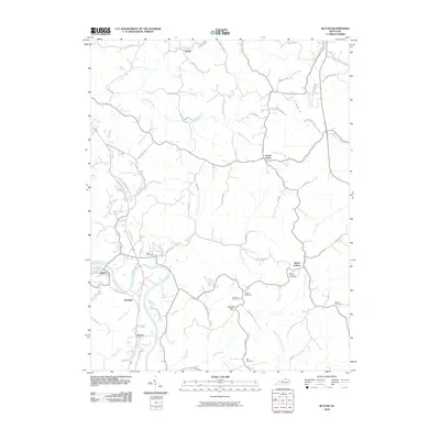 2010 Butler2010 Print · USGSCovers Butler, including Mount Auburn, Peach Grove, and other nearby areas
 - 2013 Map of De Mossville, 2013 Print
 2013 De Mossville2013 Print · USGSCovers Butler, including Caldwell, Morning View, and other nearby areas
 - 2013 Map of Butler, 2013 Print
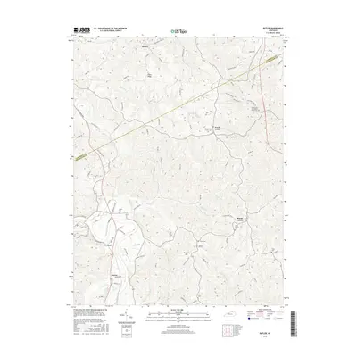
 2013 Butler2013 Print · USGSCovers Butler, including Mount Auburn, Peach Grove, and other nearby areas
 - 2016 Map of De Mossville, 2016 Print
 2016 De Mossville2016 Print · USGSCovers Butler, including Caldwell, Morning View, and other nearby areas
 - 2016 Map of Butler, 2016 Print
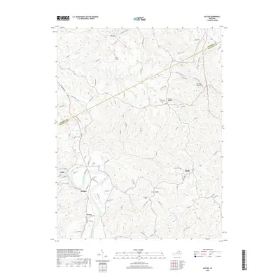
 2016 Butler2016 Print · USGSCovers Butler, including Mount Auburn, Peach Grove, and other nearby areas
 - 2019 Map of Butler, 2019 Print
 2019 Butler2019 Print · USGSCovers Butler, including Mount Auburn, Peach Grove, and other nearby areas
 - 2019 Map of De Mossville, 2019 Print
 2019 De Mossville2019 Print · USGSCovers Butler, including Caldwell, Morning View, and other nearby areas
 - 2022 Map of Butler, 2022 Print
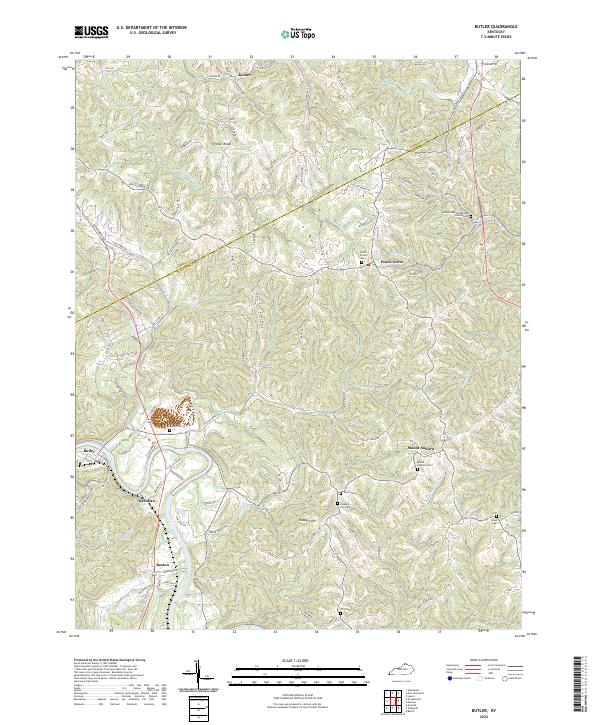 2022 Butler2022 Print · USGSThe Licking River valley and the ridges of northern Kentucky are captured here in recent detail. Researchers can trace family history through numerous rural landmarks like the Immaculate Conception Church Cem, Mount Auburn, and Fisher Ridge.
 - 2022 Map of De Mossville, 2022 Print
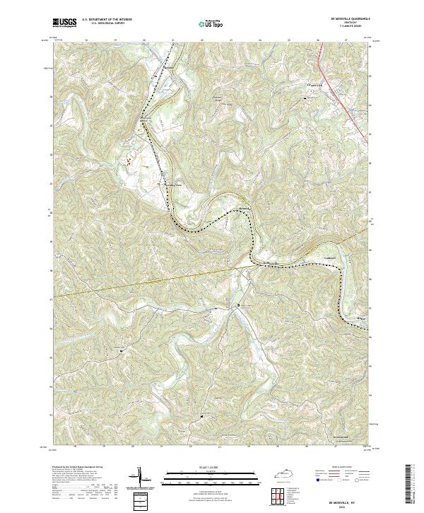 2022 De Mossville2022 Print · USGSThe Licking River valley in Northern Kentucky is captured here as it appeared in 2022, showing the rural communities along the Pendleton and Kenton County lines. Researchers can trace historic cemeteries and rail lines through DeMossville, Grants Lick, and the Licking Valley RR.
End of results
Showing maps 1-20 of 20
Top cities near Butler
- Covington historical maps
- Independence historical maps
- Erlanger historical maps
- Edgewood historical maps
- Alexandria historical maps
- Elsmere historical maps
See more
Frequently asked questions
- What are the different types of historical maps available for Butler?
- What is the oldest map of Butler?
- Where can I purchase historical maps of Butler for my home or office?
- Where can I download high-res historical maps of Butler?
- Are there historical topographic maps available for Butler?
- Is there historical aerial imagery available for Butler?
- Where are historical maps of Butler sourced from?