Old Maps of Thurgood Marshall Memorial Plaza, Annapolis
Explore 17 old maps of Thurgood Marshall Memorial Plaza, spanning from 1892 to today. These high-resolution historic maps reveal how streets, neighborhoods, landmarks, and natural features evolved over time — perfect for genealogy, metal detecting, research, and local history exploration.
What you can do with these maps:
- See how Thurgood Marshall Memorial Plaza changed over time: Compare historical maps to modern-day views to trace roads, homesites, rail lines & more.
- View detailed metadata: Each map includes creators, publishers, year, scale, and archive source.
- Overlay maps with satellite & LiDAR: Visualize the past alongside modern tools to explore terrain & human change.
- Trusted historical sources: Maps sourced from the USGS, Library of Congress, and other archives.
- Access maps your way: View online, download high-res files, or order prints for personal or research use.
Start exploring old maps of Thurgood Marshall Memorial Plaza to uncover forgotten places, hidden landmarks, and the deep history beneath your feet.
Thurgood Marshall Memorial Plaza, Annapolis maps
(17)- 1892 Map of Annapolis
 1892 Annapolis1892 Print · USGSMaryland's capital and the surrounding Chesapeake Bay shores appear here during the late Victorian era, before modern bridges linked the coastlines. Genealogists can trace early homesteads and rail lines in Annapolis or explore eastern shore landings like Claiborne and Kent Island.2 unique versions available
 - 1898 Map of Choptank
 1898 Choptank1898 Print · USGSThe Maryland Eastern Shore and its intricate Chesapeake coastline are documented here in the late 1890s. Genealogists can trace family roots in Annapolis or Easton, while maritime historians can locate historic landings such as Corners Wharf and Wye Landing.2 unique versions available
 - 1904 Map of Annapolis
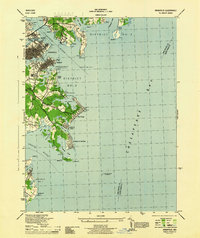
 1904 Annapolis1904 Print · USGSMaryland's capital and the Eastern Shore are captured in detail just after the turn of the century. Genealogists and maritime historians can trace property near Annapolis, the grounds of the U. S. Naval Academy, and remote settlements like Stevensville on Kent Island.5 unique versions available
 - 1908 Map of Choptank
 1908 Choptank1908 Print · USGSMaryland's Eastern Shore and the Chesapeake Bay are captured here at the start of the twentieth century, showing a world of steamships and rail. Genealogists can trace family names at St Michaels, Oxford, and waterfront landings like Claiborne or Arundel on the Bay.5 unique versions available
 - 1944 Map of Annapolis
 1944 Annapolis1944 Print · USGSCoastal Maryland at the height of the war years reveals a landscape defined by naval expansion and developing bayside communities. Researchers can trace the mid-century footprints of Highland Beach, the U S Naval Academy, and the historic Thomas Point Shoal Lighthouse.
 - 1948 Map of Washington
 1948 Washington1948 Print · USGSThe Potomac and Chesapeake regions in the late 1940s reveal a landscape of expanding military reach and deep-rooted Tidewater settlements. Trace old rail corridors like the Richmond Fredericksburg & Potomac RR or locate landmarks like the Wakefield Washington Monument and St. Marys College.2 unique versions available
 - 1953 Map of Annapolis
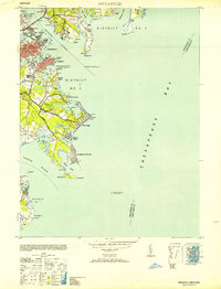 1953 Annapolis1953 Print · USGSThe Annapolis waterfront during the early 1950s shows a dense landscape of naval facilities and coastal settlements. Genealogists and historians can trace the development of Eastport, Arundel on the Bay, and the historic U S Naval Academy.
 - 1957 Map of Annapolis, 1958 Print
 1957 Annapolis1958 Print · USGSMid-century Annapolis and its surrounding peninsula are captured here as suburban growth begins to reach the Chesapeake shoreline. Researchers can trace the layout of the U S Naval Academy, find local landmarks like St Marys Church, or locate vanished leisure spots like Carrs Beach.5 unique versions available
 - 1957 Map of Washington, 1966 Print
 1957 Washington1966 Print · USGSThe mid-Atlantic region during the mid-fifties and early sixties reveals a landscape of growing suburbs and vital military outposts. Researchers can trace historic river towns and shorelines from Alexandria to the Hooper Islands and St Clements Island.5 unique versions available
 - 1961 Map of Washington
 1961 Washington1961 Print · USGSThe mid-Atlantic region in the late fifties is presented in remarkable detail, from the Blue Ridge foothills to the Chesapeake Eastern Shore. Researchers can trace historic river landings and military sites like Mount Vernon, Fort Belvoir, and Point Lookout.2 unique versions available
 - 1983 Map of Washington East, 1984 Print
 1983 Washington East1984 Print · USGSThe Chesapeake Bay region in the early eighties shows the Maryland capital and its suburbs meeting the maritime traditions of the Eastern Shore. Researchers can trace land patterns from Andrews Air Force Base to waterfront settlements like Oxford and Chesapeake Beach.2 unique versions available
 - 1989 Map of Washington
 1989 Washington1989 Print · USGSThe Potomac River valley and Chesapeake Bay are shown in comprehensive detail during the late 1980s. Genealogists and historians can trace the transition from urban Alexandria to the rural Northern Neck, locating landmarks like Mount Vernon and Stratford Hall.
 - 2011 Map of Annapolis, 2011 Print
 2011 Annapolis2011 Print · USGSCovers Thurgood Marshall Memorial Plaza, including Annapolis, Naval Academy, and other nearby areas
 - 2014 Map of Annapolis, 2014 Print
 2014 Annapolis2014 Print · USGSCovers Thurgood Marshall Memorial Plaza, including Annapolis, Naval Academy, and other nearby areas
 - 2016 Map of Annapolis, 2016 Print
 2016 Annapolis2016 Print · USGSCovers Thurgood Marshall Memorial Plaza, including Annapolis, Naval Academy, and other nearby areas
 - 2019 Map of Annapolis, 2019 Print
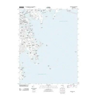
 2019 Annapolis2019 Print · USGSCovers Thurgood Marshall Memorial Plaza, including Annapolis, Naval Academy, and other nearby areas
 - 2023 Map of Annapolis, 2023 Print
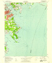
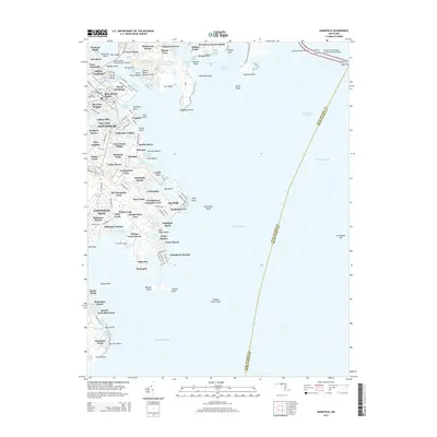
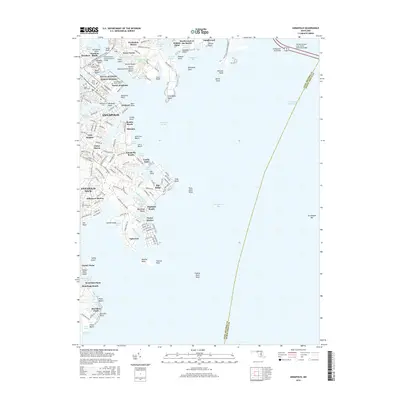
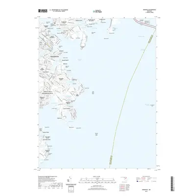
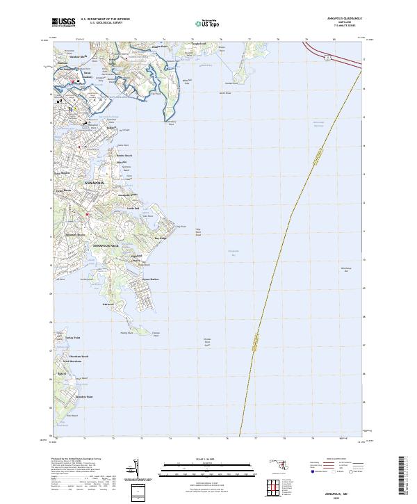 2023 Annapolis2023 Print · USGSThe capital of Maryland and its surrounding neck of land are shown here as they appear in the early 2020s, showing a landscape defined by maritime history and bayfront development. Trace the grounds of the Naval Academy, explore historic Eastport, or locate family sites at Saint Annes Cem and Cedar Bluff Cem.
End of results
Showing maps 1-17 of 17
Frequently asked questions
- What are the different types of historical maps available for Thurgood Marshall Memorial Plaza?
- What is the oldest map of Thurgood Marshall Memorial Plaza?
- Where can I purchase historical maps of Thurgood Marshall Memorial Plaza for my home or office?
- Where can I download high-res historical maps of Thurgood Marshall Memorial Plaza?
- Are there historical topographic maps available for Thurgood Marshall Memorial Plaza?
- Is there historical aerial imagery available for Thurgood Marshall Memorial Plaza?
- Where are historical maps of Thurgood Marshall Memorial Plaza sourced from?