Old Maps of Point Field Landing on the Severn, Maryland
Explore 19 old maps of Point Field Landing on the Severn, spanning from 1894 to today. These high-resolution historic maps reveal how streets, neighborhoods, landmarks, and natural features evolved over time — perfect for genealogy, metal detecting, research, and local history exploration.
What you can do with these maps:
- See how Point Field Landing on the Severn changed over time: Compare historical maps to modern-day views to trace roads, homesites, rail lines & more.
- View detailed metadata: Each map includes creators, publishers, year, scale, and archive source.
- Overlay maps with satellite & LiDAR: Visualize the past alongside modern tools to explore terrain & human change.
- Trusted historical sources: Maps sourced from the USGS, Library of Congress, and other archives.
- Access maps your way: View online, download high-res files, or order prints for personal or research use.
Start exploring old maps of Point Field Landing on the Severn to uncover forgotten places, hidden landmarks, and the deep history beneath your feet.
Point Field Landing on the Severn, MD maps
(19)- 1894 Map of Relay
 1894 Relay1894 Print · USGSAnne Arundel and Howard counties are shown in the late nineteenth century as the regional rail network reached its peak. Genealogists and historians can trace the early footprints of Glen Burnie, identify old landings like Whitneys Ld., and locate the St. Helena church.4 unique versions available
 - 1907 Map of Relay
 1907 Relay1907 Print · USGSAnne Arundel County and the Patapsco waterfront are shown here in the early nineteen-hundreds, as industry and maritime trade reshaped the Maryland coast. Genealogists and historians can trace rail lines and early settlements like Relay and Elkridge, or locate landmarks such as Fort Carroll and St. Stephens Church.8 unique versions available
 - 1908 Map of Patapsco
 1908 Patapsco1908 Print · USGSMaryland's central corridor at the opening of the twentieth century reveals a dense network of harbor defenses and rail-line economies. Genealogists and historians can trace the foundations of Baltimore alongside local landmarks like Ashland Furnace, St Charles College, and Fort McHenry.4 unique versions available
 - 1944 Map of Round Bay
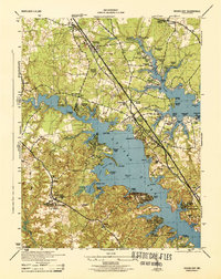 1944 Round Bay1944 Print · USGSMid-century Anne Arundel County shows a landscape of burgeoning waterfront communities and historic estates along the Severn and Magothy Rivers. Genealogists and researchers can trace local family landmarks and institutional sites like Crownsville State Hospital, Belvoir Manor, and the Baltimore and Annapolis RR.
 - 1947 Map of Relay, 1954 Print
 1947 Relay1954 Print · USGSMid-century Anne Arundel County is caught between its rail-and-river heritage and the rise of the jet age. Genealogists and local historians can trace the footprint of the Baltimore Friendship International Airport or locate family plots in Cedar Hill Cem and Arundel Cem.2 unique versions available
 - 1948 Map of Baltimore
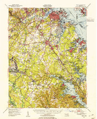
 1948 Baltimore1948 Print · USGSMaryland and Pennsylvania crossroads are captured in the late 1940s, showing a landscape defined by historic rail lines and major military installations. Genealogists can trace family connections in Gettysburg, Westminster, and near the U.S. Naval Academy in Annapolis.2 unique versions available
 - 1949 Map of Round Bay, 1953 Print
 1949 Round Bay1953 Print · USGSMid-century Anne Arundel County is captured here as suburban growth follows the Baltimore and Annapolis RR. Genealogists can trace local roots at St Marys-on-the-Severn Ch, Magothy Sch, and the estates of Sherwood Forest.2 unique versions available
 - 1954 Map of Baltimore
 1954 Baltimore1954 Print · USGSThe Mid-Atlantic region in the early fifties shows a landscape of growing suburban centers and heavy rail corridors. Trace mid-century transit networks and military landmarks from the Aberdeen Proving Ground to the Gettysburg National Military Park.
 - 1956 Map of Baltimore
 1956 Baltimore1956 Print · USGSMid-century Maryland and Pennsylvania are captured here during a period of massive suburban and military growth across the Chesapeake region. Genealogists and historians can trace the rail corridors of the Baltimore & Ohio RR and locate landmarks like Fort McHenry or the Aberdeen Proving Ground.
 - 1956 Map of Round Bay, 1960 Print
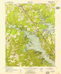
 1956 Round Bay1960 Print · USGSAnne Arundel County is captured here in the mid-1950s as its tidal shorelines transitioned into vibrant residential communities. Genealogists and local historians can trace the Baltimore and Annapolis Railroad corridor through Earleigh Heights and locate landmarks like the Crownsville State Hospital.4 unique versions available
 - 1957 Map of Baltimore, 1964 Print
 1957 Baltimore1964 Print · USGSMaryland and Southern Pennsylvania are shown during the mid-century expansion of the Baltimore-Washington corridor. Researchers can trace the extensive rail lines of the Baltimore & Ohio RR and locate sites like Fort Detrick and Gettysburg National Military Park.5 unique versions available
 - 1961 Map of Baltimore
 1961 Baltimore1961 Print · USGSMaryland and Pennsylvania are captured at a mid-century peak of industrial and military expansion. Genealogists and historians can trace rail corridors like the Western Maryland Ry or locate regional landmarks such as Camp Detrick and Kent Island.
 - 1984 Map of Baltimore
 1984 Baltimore1984 Print · USGSThe Baltimore and Annapolis corridor in the mid-eighties shows a landscape of rapid suburban growth and deep-seated maritime history. Researchers can trace the massive footprints of the U S Naval Academy, Fort George G Meade, and Goddard Space Flight Ctr.
 - 1989 Map of Baltimore
 1989 Baltimore1989 Print · USGSThe Mid-Atlantic corridor in the late eighties is captured here, from the Baltimore harbor to the Blue Ridge foothills. Researchers can trace the sprawling footprints of Aberdeen Proving Ground, the historic grounds of Gettysburg National Military Park, and the winding Susquehanna River.
 - 2011 Map of Round Bay, 2011 Print
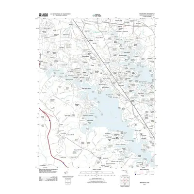 2011 Round Bay2011 Print · USGSCovers Point Field Landing on the Severn, including Severna Park, Annapolis, and other nearby areas
 - 2014 Map of Round Bay, 2014 Print
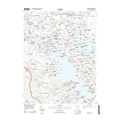 2014 Round Bay2014 Print · USGSCovers Point Field Landing on the Severn, including Severna Park, Annapolis, and other nearby areas
 - 2016 Map of Round Bay, 2016 Print
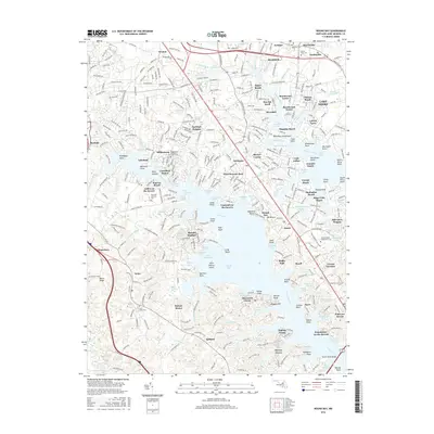 2016 Round Bay2016 Print · USGSCovers Point Field Landing on the Severn, including Severna Park, Annapolis, and other nearby areas
 - 2019 Map of Round Bay, 2019 Print
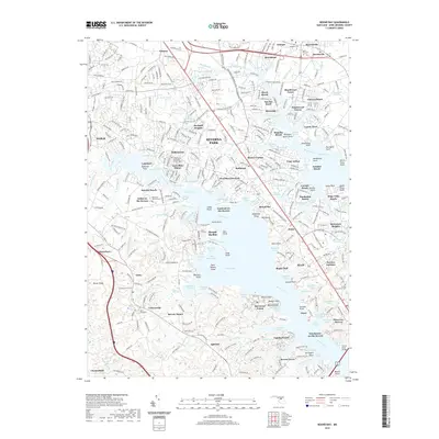 2019 Round Bay2019 Print · USGSCovers Point Field Landing on the Severn, including Severna Park, Annapolis, and other nearby areas
 - 2023 Map of Round Bay, 2023 Print
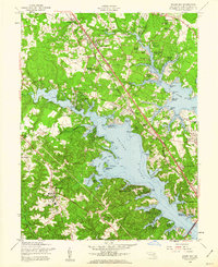
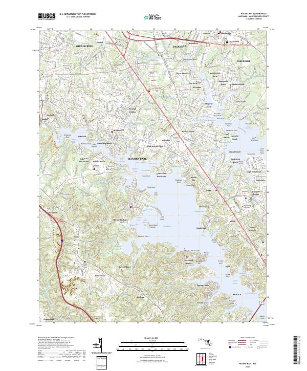 2023 Round Bay2023 Print · USGSCoastal Anne Arundel County comes alive in this survey of the tidal inlets and growing suburbs during the early twenty-first century. Genealogists and local historians can trace family-named sites and landmarks from Mount Zion Cem to the waterfront reaches of Arden on the Severn and Saint Helena Island.
End of results
Showing maps 1-19 of 19
Top cities near Point Field Landing on the Severn
- Baltimore historical maps
- Glen Burnie historical maps
- Dundalk historical maps
- Bowie historical maps
- Ellicott City historical maps
- Odenton historical maps
See more
Frequently asked questions
- What are the different types of historical maps available for Point Field Landing on the Severn?
- What is the oldest map of Point Field Landing on the Severn?
- Where can I purchase historical maps of Point Field Landing on the Severn for my home or office?
- Where can I download high-res historical maps of Point Field Landing on the Severn?
- Are there historical topographic maps available for Point Field Landing on the Severn?
- Is there historical aerial imagery available for Point Field Landing on the Severn?
- Where are historical maps of Point Field Landing on the Severn sourced from?