Old Maps of Great Barrington, Massachusetts
Explore 98 old maps of Great Barrington, spanning from 1885 to today. These high-resolution historic maps reveal how streets, neighborhoods, landmarks, and natural features evolved over time — perfect for genealogy, metal detecting, research, and local history exploration.
What you can do with these maps:
- See how Great Barrington changed over time: Compare historical maps to modern-day views to trace roads, homesites, rail lines & more.
- View detailed metadata: Each map includes creators, publishers, year, scale, and archive source.
- Overlay maps with satellite & LiDAR: Visualize the past alongside modern tools to explore terrain & human change.
- Trusted historical sources: Maps sourced from the USGS, Library of Congress, and other archives.
- Access maps your way: View online, download high-res files, or order prints for personal or research use.
Start exploring old maps of Great Barrington to uncover forgotten places, hidden landmarks, and the deep history beneath your feet.
Great Barrington, MA maps
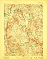
(98)- 1885 Map of Sheffield
 1885 Sheffield1885 Print · USGSThe Berkshires meet the Connecticut and New York borders during a period of heavy rail expansion and riverside industry. Genealogists can trace family roots through settlements like Gomorrah, Sodom, and North Egremont, or locate landmarks such as Union Church and Ashley Falls.
 - 1886 Map of Becket
 1886 Becket1886 Print · USGSThe Berkshire Highlands come into focus in the late nineteenth century, revealing a landscape of hill-town settlements and early industrial rail lines. Genealogists and historians can trace family locations in Becket Center, Middlefield, and Washington, or follow the Boston and Albany railroad as it passes Lenox Furnace.
 - 1888 Map of Sheffield
 1888 Sheffield1888 Print · USGSThe Housatonic Valley in the 1880s is captured here at the height of its rail-and-mill era, spanning the borderlands of Massachusetts and Connecticut. Researchers can trace the original routes of the Housatonic Railroad and locate community landmarks like Union Church and Twin Lakes Station.
 - 1888 Map of Becket
 1888 Becket1888 Print · USGSThe Berkshire highlands come alive in the late 1880s, showcasing a network of mountain settlements and vital rail corridors. Trace the path of the Boston and Albany Railroad through high-elevation stops like Washington Station and industrial sites at Lenox Furnace.
 - 1888 Map of Sandisfield
 1888 Sandisfield1888 Print · USGSThe Berkshires at the end of the nineteenth century reveal a landscape of mountain villages and river-powered industry. Genealogists can trace family roots through the early roads of Sandisfield, New Marlborough, and the banks of the Farmington River.
 - 1888 Map of Pittsfield
 1888 Pittsfield1888 Print · USGSThe Berkshires and eastern New York meet in this late 19th-century record of a landscape defined by communal settlements and early industry. Genealogists and historians can trace the footprint of the Canaan Shakers, industrial sites at Richmond Furnace, and the early rail stops at Edwards Station.
 - 1890 Map of Pittsfield
 1890 Pittsfield1890 Print · USGSThe Berkshires and New York borderlands are captured here in the late nineteenth century, showing a landscape defined by communal Shaker life and iron works. Researchers can trace the Lebanon Springs Railroad through Lebanon Springs or locate early industrial hubs like Richmond Furnace and Lower Barkerville.
 - 1891 Map of Sheffield
 1891 Sheffield1891 Print · USGSThe Housatonic Valley in the 1890s reveals a bustling corridor of rail-and-river commerce at the foot of the Berkshire mountains. Genealogists and historians can trace Victorian-era settlements from Great Barrington to Sheffield, locating old landmarks like Union Church and Chapinville Station.
 - 1893 Map of Becket
 1893 Becket1893 Print · USGSThe Berkshire highlands in the 1890s reveal a landscape of mountain railroading and early industrial water power. Genealogists and historians can trace family locations near Washington Station, Lenox Furnace, and the early settlements of Becket Center.
 - 1893 Map of Sheffield
 1893 Sheffield1893 Print · USGSThe Housatonic River valley flourished at the end of the century as a hub for rail and water-powered industry. Researchers can trace the path of the Housatonic Railroad through Great Barrington and locate landmarks like Union Church and Bashbish Falls.
 - 1893 Map of Pittsfield
 1893 Pittsfield1893 Print · USGSThe Berkshires and the New York border are captured here in the late nineteenth century, showing a landscape of Shaker communities and early industrial sites. Genealogists can trace family roots in Barkerville, Curtisville, and near the historic Richmond Furnace.
 - 1893 Map of Sandisfield
 1893 Sandisfield1893 Print · USGSThe Berkshires and northern Litchfield County are captured here in the late nineteenth century during a period of established river-valley industry. Genealogists and historians can trace the early layout of Sandisfield, New Boston, and Colebrook River along the Farmington River corridor.
 - 1894 Map of Pittsfield
 1894 Pittsfield1894 Print · USGSThe Massachusetts and New York borderlands meet in the 1890s, where industrial villages and Shaker settlements thrive along the rail corridors. Genealogists and historians can trace family roots through communities like Canaan Shakers, Richmond Furnace, and Lower Barkerville.
 - 1897 Map of Sandisfield
 1897 Sandisfield1897 Print · USGSThe Berkshires and Litchfield Hills are captured here in the late nineteenth century before modern development reshaped the highlands. Genealogists can trace early homesteads and hamlets along the Farmington River, including New Boston, Montville, and South Sandisfield.7 unique versions available
 - 1897 Map of Becket
 1897 Becket1897 Print · USGSThe Berkshires at the end of the nineteenth century reveal a landscape of mountain rail lines and industrial waterpower. Genealogists and historians can trace family locations in Becket Center, Washington Station (P.O.), and Lenox Furnace.8 unique versions available
 - 1897 Map of Pittsfield
 1897 Pittsfield1897 Print · USGSThe Berkshires and Columbia County come to life in the late nineteenth century as a hub of rail travel and communal living. Trace the historic Canaan Shakers settlement, find long-gone stops like Edwards Station, or study the industrial layout of Richmond Furnace.11 unique versions available
 - 1897 Map of Sheffield
 1897 Sheffield1897 Print · USGSThe Housatonic valley and the Berkshire foothills are captured here in the late 1800s, showing a landscape defined by river-driven industry and early rail lines. Trace family roots and old homesteads in Great Barrington, South Egremont, and the high mountain village of Mt Washington.10 unique versions available
 - 1899 Map of Housatonic
 1899 Housatonic1899 Print · USGSThe Berkshire hills at the close of the nineteenth century reveal a landscape of industrial hamlets and Shaker settlements. Trace the rail-and-river economy through Lenox Furnace, locate the historic Shaker Village, and find landmarks like Laura Tower.
 - 1900 Map of Housatonic
 1900 Housatonic1900 Print · USGSThe Berkshires and the Housatonic Valley are captured here at a moment of industrial and social transition during the late Victorian era. Genealogists and historians can trace the early rail networks of the Boston and Albany R.R. through old settlements like Shaker Village and Lenox Furnace.5 unique versions available
 - 1907 Map of Sandisfield, 1910 Print
 1907 Sandisfield1910 Print · USGSThe Massachusetts-Connecticut borderlands appear here at the turn of the century, showing a network of river-valley hamlets and upland farms. Genealogists can trace family roots through old settlements like Sandisfield, New Boston, and Montville along the Clam River.3 unique versions available
 - 1943 Map of Housatonic
 1943 Housatonic1943 Print · USGSThe Berkshires and the Housatonic Valley are captured during the war years, showing a landscape of traditional Shaker settlements and growing industrial centers. Trace the routes of the NY NH & H RR and explore sites like Shaker Village, Richmond Furnace, and Rockdale Mills.
 - 1944 Map of State Line, 1954 Print
 1944 State Line1954 Print · USGSThe New York and Massachusetts border during the mid-1940s reveals a landscape of industrial hamlets and mountain schools. Genealogists and historians can trace the rail corridors of the Boston and Albany or locate Red Rock Sch and Richmond Furnace.3 unique versions available
 - 1945 Map of East Lee, 1956 Print
 1945 East Lee1956 Print · USGSThe Berkshires at the end of the Second World War reveal a landscape of industrial river towns and high mountain reservoirs. Genealogists and hikers can trace the legacy of the New York New Haven and Hartford railroad and the early footprint of the Massachusetts Turnpike near East Lee and Goose Pond.2 unique versions available
 - 1946 Map of State Line
 1946 State Line1946 Print · USGSThe Berkshires meet the New York border in the late 1940s, where heavy rail lines and old iron works define the mountain passes. Genealogists can trace family footprints through high-elevation settlements like Austerlitz and Williamsville or locate rural landmarks such as Red Rock Sch and Richmond Furnace.
 - 1946 Map of Monterey, 1957 Print
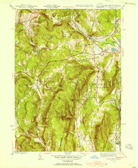
 1946 Monterey1957 Print · USGSThe Berkshire highlands of Monterey and Tyringham are captured here just after the war, showing a landscape of secluded valleys and hill farms. Researchers can trace the Appalachian Trail through the summits and locate local landmarks like Old Center Cem and Lake Garfield.
Showing maps 1-25 of 98
Top cities near Great Barrington
- Pittsfield historical maps
- Dalton historical maps
- Lee historical maps
- Lenox historical maps
- Salisbury historical maps
- Chatham historical maps
See more
Top neighborhoods of Great Barrington
- Risingdale historical maps
- Berkshire Heights historical maps
- Brookside historical maps
- Housatonic historical maps
- Van Deusenville historical maps
Frequently asked questions
- What are the different types of historical maps available for Great Barrington?
- What is the oldest map of Great Barrington?
- Where can I purchase historical maps of Great Barrington for my home or office?
- Where can I download high-res historical maps of Great Barrington?
- Are there historical topographic maps available for Great Barrington?
- Is there historical aerial imagery available for Great Barrington?
- Where are historical maps of Great Barrington sourced from?