Old Maps of Natick, Massachusetts
Explore 33 old maps of Natick, spanning from 1886 to today. These high-resolution historic maps reveal how streets, neighborhoods, landmarks, and natural features evolved over time — perfect for genealogy, metal detecting, research, and local history exploration.
What you can do with these maps:
- See how Natick changed over time: Compare historical maps to modern-day views to trace roads, homesites, rail lines & more.
- View detailed metadata: Each map includes creators, publishers, year, scale, and archive source.
- Overlay maps with satellite & LiDAR: Visualize the past alongside modern tools to explore terrain & human change.
- Trusted historical sources: Maps sourced from the USGS, Library of Congress, and other archives.
- Access maps your way: View online, download high-res files, or order prints for personal or research use.
Start exploring old maps of Natick to uncover forgotten places, hidden landmarks, and the deep history beneath your feet.
Natick, MA maps
(33)- 1886 Map of Framingham
 1886 Framingham1886 Print · USGSCovers Natick, including Newton, Framingham, and other nearby areas
 - 1887 Map of Franklin
 1887 Franklin1887 Print · USGSCovers Natick, including Woonsocket, Cumberland, and other nearby areas
 - 1889 Map of Franklin
 1889 Franklin1889 Print · USGSCovers Natick, including Woonsocket, Cumberland, and other nearby areas
 - 1889 Map of Framingham
 1889 Framingham1889 Print · USGSCovers Natick, including Newton, Framingham, and other nearby areas
 - 1893 Map of Franklin
 1893 Franklin1893 Print · USGSCovers Natick, including Woonsocket, Cumberland, and other nearby areas8 unique versions available
 - 1894 Map of Framingham
 1894 Framingham1894 Print · USGSCovers Natick, including Newton, Framingham, and other nearby areas11 unique versions available
 - 1918 Map of Framingham
 1918 Framingham1918 Print · USGSCovers Natick, including Newton, Framingham, and other nearby areas2 unique versions available
 - 1919 Map of Franklin
 1919 Franklin1919 Print · USGSCovers Natick, including Woonsocket, Cumberland, and other nearby areas2 unique versions available
 - 1921 Map of Franklin, 1942 Print
 1921 Franklin1942 Print · USGSCovers Natick, including Woonsocket, Cumberland, and other nearby areas
 - 1940 Map of Medfield
 1940 Medfield1940 Print · USGSCovers Natick, including Walpole, Westwood, and other nearby areas2 unique versions available
 - 1943 Map of Framingham
 1943 Framingham1943 Print · USGSCovers Natick, including Framingham, Marlborough, and other nearby areas3 unique versions available
 - 1943 Map of Boston
 1943 Boston1943 Print · USGSCovers Natick, including Boston, Cambridge, and other nearby areas
 - 1943 Map of Natick
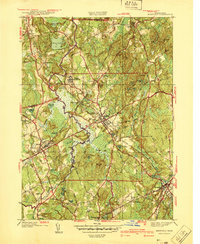
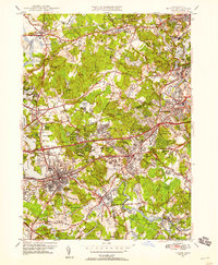
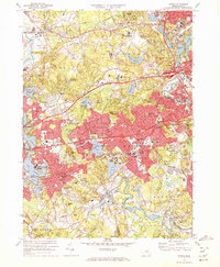
 1943 Natick1943 Print · USGSCovers Natick, including Newton, Waltham, and other nearby areas6 unique versions available
 - 1945 Map of Medfield, 1954 Print
 1945 Medfield1954 Print · USGSCovers Natick, including Walpole, Westwood, and other nearby areas3 unique versions available
 - 1946 Map of Medfield
 1946 Medfield1946 Print · USGSCovers Natick, including Walpole, Westwood, and other nearby areas2 unique versions available
 - 1948 Map of Boston
 1948 Boston1948 Print · USGSCovers Natick, including Boston, Worcester, and other nearby areas2 unique versions available
 - 1950 Map of Natick, 1956 Print
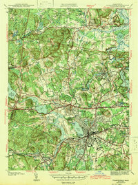
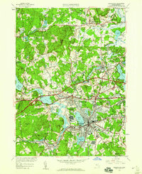
 1950 Natick1956 Print · USGSCovers Natick, including Newton, Waltham, and other nearby areas3 unique versions available
 - 1950 Map of Framingham, 1959 Print
 1950 Framingham1959 Print · USGSCovers Natick, including Framingham, Marlborough, and other nearby areas
 - 1956 Map of Boston, 1967 Print
 1956 Boston1967 Print · USGSCovers Natick, including Boston, Worcester, and other nearby areas6 unique versions available
 - 1957 Map of Medfield, 1960 Print
 1957 Medfield1960 Print · USGSCovers Natick, including Walpole, Westwood, and other nearby areas2 unique versions available
 - 1958 Map of Boston
 1958 Boston1958 Print · USGSCovers Natick, including Boston, Worcester, and other nearby areas2 unique versions available
 - 1958 Map of Natick, 1960 Print
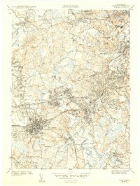
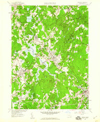
 1958 Natick1960 Print · USGSCovers Natick, including Newton, Waltham, and other nearby areas2 unique versions available
 - 1961 Map of Boston
 1961 Boston1961 Print · USGSCovers Natick, including Boston, Worcester, and other nearby areas2 unique versions available
 - 1965 Map of Framingham, 1967 Print
 1965 Framingham1967 Print · USGSCovers Natick, including Framingham, Marlborough, and other nearby areas2 unique versions available
 - 1970 Map of Natick, 1972 Print
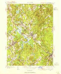
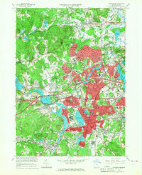
 1970 Natick1972 Print · USGSCovers Natick, including Newton, Waltham, and other nearby areas2 unique versions available
Showing maps 1-25 of 33
Top cities near Natick
- Boston historical maps
- Cambridge historical maps
- Newton historical maps
- Somerville historical maps
- Framingham historical maps
- Brookline historical maps
See more
Top neighborhoods of Natick
- Morseville historical maps
- West Natick historical maps
- Lokerville historical maps
- South Natick historical maps
- East Natick historical maps
- Felchville historical maps
See more
Frequently asked questions
- What are the different types of historical maps available for Natick?
- What is the oldest map of Natick?
- Where can I purchase historical maps of Natick for my home or office?
- Where can I download high-res historical maps of Natick?
- Are there historical topographic maps available for Natick?
- Is there historical aerial imagery available for Natick?
- Where are historical maps of Natick sourced from?