Old Maps of Bay Mills Township, Michigan
Explore 47 old maps of Bay Mills Township, spanning from 1913 to today. These high-resolution historic maps reveal how streets, neighborhoods, landmarks, and natural features evolved over time — perfect for genealogy, metal detecting, research, and local history exploration.
What you can do with these maps:
- See how Bay Mills Township changed over time: Compare historical maps to modern-day views to trace roads, homesites, rail lines & more.
- View detailed metadata: Each map includes creators, publishers, year, scale, and archive source.
- Overlay maps with satellite & LiDAR: Visualize the past alongside modern tools to explore terrain & human change.
- Trusted historical sources: Maps sourced from the USGS, Library of Congress, and other archives.
- Access maps your way: View online, download high-res files, or order prints for personal or research use.
Start exploring old maps of Bay Mills Township to uncover forgotten places, hidden landmarks, and the deep history beneath your feet.
Bay Mills Township, MI maps
(47)- 1913 Map of Sault Sainte Marie, 1919 Print
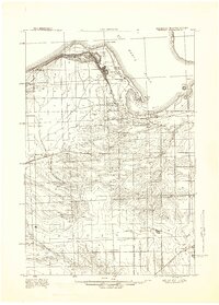
 1913 Sault Sainte Marie1919 Print · USGSUpper Peninsula maritime and rail activity converge at the border in the years before the Great War. Genealogists and local historians can trace early rural post offices and docks like Donaldson P.O., Shine Dock, and the hamlet of McCarron.
 - 1941 Map of Sault Sainte Marie
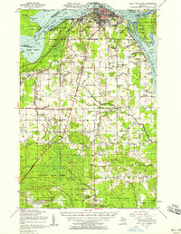
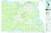
 1941 Sault Sainte Marie1941 Print · USGSUpper Peninsula life centered on the locks and river during the early years of the war. Genealogists and historians can trace family-named schools and rural landmarks from Algonquin down to the Parkerville Church and Dafter.
 - 1941 Map of Strongs, 1947 Print
 1941 Strongs1947 Print · USGSChippewa County in the early 1940s centers on the rail-side life of Strongs and the northern shore of Pendills Bay. Researchers can locate vanished landmarks like the Jones School, the Demond Hill Fire Tower, and the early layout of Raco Field.
 - 1941 Map of Brimley, 1947 Print
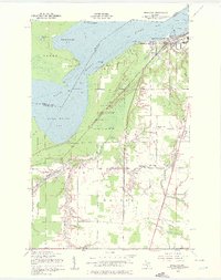
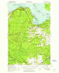
 1941 Brimley1947 Print · USGSThe Lake Superior shoreline and St. Marys River come alive in this wartime-era survey of the Upper Peninsula. Genealogists can trace family roots at the Finnish Church or locate vanished school sites like the Maple Grove School and Dorgan School.
 - 1951 Map of Shallows
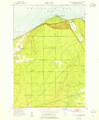
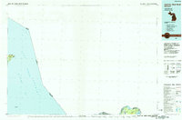
 1951 Shallows1951 Print · USGSThe Upper Peninsula shoreline south of the Canadian border was a landscape of dense state forests and emerging rail hubs in the early fifties. Local historians can trace the foundations of Sault Ste Marie and rural landmarks like the County Farm and Pine Grove Cem.3 unique versions available
 - 1951 Map of McNearney Lake, 1955 Print
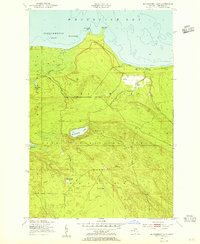 1951 McNearney Lake1955 Print · USGSUpper Peninsula shoreline meets the deep woods in the early fifties, showing the coastal transition from bay to forest. Researchers can trace the path of Lake Shore Drive or locate landmarks like the McNearney Lake Tower and Naomikong Island.3 unique versions available
 - 1951 Map of Pendills Lake, 1955 Print
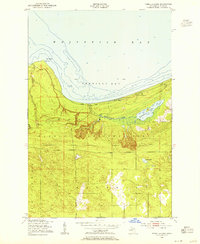 1951 Pendills Lake1955 Print · USGSThe Lake Superior coastline in Chippewa County shows its mid-century recreational and forest service character during the early 1950s. Researchers can trace the development of the Marquette National Forest and locate public sites like Bayview Camp Grounds and Pendills Lake.2 unique versions available
 - 1951 Map of Dollar Settlement, 1955 Print
 1951 Dollar Settlement1955 Print · USGSCoastal life in the Upper Peninsula was defined by timber and the Lake Superior shoreline during the early fifties. Genealogists and local historians can trace the Dollar Settlement community, including the Dollar Settlement Sch, and the railway stop at Raco.2 unique versions available
 - 1951 Map of Brimley, 1958 Print
 1951 Brimley1958 Print · USGSThe Upper Peninsula shoreline and interior forests are captured here in the early fifties, showing the tribal lands and rail towns of the Whitefish Bay region. Genealogists can trace family locations at Dollar Settlement, St Catherines Ch, and Rudyard Cem.2 unique versions available
 - 1951 Map of Sault Ste. Marie, 1958 Print
 1951 Sault Ste. Marie1958 Print · USGSSault Ste. Marie and the eastern Upper Peninsula are seen here at the dawn of the 1950s, showing the vital shipping arteries and borderlands. Researchers can locate numerous vanished rural schoolhouses like Green Sch Aband and trace the original Michigan 129 through Barbeau and Rosedale.2 unique versions available
 - 1951 Map of Strongs, 1958 Print
 1951 Strongs1958 Print · USGSCoastal Chippewa County is captured here in the early fifties, showing the interplay between Lake Superior's Whitefish Bay and the wooded interior. Genealogists and hikers can locate the Strong Sch, the Demond Hill Lookout Tower, and old camps like Mt. Misery Lodge.
 - 1951 Map of Brimley, 1958 Print
 1951 Brimley1958 Print · USGSThe Lake Superior shoreline near the Canadian border comes alive in the early fifties, showing the interplay of rail and river. You can trace the Duluth South Shore and Atlantic railroad through Brimley or locate several old missions like St Catherines Ch.2 unique versions available
 - 1954 Map of Sault Sainte Marie, 1979 Print
 1954 Sault Sainte Marie1979 Print · USGSThe Eastern Upper Peninsula and Ontario borderlands are captured here at the height of the mid-century era. Family historians can trace settlements like Grand Marais and Stalwart, while mapping the strategic grounds of Kincheloe AFB.3 unique versions available
 - 1956 Map of Sault Sainte Marie, 1964 Print
 1956 Sault Sainte Marie1964 Print · USGSThe Eastern Upper Peninsula and the Canadian border meet in this mid-sixties survey of the bustling Soo Locks region. Genealogists and historians can trace the paths of the Soo Line and locate lakeside communities from Grand Marais to Shelldrake.2 unique versions available
 - 1957 Map of Sault Sainte Marie
 1957 Sault Sainte Marie1957 Print · USGSThe Upper Peninsula and Ontario border come alive in this mid-century portrait of the eastern Lake Superior shoreline and the vital St. Marys River corridor. Genealogists and historians can trace rail-era settlements from Newberry to Detour, while locating military landmarks like Kinross Air Force Base.
 - 1958 Map of Sault Sainte Marie
 1958 Sault Sainte Marie1958 Print · USGSThe eastern Upper Peninsula and the Canadian borderland appear here during the late fifties, a time of military growth and forest management. Researchers can locate vanished rail stops along the Soo Line, early sites like the Fiborn Quarry, and the sprawling Kinross Air Force Base.
 - 1984 Map of Sault Ste. Marie South, 1985 Print
 1984 Sault Ste. Marie South1985 Print · USGSEastern Upper Peninsula life in the 1980s is captured here, from the northern forests down to the northern shores of Lake Huron. Researchers can locate small lakeside communities like Dollar Settlement, trace the Soo Line Railroad, and find family sites near Pine Grove Cem.2 unique versions available
 - 1985 Map of Sault Ste. Marie North
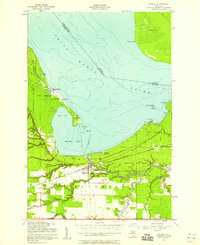
 1985 Sault Ste. Marie North1985 Print · USGSThe international waters of the Upper Peninsula take center stage in the mid-eighties as the shipping lanes connect the Great Lakes. Traces of early settlements and vital maritime infrastructure are visible at the Soo Locks, Sugar Island, and the remote Whitefish Point.2 unique versions available
 - 2011 Map of McNearney Lake, 2011 Print
 2011 McNearney Lake2011 Print · USGSCovers Bay Mills Township, including Chippewa Township, Whitefish Township, and other nearby areas
 - 2011 Map of Dollar Settlement, 2011 Print
 2011 Dollar Settlement2011 Print · USGSCovers Bay Mills Township, including Dollar Settlement, Superior Township, and other nearby areas
 - 2011 Map of Pendills Lake, 2011 Print
 2011 Pendills Lake2011 Print · USGSCovers Bay Mills Township, including Superior Township, Chippewa Township, and other nearby areas
 - 2011 Map of Shallows, 2011 Print
 2011 Shallows2011 Print · USGSCovers Bay Mills Township, including Sault Ste. Marie, Sault Ste. Marie, and other nearby areas
 - 2011 Map of Brimley, 2011 Print
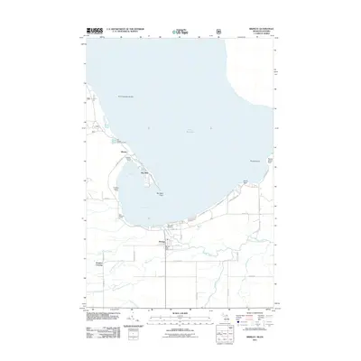 2011 Brimley2011 Print · USGSCovers Bay Mills Township, including Sault Ste. Marie, Bay Mills, and other nearby areas
 - 2014 Map of Pendills Lake, 2014 Print
 2014 Pendills Lake2014 Print · USGSCovers Bay Mills Township, including Superior Township, Chippewa Township, and other nearby areas
 - 2014 Map of McNearney Lake, 2014 Print
 2014 McNearney Lake2014 Print · USGSCovers Bay Mills Township, including Chippewa Township, Whitefish Township, and other nearby areas
Showing maps 1-25 of 47
Top cities near Bay Mills Township
Top neighborhoods of Bay Mills Township
Frequently asked questions
- What are the different types of historical maps available for Bay Mills Township?
- What is the oldest map of Bay Mills Township?
- Where can I purchase historical maps of Bay Mills Township for my home or office?
- Where can I download high-res historical maps of Bay Mills Township?
- Are there historical topographic maps available for Bay Mills Township?
- Is there historical aerial imagery available for Bay Mills Township?
- Where are historical maps of Bay Mills Township sourced from?