Old Maps of Tupelo, Mississippi
Explore 12 old maps of Tupelo, spanning from 1921 to today. These high-resolution historic maps reveal how streets, neighborhoods, landmarks, and natural features evolved over time — perfect for genealogy, metal detecting, research, and local history exploration.
What you can do with these maps:
- See how Tupelo changed over time: Compare historical maps to modern-day views to trace roads, homesites, rail lines & more.
- View detailed metadata: Each map includes creators, publishers, year, scale, and archive source.
- Overlay maps with satellite & LiDAR: Visualize the past alongside modern tools to explore terrain & human change.
- Trusted historical sources: Maps sourced from the USGS, Library of Congress, and other archives.
- Access maps your way: View online, download high-res files, or order prints for personal or research use.
Start exploring old maps of Tupelo to uncover forgotten places, hidden landmarks, and the deep history beneath your feet.
Tupelo, MS maps
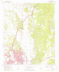
(12)- 1921 Map of Tupelo
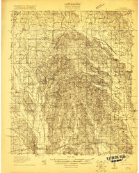 1921 Tupelo1921 Print · USGSCovers Tupelo, including Saltillo, Baldwyn, and other nearby areas2 unique versions available
 - 1923 Map of Tupelo
 1923 Tupelo1923 Print · USGSCovers Tupelo, including Saltillo, Baldwyn, and other nearby areas2 unique versions available
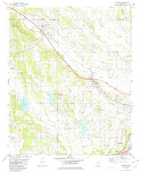
 - 1955 Map of Sherman, 1956 Print
 1955 Sherman1956 Print · USGSCovers Tupelo, including New Albany, Pontotoc, and other nearby areas2 unique versions available
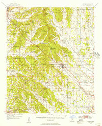
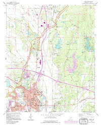
 - 1956 Map of Tupelo, 1967 Print
 1956 Tupelo1967 Print · USGSCovers Tupelo, including Memphis, Southaven, and other nearby areas2 unique versions available
 - 1958 Map of Tupelo
 1958 Tupelo1958 Print · USGSCovers Tupelo, including Memphis, Southaven, and other nearby areas
 - 1966 Map of Bissell, 1967 Print
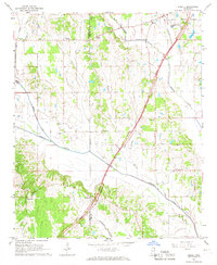 1966 Bissell1967 Print · USGSCovers Tupelo, including Praise Acres, Fawn Meadows, and other nearby areas3 unique versions available
 - 1966 Map of Verona, 1967 Print
 1966 Verona1967 Print · USGSCovers Tupelo, including Verona, Shannon, and other nearby areas3 unique versions available
 - 1973 Map of Tupelo, 1975 Print
 1973 Tupelo1975 Print · USGSCovers Tupelo, including Saltillo, Boggan Grove, and other nearby areas2 unique versions available
 - 1980 Map of Sherman, 1981 Print
 1980 Sherman1981 Print · USGSCovers Tupelo, including Sherman, Wildwood, and other nearby areas
 - 1984 Map of Tupelo
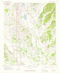
 1984 Tupelo1984 Print · USGSCovers Tupelo, including Memphis, Southaven, and other nearby areas3 unique versions available
 - 1984 Map of Tupelo, 1985 Print
 1984 Tupelo1985 Print · USGSCovers Tupelo, including New Albany, Amory, and other nearby areas
 - 1992 Map of Tupelo, 1995 Print
 1992 Tupelo1995 Print · USGSCovers Tupelo, including Saltillo, Boggan Grove, and other nearby areas2 unique versions available
End of results
Showing maps 1-12 of 12
Top cities near Tupelo
- Saltillo historical maps
- Verona historical maps
- Baldwyn historical maps
- Nettleton historical maps
- Shannon historical maps
- Guntown historical maps
See more
Top neighborhoods of Tupelo
- Forest Hills historical maps
- Foxmoor historical maps
- Oakridge historical maps
- Applewood historical maps
- Belledeer Hills historical maps
- Bristow Acres historical maps
See more
Frequently asked questions
- What are the different types of historical maps available for Tupelo?
- What is the oldest map of Tupelo?
- Where can I purchase historical maps of Tupelo for my home or office?
- Where can I download high-res historical maps of Tupelo?
- Are there historical topographic maps available for Tupelo?
- Is there historical aerial imagery available for Tupelo?
- Where are historical maps of Tupelo sourced from?