Old Maps of Brandon, Mississippi
Explore 24 old maps of Brandon, spanning from 1903 to today. These high-resolution historic maps reveal how streets, neighborhoods, landmarks, and natural features evolved over time — perfect for genealogy, metal detecting, research, and local history exploration.
What you can do with these maps:
- See how Brandon changed over time: Compare historical maps to modern-day views to trace roads, homesites, rail lines & more.
- View detailed metadata: Each map includes creators, publishers, year, scale, and archive source.
- Overlay maps with satellite & LiDAR: Visualize the past alongside modern tools to explore terrain & human change.
- Trusted historical sources: Maps sourced from the USGS, Library of Congress, and other archives.
- Access maps your way: View online, download high-res files, or order prints for personal or research use.
Start exploring old maps of Brandon to uncover forgotten places, hidden landmarks, and the deep history beneath your feet.
Brandon, MS maps
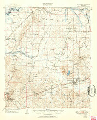
(24)- 1903 Map of Jackson
 1903 Jackson1903 Print · USGSCovers Brandon, including Jackson, Clinton, and other nearby areas
 - 1905 Map of Jackson
 1905 Jackson1905 Print · USGSCovers Brandon, including Jackson, Madison, and other nearby areas3 unique versions available
 - 1906 Map of Florence, 1965 Print
 1906 Florence1965 Print · USGSCovers Brandon, including Jackson, Pearl, and other nearby areas
 - 1908 Map of Jackson
 1908 Jackson1908 Print · USGSCovers Brandon, including Jackson, Madison, and other nearby areas2 unique versions available
 - 1908 Map of Florence
 1908 Florence1908 Print · USGSCovers Brandon, including Jackson, Pearl, and other nearby areas2 unique versions available
 - 1922 Map of Pelahatchee
 1922 Pelahatchee1922 Print · USGSCovers Brandon, including Flowood, Pelahatchie, and other nearby areas
 - 1924 Map of Pelahatchee
 1924 Pelahatchee1924 Print · USGSCovers Brandon, including Flowood, Pelahatchie, and other nearby areas
 - 1950 Map of Pelahatchie, 1968 Print
 1950 Pelahatchie1968 Print · USGSCovers Brandon, including Flowood, Pelahatchie, and other nearby areas2 unique versions available
 - 1952 Map of Pelahatchie
 1952 Pelahatchie1952 Print · USGSCovers Brandon, including Flowood, Pelahatchie, and other nearby areas
 - 1953 Map of Meridian, 1966 Print
 1953 Meridian1966 Print · USGSCovers Brandon, including Meridian, Nanih Waiya, and other nearby areas2 unique versions available
 - 1955 Map of Jackson
 1955 Jackson1955 Print · USGSCovers Brandon, including Jackson, Monroe, and other nearby areas3 unique versions available
 - 1957 Map of Meridian
 1957 Meridian1957 Print · USGSCovers Brandon, including Meridian, Nanih Waiya, and other nearby areas
 - 1961 Map of Jackson
 1961 Jackson1961 Print · USGSCovers Brandon, including Jackson, Monroe, and other nearby areas
 - 1962 Map of Jackson
 1962 Jackson1962 Print · USGSCovers Brandon, including Jackson, Monroe, and other nearby areas2 unique versions available
 - 1963 Map of Jackson SE, 1964 Print
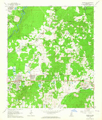 1963 Jackson SE1964 Print · USGSCovers Brandon, including Jackson, Pearl, and other nearby areas3 unique versions available
 - 1965 Map of Meridian
 1965 Meridian1965 Print · USGSCovers Brandon, including Meridian, Nanih Waiya, and other nearby areas
 - 1968 Map of Puckett NW, 1970 Print
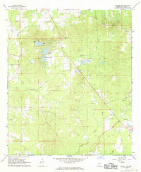 1968 Puckett NW1970 Print · USGSCovers Brandon, including Rock Hill, Sherwood Forest, and other nearby areas3 unique versions available
 - 1971 Map of Whitfield, 1973 Print
 1971 Whitfield1973 Print · USGSCovers Brandon, including Pearl, Florence, and other nearby areas
 - 1980 Map of Whitfield
 1980 Whitfield1980 Print · USGSCovers Brandon, including Pearl, Florence, and other nearby areas
 - 1980 Map of Jackson SE
 1980 Jackson SE1980 Print · USGSCovers Brandon, including Jackson, Pearl, and other nearby areas2 unique versions available
 - 1982 Map of Brandon, 1983 Print
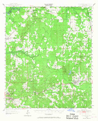
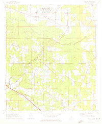
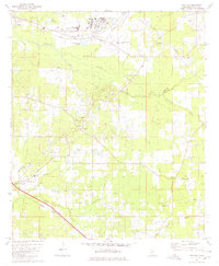
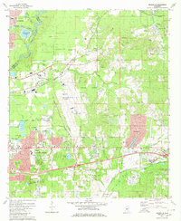
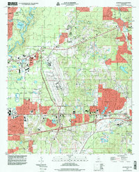
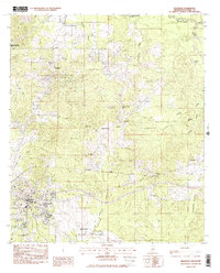 1982 Brandon1983 Print · USGSCovers Brandon, including Flowood, Pelahatchie, and other nearby areas
 - 1984 Map of Forest
 1984 Forest1984 Print · USGSCovers Brandon, including Flowood, Forest, and other nearby areas2 unique versions available
 - 1984 Map of Jackson
 1984 Jackson1984 Print · USGSCovers Brandon, including Jackson, Clinton, and other nearby areas
 - 1998 Map of Jackson SE
 1998 Jackson SE1998 Print · USGSCovers Brandon, including Jackson, Pearl, and other nearby areas
End of results
Showing maps 1-24 of 24
Top cities near Brandon
- Jackson historical maps
- Madison historical maps
- Pearl historical maps
- Ridgeland historical maps
- Flowood historical maps
- Richland historical maps
See more
Top neighborhoods of Brandon
- Terrapin Hill historical maps
- The Commons historical maps
- Cornerstone Subdivision historical maps
- Easthaven historical maps
- Grove Park historical maps
- Hunters Woods historical maps
See more
Frequently asked questions
- What are the different types of historical maps available for Brandon?
- What is the oldest map of Brandon?
- Where can I purchase historical maps of Brandon for my home or office?
- Where can I download high-res historical maps of Brandon?
- Are there historical topographic maps available for Brandon?
- Is there historical aerial imagery available for Brandon?
- Where are historical maps of Brandon sourced from?