Old Maps of Spencerburg, Missouri
Explore 11 old maps of Spencerburg, spanning from 1890 to today. These high-resolution historic maps reveal how streets, neighborhoods, landmarks, and natural features evolved over time — perfect for genealogy, metal detecting, research, and local history exploration.
What you can do with these maps:
- See how Spencerburg changed over time: Compare historical maps to modern-day views to trace roads, homesites, rail lines & more.
- View detailed metadata: Each map includes creators, publishers, year, scale, and archive source.
- Overlay maps with satellite & LiDAR: Visualize the past alongside modern tools to explore terrain & human change.
- Trusted historical sources: Maps sourced from the USGS, Library of Congress, and other archives.
- Access maps your way: View online, download high-res files, or order prints for personal or research use.
Start exploring old maps of Spencerburg to uncover forgotten places, hidden landmarks, and the deep history beneath your feet.
Spencerburg, MO maps
(11)- 1890 Map of Louisiana
 1890 Louisiana1890 Print · USGSUpper Missouri and Illinois river country in the 1890s is captured here at the height of the steam-rail era. Genealogists can trace family roots through old rural outposts like New Harmony, Prairieville, and the transit hub at Bowling Green.5 unique versions available
 - 1943 Map of Vandalia, 1972 Print
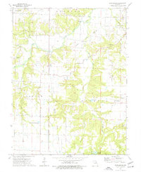
 1943 Vandalia1972 Print · USGSMissouri's rural heartland is captured here in the 1940s at the junction of Audrain, Pike, and Ralls Counties. Genealogists can trace dozens of rural schoolhouses and churches, including Round Grove Sch, Elm Grove Ch, and the settlement of Madisonville.
 - 1945 Map of Vandalia
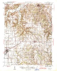 1945 Vandalia1945 Print · USGSMid-century Audrain and Pike Counties are shown here at a peak of rural settlement, centered on the rail hub of Vandalia. Genealogists can locate dozens of country schools and churches, from New Michigan Sch to Mt Air Ch and Spencerburg.3 unique versions available
 - 1948 Map of Quincy
 1948 Quincy1948 Print · USGSThe Mississippi and Illinois River valleys are captured at a post-war crossroads as rail and river travel met the expanding highway system. Genealogists can trace family settlements from Quincy to Hannibal and smaller towns like Vandalia and Jerseyville.2 unique versions available
 - 1956 Map of Quincy, 1967 Print
 1956 Quincy1967 Print · USGSThe river and rail corridors of the Illinois-Missouri border are documented here during the mid-1950s. Researchers can trace historic river landings and regional transit hubs from Quincy and Hannibal to smaller settlements like Meredosia and Roodhouse.3 unique versions available
 - 1973 Map of Spencerburg, 1977 Print
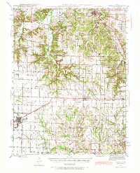
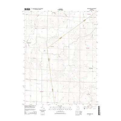
 1973 Spencerburg1977 Print · USGSThe rural border of Ralls and Pike counties is captured here in the early 1970s, showcasing the agricultural and natural character of the region. Researchers can locate family landmarks like Adiel Cemetery and Pleasant Hill Church, or explore karst features like Woodson Cave.
 - 1986 Map of Mexico
 1986 Mexico1986 Print · USGSEast Central Missouri in the mid-eighties shows a landscape of steady agricultural towns and the expansive waters of Mark Twain Lake. Genealogists and historians can trace rail-side communities like Laddonia and Wellsville or locate family markers at Elwood Cem.2 unique versions available
 - 2012 Map of Spencerburg, 2012 Print
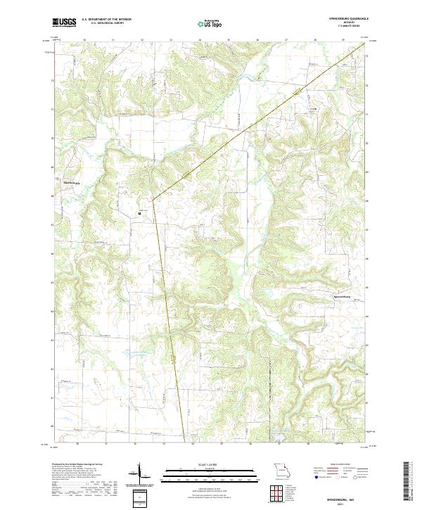
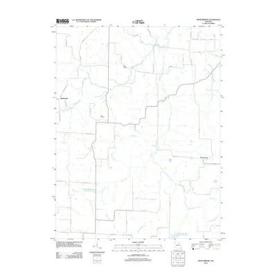 2012 Spencerburg2012 Print · USGSCovers Spencerburg, including Madisonville, Pike County, and other nearby areas
 - 2014 Map of Spencerburg, 2014 Print
 2014 Spencerburg2014 Print · USGSCovers Spencerburg, including Madisonville, Pike County, and other nearby areas
 - 2017 Map of Spencerburg, 2017 Print
 2017 Spencerburg2017 Print · USGSCovers Spencerburg, including Madisonville, Pike County, and other nearby areas
 - 2021 Map of Spencerburg, 2021 Print
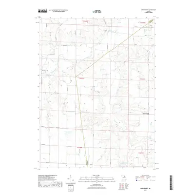
 2021 Spencerburg2021 Print · USGSThe borderlands of Pike and Ralls counties come into focus in this recent look at a deeply rooted Missouri agricultural region. Genealogists and local researchers can trace the area around Spencerburg and Madisonville, locating landmarks like Adiel Cem and Neal Pond.
End of results
Showing maps 1-11 of 11
Top cities near Spencerburg
- Bowling Green historical maps
- Vandalia historical maps
- New London historical maps
- Center historical maps
- Farber historical maps
- Frankford historical maps
See more
Frequently asked questions
- What are the different types of historical maps available for Spencerburg?
- What is the oldest map of Spencerburg?
- Where can I purchase historical maps of Spencerburg for my home or office?
- Where can I download high-res historical maps of Spencerburg?
- Are there historical topographic maps available for Spencerburg?
- Is there historical aerial imagery available for Spencerburg?
- Where are historical maps of Spencerburg sourced from?