Old Maps of Butler County, Nebraska
Explore 87 old maps of Butler County, spanning from 1899 to today. These high-resolution historic maps reveal how streets, neighborhoods, landmarks, and natural features evolved over time — perfect for genealogy, metal detecting, research, and local history exploration.
What you can do with these maps:
- See how Butler County changed over time: Compare historical maps to modern-day views to trace roads, homesites, rail lines & more.
- View detailed metadata: Each map includes creators, publishers, year, scale, and archive source.
- Overlay maps with satellite & LiDAR: Visualize the past alongside modern tools to explore terrain & human change.
- Trusted historical sources: Maps sourced from the USGS, Library of Congress, and other archives.
- Access maps your way: View online, download high-res files, or order prints for personal or research use.
Start exploring old maps of Butler County to uncover forgotten places, hidden landmarks, and the deep history beneath your feet.
Butler County, NE maps
(87)- 1899 Map of Wahoo
 1899 Wahoo1899 Print · USGSSaunders County and its neighbors thrive as a booming rail hub in the 1890s, where the Platte River meets a dense web of iron tracks. Trace the early development of prairie towns like Wahoo, Valparaiso, and the Bohemian settlement at Prague.3 unique versions available
 - 1899 Map of David City
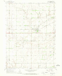
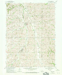
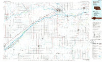
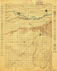 1899 David City1899 Print · USGSButler County and its neighbors flourished during the late nineteenth-century railroad boom, centered on the junction at David City. Genealogists and historians can trace the early footprints of Surprise, Wayland, and Rising along the extensive steam rail networks.3 unique versions available
 - 1955 Map of Fremont, 1966 Print
 1955 Fremont1966 Print · USGSEastern Nebraska and the Missouri River border are captured during the mid-fifties, just as the interstate system began to emerge. Researchers can trace the development of Omaha, locate the sprawling Offutt Air Force Base, or study the river-bound ecology of the De Soto National Wildlife Refuge.3 unique versions available
 - 1957 Map of Fremont
 1957 Fremont1957 Print · USGSEastern Nebraska and western Iowa thrive along the Platte and Missouri rivers during the mid-fifties. Genealogists can locate small rural schools like Fairview School and tracing the paths of the Union Pacific through towns like Albion and Humphrey.
 - 1958 Map of Fremont
 1958 Fremont1958 Print · USGSEastern Nebraska in the late fifties is captured here as a thriving corridor of river-valley commerce and rail transport. Researchers can trace the development of Omaha and Fremont or locate local landmarks like Midland College and Offutt Air Force Base.
 - 1958 Map of Columbus SE, 1959 Print
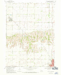
 1958 Columbus SE1959 Print · USGSButler County farmland in the late fifties shows an intricate system of rural school districts and township boundaries. Trace the locations of historic country schools like School No 51 and the St Joseph Church grounds.2 unique versions available
 - 1958 Map of Columbus, 1959 Print
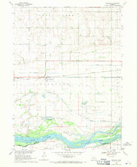
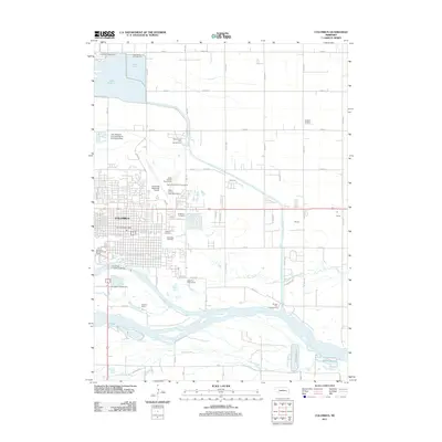
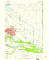 1958 Columbus1959 Print · USGSColumbus thrived as a transportation hub in the late fifties at the junction of the Loup and Platte rivers. Researchers can trace the mid-century city layout through its numerous schools, the Union Pacific rail lines, and landmarks like the Drive-in Theater.2 unique versions available
 - 1965 Map of Brainard, 1967 Print
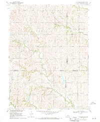
 1965 Brainard1967 Print · USGSButler County farmland transitions from the outskirts of David City to the village of Brainard in the mid-sixties. Researchers can trace the Union Pacific line, find rural schools like Speedway Sch, and locate the St Marys Cem.
 - 1965 Map of Garrison, 1967 Print
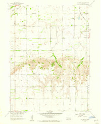
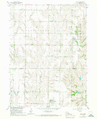
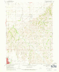
 1965 Garrison1967 Print · USGSButler County, Nebraska, is captured here in the mid-1960s as a thriving rail and agricultural corridor. Researchers can trace the heritage of David City and Garrison through landmarks like Aquinas High Sch, Zion Ch Cem, and the Bongers Sky Ranch Airfield.
 - 1965 Map of Rising City, 1967 Print
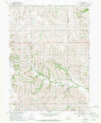
 1965 Rising City1967 Print · USGSButler County's agricultural heartland is captured here in the mid-sixties, centered on the rail-aligned streets of Rising City. Genealogists and local historians can trace the locations of St Johns Ch, Rising Sun Cem, and the path of the Union Pacific line.
 - 1966 Map of Dwight, 1967 Print
 1966 Dwight1967 Print · USGSButler and Seward Counties appear in the mid-1960s as a productive agricultural landscape defined by small villages and creek drainages. You can trace early settlement patterns through St Marys Cem, the Old Railroad Grade, and the village of Dwight.
 - 1966 Map of Ulysses, 1967 Print
 1966 Ulysses1967 Print · USGSUlysses was a hub of rail and river activity in the mid-sixties at the junction of the Big Blue River and the Chicago Burlington and Quincy line. Family historians can locate several rural burial grounds like Grimm Cem and Karpisek Cem, or trace the grounds of the Leader Sch.
 - 1966 Map of Surprise, 1967 Print
 1966 Surprise1967 Print · USGSThe village of Surprise and its surrounding farmsteads are captured in the mid-1960s at the meeting of Butler, Polk, York, and Seward counties. Trace local family history through the Surprise Cem, St Paul Ch, and an Old Railroad Grade.
 - 1968 Map of Bruno, 1971 Print
 1968 Bruno1971 Print · USGSButler County and the Saunders County line are captured in the late sixties, showing a landscape of Czech-settled hamlets and prairie creek beds. Genealogists can trace family footprints at Bohemian Cem, St Anthony Cem, and the Old Railroad Grade.
 - 1968 Map of David City West, 1971 Print
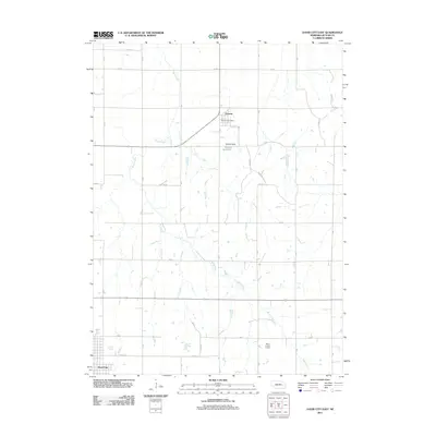
 1968 David City West1971 Print · USGSButler County's agricultural heartland is captured here in the late sixties, showing the rural townships as they transitioned into the modern era. Genealogists can locate family landmarks such as SS Peter & Mary Cem, St Marys Sch, and the local Fairground near the edge of David City.
 - 1968 Map of Richland, 1971 Print
 1968 Richland1971 Print · USGSRichland and the surrounding Colfax County farmland are captured in the late sixties as the Union Pacific railroad still drove local commerce. Researchers can locate Richland Cem, School No 1, and family landmarks near the banks of Lake McAllister.
 - 1968 Map of Schuyler, 1971 Print
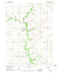
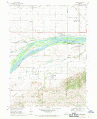
 1968 Schuyler1971 Print · USGSThe Platte River valley in the late sixties shows a landscape of braided channels and Nebraska prairie. Genealogists and local historians can trace family roots at Schuyler Cemetery or locate the old Riverside Sch and Edholm settlement.
 - 1968 Map of David City East, 1971 Print
 1968 David City East1971 Print · USGSButler County farmland transitions from the outskirts of the county seat to rural townships in the late sixties. Genealogists and local historians can locate the Hospital and High Sch in David City, or trace rural landmarks like Assumption Ch and Appleton Sch.
 - 1968 Map of Rogers, 1971 Print
 1968 Rogers1971 Print · USGSThe Platte River valley in the late sixties is shown here in meticulous detail, capturing the river's many islands and the surrounding rail-side towns. Genealogists and local historians can trace rural roots at Dawson Cem, St Marys Cem, and numerous school sites like School No 4.
 - 1969 Map of Valparaiso SW, 1971 Print
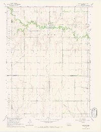
 1969 Valparaiso SW1971 Print · USGSSoutheast Butler County and the surrounding Nebraska prairie are captured here in the late sixties. Researchers can trace the path of the Union Pacific railroad and locate local landmarks like the Oak Ridge Sch and the Flowing Well.
 - 1969 Map of Loma, 1971 Print
 1969 Loma1971 Print · USGSAgricultural Butler County comes into focus in the late 1960s, showing the rural rhythm of the Nebraska plains. Genealogists can locate family landmarks like Holy Trinity Cem and Loma Cem or the rural La Cross Sch.
 - 1982 Map of Fremont
 1982 Fremont1982 Print · USGSEastern Nebraska in the early eighties exhibits a landscape of industrious rail towns and river-fed agriculture. Genealogists and historians can trace the development of Fremont, locate the National Cem, and find landmarks like the Todd Valley.2 unique versions available
 - 1985 Map of David City
 1985 David City1985 Print · USGSCentral Nebraska in the mid-eighties centers on the convergence of the Platte River and Loup River. Trace the rail-and-river economy through towns like Columbus, David City, and Stromsburg, or locate family sites near Swedehome and Surprise.2 unique versions available
 - 2011 Map of David City East, 2011 Print
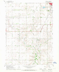
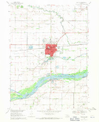
 2011 David City East2011 Print · USGSCovers Butler County, including David City, Octavia, and other nearby areas
 - 2011 Map of Columbus, 2011 Print
 2011 Columbus2011 Print · USGSCovers Butler County, including Columbus, Carriage House Estates, and other nearby areas
Showing maps 1-25 of 87
Top cities of Butler County
- David City historical maps
- Bellwood historical maps
- Rising City historical maps
- Brainard historical maps
- Ulysses historical maps
- Dwight historical maps
See more
Frequently asked questions
- What are the different types of historical maps available for Butler County?
- What is the oldest map of Butler County?
- Where can I purchase historical maps of Butler County for my home or office?
- Where can I download high-res historical maps of Butler County?
- Are there historical topographic maps available for Butler County?
- Is there historical aerial imagery available for Butler County?
- Where are historical maps of Butler County sourced from?