Old Maps of Sterling, Nebraska
Explore 14 old maps of Sterling, spanning from 1955 to today. These high-resolution historic maps reveal how streets, neighborhoods, landmarks, and natural features evolved over time — perfect for genealogy, metal detecting, research, and local history exploration.
What you can do with these maps:
- See how Sterling changed over time: Compare historical maps to modern-day views to trace roads, homesites, rail lines & more.
- View detailed metadata: Each map includes creators, publishers, year, scale, and archive source.
- Overlay maps with satellite & LiDAR: Visualize the past alongside modern tools to explore terrain & human change.
- Trusted historical sources: Maps sourced from the USGS, Library of Congress, and other archives.
- Access maps your way: View online, download high-res files, or order prints for personal or research use.
Start exploring old maps of Sterling to uncover forgotten places, hidden landmarks, and the deep history beneath your feet.
Sterling, NE maps
(14)- 1955 Map of Lincoln, 1967 Print
 1955 Lincoln1967 Print · USGSSoutheast Nebraska in the mid-fifties presents a landscape of thriving railroad towns and the expanding footprint of the capital city. Researchers can trace the legacy of the pioneer era at the Homestead National Monument of America or locate mid-century military infrastructure like Lincoln Air Force Base.5 unique versions available
 - 1957 Map of Lincoln
 1957 Lincoln1957 Print · USGSSoutheastern Nebraska at mid-century shows a landscape of thriving rail towns and expanding infrastructure centered on Lincoln. Researchers can trace the path of the Chicago Burlington and Quincy railroad through communities like Weeping Water, Fairmont, and Seward.
 - 1958 Map of Lincoln
 1958 Lincoln1958 Print · USGSSoutheast Nebraska at the end of the 1950s shows a region defined by agricultural trade and the expansion of the state capital. Genealogists can trace family footprints across the Blue Valley and locate landmarks like the Lincoln AFB or the U.S. Veterans Hospital.
 - 1965 Map of Sterling, 1966 Print
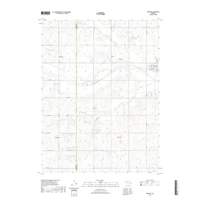
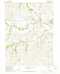 1965 Sterling1966 Print · USGSSoutheast Nebraska's agricultural heartland is documented here in the mid-1960s, centered on the railroad town of Sterling. Researchers can locate historic rural institutions like Hooker Sch and South St Johns Ch among the rolling creek valleys.
 - 1965 Map of St. Mary, 1968 Print
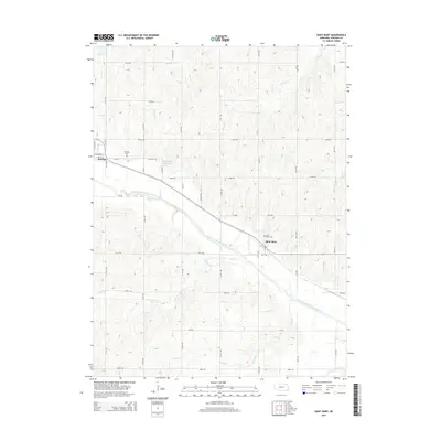
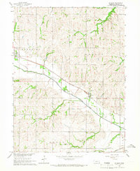 1965 St. Mary1968 Print · USGSJohnson County’s rural landscape is captured here in the mid-1960s, showing the agricultural heartland centered on the North Fork Big Nemaha River. Local historians can trace the path of the Chicago Burlington and Quincy Railroad as it links Sterling, St. Mary, and the quiet crossroads of Beatty.
 - 1986 Map of Beatrice
 1986 Beatrice1986 Print · USGSSoutheast Nebraska and the Kansas borderlands appear in the mid-1980s as a thriving agricultural region centered on the Big Blue River. Researchers can trace historic rail routes like the Burlington Northern through hubs such as Beatrice and Pawnee City.2 unique versions available
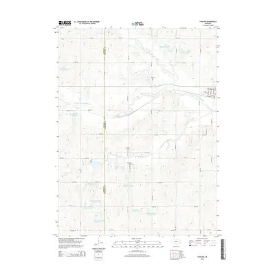
 - 2011 Map of Sterling, 2011 Print
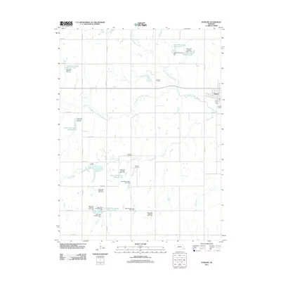 2011 Sterling2011 Print · USGSCovers Sterling, including Gage County, Johnson County, and other nearby areas
 - 2012 Map of Saint Mary, 2012 Print
 2012 Saint Mary2012 Print · USGSCovers Sterling, including Saint Mary, Johnson County, and other nearby areas
 - 2014 Map of Sterling, 2014 Print
 2014 Sterling2014 Print · USGSCovers Sterling, including Gage County, Johnson County, and other nearby areas
 - 2014 Map of Saint Mary, 2014 Print
 2014 Saint Mary2014 Print · USGSCovers Sterling, including Saint Mary, Johnson County, and other nearby areas
 - 2017 Map of Sterling, 2017 Print
 2017 Sterling2017 Print · USGSCovers Sterling, including Gage County, Johnson County, and other nearby areas
 - 2017 Map of Saint Mary, 2017 Print
 2017 Saint Mary2017 Print · USGSCovers Sterling, including Saint Mary, Johnson County, and other nearby areas
 - 2021 Map of Saint Mary, 2021 Print
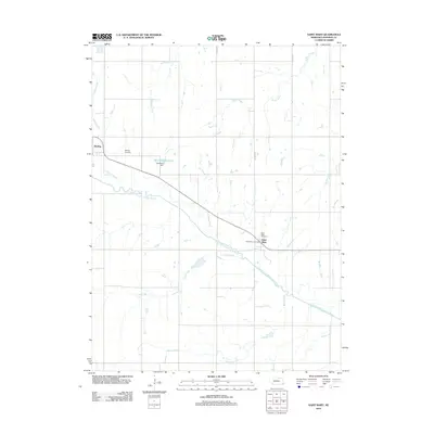
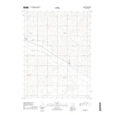
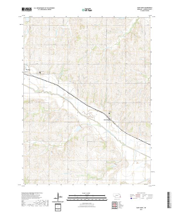 2021 Saint Mary2021 Print · USGSSoutheast Nebraska's agricultural heartland is captured here in the early twenty-first century, centered on the river valleys of Johnson County. Genealogists and local historians can locate family sites near Saint Mary and Sterling, or trace landmarks like the Heusman Reservoir and Saint Mary Cem.
 - 2021 Map of Sterling, 2021 Print
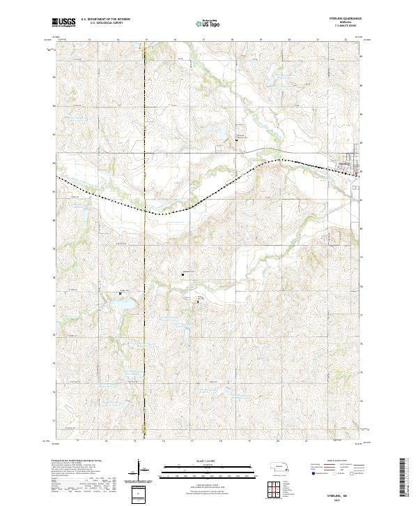 2021 Sterling2021 Print · USGSSoutheast Nebraska’s agricultural heartland is documented here in the early twenty-first century, centered on the village of Sterling. Genealogists and local historians can locate several rural landmarks including Immanuel Lutheran Cem, Hooker Cem, and the winding Hooker Creek.
End of results
Showing maps 1-14 of 14
Top cities near Sterling
- Syracuse historical maps
- Tecumseh historical maps
- Bennet historical maps
- Firth historical maps
- Adams historical maps
- Unadilla historical maps
See more
Frequently asked questions
- What are the different types of historical maps available for Sterling?
- What is the oldest map of Sterling?
- Where can I purchase historical maps of Sterling for my home or office?
- Where can I download high-res historical maps of Sterling?
- Are there historical topographic maps available for Sterling?
- Is there historical aerial imagery available for Sterling?
- Where are historical maps of Sterling sourced from?