Old Maps of Milford, Nebraska
Explore 11 old maps of Milford, spanning from 1934 to today. These high-resolution historic maps reveal how streets, neighborhoods, landmarks, and natural features evolved over time — perfect for genealogy, metal detecting, research, and local history exploration.
What you can do with these maps:
- See how Milford changed over time: Compare historical maps to modern-day views to trace roads, homesites, rail lines & more.
- View detailed metadata: Each map includes creators, publishers, year, scale, and archive source.
- Overlay maps with satellite & LiDAR: Visualize the past alongside modern tools to explore terrain & human change.
- Trusted historical sources: Maps sourced from the USGS, Library of Congress, and other archives.
- Access maps your way: View online, download high-res files, or order prints for personal or research use.
Start exploring old maps of Milford to uncover forgotten places, hidden landmarks, and the deep history beneath your feet.
Milford, NE maps
(11)- 1934 Map of Seward
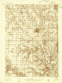 1934 Seward1934 Print · USGSSeward County at the height of the mid-thirties reveals a landscape of thriving river towns and essential rail connections. Genealogists and historians can trace numerous rural districts from School No 87 to the Old Soldiers and Sailors Home and Perry Mound Cem.
 - 1939 Map of Seward
 1939 Seward1939 Print · USGSSeward County in the mid-1930s shows a thriving network of rail-side towns and rural school districts at the heart of the Nebraska plains. Genealogists and local historians can trace hundreds of farmstead locations and community anchors like Old Salem Cem, Evangelical Ch, and Goehner.3 unique versions available
 - 1955 Map of Lincoln, 1967 Print
 1955 Lincoln1967 Print · USGSSoutheast Nebraska in the mid-fifties presents a landscape of thriving railroad towns and the expanding footprint of the capital city. Researchers can trace the legacy of the pioneer era at the Homestead National Monument of America or locate mid-century military infrastructure like Lincoln Air Force Base.5 unique versions available
 - 1957 Map of Lincoln
 1957 Lincoln1957 Print · USGSSoutheastern Nebraska at mid-century shows a landscape of thriving rail towns and expanding infrastructure centered on Lincoln. Researchers can trace the path of the Chicago Burlington and Quincy railroad through communities like Weeping Water, Fairmont, and Seward.
 - 1958 Map of Lincoln
 1958 Lincoln1958 Print · USGSSoutheast Nebraska at the end of the 1950s shows a region defined by agricultural trade and the expansion of the state capital. Genealogists can trace family footprints across the Blue Valley and locate landmarks like the Lincoln AFB or the U.S. Veterans Hospital.
 - 1964 Map of Milford, 1965 Print
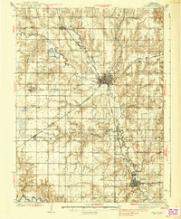
 1964 Milford1965 Print · USGSSeward County's river valley is caught in a moment of transition during the mid-1960s as new infrastructure arrives. You can trace the path of the Chicago Burlington and Quincy railroad or locate local landmarks like Milford Mennonite Cem and Horseshoe Lake.2 unique versions available
 - 1985 Map of York
 1985 York1985 Print · USGSSoutheast Nebraska in the mid-1980s shows a landscape of productive plains and vital transport corridors along the Burlington Northern line. Trace the history of local institutions like Concordia Teachers College and find family sites at Greenwood Cem or Thayer Cem.2 unique versions available
 - 2011 Map of Milford, 2011 Print
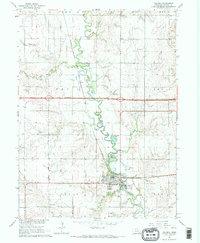
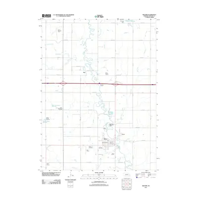 2011 Milford2011 Print · USGSCovers Milford, including Riverside Park, Ruby, and other nearby areas
 - 2014 Map of Milford, 2014 Print
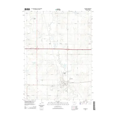 2014 Milford2014 Print · USGSCovers Milford, including Riverside Park, Ruby, and other nearby areas
 - 2017 Map of Milford, 2017 Print
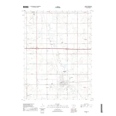 2017 Milford2017 Print · USGSCovers Milford, including Riverside Park, Ruby, and other nearby areas
 - 2021 Map of Milford, 2021 Print
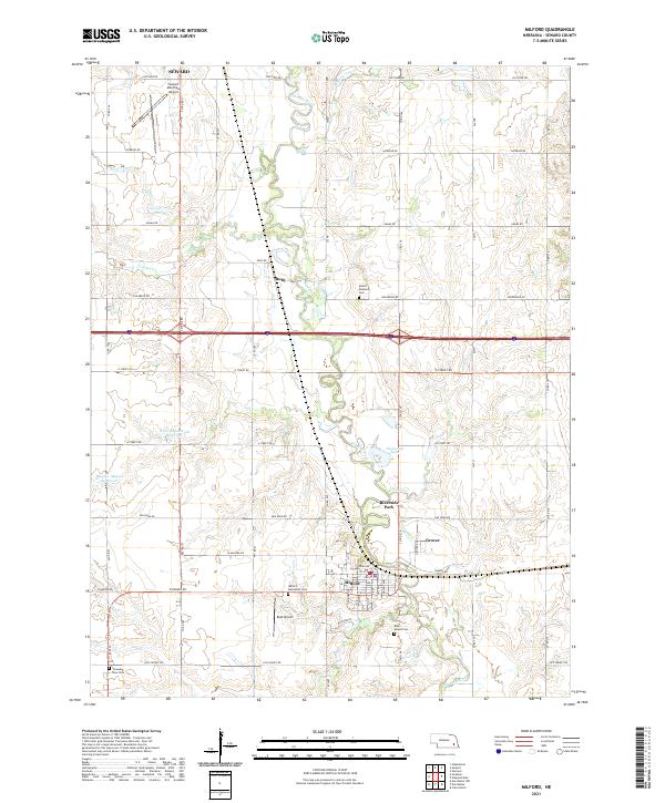 2021 Milford2021 Print · USGSSeward County's agricultural and river landscape is captured here in the early 2020s. Researchers can trace family history at Mount Pleasant Cem, locate landmarks like Roth Airport, and follow the winding path of the Big Blue River.
End of results
Showing maps 1-11 of 11
Top cities near Milford
- Seward historical maps
- Crete historical maps
- Friend historical maps
- Dorchester historical maps
- Beaver Crossing historical maps
- Malcolm historical maps
See more
Frequently asked questions
- What are the different types of historical maps available for Milford?
- What is the oldest map of Milford?
- Where can I purchase historical maps of Milford for my home or office?
- Where can I download high-res historical maps of Milford?
- Are there historical topographic maps available for Milford?
- Is there historical aerial imagery available for Milford?
- Where are historical maps of Milford sourced from?