Old Maps of Eaton, New Hampshire
Explore 35 old maps of Eaton, spanning from 1910 to today. These high-resolution historic maps reveal how streets, neighborhoods, landmarks, and natural features evolved over time — perfect for genealogy, metal detecting, research, and local history exploration.
What you can do with these maps:
- See how Eaton changed over time: Compare historical maps to modern-day views to trace roads, homesites, rail lines & more.
- View detailed metadata: Each map includes creators, publishers, year, scale, and archive source.
- Overlay maps with satellite & LiDAR: Visualize the past alongside modern tools to explore terrain & human change.
- Trusted historical sources: Maps sourced from the USGS, Library of Congress, and other archives.
- Access maps your way: View online, download high-res files, or order prints for personal or research use.
Start exploring old maps of Eaton to uncover forgotten places, hidden landmarks, and the deep history beneath your feet.
Eaton, NH maps
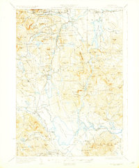
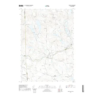
(35)- 1910 Map of Kezar Falls
 1910 Kezar Falls1910 Print · USGSMaine and New Hampshire borderlands are captured here at the height of the railroad era, as the Maine Central linked river towns. Genealogists can trace family footprints through sites like the Parsonsfield Seminary, Merrill Corner, and the Haley School.5 unique versions available
 - 1911 Map of Kezar Falls
 1911 Kezar Falls1911 Print · USGSThe Saco River valley at the turn of the century shows a landscape defined by riverside industry and mountain schools. Genealogists and historians can trace rail depots like Bridgton Junction and early landmarks such as Parsonsfield Seminary and Rankins Mill.5 unique versions available
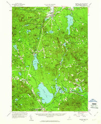
 - 1930 Map of Ossipee Lake
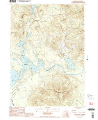
 1930 Ossipee Lake1930 Print · USGSCarroll County at the dawn of the 1930s shows a landscape of lakeside villages and mountain resorts connected by the Boston and Maine Railroad. Genealogy researchers can trace family sites like the Albany Cem, Mountain Ch, or old schoolhouses like the Nickerson Sch.8 unique versions available
 - 1949 Map of Portland
 1949 Portland1949 Print · USGSCoastal Maine and the New Hampshire interior are shown in detail during the late forties, from the bustling harbors to the lakeside villages. Researchers can trace historical rail networks like the Boston & Maine RR and locate coastal defenses such as Fort Preble.3 unique versions available
 - 1956 Map of Portland, 1963 Print
 1956 Portland1963 Print · USGSSouthern Maine and eastern New Hampshire are captured here in the mid-fifties, during a time of major highway expansion and military growth. You can trace the path of the Maine Turnpike and locate landmarks like the Portsmouth Naval Shipyard and Sebago Lake.4 unique versions available
 - 1958 Map of Ossipee Lake, 1960 Print
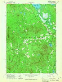
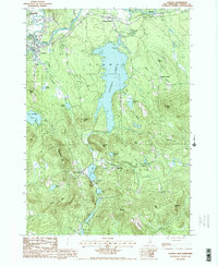
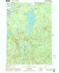
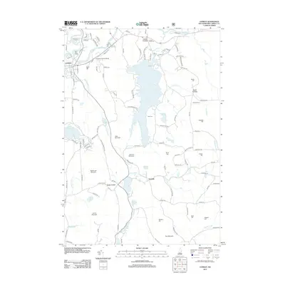
 1958 Ossipee Lake1960 Print · USGSEastern Carroll County in the late fifties was a landscape of timbered peaks and rising lakeside tourism. Genealogists and historians can trace the region's development through the Boston and Maine Railroad stations, the Albany Chapel, and landmarks like Madison Boulder.4 unique versions available
 - 1959 Map of Portland
 1959 Portland1959 Print · USGSThe Maine and New Hampshire coastlines meet in this mid-century portrait of maritime commerce and inland rail networks. Researchers can trace the legacy of coastal defense at Fort Williams and follow the historic path of the Maine Central RR through the White Mountain National Forest.2 unique versions available
 - 1963 Map of Portland
 1963 Portland1963 Print · USGSCoastal Maine and New Hampshire thrived as maritime and industrial hubs during the mid-sixties, linked by a dense network of rail and river. Researchers can trace historic transit corridors like the Maine Central RR and locate key sites such as the Portsmouth Naval Shipyard or Pease Air Force Base.3 unique versions available
 - 1964 Map of Brownfield, 1966 Print
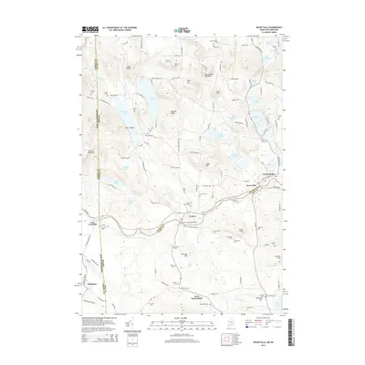
 1964 Brownfield1966 Print · USGSOxford County settlement and the Saco River valley are captured here in the mid-sixties. Genealogists and local historians can trace family burial sites at Merrill Cem and Wentworth Cem or follow the path of the Maine Central Railroad.2 unique versions available
 - 1964 Map of Kezar Falls, 1966 Print
 1964 Kezar Falls1966 Print · USGSThe Maine-New Hampshire borderlands near Kezar Falls are captured here in the mid-sixties, showing a landscape of river-driven towns and upland ponds. Genealogists can trace family lines through numerous rural burial grounds like Churchill Cem and local landmarks such as the Parsonsfield Seminary.4 unique versions available
 - 1985 Map of Portland, 1986 Print
 1985 Portland1986 Print · USGSThe Maine coast and Sebago Lake region are captured in the mid-1980s, showcasing the transition from traditional maritime centers to a modern transportation hub. Genealogists and historians can trace rail lines like the Grand Trunk RR and find local landmarks such as the U.S. Marine Hospital or Old Orchard Beach.2 unique versions available
 - 1986 Map of Lake Winnipesaukee
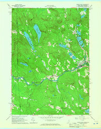
 1986 Lake Winnipesaukee1986 Print · USGSThe Lakes Region in the mid-eighties shows a landscape of dense water bodies and mountain ranges at the peak of its twentieth-century character. Trace the legacy of old rail lines like the Boston and Maine RR and locate historic centers from Rumney Depot to Melvin Village.2 unique versions available
 - 1987 Map of Conway
 1987 Conway1987 Print · USGSThe Saco River valley and the village of Conway appear here in the late eighties, surrounded by the peaks and ponds of Carroll County. Researchers can locate family cemeteries and trace the shorelines of Conway Lake, Purity Lake, and Crystal Lake near settlements like Snowville.2 unique versions available
 - 1987 Map of Freedom
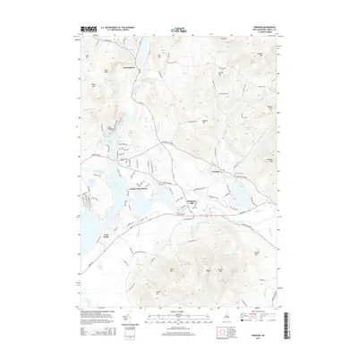
 1987 Freedom1987 Print · USGSFreedom and the surrounding Ossipee Valley are captured in the late eighties, a landscape shaped by glacial lakes and forested peaks. Genealogists and local historians can trace family-named sites like Durgin Hill, the settlement at Effingham Falls, and the grounds of Camp Huckins.2 unique versions available
 - 1998 Map of Conway, 2001 Print
 1998 Conway2001 Print · USGSCarroll County’s landscape is captured here at the end of the century, showing the established communities of Conway and Center Conway during a period of steady growth. Researchers can trace local landmarks from Conway Lake to smaller hamlets like Snowville and Eaton Center.
 - 2011 Map of Kezar Falls, 2011 Print
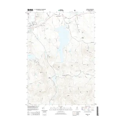
 2011 Kezar Falls2011 Print · USGSCovers Eaton, including Parsonsfield, Effingham, and other nearby areas
 - 2011 Map of Brownfield, 2011 Print
 2011 Brownfield2011 Print · USGSCovers Eaton, including Conway, Fryeburg, and other nearby areas
 - 2012 Map of Freedom, 2012 Print
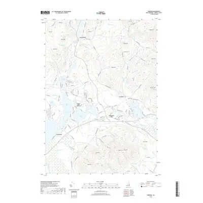
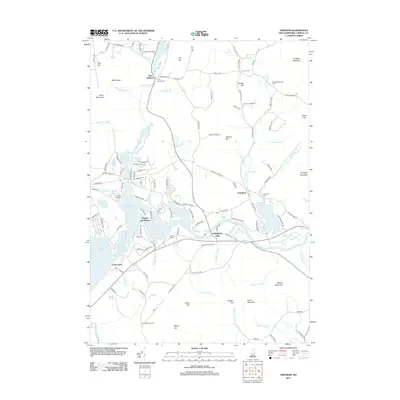 2012 Freedom2012 Print · USGSCovers Eaton, including Ossipee, Madison, and other nearby areas
 - 2012 Map of Conway, 2012 Print
 2012 Conway2012 Print · USGSCovers Eaton, including Conway, Madison, and other nearby areas
 - 2014 Map of Brownfield, 2014 Print
 2014 Brownfield2014 Print · USGSCovers Eaton, including Conway, Fryeburg, and other nearby areas
 - 2014 Map of Kezar Falls, 2014 Print
 2014 Kezar Falls2014 Print · USGSCovers Eaton, including Parsonsfield, Effingham, and other nearby areas
 - 2015 Map of Freedom, 2015 Print
 2015 Freedom2015 Print · USGSCovers Eaton, including Ossipee, Madison, and other nearby areas
 - 2015 Map of Conway, 2015 Print
 2015 Conway2015 Print · USGSCovers Eaton, including Conway, Madison, and other nearby areas
 - 2018 Map of Freedom, 2018 Print
 2018 Freedom2018 Print · USGSCovers Eaton, including Ossipee, Madison, and other nearby areas
 - 2018 Map of Kezar Falls, 2018 Print
 2018 Kezar Falls2018 Print · USGSCovers Eaton, including Parsonsfield, Effingham, and other nearby areas
Showing maps 1-25 of 35
Top cities near Eaton
- Bridgton historical maps
- Wakefield historical maps
- Moultonborough historical maps
- Ossipee historical maps
- Conway historical maps
- Fryeburg historical maps
See more
Top neighborhoods of Eaton
Frequently asked questions
- What are the different types of historical maps available for Eaton?
- What is the oldest map of Eaton?
- Where can I purchase historical maps of Eaton for my home or office?
- Where can I download high-res historical maps of Eaton?
- Are there historical topographic maps available for Eaton?
- Is there historical aerial imagery available for Eaton?
- Where are historical maps of Eaton sourced from?