Old Maps of Wilton, New Hampshire
Explore 16 old maps of Wilton, spanning from 1900 to today. These high-resolution historic maps reveal how streets, neighborhoods, landmarks, and natural features evolved over time — perfect for genealogy, metal detecting, research, and local history exploration.
What you can do with these maps:
- See how Wilton changed over time: Compare historical maps to modern-day views to trace roads, homesites, rail lines & more.
- View detailed metadata: Each map includes creators, publishers, year, scale, and archive source.
- Overlay maps with satellite & LiDAR: Visualize the past alongside modern tools to explore terrain & human change.
- Trusted historical sources: Maps sourced from the USGS, Library of Congress, and other archives.
- Access maps your way: View online, download high-res files, or order prints for personal or research use.
Start exploring old maps of Wilton to uncover forgotten places, hidden landmarks, and the deep history beneath your feet.
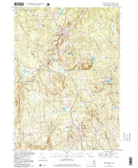
Wilton, NH maps
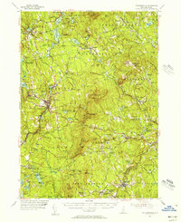
(16)- 1900 Map of Peterboro
 1900 Peterboro1900 Print · USGSCovers Wilton, including Rindge, Peterborough, and other nearby areas9 unique versions available
 - 1906 Map of Milford
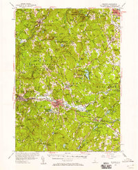
 1906 Milford1906 Print · USGSCovers Wilton, including Manchester, Nashua, and other nearby areas8 unique versions available
 - 1943 Map of Fitchburg
 1943 Fitchburg1943 Print · USGSCovers Wilton, including Manchester, Nashua, and other nearby areas
 - 1948 Map of Boston
 1948 Boston1948 Print · USGSCovers Wilton, including Boston, Worcester, and other nearby areas2 unique versions available
 - 1953 Map of Peterborough, 1956 Print
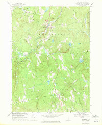
 1953 Peterborough1956 Print · USGSCovers Wilton, including Rindge, Peterborough, and other nearby areas3 unique versions available
 - 1953 Map of Milford, 1958 Print
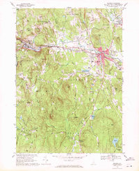
 1953 Milford1958 Print · USGSCovers Wilton, including Manchester, Nashua, and other nearby areas3 unique versions available
 - 1956 Map of Boston, 1967 Print
 1956 Boston1967 Print · USGSCovers Wilton, including Boston, Worcester, and other nearby areas6 unique versions available
 - 1958 Map of Boston
 1958 Boston1958 Print · USGSCovers Wilton, including Boston, Worcester, and other nearby areas2 unique versions available
 - 1961 Map of Boston
 1961 Boston1961 Print · USGSCovers Wilton, including Boston, Worcester, and other nearby areas2 unique versions available
 - 1968 Map of New Boston, 1971 Print
 1968 New Boston1971 Print · USGSCovers Wilton, including New Boston, Mont Vernon, and other nearby areas3 unique versions available
 - 1968 Map of Milford, 1971 Print
 1968 Milford1971 Print · USGSCovers Wilton, including Milford, Hollis, and other nearby areas3 unique versions available
 - 1984 Map of Lowell
 1984 Lowell1984 Print · USGSCovers Wilton, including Manchester, Lowell, and other nearby areas
 - 1987 Map of Greenville
 1987 Greenville1987 Print · USGSCovers Wilton, including New Ipswich, Greenville, and other nearby areas
 - 1988 Map of Lowell
 1988 Lowell1988 Print · USGSCovers Wilton, including Manchester, Lowell, and other nearby areas2 unique versions available
 - 1995 Map of New Boston, 1999 Print
 1995 New Boston1999 Print · USGSCovers Wilton, including New Boston, Mont Vernon, and other nearby areas
 - 1997 Map of Greenville, 1998 Print
 1997 Greenville1998 Print · USGSCovers Wilton, including New Ipswich, Greenville, and other nearby areas
End of results
Showing maps 1-16 of 16
Top cities near Wilton
- Nashua historical maps
- Fitchburg historical maps
- Merrimack historical maps
- Gardner historical maps
- Bedford historical maps
- Goffstown historical maps
See more
Top neighborhoods of Wilton
Frequently asked questions
- What are the different types of historical maps available for Wilton?
- What is the oldest map of Wilton?
- Where can I purchase historical maps of Wilton for my home or office?
- Where can I download high-res historical maps of Wilton?
- Are there historical topographic maps available for Wilton?
- Is there historical aerial imagery available for Wilton?
- Where are historical maps of Wilton sourced from?