Old Maps of Bayonne, New Jersey
Explore 30 old maps of Bayonne, spanning from 1898 to today. These high-resolution historic maps reveal how streets, neighborhoods, landmarks, and natural features evolved over time — perfect for genealogy, metal detecting, research, and local history exploration.
What you can do with these maps:
- See how Bayonne changed over time: Compare historical maps to modern-day views to trace roads, homesites, rail lines & more.
- View detailed metadata: Each map includes creators, publishers, year, scale, and archive source.
- Overlay maps with satellite & LiDAR: Visualize the past alongside modern tools to explore terrain & human change.
- Trusted historical sources: Maps sourced from the USGS, Library of Congress, and other archives.
- Access maps your way: View online, download high-res files, or order prints for personal or research use.
Start exploring old maps of Bayonne to uncover forgotten places, hidden landmarks, and the deep history beneath your feet.
Bayonne, NJ maps
(30)- 1898 Map of Staten Island
 1898 Staten Island1898 Print · USGSGreater Staten Island and the industrial shores of New Jersey are captured during the peak of the Victorian maritime era. Genealogists can trace early neighborhood boundaries and landmarks like Moravian Cemetery, the Morris Canal, and the vanished industry of Linoleumville.
 - 1900 Map of Passaic
 1900 Passaic1900 Print · USGSNorthern New Jersey and the New York Harbor are captured here at the close of the nineteenth century, showing a landscape defined by rail, river, and coastal defense. Researchers can trace the original path of the Morris Canal, locate Seton Hall College, and explore the batteries at Fort Wadsworth.
 - 1900 Map of Staten Island
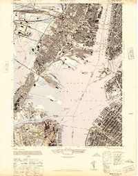
 1900 Staten Island1900 Print · USGSThe New York and New Jersey harbor comes alive in the late Victorian era, showing Staten Island when small villages and defensive forts still defined the coastline. Trace family roots and vanished landmarks through Fort Wadsworth, the Morris Canal, and historic settlements like Rossville or Tottenville.10 unique versions available
 - 1905 Map of Passaic
 1905 Passaic1905 Print · USGSNorthern New Jersey and Staten Island appear here at a pivotal moment of early 20th-century growth and industrialization. Researchers can trace the development of transit hubs like Convent Sta. or locate legacy landmarks including Hillside Cemetery and the Moravian Cemetery.4 unique versions available
 - 1942 Map of Passaic
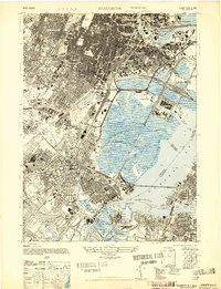
 1942 Passaic1942 Print · USGSNorthern New Jersey and New York harbor appear in detail at the start of the war, showing a landscape of burgeoning suburbs and vital industry. Trace family roots and local history across the Passaic River valley, from Paterson to the Watchung Mountains.
 - 1944 Map of Newark, 1971 Print
 1944 Newark1971 Print · USGSThe industrial corridor from Philadelphia to New York was in a period of massive transition during the mid-forties. Genealogists and researchers can trace the rail lines of the Lehigh Valley RR, locate military installations like Picatinny Arsenal, and explore the early sprawl near Levittown.5 unique versions available
 - 1947 Map of Jersey City
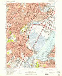
 1947 Jersey City1947 Print · USGSThe harbor was a hive of industrial and maritime activity just after the war, featuring the intricate rail networks of the Lackawanna and Pennsylvania lines. Trace the early footprints of the Holland Vehicular Tunnels and landmarks like the Statue of Liberty.
 - 1947 Map of Elizabeth
 1947 Elizabeth1947 Print · USGSIn the late 1940s, the industrial corridor between Newark and Staten Island reached its peak of rail and maritime activity. Researchers can trace the development of Newark Airport, identify local parish sites like St James, and locate vanished rail stops such as Bay Way Sta.2 unique versions available
 - 1949 Map of Newark
 1949 Newark1949 Print · USGSThe industrial corridor between Philadelphia and New York comes alive in this post-war survey. Genealogists and historians can trace the massive rail networks of the Reading Railroad and locate major installations like Fort Dix or Picatinny Arsenal.2 unique versions available
 - 1955 Map of Elizabeth, 1958 Print
 1955 Elizabeth1958 Print · USGSGreater Newark and Elizabeth are shown here at a peak of industrial and transit development during the mid-fifties. Genealogists and urban historians can trace local parish schools like St Marys Sch, the vast Evergreen Cemetery, and the early layout of Newark Airport.2 unique versions available
 - 1955 Map of Jersey City, 1958 Print
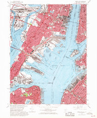
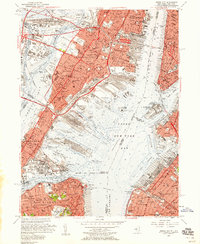 1955 Jersey City1958 Print · USGSMid-century Jersey City and the New York Harbor waterfront appear at their industrial peak, showcasing a landscape of massive rail yards and active piers. Researchers can trace the sprawling Greenville Yards, the Naval Reservation Bayonne Supply Depot, and local landmarks like Roosevelt Stadium.2 unique versions available
 - 1956 Map of Newark
 1956 Newark1956 Print · USGSThe industrial heart of the Mid-Atlantic is captured here at the dawn of the highway era, tracing the dense corridors between Newark and Philadelphia. Genealogists and local historians can map the rail networks of the Reading RR or locate mid-century military life at Fort Dix Military Reservation.2 unique versions available
 - 1957 Map of Newark
 1957 Newark1957 Print · USGSThe industrial and military heart of the Mid-Atlantic is mapped during its post-war suburban boom. Genealogists and historians can trace the intricate rail corridors of the Reading Railroad and locate key landmarks from Princeton University to Fort Hancock.
 - 1960 Map of Newark
 1960 Newark1960 Print · USGSThe industrial heart of the Mid-Atlantic is shown at mid-century, stretching from the dense urban centers of Newark and Philadelphia to the Blue Mountain ridges. Researchers can trace historic rail lines, coastal defenses at Fort Hancock, and the riverfront growth of Trenton and Easton.3 unique versions available
 - 1964 Map of Newark
 1964 Newark1964 Print · USGSGreater New Jersey and eastern Pennsylvania appear at the peak of their industrial and rail-centered development in the mid-sixties. Genealogists and historians can trace the paths of the Pennsylvania RR, identify mid-century landmarks like CAMP KILMER, or follow the Schuylkill River through READING.2 unique versions available
 - 1967 Map of Jersey City, 1969 Print
 1967 Jersey City1969 Print · USGSThe industrial waterfront of Hudson County and Brooklyn is captured here in the late sixties. Researchers can trace the massive rail-to-sea networks of Meadows Yards and locate landmarks like Roosevelt Stadium and Ellis Island.3 unique versions available
 - 1967 Map of Elizabeth, 1969 Print
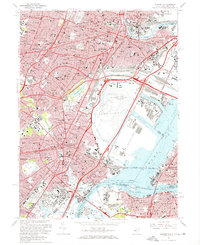 1967 Elizabeth1969 Print · USGSGreater Newark and Elizabeth are seen here at a mid-century peak of industrial and transit development. Researchers can trace historic parish boundaries and major landmarks like Seton Hall Univ, Evergreen Cemetery, and the Passaic River waterfront.3 unique versions available
 - 1984 Map of Newark, 1985 Print
 1984 Newark1985 Print · USGSNorthern New Jersey's massive industrial and transit network is on full display in the mid-eighties, showing the region just before modern redevelopment. Genealogists and historians can trace the dense urban grids of Newark, find historic landmarks like Ellis Island, and locate the sprawling Picatinny Arsenal in the western hills.
 - 1986 Map of Newark, 1987 Print
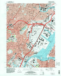
 1986 Newark1987 Print · USGSNorthern New Jersey during the mid-eighties shows an incredible transition from the industrial harbor to the wooded Highlands. Researchers can trace the massive footprints of Picatinny Arsenal and Newark International Airport or explore protected lands like the Great Swamp National Wildlife Refuge.
 - 1995 Map of Elizabeth, 1998 Print
 1995 Elizabeth1998 Print · USGSNorthern New Jersey and Staten Island show their dense urban and industrial character in the 1990s. Trace local history through institutions like Seton Hall Univ or find family landmarks in Evergreen Cemetery and Rose Hill Cemetery.
 - 2011 Map of Jersey City, 2011 Print
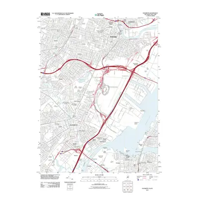
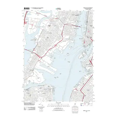 2011 Jersey City2011 Print · USGSCovers Bayonne, including New York, Newark, and other nearby areas
 - 2011 Map of Elizabeth, 2011 Print
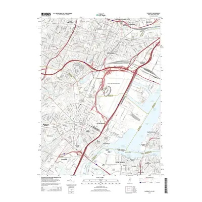
 2011 Elizabeth2011 Print · USGSCovers Bayonne, including New York, Newark, and other nearby areas
 - 2014 Map of Jersey City, 2014 Print
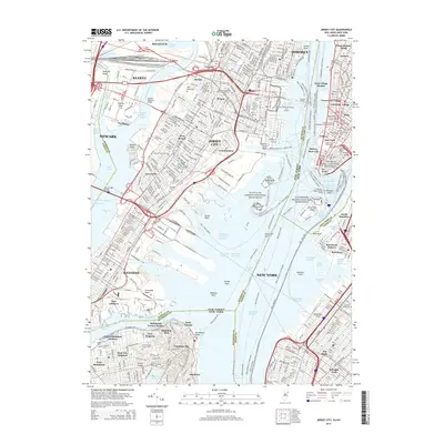 2014 Jersey City2014 Print · USGSCovers Bayonne, including New York, Newark, and other nearby areas
 - 2014 Map of Elizabeth, 2014 Print
 2014 Elizabeth2014 Print · USGSCovers Bayonne, including New York, Newark, and other nearby areas
 - 2016 Map of Jersey City, 2016 Print
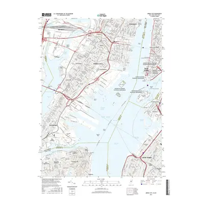 2016 Jersey City2016 Print · USGSCovers Bayonne, including New York, Newark, and other nearby areas
Showing maps 1-25 of 30
Top cities near Bayonne
- New York historical maps
- Newark historical maps
- Jersey City historical maps
- Paterson historical maps
- Elizabeth historical maps
- Edison historical maps
See more
Top neighborhoods of Bayonne
Frequently asked questions
- What are the different types of historical maps available for Bayonne?
- What is the oldest map of Bayonne?
- Where can I purchase historical maps of Bayonne for my home or office?
- Where can I download high-res historical maps of Bayonne?
- Are there historical topographic maps available for Bayonne?
- Is there historical aerial imagery available for Bayonne?
- Where are historical maps of Bayonne sourced from?