Old Maps of Holiday City South, Berkeley Township
Explore 24 old maps of Holiday City South, spanning from 1884 to today. These high-resolution historic maps reveal how streets, neighborhoods, landmarks, and natural features evolved over time — perfect for genealogy, metal detecting, research, and local history exploration.
What you can do with these maps:
- See how Holiday City South changed over time: Compare historical maps to modern-day views to trace roads, homesites, rail lines & more.
- View detailed metadata: Each map includes creators, publishers, year, scale, and archive source.
- Overlay maps with satellite & LiDAR: Visualize the past alongside modern tools to explore terrain & human change.
- Trusted historical sources: Maps sourced from the USGS, Library of Congress, and other archives.
- Access maps your way: View online, download high-res files, or order prints for personal or research use.
Start exploring old maps of Holiday City South to uncover forgotten places, hidden landmarks, and the deep history beneath your feet.
Holiday City South, Berkeley Township maps
(24)- 1884 Map of Whitings
 1884 Whitings1884 Print · USGSCovers Holiday City South, including Toms River, Jackson Township, and other nearby areas
 - 1888 Map of Barnegat
 1888 Barnegat1888 Print · USGSCovers Holiday City South, including Toms River, Manchester Township, and other nearby areas
 - 1888 Map of Whitings, 1900 Print
 1888 Whitings1900 Print · USGSCovers Holiday City South, including Toms River, Jackson Township, and other nearby areas3 unique versions available
 - 1893 Map of Barnegat
 1893 Barnegat1893 Print · USGSCovers Holiday City South, including Toms River, Manchester Township, and other nearby areas2 unique versions available
 - 1898 Map of Barnegat, 1904 Print
 1898 Barnegat1904 Print · USGSCovers Holiday City South, including Toms River, Manchester Township, and other nearby areas5 unique versions available
 - 1919 Map of Barnegat, 1921 Print
 1919 Barnegat1921 Print · USGSCovers Holiday City South, including Toms River, Manchester Township, and other nearby areas
 - 1941 Map of Toms River
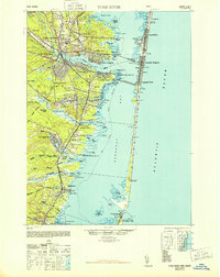
 1941 Toms River1941 Print · USGSCovers Holiday City South, including Toms River, Manchester Township, and other nearby areas2 unique versions available
 - 1942 Map of Whiting
 1942 Whiting1942 Print · USGSCovers Holiday City South, including Toms River, Jackson Township, and other nearby areas2 unique versions available
 - 1946 Map of Wilmington, 1948 Print
 1946 Wilmington1948 Print · USGSCovers Holiday City South, including Philadelphia, Toms River, and other nearby areas2 unique versions available
 - 1948 Map of Toms River
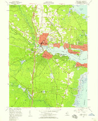
 1948 Toms River1948 Print · USGSCovers Holiday City South, including Toms River, Manchester Township, and other nearby areas6 unique versions available
 - 1949 Map of Whiting, 1954 Print
 1949 Whiting1954 Print · USGSCovers Holiday City South, including Toms River, Jackson Township, and other nearby areas3 unique versions available
 - 1951 Map of Keswick Grove
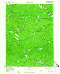
 1951 Keswick Grove1951 Print · USGSCovers Holiday City South, including Toms River, Manchester Township, and other nearby areas
 - 1953 Map of Toms River, 1958 Print
 1953 Toms River1958 Print · USGSCovers Holiday City South, including Toms River, Manchester Township, and other nearby areas3 unique versions available
 - 1955 Map of Wilmington
 1955 Wilmington1955 Print · USGSCovers Holiday City South, including Philadelphia, Toms River, and other nearby areas
 - 1957 Map of Wilmington
 1957 Wilmington1957 Print · USGSCovers Holiday City South, including Philadelphia, Toms River, and other nearby areas2 unique versions available
 - 1957 Map of Keswick Grove, 1961 Print
 1957 Keswick Grove1961 Print · USGSCovers Holiday City South, including Toms River, Manchester Township, and other nearby areas3 unique versions available
 - 1959 Map of Wilmington
 1959 Wilmington1959 Print · USGSCovers Holiday City South, including Philadelphia, Toms River, and other nearby areas3 unique versions available
 - 1966 Map of Wilmington, 1968 Print
 1966 Wilmington1968 Print · USGSCovers Holiday City South, including Philadelphia, Toms River, and other nearby areas4 unique versions available
 - 1972 Map of Wilmington, 1976 Print
 1972 Wilmington1976 Print · USGSCovers Holiday City South, including Philadelphia, Toms River, and other nearby areas2 unique versions available
 - 1984 Map of Hammonton, 1986 Print
 1984 Hammonton1986 Print · USGSCovers Holiday City South, including Toms River, Cherry Hill Township, and other nearby areas3 unique versions available
 - 1989 Map of Toms River
 1989 Toms River1989 Print · USGSCovers Holiday City South, including Toms River, Manchester Township, and other nearby areas
 - 1995 Map of Toms River, 2001 Print
 1995 Toms River2001 Print · USGSCovers Holiday City South, including Toms River, Manchester Township, and other nearby areas
 - 2023 Map of Toms River, 2023 Print
 2023 Toms River2023 Print · USGSCovers Holiday City South, including Toms River, Manchester Township, and other nearby areas
 - 2023 Map of Keswick Grove, 2023 Print
 2023 Keswick Grove2023 Print · USGSCovers Holiday City South, including Toms River, Manchester Township, and other nearby areas
End of results
Showing maps 1-24 of 24
Frequently asked questions
- What are the different types of historical maps available for Holiday City South?
- What is the oldest map of Holiday City South?
- Where can I purchase historical maps of Holiday City South for my home or office?
- Where can I download high-res historical maps of Holiday City South?
- Are there historical topographic maps available for Holiday City South?
- Is there historical aerial imagery available for Holiday City South?
- Where are historical maps of Holiday City South sourced from?