Old Maps of Pennsville Township, New Jersey
Explore 31 old maps of Pennsville Township, spanning from 1890 to today. These high-resolution historic maps reveal how streets, neighborhoods, landmarks, and natural features evolved over time — perfect for genealogy, metal detecting, research, and local history exploration.
What you can do with these maps:
- See how Pennsville Township changed over time: Compare historical maps to modern-day views to trace roads, homesites, rail lines & more.
- View detailed metadata: Each map includes creators, publishers, year, scale, and archive source.
- Overlay maps with satellite & LiDAR: Visualize the past alongside modern tools to explore terrain & human change.
- Trusted historical sources: Maps sourced from the USGS, Library of Congress, and other archives.
- Access maps your way: View online, download high-res files, or order prints for personal or research use.
Start exploring old maps of Pennsville Township to uncover forgotten places, hidden landmarks, and the deep history beneath your feet.
Pennsville Township, NJ maps
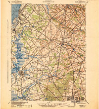
(31)- 1890 Map of Salem
 1890 Salem1890 Print · USGSCovers Pennsville Township, including Wilmington, Carneys Point Township, and other nearby areas2 unique versions available
 - 1898 Map of Salem
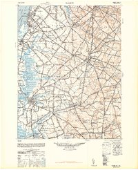
 1898 Salem1898 Print · USGSCovers Pennsville Township, including Wilmington, Carneys Point Township, and other nearby areas6 unique versions available
 - 1901 Map of Camden
 1901 Camden1901 Print · USGSCovers Pennsville Township, including Philadelphia, Upper Darby, and other nearby areas3 unique versions available
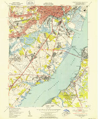
 - 1904 Map of Wilmington, 1961 Print
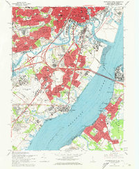
 1904 Wilmington1961 Print · USGSCovers Pennsville Township, including Wilmington, Newark, and other nearby areas
 - 1906 Map of Wilmington
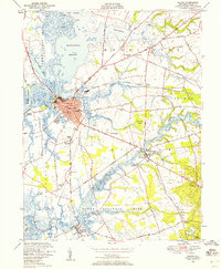
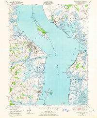
 1906 Wilmington1906 Print · USGSCovers Pennsville Township, including Wilmington, Newark, and other nearby areas7 unique versions available
 - 1919 Map of Wilmington
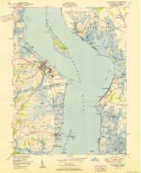
 1919 Wilmington1919 Print · USGSCovers Pennsville Township, including Wilmington, Newark, and other nearby areas2 unique versions available
 - 1941 Map of Salem
 1941 Salem1941 Print · USGSCovers Pennsville Township, including Wilmington, Carneys Point Township, and other nearby areas
 - 1942 Map of Camden
 1942 Camden1942 Print · USGSCovers Pennsville Township, including Philadelphia, Upper Darby, and other nearby areas
 - 1946 Map of Wilmington, 1948 Print
 1946 Wilmington1948 Print · USGSCovers Pennsville Township, including Philadelphia, Toms River, and other nearby areas2 unique versions available
 - 1948 Map of Salem
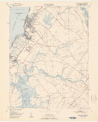
 1948 Salem1948 Print · USGSCovers Pennsville Township, including Wilmington, Carneys Point Township, and other nearby areas3 unique versions available
 - 1948 Map of Wilmington South, 1952 Print
 1948 Wilmington South1952 Print · USGSCovers Pennsville Township, including Wilmington, Wilmington Manor, and other nearby areas2 unique versions available
 - 1948 Map of Salem, 1958 Print
 1948 Salem1958 Print · USGSCovers Pennsville Township, including Salem, Quinton Township, and other nearby areas5 unique versions available
 - 1948 Map of Delaware City, 1965 Print
 1948 Delaware City1965 Print · USGSCovers Pennsville Township, including Lower Alloways Creek Township, Delaware City, and other nearby areas5 unique versions available
 - 1951 Map of Salem
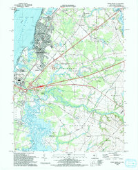
 1951 Salem1951 Print · USGSCovers Pennsville Township, including Salem, Quinton Township, and other nearby areas2 unique versions available
 - 1951 Map of Delaware City
 1951 Delaware City1951 Print · USGSCovers Pennsville Township, including Lower Alloways Creek Township, Delaware City, and other nearby areas
 - 1951 Map of Penns Grove
 1951 Penns Grove1951 Print · USGSCovers Pennsville Township, including Wilmington, Carneys Point Township, and other nearby areas2 unique versions available
 - 1955 Map of Wilmington
 1955 Wilmington1955 Print · USGSCovers Pennsville Township, including Philadelphia, Toms River, and other nearby areas
 - 1957 Map of Wilmington
 1957 Wilmington1957 Print · USGSCovers Pennsville Township, including Philadelphia, Toms River, and other nearby areas2 unique versions available
 - 1959 Map of Wilmington
 1959 Wilmington1959 Print · USGSCovers Pennsville Township, including Philadelphia, Toms River, and other nearby areas3 unique versions available
 - 1966 Map of Wilmington, 1968 Print
 1966 Wilmington1968 Print · USGSCovers Pennsville Township, including Philadelphia, Toms River, and other nearby areas4 unique versions available
 - 1967 Map of Penns Grove, 1969 Print
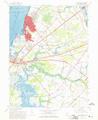 1967 Penns Grove1969 Print · USGSCovers Pennsville Township, including Wilmington, Carneys Point Township, and other nearby areas2 unique versions available
 - 1967 Map of Wilmington South, 1969 Print
 1967 Wilmington South1969 Print · USGSCovers Pennsville Township, including Wilmington, Wilmington Manor, and other nearby areas3 unique versions available
 - 1972 Map of Wilmington, 1976 Print
 1972 Wilmington1976 Print · USGSCovers Pennsville Township, including Philadelphia, Toms River, and other nearby areas2 unique versions available
 - 1984 Map of Wilmington, 1986 Print
 1984 Wilmington1986 Print · USGSCovers Pennsville Township, including Philadelphia, Upper Darby, and other nearby areas2 unique versions available
 - 1993 Map of Penns Grove
 1993 Penns Grove1993 Print · USGSCovers Pennsville Township, including Wilmington, Carneys Point Township, and other nearby areas
Showing maps 1-25 of 31
Top cities near Pennsville Township
- Wilmington historical maps
- Chester historical maps
- Newark historical maps
- Hockessin historical maps
- New Garden Township historical maps
- Middletown historical maps
See more
Top neighborhoods of Pennsville Township
- Central Park historical maps
- Church Landing historical maps
- Churchtown historical maps
- Deepwater historical maps
- Fort Mott historical maps
- Glenside historical maps
See more
Frequently asked questions
- What are the different types of historical maps available for Pennsville Township?
- What is the oldest map of Pennsville Township?
- Where can I purchase historical maps of Pennsville Township for my home or office?
- Where can I download high-res historical maps of Pennsville Township?
- Are there historical topographic maps available for Pennsville Township?
- Is there historical aerial imagery available for Pennsville Township?
- Where are historical maps of Pennsville Township sourced from?