Old Maps of Lansing Station, Lansing
Explore 14 old maps of Lansing Station, spanning from 1902 to today. These high-resolution historic maps reveal how streets, neighborhoods, landmarks, and natural features evolved over time — perfect for genealogy, metal detecting, research, and local history exploration.
What you can do with these maps:
- See how Lansing Station changed over time: Compare historical maps to modern-day views to trace roads, homesites, rail lines & more.
- View detailed metadata: Each map includes creators, publishers, year, scale, and archive source.
- Overlay maps with satellite & LiDAR: Visualize the past alongside modern tools to explore terrain & human change.
- Trusted historical sources: Maps sourced from the USGS, Library of Congress, and other archives.
- Access maps your way: View online, download high-res files, or order prints for personal or research use.
Start exploring old maps of Lansing Station to uncover forgotten places, hidden landmarks, and the deep history beneath your feet.
Lansing Station, Lansing maps
(14)- 1902 Map of Genoa
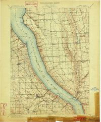 1902 Genoa1902 Print · USGSThe Finger Lakes region thrived on water and rail transport at the turn of the century, centered on the transit hub of Cayuga Lake. Genealogists and historians can trace the early Steamboat Route and find historic sites like Wells College and Taughannic Falls.8 unique versions available
 - 1942 Map of Ludlowville, 1956 Print
 1942 Ludlowville1956 Print · USGSCayuga Lake and its dramatic ravines are captured here in the early 1940s, showing the intersection of lakeside industry and rural life. Researchers can trace the Lehigh Valley rail line past the Salt Works or find family roots near Ludlowville and German Cem.3 unique versions available
 - 1943 Map of Ludlowville
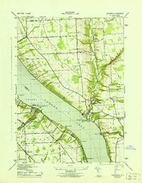 1943 Ludlowville1943 Print · USGSThe Finger Lakes region during the early war years reveals a landscape of industrial lakeside sites and quiet upland farm districts. Genealogists and researchers can trace local roots through numerous landmarks like Pine Grove Cem, Jacksonville, and the Salt Works at Myers.
 - 1950 Map of Elmira
 1950 Elmira1950 Print · USGSThe Finger Lakes region thrived in the late 1940s as a hub of industry and transport. Trace family roots and vanished landmarks near Seneca Lake or explore the rail lines of the Erie RR and the sprawling Seneca Ordnance Depot.2 unique versions available
 - 1958 Map of Elmira
 1958 Elmira1958 Print · USGSThe New York Finger Lakes during the late fifties reveal a complex landscape of glacial geology and industrial growth. Researchers can trace historic transport corridors like the Erie Canal and Erie RR, or locate institutional landmarks like Cornell University.2 unique versions available
 - 1962 Map of Elmira, 1969 Print
 1962 Elmira1969 Print · USGSThe Finger Lakes region and Southern Tier are captured here during a period of industrial maturity and highway expansion. Researchers can trace the path of the Erie Canal, the footprint of the Seneca Army Depot, and legacy rail lines through Elmira and Ithaca.4 unique versions available
 - 1965 Map of Elmira
 1965 Elmira1965 Print · USGSThe Finger Lakes and Southern Tier regions are captured in the mid-sixties, showcasing a landscape of deep glacial valleys and heavy rail infrastructure. Trace old railroad corridors like the Pennsylvania RR or visit landmarks like Letchworth State Park and the Seneca Army Depot.
 - 1971 Map of Ludlowville, 1975 Print
 1971 Ludlowville1975 Print · USGSThe shores of Cayuga Lake in the early 1970s reveal a mix of Finger Lakes recreation and industrial transit. Researchers can trace the Lehigh Valley Railroad line, locate rural burial sites like Bower Cem, and explore the gorge at Taughannock Falls State Park.2 unique versions available
 - 1986 Map of Auburn
 1986 Auburn1986 Print · USGSThe Finger Lakes region in the mid-eighties shows a landscape of deep glacial waters and significant military sites. Trace the layout of the Seneca Army Depot, find the campus of Wells College, and follow the historic Lehigh Valley RR lines.2 unique versions available
 - 2010 Map of Ludlowville, 2010 Print
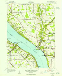
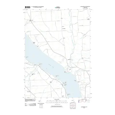 2010 Ludlowville2010 Print · USGSCovers Lansing Station, including Lansing, Ulysses, and other nearby areas
 - 2013 Map of Ludlowville, 2013 Print
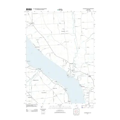 2013 Ludlowville2013 Print · USGSCovers Lansing Station, including Lansing, Ulysses, and other nearby areas
 - 2016 Map of Ludlowville, 2016 Print
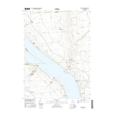 2016 Ludlowville2016 Print · USGSCovers Lansing Station, including Lansing, Ulysses, and other nearby areas
 - 2019 Map of Ludlowville, 2019 Print
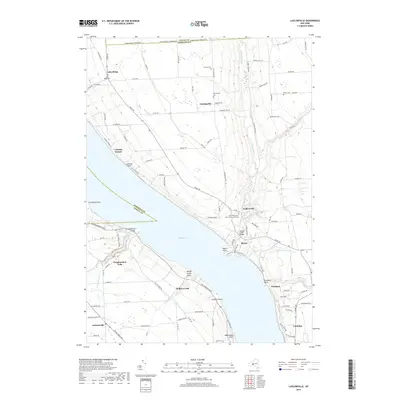 2019 Ludlowville2019 Print · USGSCovers Lansing Station, including Lansing, Ulysses, and other nearby areas
 - 2023 Map of Ludlowville, 2023 Print
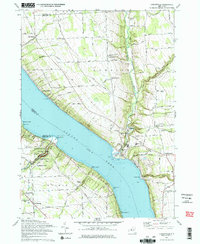
 2023 Ludlowville2023 Print · USGSThe eastern shores of Cayuga Lake come alive in this modern survey of the Tompkins County uplands. Researchers can trace family history at Lake Ridge Cem or explore the steep ravines of The Gulf near the historic settlements of Ludlowville and Myers.
End of results
Showing maps 1-14 of 14
Top cities near Lansing Station
- Ithaca historical maps
- Ithaca historical maps
- Dryden historical maps
- Lansing historical maps
- Groton historical maps
- Newfield historical maps
See more
Frequently asked questions
- What are the different types of historical maps available for Lansing Station?
- What is the oldest map of Lansing Station?
- Where can I purchase historical maps of Lansing Station for my home or office?
- Where can I download high-res historical maps of Lansing Station?
- Are there historical topographic maps available for Lansing Station?
- Is there historical aerial imagery available for Lansing Station?
- Where are historical maps of Lansing Station sourced from?