Old Maps of White Creek, New York
Explore 51 old maps of White Creek, spanning from 1895 to today. These high-resolution historic maps reveal how streets, neighborhoods, landmarks, and natural features evolved over time — perfect for genealogy, metal detecting, research, and local history exploration.
What you can do with these maps:
- See how White Creek changed over time: Compare historical maps to modern-day views to trace roads, homesites, rail lines & more.
- View detailed metadata: Each map includes creators, publishers, year, scale, and archive source.
- Overlay maps with satellite & LiDAR: Visualize the past alongside modern tools to explore terrain & human change.
- Trusted historical sources: Maps sourced from the USGS, Library of Congress, and other archives.
- Access maps your way: View online, download high-res files, or order prints for personal or research use.
Start exploring old maps of White Creek to uncover forgotten places, hidden landmarks, and the deep history beneath your feet.
White Creek, NY maps
(51)- 1895 Map of Cambridge
 1895 Cambridge1895 Print · USGSWashington County, New York, is captured in the 1890s as a landscape of interconnected rail lines and riverside villages. Genealogists and historians can trace the paths of the Rutland and Washington R.R. through Salem or locate family roots in hamlets like Pumpkin Hook and Shushan.
 - 1897 Map of Hoosick
 1897 Hoosick1897 Print · USGSThe Hoosic River valley and Taconic foothills thrive at the peak of the rail era in the late nineteenth century. Genealogists and historians can trace the specific layouts of Hoosick Falls, Boyntonville, and the remote hamlets of Sodom and Factory Hollow.10 unique versions available
 - 1898 Map of Cambridge
 1898 Cambridge1898 Print · USGSWashington County at the close of the nineteenth century was a landscape of river-powered hamlets and busy rail corridors. Researchers can trace ancestral farmsteads and early industry near Batten Kill or explore the rail stops at Easton Sta. and Salem.
 - 1900 Map of Taconic
 1900 Taconic1900 Print · USGSThe tri-state border region of the Taconic Mountains thrived at the turn of the century as a hub of rail travel and valley industry. Genealogists and historians can trace the early footprints of Hoosick Falls, Bennington, and the winding path of the Rutland R.R.4 unique versions available
 - 1901 Map of Cambridge
 1901 Cambridge1901 Print · USGSWashington County at the turn of the century is a landscape of river-powered industry and sprawling rail networks connecting New York to Vermont. Genealogists and historians can trace the paths of the Batten Kill, find old rail stops at Easton Sta., and locate vanished names like Pumpkin Hook.8 unique versions available
 - 1903 Map of Mettawee
 1903 Mettawee1903 Print · USGSThe New York and Vermont borderlands come alive in this turn-of-the-century survey of the Mettawee Valley. Genealogists can trace family footprints from Middletown Springs down to the Saratoga and Champlain Canal at Fort Ann.2 unique versions available
 - 1943 Map of Hoosick Falls, 1958 Print
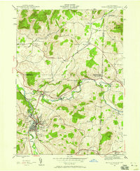 1943 Hoosick Falls1958 Print · USGSThe New York and Vermont borderlands come alive in this mid-century survey of the Hoosic and Walloomsac valleys. Trace the busy rail junctions of the Boston and Maine and locate historic sites like Bennington Battlefield Park and Sodom.4 unique versions available
 - 1944 Map of Cambridge, 1955 Print
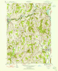 1944 Cambridge1955 Print · USGSMid-century Washington County reveals a landscape shaped by the Batten Kill and early rail corridors before the modern highway era. Researchers can trace historic property locations near Woodland Cem, rural schoolhouses like School No 1, and the rail lines of the Delaware and Hudson.3 unique versions available
 - 1944 Map of Shushan, 1958 Print
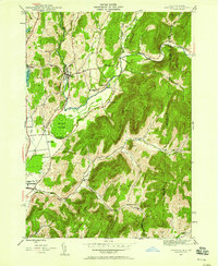 1944 Shushan1958 Print · USGSThe Batten Kill valley comes alive in this mid-century record of eastern New York and the Vermont border. Researchers can trace the path of the Delaware and Hudson railroad and locate rural landmarks like Binninger Cem and Pumpkin Hook.3 unique versions available
 - 1944 Map of Eagle Bridge, 1958 Print
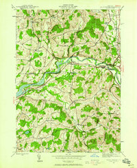 1944 Eagle Bridge1958 Print · USGSThe Hoosic River valley during the mid-1940s reveals a landscape defined by riverside rail corridors and upland farming hamlets. Genealogists can trace family roots through Woodside Cem, rural schoolhouses, and small settlements like Buskirk and West Hoosick.3 unique versions available
 - 1946 Map of Shushan
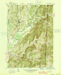 1946 Shushan1946 Print · USGSThe borderlands of New York and Vermont are captured here just after the war, showing the rural communities of Washington and Bennington counties. Genealogists can trace family names through landmarks like Binninger Cem, Pumpkin Hook, and a system of district schools from School No 6 to School No 11.2 unique versions available
 - 1946 Map of Hoosick Falls
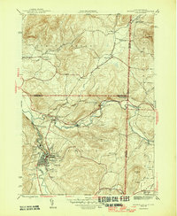 1946 Hoosick Falls1946 Print · USGSRensselaer County and the Vermont border are captured here just after the war, showing a landscape shaped by river valleys and early rail lines. Researchers can trace ancestral locations from Hoosick Falls to rural spots like Sodom, School No 5, and the St Marys Cem.2 unique versions available
 - 1946 Map of Eagle Bridge
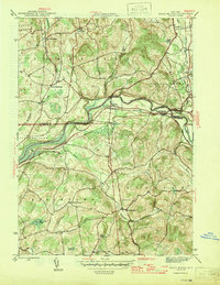 1946 Eagle Bridge1946 Print · USGSThe Hoosic River valley in the years following the war was a hub of small-town rail commerce and rural life. Genealogists and local historians can trace family roots through the clusters at Eagle Bridge, West Hoosick, and Center White Creek, or locate old landmarks like Woodside Cem and School No 2.2 unique versions available
 - 1946 Map of Cambridge
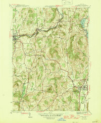 1946 Cambridge1946 Print · USGSWashington County during the mid-forties reveals a landscape of river-valley rail towns and upland dairy farms. Genealogists and local historians can trace the foundations of Cambridge and Greenwich, locating specific landmarks like Woodland Cem and the Cary Sch.2 unique versions available
 - 1947 Map of Shushan
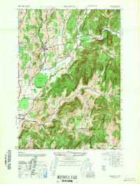 1947 Shushan1947 Print · USGSThe Batten Kill valley was a network of rail-side hamlets and mountain hollows in the late 1940s. Genealogists and historians can trace the Delaware and Hudson line through Shushan and find remote landmarks like Binninger Cem and Pumpkin Hook.
 - 1948 Map of Albany, 1951 Print
 1948 Albany1951 Print · USGSThe Hudson and Connecticut River valleys are captured here in the late 1940s, showing the vital rail and water corridors of the Northeast. You can trace the Boston and Maine tracks past Mt Greylock or locate early settlements like Great Barrington and Bennington.
 - 1950 Map of Glens Falls
 1950 Glens Falls1950 Print · USGSThe Adirondacks and the Green Mountains meet in this mid-century survey of the New York and Vermont borderlands. Researchers can trace the industrial rail corridors of the Rutland RR and Delaware & Hudson RR connecting Glens Falls, Rutland, and the shores of Lake George.
 - 1950 Map of Eagle Bridge, 1951 Print
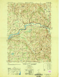 1950 Eagle Bridge1951 Print · USGSPost-war Upstate New York comes to life along the Hoosic River valley at the Washington and Rensselaer county line. Trace family roots through rural hamlets like Eagle Bridge, Buskirk, and West Hoosick, or locate old landmarks like School No 4 and Woodside Cem.
 - 1956 Map of Albany, 1968 Print
 1956 Albany1968 Print · USGSThe industrial heart of the Northeast is revealed in the mid-1950s, from the Hudson Valley to the Connecticut River. Researchers can trace the legacy of the Quabbin Reservoir, locate Westover Air Force Base, or follow the Rutland RR through the Green Mountains.2 unique versions available
 - 1956 Map of Glens Falls, 1968 Print
 1956 Glens Falls1968 Print · USGSUpper New York and the Vermont mountains are captured here in the mid-fifties, showing the rugged rail-and-river network of the Northeast. Researchers can trace the paths of the Delaware and Hudson RR and Rutland RR as they wind through valley towns like Poultney and Whitehall.3 unique versions available
 - 1957 Map of Albany
 1957 Albany1957 Print · USGSThe Tri-State region and Connecticut River Valley are captured here during a period of significant postwar growth and infrastructure expansion. Genealogists and historians can trace the rail-and-river economy through landmarks like the Boston and Maine railroad, Quabbin Reservoir, and Westover Air Force Base.
 - 1959 Map of Glens Falls
 1959 Glens Falls1959 Print · USGSUpper New York and Vermont are captured here during the late 1950s, a period of transition for these mountain communities. Researchers can trace the legacy of the region's river-and-rail economy through landmarks like Lake George, Saratoga Springs, and Killington Peak.2 unique versions available
 - 1959 Map of Albany
 1959 Albany1959 Print · USGSThe Hudson and Connecticut River valleys are captured here during the late fifties, showing the region's dense rail networks and massive water projects. Researchers can trace the New York State Thruway or locate local landmarks like Mt Greylock and the Quabbin Reservoir.
 - 1962 Map of Albany
 1962 Albany1962 Print · USGSThe Hudson and Connecticut River valleys meet the Green Mountains and Berkshires in this mid-century overview of the Northeast. Genealogists and historians can trace the industrial hearts of Albany and Springfield or locate features like Quabbin Reservoir and Westover Air Force Base.
 - 1964 Map of Glens Falls
 1964 Glens Falls1964 Print · USGSThe tri-state borderlands of New York, Vermont, and New Hampshire appear here in the mid-1960s. Researchers can trace the rail routes of the Rutland RR and find historic sites like Ticonderoga and Saratoga National Historical Park.
Showing maps 1-25 of 51
Top cities near White Creek
- Brunswick historical maps
- Bennington historical maps
- Schaghticoke historical maps
- Hoosick historical maps
- Fort Edward historical maps
- Saratoga historical maps
See more
Top neighborhoods of White Creek
Frequently asked questions
- What are the different types of historical maps available for White Creek?
- What is the oldest map of White Creek?
- Where can I purchase historical maps of White Creek for my home or office?
- Where can I download high-res historical maps of White Creek?
- Are there historical topographic maps available for White Creek?
- Is there historical aerial imagery available for White Creek?
- Where are historical maps of White Creek sourced from?