Old Maps of Spear, North Carolina
Explore 17 old maps of Spear, spanning from 1891 to today. These high-resolution historic maps reveal how streets, neighborhoods, landmarks, and natural features evolved over time — perfect for genealogy, metal detecting, research, and local history exploration.
What you can do with these maps:
- See how Spear changed over time: Compare historical maps to modern-day views to trace roads, homesites, rail lines & more.
- View detailed metadata: Each map includes creators, publishers, year, scale, and archive source.
- Overlay maps with satellite & LiDAR: Visualize the past alongside modern tools to explore terrain & human change.
- Trusted historical sources: Maps sourced from the USGS, Library of Congress, and other archives.
- Access maps your way: View online, download high-res files, or order prints for personal or research use.
Start exploring old maps of Spear to uncover forgotten places, hidden landmarks, and the deep history beneath your feet.
Spear, NC maps
(17)- 1891 Map of Roan Mountain
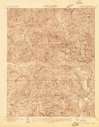
 1891 Roan Mountain1891 Print · USGSThe Tennessee-North Carolina border country comes alive in the 1890s, when narrow-gauge railroads and mountain ferries still moved the region's goods. Genealogists and historians can trace early crossings like Shipley's Ferry, industrial sites at Embreeville, and high-country settlements like Cloudland.
 - 1894 Map of Roan Mountain
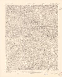
 1894 Roan Mountain1894 Print · USGSNortheast Tennessee and Western North Carolina are mapped here in the late nineteenth century as the rail network expands through the Unaka Range. Trace early industrial footprints and family lands near Elizabethton, Terry Furnace, and the high summit at Cloudland.3 unique versions available
 - 1904 Map of Roan Mountain
 1904 Roan Mountain1904 Print · USGSUpper East Tennessee and Western North Carolina are documented here at a time when river fords and narrow-gauge railroads still connected mountain hollows. Trace the paths to Hodge Ore Bank, find old Poplar Ridge Church, or locate river crossings like Yoakley Ferry.4 unique versions available
 - 1934 Map of Carvers Gap
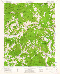
 1934 Carvers Gap1934 Print · USGSThe high peaks of the Blue Ridge meet the industrial activity of Mitchell and Avery counties in the mid-1930s. Genealogists can trace early mountain life through landmarks like Yellow Mountain Church, Glen Ayre, and mineral operations such as the Jackson Mine.
 - 1955 Map of Johnson City
 1955 Johnson City1955 Print · USGSEast Tennessee and the bordering highlands of Virginia and Kentucky appear here during the post-war industrial boom. You can trace the complex network of mountain ridges and new TVA lakes, from Johnson City to the coalfields near Middlesboro and Lynch.
 - 1955 Map of Carvers Gap
 1955 Carvers Gap1955 Print · USGSThe high ridges of the Blue Ridge Mountains come into focus during the mid-twentieth century, as mining and mountain farming shaped the landscape. Genealogists and historians can trace family roots through remote settlements like Yellow Mountain City and local landmarks like Conley Chapel or the Cranberry Mine.
 - 1957 Map of Johnson City, 1966 Print
 1957 Johnson City1966 Print · USGSUpper East Tennessee and Southwest Virginia are shown here during the mid-sixties transition of the Appalachians. Researchers can trace the industrial rail hubs of Kingsport, the sprawling waters of Cherokee Lake, and the historic Cumberland Gap.
 - 1960 Map of Johnson City
 1960 Johnson City1960 Print · USGSUpper East Tennessee and the surrounding tri-state area are shown in the mid-fifties during the height of the TVA reservoir era. Trace the industrial rail lines of the Southern and Louisville and Nashville between Kingsport and Johnson City.
 - 1960 Map of Carvers Gap, 1962 Print
 1960 Carvers Gap1962 Print · USGSThe high country of the North Carolina and Tennessee border is captured here during the early sixties, showing the Appalachian Trail as it crosses Roan Mountain. Researchers can locate family landmarks like the Ollis Cem, Glen Ayre school, and Burleson Chapel.2 unique versions available
 - 1963 Map of Johnson City
 1963 Johnson City1963 Print · USGSThe Tri-Cities and the surrounding Appalachian ridges are shown in detail during the early sixties, highlighting the era's vital rail and river networks. Genealogists and historians can trace the routes of the Clinchfield RR and locate settlements from Rogersville to Elizabethton.
 - 1980 Map of Johnson City, 1981 Print
 1980 Johnson City1981 Print · USGSEast Tennessee in the early eighties shows a landscape of mountain ridges and growing valley towns. Trace local history through Washington College and the Andrew Johnson National Cemetery, or find sites like David Crockett Birthplace State Park.
 - 1994 Map of Carvers Gap, 1997 Print
 1994 Carvers Gap1997 Print · USGSThe high North Carolina and Tennessee borderlands are captured here in the mid-nineties as the wilderness and rural communities intersected. Researchers can trace family sites like Hobson Cem, Plumtree, and Roaring Creek Ch along the base of Roan Mountain.
 - 2011 Map of Carvers Gap, 2011 Print
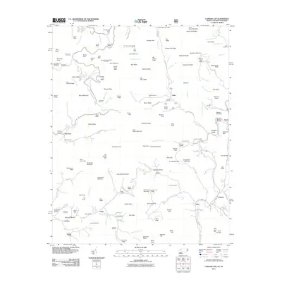 2011 Carvers Gap2011 Print · USGSCovers Spear, including Valley, Greene Cove, and other nearby areas
 - 2013 Map of Carvers Gap, 2013 Print
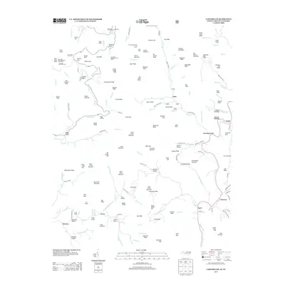 2013 Carvers Gap2013 Print · USGSCovers Spear, including Valley, Greene Cove, and other nearby areas
 - 2016 Map of Carvers Gap, 2016 Print
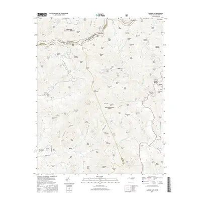 2016 Carvers Gap2016 Print · USGSCovers Spear, including Valley, Greene Cove, and other nearby areas
 - 2019 Map of Carvers Gap, 2019 Print
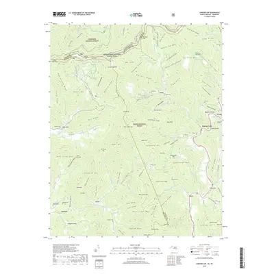 2019 Carvers Gap2019 Print · USGSCovers Spear, including Valley, Greene Cove, and other nearby areas
 - 2022 Map of Carvers Gap, 2022 Print
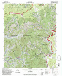
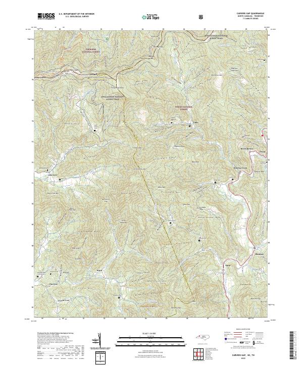 2022 Carvers Gap2022 Print · USGSHigh mountain ridges along the North Carolina and Tennessee border define this area during the early twenty-first century. Genealogists can trace family lineage through numerous sites like Roan Valley Cem, Pittman Cem, and the riverside community of Plumtree.
End of results
Showing maps 1-17 of 17
Top cities near Spear
- Spruce Pine historical maps
- Banner Elk historical maps
- Newland historical maps
- Elk Park historical maps
- Bakersville historical maps
- Seven Devils historical maps
See more
Frequently asked questions
- What are the different types of historical maps available for Spear?
- What is the oldest map of Spear?
- Where can I purchase historical maps of Spear for my home or office?
- Where can I download high-res historical maps of Spear?
- Are there historical topographic maps available for Spear?
- Is there historical aerial imagery available for Spear?
- Where are historical maps of Spear sourced from?