Old Maps of Cataloochee, North Carolina
Explore 18 old maps of Cataloochee, spanning from 1893 to today. These high-resolution historic maps reveal how streets, neighborhoods, landmarks, and natural features evolved over time — perfect for genealogy, metal detecting, research, and local history exploration.
What you can do with these maps:
- See how Cataloochee changed over time: Compare historical maps to modern-day views to trace roads, homesites, rail lines & more.
- View detailed metadata: Each map includes creators, publishers, year, scale, and archive source.
- Overlay maps with satellite & LiDAR: Visualize the past alongside modern tools to explore terrain & human change.
- Trusted historical sources: Maps sourced from the USGS, Library of Congress, and other archives.
- Access maps your way: View online, download high-res files, or order prints for personal or research use.
Start exploring old maps of Cataloochee to uncover forgotten places, hidden landmarks, and the deep history beneath your feet.
Cataloochee, NC maps
(18)- 1893 Map of Mt Guyot
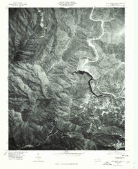
 1893 Mt Guyot1893 Print · USGSThe Tennessee and North Carolina borderlands are captured here in the 1890s, when isolated mountain coves and river towns relied on the Virginia and Georgia Railroad. Researchers can trace old family sites and transport routes through Fair Garden, Jones Cove, and along the Elliot Ferry Road.3 unique versions available
 - 1912 Map of Mt Guyot
 1912 Mt Guyot1912 Print · USGSThe Tennessee and North Carolina borderlands come into focus in the early twentieth century, prior to the creation of the Great Smoky Mountains National Park. Trace ancestral locations like Cataloochee and Smokemont or follow the Southern RR to Newport.5 unique versions available
 - 1936 Map of Cove Creek Gap
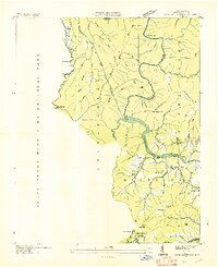 1936 Cove Creek Gap1936 Print · USGSHaywood County is captured in the mid-1930s as the Tennessee Valley Authority transformed the river valleys. Researchers can locate vanished rural schools and family cemeteries such as Big Bend Sch, Clark Cem, and the church at Pigeon Ch.
 - 1941 Map of Cove Creek Gap, 1956 Print
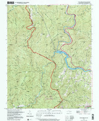
 1941 Cove Creek Gap1956 Print · USGSHaywood County is shown in the early forties during the expansion of the national park system into the mountains. Genealogists can trace family footprints at Little Cataloochee Ch, the Beech Grove Sch, and cemeteries like Hannah Cem or Redman Cem.
 - 1942 Map of Cove Creek Gap
 1942 Cove Creek Gap1942 Print · USGSThe North Carolina mountains are shown just as the national park and forest boundaries were being established in the 1940s. Genealogists can locate family landmarks like Palmer Chapel, Beech Grove Sch, and numerous mountain burial grounds like Hannah Cem.
 - 1955 Map of Knoxville
 1955 Knoxville1955 Print · USGSThe Southern Appalachians and the Smoky Mountains are shown here at a peak of mid-century development and conservation. Genealogists and historians can trace the early road networks connecting Gatlinburg, Waynesville, and the Cherokee Indian Reservation across the high ridges.
 - 1957 Map of Knoxville, 1966 Print
 1957 Knoxville1966 Print · USGSThe Southern Appalachians of Tennessee and North Carolina are mapped here during the mid-twentieth century as new highways reached the high country. Genealogists and historians can trace the topography between Knoxville and Asheville, locating family landmarks near Fontana Lake or along the Blue Ridge Parkway.4 unique versions available
 - 1960 Map of Knoxville
 1960 Knoxville1960 Print · USGSThe Southern Appalachians come alive in the 1950s, showing the intersection of new national park tourism and deep-rooted mountain industry. Trace old rail lines like the Clinchfield RR and find high-altitude landmarks from Mt Le Conte to the Cherokee Indian Reservation.2 unique versions available
 - 1964 Map of Knoxville
 1964 Knoxville1964 Print · USGSThe Southern Appalachians and Great Smokies are captured here during the mid-sixties, showing the rugged borderlands of Tennessee and North Carolina. Researchers can trace historic mountain routes like U S 441, the expanse of Pisgah National Forest, and the growing footprints of Asheville and Knoxville.
 - 1967 Map of Cove Creek Gap, 1970 Print
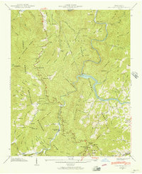
 1967 Cove Creek Gap1970 Print · USGSThe high ridges of Haywood County meet at the edge of the Smokies in the late sixties, where old mountain settlements gave way to forest management. Genealogists can trace family heritage at Sutton Cem and Hannah Cem or locate the Abandoned mine near the Pigeon River.4 unique versions available
 - 1976 Map of Cove Creek Gap, 1979 Print
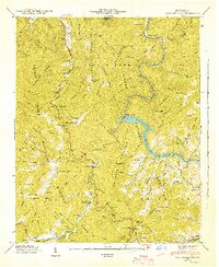
 1976 Cove Creek Gap1979 Print · USGSHaywood County is captured in the mid-seventies, showing the steep mountain landscape before further development. Researchers can trace the winding course of the Pigeon River and identify topographic landmarks like Cove Creek Gap and White Oak Mountain.
 - 1983 Map of Knoxville, 1984 Print
 1983 Knoxville1984 Print · USGSThe Tennessee valley and the rising Smokies are captured here in the early eighties, showing the region as the tourism and transit hub of the Southern Appalachians. Researchers can trace the layout of the University of Tennessee or locate rural landmarks like Shady Grove Ch and Pleasant Hill Cem.
 - 1997 Map of Cove Creek Gap, 2001 Print
 1997 Cove Creek Gap2001 Print · USGSThe high country of the Great Smokies and Pisgah Forest is captured in the late twentieth century, showing a landscape shaped by narrow gaps and river bends. Genealogists can trace family names at Harrell Cem and Hannah Cem or locate the Little Cataloochee Ch.
 - 2011 Map of Cove Creek Gap, 2011 Print
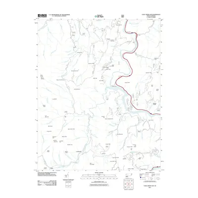 2011 Cove Creek Gap2011 Print · USGSCovers Cataloochee, including Shelton Laurel, Haywood County, and other nearby areas
 - 2013 Map of Cove Creek Gap, 2013 Print
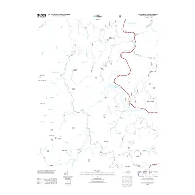 2013 Cove Creek Gap2013 Print · USGSCovers Cataloochee, including Shelton Laurel, Haywood County, and other nearby areas
 - 2016 Map of Cove Creek Gap, 2016 Print
 2016 Cove Creek Gap2016 Print · USGSCovers Cataloochee, including Shelton Laurel, Haywood County, and other nearby areas
 - 2019 Map of Cove Creek Gap, 2019 Print
 2019 Cove Creek Gap2019 Print · USGSCovers Cataloochee, including Shelton Laurel, Haywood County, and other nearby areas
 - 2022 Map of Cove Creek Gap, 2022 Print
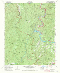
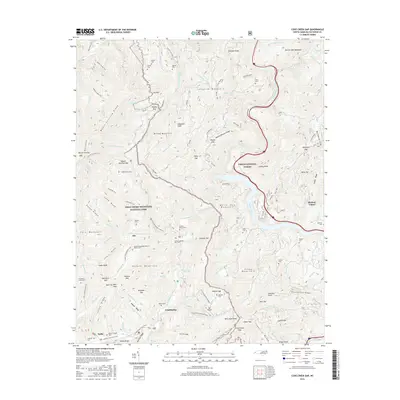
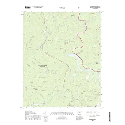
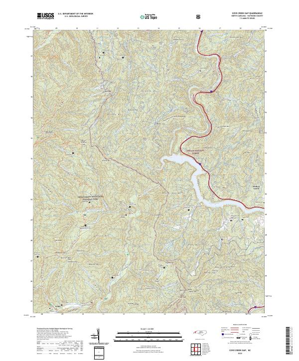 2022 Cove Creek Gap2022 Print · USGSHaywood County is shown in this contemporary study of the border between the Great Smoky Mountains and Pisgah National Forest. Researchers can trace ancestral sites like the Little Cataloochee Baptist Church, Palmer Chapel, and the O E Kerr African Cem.
End of results
Showing maps 1-18 of 18
Top cities near Cataloochee
Frequently asked questions
- What are the different types of historical maps available for Cataloochee?
- What is the oldest map of Cataloochee?
- Where can I purchase historical maps of Cataloochee for my home or office?
- Where can I download high-res historical maps of Cataloochee?
- Are there historical topographic maps available for Cataloochee?
- Is there historical aerial imagery available for Cataloochee?
- Where are historical maps of Cataloochee sourced from?