Old Maps of Big Cove Community, North Carolina
Explore 24 old maps of Big Cove Community, spanning from 1893 to today. These high-resolution historic maps reveal how streets, neighborhoods, landmarks, and natural features evolved over time — perfect for genealogy, metal detecting, research, and local history exploration.
What you can do with these maps:
- See how Big Cove Community changed over time: Compare historical maps to modern-day views to trace roads, homesites, rail lines & more.
- View detailed metadata: Each map includes creators, publishers, year, scale, and archive source.
- Overlay maps with satellite & LiDAR: Visualize the past alongside modern tools to explore terrain & human change.
- Trusted historical sources: Maps sourced from the USGS, Library of Congress, and other archives.
- Access maps your way: View online, download high-res files, or order prints for personal or research use.
Start exploring old maps of Big Cove Community to uncover forgotten places, hidden landmarks, and the deep history beneath your feet.
Big Cove Community, NC maps
(24)- 1893 Map of Mt Guyot
 1893 Mt Guyot1893 Print · USGSThe Tennessee and North Carolina borderlands are captured here in the 1890s, when isolated mountain coves and river towns relied on the Virginia and Georgia Railroad. Researchers can trace old family sites and transport routes through Fair Garden, Jones Cove, and along the Elliot Ferry Road.3 unique versions available
 - 1912 Map of Mt Guyot
 1912 Mt Guyot1912 Print · USGSThe Tennessee and North Carolina borderlands come into focus in the early twentieth century, prior to the creation of the Great Smoky Mountains National Park. Trace ancestral locations like Cataloochee and Smokemont or follow the Southern RR to Newport.5 unique versions available
 - 1936 Map of Bunches Bald
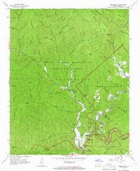
 1936 Bunches Bald1936 Print · USGSThe high ridges and tribal lands of Swain and Jackson counties are documented here in the mid-1930s as the national park system was taking shape. Genealogists and hikers can trace the Bunches Trail, locate the Peach Tree Ch, and study the early layout of the Cherokee Indian Reservation.
 - 1936 Map of Ravensford
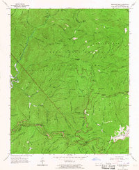
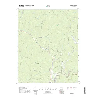
 1936 Ravensford1936 Print · USGSSwain County, North Carolina, appears here in the mid-1930s as the national park boundary was being established adjacent to tribal lands. Genealogists and local historians can locate the Big Cove Sch, Piney Grove Ch, and the riverside settlement of Ravensford.
 - 1955 Map of Knoxville
 1955 Knoxville1955 Print · USGSThe Southern Appalachians and the Smoky Mountains are shown here at a peak of mid-century development and conservation. Genealogists and historians can trace the early road networks connecting Gatlinburg, Waynesville, and the Cherokee Indian Reservation across the high ridges.
 - 1957 Map of Knoxville, 1966 Print
 1957 Knoxville1966 Print · USGSThe Southern Appalachians of Tennessee and North Carolina are mapped here during the mid-twentieth century as new highways reached the high country. Genealogists and historians can trace the topography between Knoxville and Asheville, locating family landmarks near Fontana Lake or along the Blue Ridge Parkway.4 unique versions available
 - 1960 Map of Knoxville
 1960 Knoxville1960 Print · USGSThe Southern Appalachians come alive in the 1950s, showing the intersection of new national park tourism and deep-rooted mountain industry. Trace old rail lines like the Clinchfield RR and find high-altitude landmarks from Mt Le Conte to the Cherokee Indian Reservation.2 unique versions available
 - 1964 Map of Knoxville
 1964 Knoxville1964 Print · USGSThe Southern Appalachians and Great Smokies are captured here during the mid-sixties, showing the rugged borderlands of Tennessee and North Carolina. Researchers can trace historic mountain routes like U S 441, the expanse of Pisgah National Forest, and the growing footprints of Asheville and Knoxville.
 - 1964 Map of Smokemont, 1966 Print
 1964 Smokemont1966 Print · USGSThe Cherokee Indian Reservation and Great Smoky Mountains National Park meet in the mid-1960s at the confluence of the Oconaluftee River. Genealogists can locate several family burial sites including the Slave Cem, Sequoyah Cem, and Nations Cem.4 unique versions available
 - 1964 Map of Bunches Bald, 1967 Print
 1964 Bunches Bald1967 Print · USGSSwain and Haywood counties are captured here in the mid-1960s, showing where the national park and tribal lands converge. Genealogists and hikers can trace the Masonic Monument, old peaks like Chiltoskie Mtn, and the winding Blue Ridge Parkway.3 unique versions available
 - 1976 Map of Bunches Bald, 1978 Print
 1976 Bunches Bald1978 Print · USGSThe high ridges of Swain County are captured in the mid-seventies through detailed aerial photography. Hikers and local historians can trace the steep drainages of Raven Fork and identify prominent peaks like Bunches Bald and Barnett Knob.
 - 1983 Map of Knoxville, 1984 Print
 1983 Knoxville1984 Print · USGSThe Tennessee valley and the rising Smokies are captured here in the early eighties, showing the region as the tourism and transit hub of the Southern Appalachians. Researchers can trace the layout of the University of Tennessee or locate rural landmarks like Shady Grove Ch and Pleasant Hill Cem.
 - 2000 Map of Bunches Bald, 2001 Print
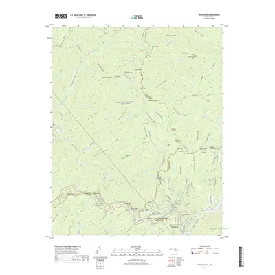
 2000 Bunches Bald2001 Print · USGSThe high ridges of the Great Smoky Mountains meet the Cherokee Indian Reservation at the turn of the millennium. Local historians can trace the paths of the Blue Ridge Parkway past the Big Cove Mission and the Masonic Monument.
 - 2000 Map of Smokemont, 2001 Print
 2000 Smokemont2001 Print · USGSSwain County's mountain landscape is captured at the start of the millennium, showing where the National Park and the Cherokee Indian Reservation converge. Genealogists and local researchers can trace numerous family burial sites such as Slave Cem and Nations Cem alongside landmarks like Mingo Falls.
 - 2010 Map of Bunches Bald, 2010 Print
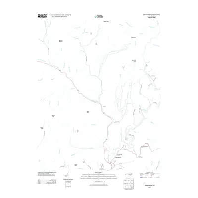
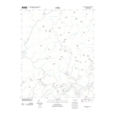 2010 Bunches Bald2010 Print · USGSCovers Big Cove Community, including Wolftown Community, Balsam Mountain, and other nearby areas
 - 2010 Map of Smokemont, 2010 Print
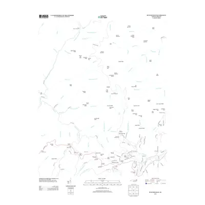
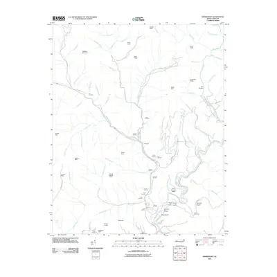 2010 Smokemont2010 Print · USGSCovers Big Cove Community, including Birdtown Community, Yellowhill Community, and other nearby areas
 - 2013 Map of Smokemont, 2013 Print
 2013 Smokemont2013 Print · USGSCovers Big Cove Community, including Birdtown Community, Yellowhill Community, and other nearby areas
 - 2013 Map of Bunches Bald, 2013 Print
 2013 Bunches Bald2013 Print · USGSCovers Big Cove Community, including Wolftown Community, Balsam Mountain, and other nearby areas
 - 2016 Map of Bunches Bald, 2016 Print
 2016 Bunches Bald2016 Print · USGSCovers Big Cove Community, including Wolftown Community, Balsam Mountain, and other nearby areas
 - 2016 Map of Smokemont, 2016 Print
 2016 Smokemont2016 Print · USGSCovers Big Cove Community, including Birdtown Community, Yellowhill Community, and other nearby areas
 - 2019 Map of Smokemont, 2019 Print
 2019 Smokemont2019 Print · USGSCovers Big Cove Community, including Birdtown Community, Yellowhill Community, and other nearby areas
 - 2019 Map of Bunches Bald, 2019 Print
 2019 Bunches Bald2019 Print · USGSCovers Big Cove Community, including Wolftown Community, Balsam Mountain, and other nearby areas
 - 2022 Map of Smokemont, 2022 Print
 2022 Smokemont2022 Print · USGSThe southern reaches of the Smokies come alive in this recent survey, centered on the high ridges and river valleys of Swain County. Genealogists can trace deep roots through a remarkable number of family burial sites, including the Enloe Slave Cem, Bradley Family Cem, and Jonas Jenkins Cem.
 - 2022 Map of Bunches Bald, 2022 Print
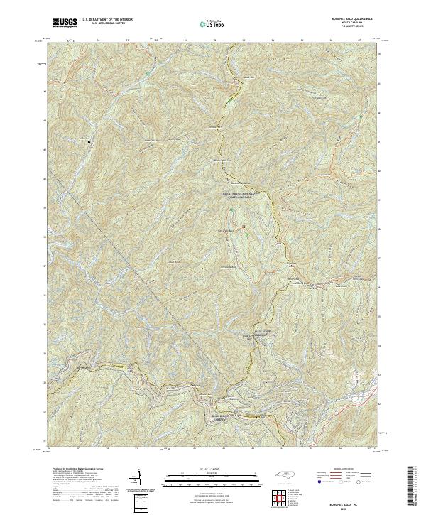 2022 Bunches Bald2022 Print · USGSThis part of the Smokies on the Swain and Haywood county line is shown here in its modern conservation era. Genealogists and hikers can trace high-altitude landmarks and family history sites like McGhee Cem, the Blue Ridge Parkway, and Potato Hill Bald.
End of results
Showing maps 1-24 of 24
Top cities near Big Cove Community
- Waynesville historical maps
- Gatlinburg historical maps
- Sylva historical maps
- Cherokee historical maps
- Bryson City historical maps
- Maggie Valley historical maps
See more
Top neighborhoods of Big Cove Community
Frequently asked questions
- What are the different types of historical maps available for Big Cove Community?
- What is the oldest map of Big Cove Community?
- Where can I purchase historical maps of Big Cove Community for my home or office?
- Where can I download high-res historical maps of Big Cove Community?
- Are there historical topographic maps available for Big Cove Community?
- Is there historical aerial imagery available for Big Cove Community?
- Where are historical maps of Big Cove Community sourced from?