Old Maps of Burns, Oregon
Explore 10 old maps of Burns, spanning from 1955 to today. These high-resolution historic maps reveal how streets, neighborhoods, landmarks, and natural features evolved over time — perfect for genealogy, metal detecting, research, and local history exploration.
What you can do with these maps:
- See how Burns changed over time: Compare historical maps to modern-day views to trace roads, homesites, rail lines & more.
- View detailed metadata: Each map includes creators, publishers, year, scale, and archive source.
- Overlay maps with satellite & LiDAR: Visualize the past alongside modern tools to explore terrain & human change.
- Trusted historical sources: Maps sourced from the USGS, Library of Congress, and other archives.
- Access maps your way: View online, download high-res files, or order prints for personal or research use.
Start exploring old maps of Burns to uncover forgotten places, hidden landmarks, and the deep history beneath your feet.
Burns, OR maps
(10)- 1955 Map of Burns, 1964 Print
 1955 Burns1964 Print · USGSHarney County's high desert ranching and timber heartland is captured here in the mid-fifties, centered on the hub of Burns and Hines. Genealogists and researchers can locate remote landmarks like the Suntex School, New Princeton P. O., and the Lumber Mill.3 unique versions available
 - 1958 Map of Burns
 1958 Burns1958 Print · USGSHarney County ranching and timber lands are captured here in the late fifties. Genealogists and local historians can trace family holdings and rural institutions, from the Kimball Flat School to remote outposts like Crow Camp Ranch and the Sutton Ranch.
 - 1959 Map of Burns
 1959 Burns1959 Print · USGSHarney County in the late fifties remains a landscape of high-desert ranching and timber production, centered on the hubs of Burns and Hines. Researchers can locate remote rural institutions like the Suntex School or trace family landholdings such as the Stallard Ranch and O'Keefe Homestead.
 - 1960 Map of Burns, 1962 Print
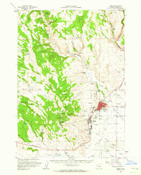 1960 Burns1962 Print · USGSHarney County's high desert hubs and surrounding cattle country are captured here just as the postwar era matured. Genealogists and local historians can locate family landmarks like the Peterson Ranch, trace the Northwestern Pacific rail line, or find early civic sites like the Union High Sch.
 - 1960 Map of Burns, 1962 Print
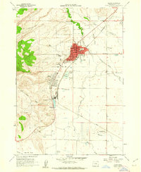 1960 Burns1962 Print · USGSThe Harney Basin communities of Burns and Hines are shown here in the early sixties at a peak of rail-driven and agricultural activity. Researchers can trace family history at the Burns Piute Cemetery or locate civic landmarks like the Grange Hall and the Experimental Station.2 unique versions available
 - 1975 Map of Burns, 1977 Print
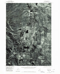 1975 Burns1977 Print · USGSThe high desert settlements of Burns and Hines are captured in detailed aerial imagery during the mid-seventies, documenting the footprint of Harney County at this moment in time. Genealogists and local historians can trace the development of the street grids and the path of the Silvies River and East Fork as they cross the landscape.
 - 1993 Map of Burns
 1993 Burns1993 Print · USGSThe Harney County high desert and timbered uplands are captured here in the early nineties, centered on the ranching hubs of Burns and Hines. Trace the vital water systems of the Silvies River and Chickahominy Reservoir alongside landmarks like Wagontire Mountain.
 - 2014 Map of Burns, 2014 Print
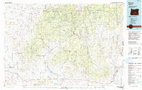
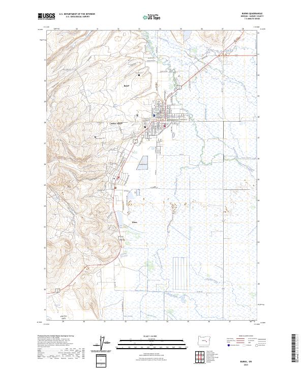
 2014 Burns2014 Print · USGSCovers Burns, including Hines, Indian Village, and other nearby areas
 - 2020 Map of Burns, 2020 Print
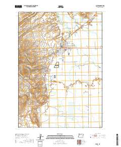 2020 Burns2020 Print · USGSCovers Burns, including Hines, Indian Village, and other nearby areas
 - 2023 Map of Burns, 2023 Print
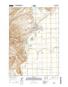
 2023 Burns2023 Print · USGSHarney County's seat of government and the surrounding high-desert wetlands are shown here in detail during the early 2020s. Genealogists and local historians can trace burial sites at Burns Cem and Burns Paiute Cem or locate regional landmarks like the Harney County Courthouse.
End of results
Showing maps 1-10 of 10
Top cities near Burns
Top neighborhoods of Burns
Frequently asked questions
- What are the different types of historical maps available for Burns?
- What is the oldest map of Burns?
- Where can I purchase historical maps of Burns for my home or office?
- Where can I download high-res historical maps of Burns?
- Are there historical topographic maps available for Burns?
- Is there historical aerial imagery available for Burns?
- Where are historical maps of Burns sourced from?