Old Maps of Middlesex Township, Pennsylvania
Explore 38 old maps of Middlesex Township, spanning from 1904 to today. These high-resolution historic maps reveal how streets, neighborhoods, landmarks, and natural features evolved over time — perfect for genealogy, metal detecting, research, and local history exploration.
What you can do with these maps:
- See how Middlesex Township changed over time: Compare historical maps to modern-day views to trace roads, homesites, rail lines & more.
- View detailed metadata: Each map includes creators, publishers, year, scale, and archive source.
- Overlay maps with satellite & LiDAR: Visualize the past alongside modern tools to explore terrain & human change.
- Trusted historical sources: Maps sourced from the USGS, Library of Congress, and other archives.
- Access maps your way: View online, download high-res files, or order prints for personal or research use.
Start exploring old maps of Middlesex Township to uncover forgotten places, hidden landmarks, and the deep history beneath your feet.
Middlesex Township, PA maps
(38)- 1904 Map of Carlisle
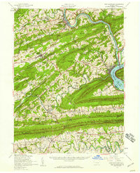
 1904 Carlisle1904 Print · USGSCumberland County at the opening of the century is a network of thriving rail hubs and rural gaps. Genealogists and historians can trace the foundations of Carlisle, find the grounds of the Carlisle Indian School, and locate rural landmarks like Salem Church and Boiling Springs.7 unique versions available
 - 1907 Map of New Bloomfield
 1907 New Bloomfield1907 Print · USGSPerry County at the start of the twentieth century was a landscape of steep ridges and vital river junctions. Genealogists and historians can trace family locations in settlements like New Bloomfield or locate early industrial sites such as Juniata Furnace and Cove Forge.6 unique versions available
 - 1943 Map of New Bloomfield
 1943 New Bloomfield1943 Print · USGSPerry County's ridge-and-valley landscape is captured here during the Second World War as the rail-and-river corridor remained vital to the region. Genealogists can locate family landmarks like Hustons Mill, Mecks Corner, and the old Wila P O post office.
 - 1943 Map of Carlisle, 1944 Print
 1943 Carlisle1944 Print · USGSCumberland County during the mid-forties reveals a landscape transitioning between its deep industrial roots and new high-speed transit. Genealogists and historians can trace family locations through numerous rural landmarks like Farmers Academy, Reading Banks, and the Carlisle Barracks.3 unique versions available
 - 1950 Map of Harrisburg, 1952 Print
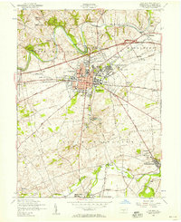
 1950 Harrisburg1952 Print · USGSMid-century Central Pennsylvania comes alive through its dense rail networks and river valley settlements during the post-war industrial era. Genealogists and historians can trace family roots through hubs like Harrisburg, locate Carlisle Barracks, or follow the Pennsylvania RR through the Lebanon Valley.
 - 1952 Map of Wertzville, 1958 Print
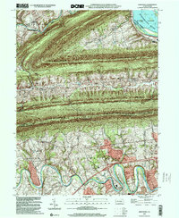
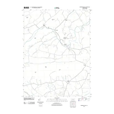
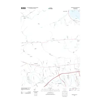
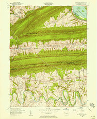 1952 Wertzville1958 Print · USGSPerry and Cumberland counties are shown here in the early 1950s, defined by the steep ridges of the Appalachians and the winding Conodoguinet Creek. Researchers can trace the mid-century landscape of Wertzville, find Hustons Mill, or follow the Appalachian Trail over Blue Mountain.4 unique versions available
 - 1952 Map of Carlisle, 1958 Print
 1952 Carlisle1958 Print · USGSCumberland County at the start of the 1950s shows a landscape defined by its strategic military history and emerging turnpike traffic. Researchers can trace family roots at Westminster Cemetery or locate old school sites like Union Hall School and the Basin Hill School.6 unique versions available
 - 1952 Map of Mechanicsburg, 1958 Print
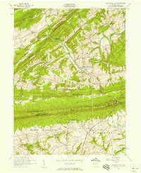
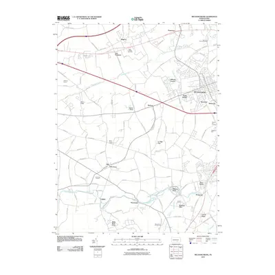
 1952 Mechanicsburg1958 Print · USGSCumberland County at mid-century shows a landscape of historic crossroad villages and burgeoning military infrastructure. Trace the early routes of the Appalachian Trail and find family-named landmarks like Leidighs, Churchtown, and Hickorytown.6 unique versions available
 - 1952 Map of Shermans Dale, 1958 Print
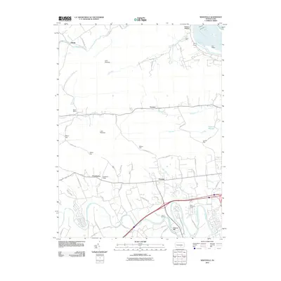
 1952 Shermans Dale1958 Print · USGSPerry County ridge country is captured here in the early fifties, showing the winding Sherman Creek and the village of Shermans Dale. Trace local history through numerous one-room schoolhouses like Sandy Hollow School and old congregations including Mt Gilead Church.4 unique versions available
 - 1952 Map of Carlisle, 1959 Print
 1952 Carlisle1959 Print · USGSCumberland County at the midpoint of the century shows a landscape defined by its historic military presence and the emerging Turnpike. Genealogists and hikers can trace the Appalachian Trail over Long Mountain or locate family sites at Churchtown and Deardorffs Mill.2 unique versions available
 - 1952 Map of New Bloomfield, 1959 Print
 1952 New Bloomfield1959 Print · USGSPerry County's ridge-and-valley landscape is captured here in the early 1950s, showing a region defined by river commerce and rural mountain life. Genealogists can trace family names through dozens of landmarks like Carson Long Institute, St Davids Ch, and Shermans Dale Sch.2 unique versions available
 - 1957 Map of Harrisburg
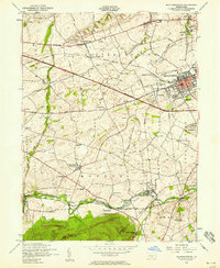
 1957 Harrisburg1957 Print · USGSMid-century Central Pennsylvania comes into focus as a bustling network of rail, river, and mountain ridges. Genealogists and historians can trace the development of the State Capitol and surrounding hubs like Middletown, Columbia, and Pottsville.7 unique versions available
 - 1961 Map of Harrisburg
 1961 Harrisburg1961 Print · USGSCentral Pennsylvania is shown at a mid-century peak of industrial and military activity, from the Susquehanna water gaps to the fertile Dutch Country. Genealogists and historians can trace the rail corridors of the Pennsylvania RR and find landmarks like Carlisle Barracks or the Anthracite Coal Fields.2 unique versions available
 - 1964 Map of Harrisburg
 1964 Harrisburg1964 Print · USGSCentral Pennsylvania in the mid-fifties reveals a landscape shaped by ridge-and-valley geology and critical Cold War infrastructure. Researchers can trace the massive Indiantown Gap Military Reservation or the rail corridors of the Pennsylvania RR and Reading RR.
 - 1984 Map of Carlisle, 1985 Print
 1984 Carlisle1985 Print · USGSSouth-central Pennsylvania is shown during the mid-eighties as a hub of military activity and mountain transit. Genealogists and historians can trace the development of Carlisle Barracks and Letterkenny Army Depot, alongside rail routes like Conrail.2 unique versions available
 - 1994 Map of Carlisle, 1999 Print
 1994 Carlisle1999 Print · USGSCumberland County at the close of the twentieth century shows a landscape where historic military grounds and borough streets meet the fertile valley floor. Trace local roots at Westminster Cem, Springville, or the grounds of the Carlisle Barracks.
 - 1999 Map of Mechanicsburg, 2001 Print
 1999 Mechanicsburg2001 Print · USGSCumberland County at the close of the century shows a blend of military industry and rural tradition. Trace local genealogy at Bakers Church, the Silver Spring Meeting House, or the vanished schoolhouses like Givler School.
 - 1999 Map of Wertzville, 2001 Print
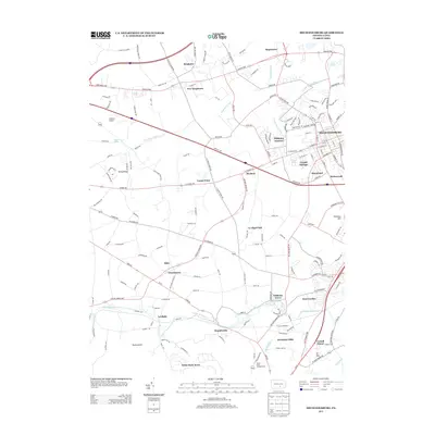
 1999 Wertzville2001 Print · USGSPerry and Cumberland counties meet along a series of prominent mountain ridges at the turn of the millennium. Researchers can trace local heritage at Hustons Mill, Oak Grove Cemetery, and several rural school sites like Elliotts School and Summers School.
 - 2010 Map of Carlisle, 2010 Print
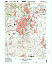
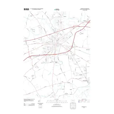
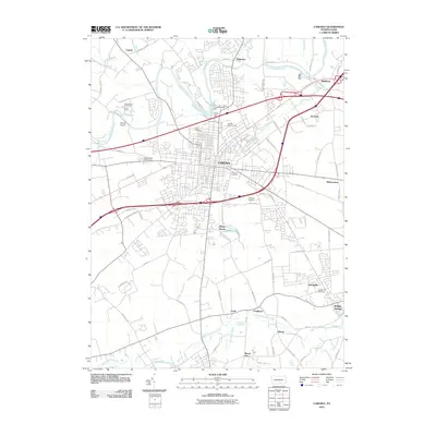 2010 Carlisle2010 Print · USGSCovers Middlesex Township, including Carlisle, Schlusser, and other nearby areas
 - 2010 Map of Shermans Dale, 2010 Print
 2010 Shermans Dale2010 Print · USGSCovers Middlesex Township, including Schlusser, Wheatfield Township, and other nearby areas
 - 2010 Map of Wertzville, 2010 Print
 2010 Wertzville2010 Print · USGSCovers Middlesex Township, including Wheatfield Township, Carroll Township, and other nearby areas
 - 2010 Map of Mechanicsburg, 2010 Print
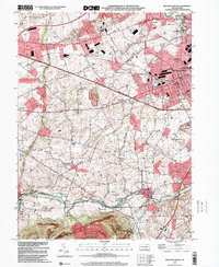
 2010 Mechanicsburg2010 Print · USGSCovers Middlesex Township, including New Kingstown, Carroll Manor, and other nearby areas
 - 2013 Map of Carlisle, 2013 Print
 2013 Carlisle2013 Print · USGSCovers Middlesex Township, including Carlisle, Schlusser, and other nearby areas
 - 2013 Map of Wertzville, 2013 Print
 2013 Wertzville2013 Print · USGSCovers Middlesex Township, including Wheatfield Township, Carroll Township, and other nearby areas
 - 2013 Map of Mechanicsburg, 2013 Print
 2013 Mechanicsburg2013 Print · USGSCovers Middlesex Township, including New Kingstown, Carroll Manor, and other nearby areas
Showing maps 1-25 of 38
Top cities near Middlesex Township
- Harrisburg historical maps
- Carlisle historical maps
- Lower Allen historical maps
- Camp Hill historical maps
- Schlusser historical maps
- Enola historical maps
See more
Top neighborhoods of Middlesex Township
- Hickorytown historical maps
- Carlisle Springs historical maps
- Donnellytown historical maps
- Drytown historical maps
Frequently asked questions
- What are the different types of historical maps available for Middlesex Township?
- What is the oldest map of Middlesex Township?
- Where can I purchase historical maps of Middlesex Township for my home or office?
- Where can I download high-res historical maps of Middlesex Township?
- Are there historical topographic maps available for Middlesex Township?
- Is there historical aerial imagery available for Middlesex Township?
- Where are historical maps of Middlesex Township sourced from?