Old Maps of Peters Township, Pennsylvania
Explore 25 old maps of Peters Township, spanning from 1900 to today. These high-resolution historic maps reveal how streets, neighborhoods, landmarks, and natural features evolved over time — perfect for genealogy, metal detecting, research, and local history exploration.
What you can do with these maps:
- See how Peters Township changed over time: Compare historical maps to modern-day views to trace roads, homesites, rail lines & more.
- View detailed metadata: Each map includes creators, publishers, year, scale, and archive source.
- Overlay maps with satellite & LiDAR: Visualize the past alongside modern tools to explore terrain & human change.
- Trusted historical sources: Maps sourced from the USGS, Library of Congress, and other archives.
- Access maps your way: View online, download high-res files, or order prints for personal or research use.
Start exploring old maps of Peters Township to uncover forgotten places, hidden landmarks, and the deep history beneath your feet.
Peters Township, PA maps
(25)- 1900 Map of Mercersburg
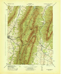
 1900 Mercersburg1900 Print · USGSFranklin County at the turn of the century is captured here as a landscape of iron furnaces and valley farms. Trace the early transport lines through Mercersburg, Richmond Furnace, and the old Southern Pennsylvania Br. rail line.
 - 1902 Map of Mercersburg
 1902 Mercersburg1902 Print · USGSFranklin and Fulton counties at the opening of the twentieth century show a landscape defined by iron furnaces and mountain gaps. Genealogists and historians can trace rail lines to Mercersburg Junction or locate family sites near Welsh Run and Foltz.5 unique versions available
 - 1942 Map of Hagerstown
 1942 Hagerstown1942 Print · USGSThe Cumberland Valley and Potomac corridor are captured here at the height of the Second World War rail-and-river era. Genealogists and historians can trace the industrial landscape of Richmond Furnace, the route of the Chesapeake and Ohio Canal, and the grounds of Camp Ritchie.
 - 1943 Map of Hagerstown
 1943 Hagerstown1943 Print · USGSThe Cumberland Valley was a critical wartime logistics hub in the 1940s, teeming with rail traffic and new military installations. Genealogists and historians can trace the Chesapeake and Ohio Canal or locate local landmarks like Richmond Furnace and Camp Ritchie.
 - 1943 Map of Mercersburg, 1952 Print
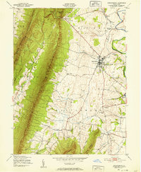 1943 Mercersburg1952 Print · USGSMercersburg and the surrounding Cumberland Valley are shown here during the early 1940s as a landscape of rural school districts and rail-side hamlets. Researchers can trace family roots at Mercersburg Academy or locate old sites like Heimbaugh Lime and Claylick Sch.6 unique versions available
 - 1943 Map of Mercersburg, 1955 Print
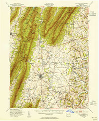 1943 Mercersburg1955 Print · USGSFranklin County in the 1940s is captured here in its transition from a ridge-and-valley wilderness to a settled agricultural heartland. Genealogists can trace family landmarks like Claylick Sch, the historic Mercersburg Academy, and the village of Fort Loudon.2 unique versions available
 - 1944 Map of St Thomas
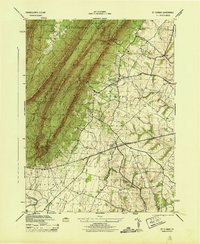 1944 St Thomas1944 Print · USGSFranklin County's deep ridges and valley farms are captured in this mid-1940s survey just as wartime industry and rural education were shifting. Researchers can trace family sites near St. Thomas, Franklin Furnace, and the Edenville Consolidated School.5 unique versions available
 - 1944 Map of Mercersburg
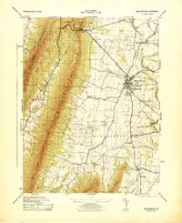 1944 Mercersburg1944 Print · USGSFranklin County's landscape during the 1940s reveals a well-developed network of small-town institutions and mountain-side preserves. Genealogists and historians can locate specific local landmarks like Mercersburg Academy, the Blue Spring School, and Heinbaugh Lime.
 - 1944 Map of Mc Connellsburg
 1944 Mc Connellsburg1944 Print · USGSFranklin and Fulton counties are captured here during the mid-forties, showing the deep valleys between the Tuscarora and Cove mountain ridges. Genealogists can locate rural schoolhouses like Jugtown School and small settlements like Richmond Furnace or Dutchtown.5 unique versions available
 - 1944 Map of Williamson
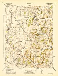 1944 Williamson1944 Print · USGSFranklin County's rural landscape is captured here during the mid-forties, showing the township life of Antrim and Montgomery. Genealogists can locate family-named schoolhouses and academies like the Welsh Run Academy and Pinefield School, or trace the rail line through Williamson.5 unique versions available
 - 1948 Map of Baltimore
 1948 Baltimore1948 Print · USGSMaryland and Pennsylvania crossroads are captured in the late 1940s, showing a landscape defined by historic rail lines and major military installations. Genealogists can trace family connections in Gettysburg, Westminster, and near the U.S. Naval Academy in Annapolis.2 unique versions available
 - 1954 Map of Baltimore
 1954 Baltimore1954 Print · USGSThe Mid-Atlantic region in the early fifties shows a landscape of growing suburban centers and heavy rail corridors. Trace mid-century transit networks and military landmarks from the Aberdeen Proving Ground to the Gettysburg National Military Park.
 - 1956 Map of Baltimore
 1956 Baltimore1956 Print · USGSMid-century Maryland and Pennsylvania are captured here during a period of massive suburban and military growth across the Chesapeake region. Genealogists and historians can trace the rail corridors of the Baltimore & Ohio RR and locate landmarks like Fort McHenry or the Aberdeen Proving Ground.
 - 1957 Map of Baltimore, 1964 Print
 1957 Baltimore1964 Print · USGSMaryland and Southern Pennsylvania are shown during the mid-century expansion of the Baltimore-Washington corridor. Researchers can trace the extensive rail lines of the Baltimore & Ohio RR and locate sites like Fort Detrick and Gettysburg National Military Park.5 unique versions available
 - 1961 Map of Baltimore
 1961 Baltimore1961 Print · USGSMaryland and Pennsylvania are captured at a mid-century peak of industrial and military expansion. Genealogists and historians can trace rail corridors like the Western Maryland Ry or locate regional landmarks such as Camp Detrick and Kent Island.
 - 1983 Map of Hagerstown, 1984 Print
 1983 Hagerstown1984 Print · USGSThe tri-state borderlands of Maryland, Pennsylvania, and West Virginia are shown in the early eighties as a hub of military installations and valley towns. Genealogists and historians can trace the landscape from Gettysburg National Military Park to the banks of the Potomac River.2 unique versions available
 - 1989 Map of Baltimore
 1989 Baltimore1989 Print · USGSThe Mid-Atlantic corridor in the late eighties is captured here, from the Baltimore harbor to the Blue Ridge foothills. Researchers can trace the sprawling footprints of Aberdeen Proving Ground, the historic grounds of Gettysburg National Military Park, and the winding Susquehanna River.
 - 1990 Map of Mc Connellsburg, 1995 Print
 1990 Mc Connellsburg1995 Print · USGSFranklin and Fulton Counties in the 1990s showcase a landscape of protected state forests and historic ridge-and-valley settlements. Researchers can trace the path of the Old Railroad Grade or locate local landmarks like Richmond Furnace and the Mountain View Sch.
 - 1990 Map of Mercersburg, 1995 Print
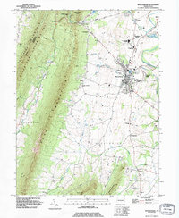 1990 Mercersburg1995 Print · USGSThe Mercersburg valley in the early nineties is a landscape of mountain ridges and historic education hubs. Researchers can trace the legacy of local families through landmarks like Spring Grove Cem, the Old Railroad Grade, and Mercersburg Academy.
 - 1990 Map of St Thomas, 1995 Print
 1990 St Thomas1995 Print · USGSFranklin County's transition from steep mountain ridges to settled valley farms is captured here during the 1990s. Researchers can locate family landmarks such as Brandts Cem and Criders Ch, or trace the legacy of industry at Franklin Furnace.
 - 1990 Map of Williamson, 1995 Print
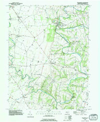 1990 Williamson1995 Print · USGSFranklin County's rolling hills and limestone creeks are captured here in the early nineties, showing a landscape defined by historic settlements and water. Genealogists can trace family connections at Montgomery Ch, the Martins Mill Covered Bridge, and the community at Welsh Run.
 - 2023 Map of Williamson, 2023 Print
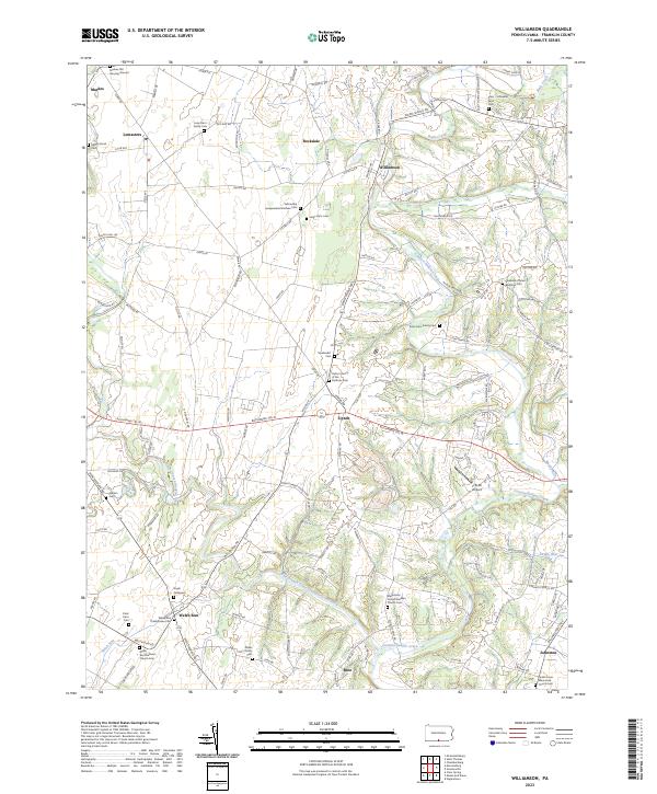 2023 Williamson2023 Print · USGSFranklin County's rural heartland is meticulously documented in this recent survey of its historic family farms and churchyards. Researchers can locate numerous ancestral sites including the Markes Old Burying Ground, Upton Church of the Brethren Cem, and Angle Graveyard.
 - 2023 Map of McConnellsburg, 2023 Print
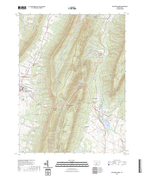 2023 McConnellsburg2023 Print · USGSThe valleys and high ridges of Fulton and Franklin Counties are documented here as they appeared in recent years. Genealogists can locate family burial sites like Magsam Family Cem and the McConnellsburg Methodist Cem or explore the history of Richmond Furnace.
 - 2023 Map of Mercersburg, 2023 Print
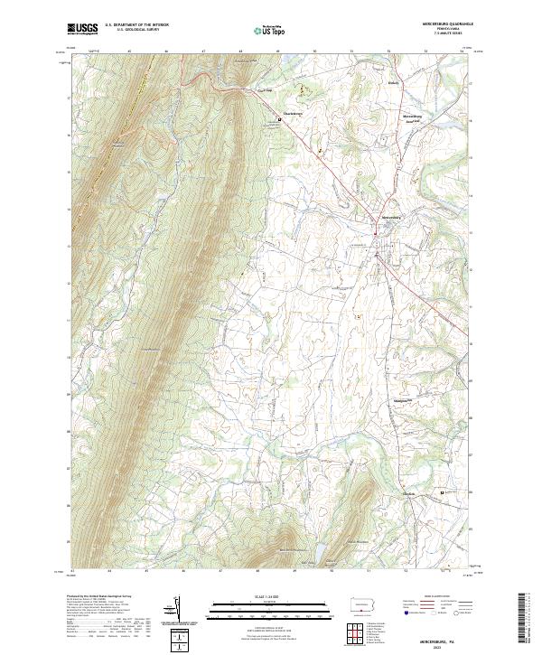 2023 Mercersburg2023 Print · USGSFranklin County's ridge-and-valley landscape is documented here in the early twenty-first century, centered on the historic borough of Mercersburg. Researchers can locate family landmarks such as the Charlestown United Methodist Church Cem and trace rural settlements like Cove Gap and Shimpstown.
 - 2023 Map of Saint Thomas, 2023 Print
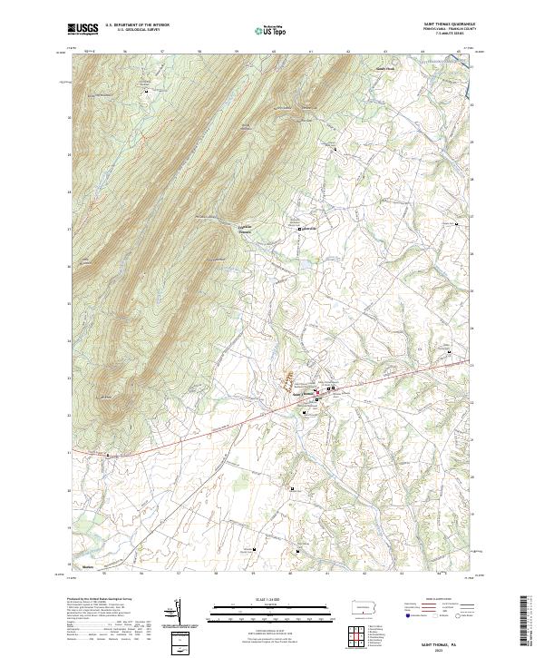 2023 Saint Thomas2023 Print · USGSSaint Thomas and the surrounding Franklin County valley are captured here in the early twenty-first century, showcasing a landscape of enduring rural settlements. Genealogists can locate family burial sites at Criders Cem and Brindle Cem or explore the history of Franklin Furnace.
End of results
Showing maps 1-25 of 25
Top cities near Peters Township
- Hagerstown historical maps
- Chambersburg historical maps
- Fountainhad-Orchard Hills historical maps
- Greencastle historical maps
- Maugansville historical maps
- State Line historical maps
See more
Top neighborhoods of Peters Township
- Charlestown historical maps
- Fort Loudon historical maps
- Rockdale historical maps
- Dickey historical maps
- Church Hill historical maps
- Lemasters historical maps
See more
Frequently asked questions
- What are the different types of historical maps available for Peters Township?
- What is the oldest map of Peters Township?
- Where can I purchase historical maps of Peters Township for my home or office?
- Where can I download high-res historical maps of Peters Township?
- Are there historical topographic maps available for Peters Township?
- Is there historical aerial imagery available for Peters Township?
- Where are historical maps of Peters Township sourced from?