Old Maps of West Lampeter Township, Pennsylvania
Explore 51 old maps of West Lampeter Township, spanning from 1902 to today. These high-resolution historic maps reveal how streets, neighborhoods, landmarks, and natural features evolved over time — perfect for genealogy, metal detecting, research, and local history exploration.
What you can do with these maps:
- See how West Lampeter Township changed over time: Compare historical maps to modern-day views to trace roads, homesites, rail lines & more.
- View detailed metadata: Each map includes creators, publishers, year, scale, and archive source.
- Overlay maps with satellite & LiDAR: Visualize the past alongside modern tools to explore terrain & human change.
- Trusted historical sources: Maps sourced from the USGS, Library of Congress, and other archives.
- Access maps your way: View online, download high-res files, or order prints for personal or research use.
Start exploring old maps of West Lampeter Township to uncover forgotten places, hidden landmarks, and the deep history beneath your feet.
West Lampeter Township, PA maps
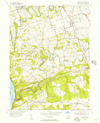
(51)- 1902 Map of Lancaster, 1956 Print
 1902 Lancaster1956 Print · USGSLancaster County at the opening of the twentieth century shows a landscape defined by iron furnaces, milling, and a sophisticated network of electric railways. Genealogists and historians can trace the paths of the New Holland Electric or locate family sites near Gevers Mill and Elizabeth Furnace.
 - 1904 Map of Lancaster
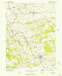
 1904 Lancaster1904 Print · USGSLancaster and its surrounding townships thrive at the turn of the century, depicted here through a complex web of trolley lines and steam railroads. Genealogists can trace family homesteads near old crossroads like Mastersonville or locate early industrial sites at Mount Hope and Geyers Mill.10 unique versions available
 - 1906 Map of New Holland, 1962 Print
 1906 New Holland1962 Print · USGSLancaster County at the start of the twentieth century shows a landscape transitioning from turnpikes to electric railways. Genealogists can trace family roots through an extensive network of rural landmarks, including Heller Church, Red Well School, and the early Waterworks at Ephrata.
 - 1908 Map of New Holland
 1908 New Holland1908 Print · USGSLancaster County at the turn of the century shows a thriving landscape of rural schoolhouses and turnpike villages. Genealogists can locate family landmarks like Middle Creek Church, Heller Church, and dozens of local schools from Stony Hill School to Clay School.6 unique versions available
 - 1912 Map of Quarryville
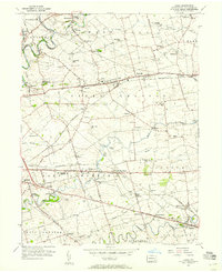
 1912 Quarryville1912 Print · USGSLancaster County's agrarian and industrial character is frozen in time here, shortly after the 1910 survey. Researchers can trace the heavy influence of the rail network through Nickel Mines or locate rural landmarks like Wheatland Mills and Mechanic Grove.6 unique versions available
 - 1912 Map of Mc Calls Ferry
 1912 Mc Calls Ferry1912 Print · USGSThe Susquehanna River valley near Safe Harbor is caught at a peak of rail-and-mill development during this pre-war survey. Genealogists and historians can trace the foundations of Martic Forge, find remote country schools like Red Hill School, and locate old stops on the Pennsylvania RR.5 unique versions available
 - 1941 Map of New Holland
 1941 New Holland1941 Print · USGSLancaster County’s agricultural heartland is documented here just as the modern highway era arrived. Genealogists and local historians can trace family locations through dozens of named rural landmarks like Heller Church, Fetter School, and the Pennsylvania RR corridor.
 - 1943 Map of Lancaster
 1943 Lancaster1943 Print · USGSLancaster County at the height of the second World War reveals a landscape defined by bustling rail hubs and thriving farm villages. Genealogists and historians can trace family roots through numerous small hamlets like Brunnerville, industrial sites at Elizabeth Furnace Gap, and recreation spots like Rocky Spring Park.
 - 1943 Map of Quarryville
 1943 Quarryville1943 Print · USGSSouthern Lancaster County is captured in detail during the early forties, showcasing a landscape of tight-knit rural townships and rail-connected villages. Genealogists can trace family footprints across numerous local sites like Nickel Mines, Conners Mill, and North Star School.
 - 1943 Map of Mc Calls Ferry
 1943 Mc Calls Ferry1943 Print · USGSMid-century Pennsylvania life unfolds along the Susquehanna during the 1940s, where river-based industry and rail lines meet established farming townships. Researchers can trace ancestral locations from Washington Boro to rural landmarks like Erbs Mill, Bethel Church, and the Red Hill School.2 unique versions available
 - 1948 Map of Baltimore
 1948 Baltimore1948 Print · USGSMaryland and Pennsylvania crossroads are captured in the late 1940s, showing a landscape defined by historic rail lines and major military installations. Genealogists can trace family connections in Gettysburg, Westminster, and near the U.S. Naval Academy in Annapolis.2 unique versions available
 - 1950 Map of Harrisburg, 1952 Print
 1950 Harrisburg1952 Print · USGSMid-century Central Pennsylvania comes alive through its dense rail networks and river valley settlements during the post-war industrial era. Genealogists and historians can trace family roots through hubs like Harrisburg, locate Carlisle Barracks, or follow the Pennsylvania RR through the Lebanon Valley.
 - 1954 Map of Baltimore
 1954 Baltimore1954 Print · USGSThe Mid-Atlantic region in the early fifties shows a landscape of growing suburban centers and heavy rail corridors. Trace mid-century transit networks and military landmarks from the Aberdeen Proving Ground to the Gettysburg National Military Park.
 - 1955 Map of Conestoga, 1956 Print
 1955 Conestoga1956 Print · USGSLancaster County's southern townships are captured in the mid-fifties, showing a landscape shaped by winding creeks and crossroad villages. Genealogists and historians can trace family roots through numerous country landmarks like Boehm Ch, Marticville, and Colemanville.7 unique versions available
 - 1955 Map of Quarryville, 1956 Print
 1955 Quarryville1956 Print · USGSMid-century Lancaster County comes to life in this survey of a landscape defined by rolling farmsteads and rail corridors. Genealogists and local historians can locate many district schools like Sandstone Sch, the Strasburg RR, and landmarks like the Quarryville Presbyterian Home.4 unique versions available
 - 1956 Map of Baltimore
 1956 Baltimore1956 Print · USGSMid-century Maryland and Pennsylvania are captured here during a period of massive suburban and military growth across the Chesapeake region. Genealogists and historians can trace the rail corridors of the Baltimore & Ohio RR and locate landmarks like Fort McHenry or the Aberdeen Proving Ground.
 - 1956 Map of Leola, 1957 Print
 1956 Leola1957 Print · USGSMid-century Lancaster County life centers on the bustling crossroads of Bird in Hand and Leola during this era of post-war growth. Genealogists and historians can trace family-named landmarks like Myers Cem or locate community hubs such as St Johns Ch and Weavertown Sch.5 unique versions available
 - 1956 Map of Lancaster, 1958 Print
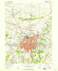 1956 Lancaster1958 Print · USGSMid-century Lancaster and its suburban frontiers are documented here during a period of significant post-war growth. Genealogists and historians can locate family landmarks like the Mennonite Home, Woodward Hill Cemetery, and Franklin and Marshall College.5 unique versions available
 - 1957 Map of Harrisburg
 1957 Harrisburg1957 Print · USGSMid-century Central Pennsylvania comes into focus as a bustling network of rail, river, and mountain ridges. Genealogists and historians can trace the development of the State Capitol and surrounding hubs like Middletown, Columbia, and Pottsville.7 unique versions available
 - 1957 Map of Baltimore, 1964 Print
 1957 Baltimore1964 Print · USGSMaryland and Southern Pennsylvania are shown during the mid-century expansion of the Baltimore-Washington corridor. Researchers can trace the extensive rail lines of the Baltimore & Ohio RR and locate sites like Fort Detrick and Gettysburg National Military Park.5 unique versions available
 - 1961 Map of Harrisburg
 1961 Harrisburg1961 Print · USGSCentral Pennsylvania is shown at a mid-century peak of industrial and military activity, from the Susquehanna water gaps to the fertile Dutch Country. Genealogists and historians can trace the rail corridors of the Pennsylvania RR and find landmarks like Carlisle Barracks or the Anthracite Coal Fields.2 unique versions available
 - 1961 Map of Baltimore
 1961 Baltimore1961 Print · USGSMaryland and Pennsylvania are captured at a mid-century peak of industrial and military expansion. Genealogists and historians can trace rail corridors like the Western Maryland Ry or locate regional landmarks such as Camp Detrick and Kent Island.
 - 1964 Map of Harrisburg
 1964 Harrisburg1964 Print · USGSCentral Pennsylvania in the mid-fifties reveals a landscape shaped by ridge-and-valley geology and critical Cold War infrastructure. Researchers can trace the massive Indiantown Gap Military Reservation or the rail corridors of the Pennsylvania RR and Reading RR.
 - 1983 Map of York, 1984 Print
 1983 York1984 Print · USGSSouth Central Pennsylvania and Northern Maryland meet along the Susquehanna during the early eighties. Genealogists and local historians can trace the transit networks of Conrail and Amtrak through towns like Red Lion and Seven Valleys.2 unique versions available
 - 1984 Map of Harrisburg, 1985 Print
 1984 Harrisburg1985 Print · USGSCentral Pennsylvania in the mid-eighties shows a landscape defined by the winding Susquehanna River and the industrial growth of its river towns. Researchers can trace the rail corridors of Amtrak and Conrail or explore the bounds of Fort Indiantown Gap Military Reservation.2 unique versions available
Showing maps 1-25 of 51
Top cities near West Lampeter Township
- Lancaster historical maps
- Ephrata historical maps
- Lititz historical maps
- Willow Street historical maps
- Millersville historical maps
- Mount Joy historical maps
See more
Top neighborhoods of West Lampeter Township
- Lampeter historical maps
- Talmage historical maps
- Oregon historical maps
- Linville Circle historical maps
- Lyndon historical maps
- Lime Valley historical maps
See more
Frequently asked questions
- What are the different types of historical maps available for West Lampeter Township?
- What is the oldest map of West Lampeter Township?
- Where can I purchase historical maps of West Lampeter Township for my home or office?
- Where can I download high-res historical maps of West Lampeter Township?
- Are there historical topographic maps available for West Lampeter Township?
- Is there historical aerial imagery available for West Lampeter Township?
- Where are historical maps of West Lampeter Township sourced from?