Old Maps of Sakonnet, Little Compton
Explore 18 old maps of Sakonnet, spanning from 1885 to today. These high-resolution historic maps reveal how streets, neighborhoods, landmarks, and natural features evolved over time — perfect for genealogy, metal detecting, research, and local history exploration.
What you can do with these maps:
- See how Sakonnet changed over time: Compare historical maps to modern-day views to trace roads, homesites, rail lines & more.
- View detailed metadata: Each map includes creators, publishers, year, scale, and archive source.
- Overlay maps with satellite & LiDAR: Visualize the past alongside modern tools to explore terrain & human change.
- Trusted historical sources: Maps sourced from the USGS, Library of Congress, and other archives.
- Access maps your way: View online, download high-res files, or order prints for personal or research use.
Start exploring old maps of Sakonnet to uncover forgotten places, hidden landmarks, and the deep history beneath your feet.
Sakonnet, Little Compton maps
(18)- 1885 Map of Sakonnet
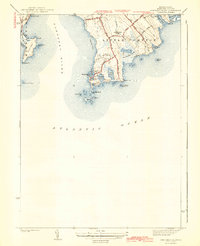
 1885 Sakonnet1885 Print · USGSThe Rhode Island coast south of Little Compton and Middletown is captured here in the late nineteenth century, showing a shoreline defined by points and coastal ponds. Researchers can trace landforms and landmarks like Sakonnet Point, Woods Castle, and Sachuest Neck.
 - 1888 Map of Sakonnet
 1888 Sakonnet1888 Print · USGSCoastal Rhode Island in the 1880s was defined by its weather-beaten points and maritime outposts. Genealogists and historians can trace the early topography of Little Compton and Middletown, from Sakonnet Point to Woods Castle.
 - 1893 Map of Sakonnet
 1893 Sakonnet1893 Print · USGSThe Rhode Island coast in the late nineteenth century is documented here as a maritime landscape of rocky points and tidal ponds. Researchers can trace the early harbor works at Sakonnet Point or locate family landmarks like Woods Castle and Warren Point.6 unique versions available
 - 1942 Map of Newport
 1942 Newport1942 Print · USGSThe Rhode Island coast appears here at a critical wartime moment, showing the heavy fortification of Narragansett Bay. Researchers can trace military sites like Fort Kearny, maritime landmarks like the Point Judith Life Saving Station, and old ferry routes.2 unique versions available
 - 1942 Map of Sakonnet Point
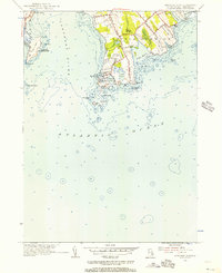
 1942 Sakonnet Point1942 Print · USGSCoastal Little Compton and Middletown are captured in the early 1940s, showing the intersection of maritime life and rural agriculture. Genealogists and historians can trace coastal holdings near Sakonnet Harbor, the Wilbur House Pond, and landmarks like Sakonnet Lh.3 unique versions available
 - 1947 Map of Providence, 1948 Print
 1947 Providence1948 Print · USGSSouthern New England is captured in the mid-1940s, showing a landscape defined by busy industrial ports and expanding military installations. Researchers can trace the rail lines of the N.Y. N.H. & H. RR or locate coastal defenses like Fort Adams and Quonset Point.5 unique versions available
 - 1948 Map of Providence, 1951 Print
 1948 Providence1951 Print · USGSSouthern New England’s coastal reaches are captured here in the late 1940s, from the industrial heart of Providence to the tip of Provincetown. Genealogists and historians can trace rail lines like the Central Vermont Railway and locate active military sites such as Otis Air Force Base and Fort Rodman.
 - 1955 Map of Sakonnet Point, 1956 Print
 1955 Sakonnet Point1956 Print · USGSThe coastal reaches of Little Compton and the Sakonnet River are captured here in the mid-fifties. Researchers can trace maritime landmarks and early summer colonies from Sakonnet Light to the grounds of the Sakonnet Golf Course.3 unique versions available
 - 1957 Map of Providence
 1957 Providence1957 Print · USGSCoastal New England at the height of the mid-century era shows a landscape shaped by maritime industry and Cold War defense. Genealogists and historians can trace the reach of the New York, New Haven & Hartford RR and locate legacy sites like Fort Adams and Quonset Point Naval Air Station.
 - 1958 Map of Providence
 1958 Providence1958 Print · USGSThe Rhode Island and Massachusetts coastlines are shown in detail during the late 1950s, from the urban cores to the tips of the islands. Researchers can trace the mid-century footprint of Quonset Point Naval Air Station, the defense works at Fort Adams, and the rail network of the New York, New Haven and Hartford RR.
 - 1963 Map of Providence
 1963 Providence1963 Print · USGSSouthern New England's coastal and industrial heartland is captured here in the early sixties, from the Rhode Island mainland to the far reaches of the Cape. Researchers can trace mid-century growth in Providence or locate landmarks on Marthas Vineyard and Nantucket Island.
 - 1984 Map of Block Island
 1984 Block Island1984 Print · USGSThe coastal borderlands of Rhode Island, Connecticut, and New York are captured here in the mid-eighties, from the rail hubs of Westerly to the shores of Block Island. Genealogists and historians can trace the shoreline's evolution through landmarks like the Pequot Indian Res, New Shoreham, and Narragansett Pier.
 - 1984 Map of Sakonnet Point
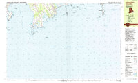 1984 Sakonnet Point1984 Print · USGSThe coastal border of Rhode Island and Massachusetts in the 1980s reveals a shoreline of wildlife refuges and rocky navigational hazards. Trace local landmarks like the Lighthouse (Abandoned) at Sakonnet Point, St Andrews by the Sea Ch, and the grounds of Woods Castle.
 - 2012 Map of Sakonnet Point, 2012 Print
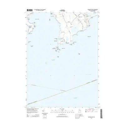
 2012 Sakonnet Point2012 Print · USGSCovers Sakonnet, including Middletown, Little Compton, and other nearby areas
 - 2015 Map of Sakonnet Point, 2015 Print
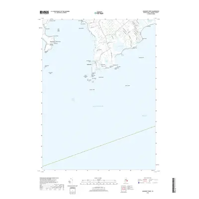
 2015 Sakonnet Point2015 Print · USGSCovers Sakonnet, including Middletown, Little Compton, and other nearby areas
 - 2018 Map of Sakonnet Point, 2018 Print
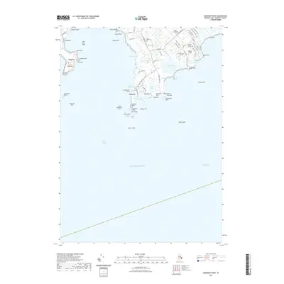
 2018 Sakonnet Point2018 Print · USGSCovers Sakonnet, including Middletown, Little Compton, and other nearby areas
 - 2021 Map of Sakonnet Point, 2021 Print
 2021 Sakonnet Point2021 Print · USGSCovers Sakonnet, including Middletown, Little Compton, and other nearby areas
 - 2024 Map of Sakonnet Point, 2024 Print
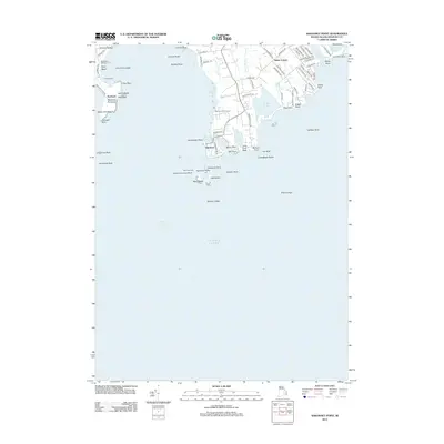
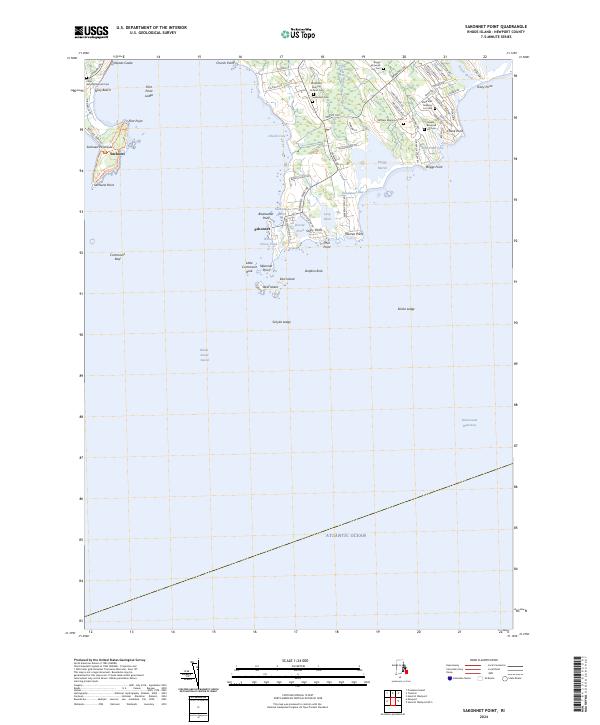 2024 Sakonnet Point2024 Print · USGSSakonnet Point and the surrounding Rhode Island coastline appear here in contemporary detail, showing a landscape shaped by conservation and historic family lineages. Genealogists can locate several family burial sites like Seaconnet Cem and the William Briggs Lot Cem near Sakonnet.
End of results
Showing maps 1-18 of 18
Frequently asked questions
- What are the different types of historical maps available for Sakonnet?
- What is the oldest map of Sakonnet?
- Where can I purchase historical maps of Sakonnet for my home or office?
- Where can I download high-res historical maps of Sakonnet?
- Are there historical topographic maps available for Sakonnet?
- Is there historical aerial imagery available for Sakonnet?
- Where are historical maps of Sakonnet sourced from?