Old Maps of Ridgeland, South Carolina
Explore 24 old maps of Ridgeland, spanning from 1918 to today. These high-resolution historic maps reveal how streets, neighborhoods, landmarks, and natural features evolved over time — perfect for genealogy, metal detecting, research, and local history exploration.
What you can do with these maps:
- See how Ridgeland changed over time: Compare historical maps to modern-day views to trace roads, homesites, rail lines & more.
- View detailed metadata: Each map includes creators, publishers, year, scale, and archive source.
- Overlay maps with satellite & LiDAR: Visualize the past alongside modern tools to explore terrain & human change.
- Trusted historical sources: Maps sourced from the USGS, Library of Congress, and other archives.
- Access maps your way: View online, download high-res files, or order prints for personal or research use.
Start exploring old maps of Ridgeland to uncover forgotten places, hidden landmarks, and the deep history beneath your feet.
Ridgeland, SC maps
(24)- 1918 Map of Yemassee
 1918 Yemassee1918 Print · USGSCoastal South Carolina at the end of the Great War reveals a landscape of tidal rivers and emerging rail junctions. Genealogists can trace family locations across Grahams Neck or near historic sites like Pocotaligo, Sheldon, and the logging camps around Gilmania.4 unique versions available
 - 1920 Map of Okatie
 1920 Okatie1920 Print · USGSThe South Carolina Lowcountry is captured here in the years following the Great War, showing a landscape defined by tidal rivers and strategic rail lines. Trace family roots and historical sites through Honey Hill Civil War Entrenchment, Grahamville, and Cherry Point Landing.
 - 1942 Map of Okatie
 1942 Okatie1942 Print · USGSCoastal South Carolina at the height of the Second World War shows a landscape of tidal marshes and strategic river landings. Genealogists and historians can trace family locations through named sites like Grahamville, Old House, and the Civil War Entrenchment north of Ridgeland.
 - 1943 Map of Yemassee
 1943 Yemassee1943 Print · USGSThe South Carolina Lowcountry in the early 1940s is defined by its massive tidal rivers and the vital rail junctions at Yemassee. Genealogists and historians can trace old community lines near McPhersonville, Mt Nevo Ch, and the coastal reaches of Seabrook.3 unique versions available
 - 1947 Map of Savannah
 1947 Savannah1947 Print · USGSCoastal Georgia and South Carolina are captured here in the mid-forties, showing the rail-and-river networks of the Lowcountry. Genealogists and researchers can trace old crossroads and river towns from Statesboro to Beaufort, alongside military sites like Camp Stewart and Parris Island.
 - 1948 Map of Savannah
 1948 Savannah1948 Print · USGSThe Georgia and South Carolina Lowcountry comes alive in this post-war survey of the coast and its river-fed hinterlands. Genealogists and historians can trace rail lines like the Central of Georgia RR and find established settlements such as Isle of Hope and Sylvania.
 - 1957 Map of Savannah, 1967 Print
 1957 Savannah1967 Print · USGSThe Lowcountry and Georgia coastal plain are shown here in the late fifties, prior to modern expansion. Researchers can trace the rail-and-river economy through the Central of Georgia lines and the Ogeechee River wetlands.4 unique versions available
 - 1960 Map of Savannah
 1960 Savannah1960 Print · USGSCoastal Georgia and the South Carolina Lowcountry are captured in the late fifties, showcasing the intricate web of islands and tidal rivers before modern expansion. Researchers can trace the rail lines of the Atlantic Coast Line or locate sites like Parris Island, Beaufort, and the Tybee Lighthouse.
 - 1961 Map of Savannah
 1961 Savannah1961 Print · USGSThe Georgia and South Carolina Lowcountry comes alive in this mid-century survey of coastal marshes, barrier islands, and river networks. Genealogists and historians can trace the paths of the Seaboard Air Line RR, locate family sites near Isle of Hope, or study the grounds of Fort Stewart Military Reservation.2 unique versions available
 - 1961 Map of Ridgeland, 1964 Print
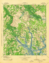
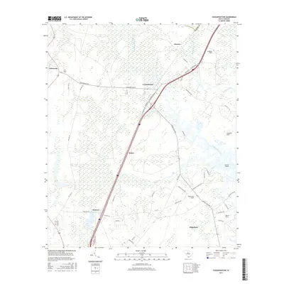
 1961 Ridgeland1964 Print · USGSIn the early sixties, the Jasper County Lowcountry remained a landscape of historic plantations and Civil War heritage. Genealogists and historians can trace family-named sites like Partridge Hill, the Grahamville Cem, and numerous Entrenchments near Honey Hill.2 unique versions available
 - 1978 Map of Beaufort
 1978 Beaufort1978 Print · USGSCoastal South Carolina and Georgia come to life in this detailed bathymetric study from the late seventies, featuring the intricate Sea Islands and the Savannah River mouth. Researchers can trace military history at Parris Island or locate inland settlements like Switzerland and Old Sheldon.2 unique versions available
 - 1986 Map of Walterboro
 1986 Walterboro1986 Print · USGSThe South Carolina Lowcountry in the mid-eighties remains a world of expansive wetlands and historic river crossings. Genealogists and historians can trace the rural communities and landmarks of Colleton and Charleston counties, from the Baptist Church at Adams Run to the coastal reaches of Edisto Beach State Park.
 - 1988 Map of Coosawhatchie
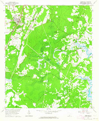
 1988 Coosawhatchie1988 Print · USGSJasper County's river-threaded Lowcountry is captured here in the late 1980s, where the landscape is shaped by coastal necks and river bends. Genealogists and local historians can trace small settlements like Bashan and Ricetown or locate family plots at several Cem sites near Coosawhatchie.
 - 1990 Map of Walterboro
 1990 Walterboro1990 Print · USGSCoastal South Carolina and its dense river networks are documented here in the early nineties as the Charleston suburbs expanded westward. Genealogists and historians can trace old community hubs like Clubhouse Crossroads, the site of Givhans Ferry, and several Strip Mines north of the Stono River.
 - 2011 Map of Ridgeland, 2011 Print
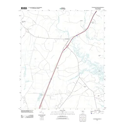
 2011 Ridgeland2011 Print · USGSCovers Ridgeland, including Nevadum, Grahamville, and other nearby areas
 - 2011 Map of Coosawhatchie, 2011 Print
 2011 Coosawhatchie2011 Print · USGSCovers Ridgeland, including Ricetown, Gilmania, and other nearby areas
 - 2014 Map of Coosawhatchie, 2014 Print
 2014 Coosawhatchie2014 Print · USGSCovers Ridgeland, including Ricetown, Gilmania, and other nearby areas
 - 2014 Map of Ridgeland, 2014 Print
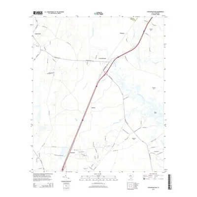
 2014 Ridgeland2014 Print · USGSCovers Ridgeland, including Nevadum, Grahamville, and other nearby areas
 - 2017 Map of Ridgeland, 2017 Print
 2017 Ridgeland2017 Print · USGSCovers Ridgeland, including Nevadum, Grahamville, and other nearby areas
 - 2017 Map of Coosawhatchie, 2017 Print
 2017 Coosawhatchie2017 Print · USGSCovers Ridgeland, including Ricetown, Gilmania, and other nearby areas
 - 2020 Map of Coosawhatchie, 2020 Print
 2020 Coosawhatchie2020 Print · USGSCovers Ridgeland, including Ricetown, Gilmania, and other nearby areas
 - 2020 Map of Ridgeland, 2020 Print
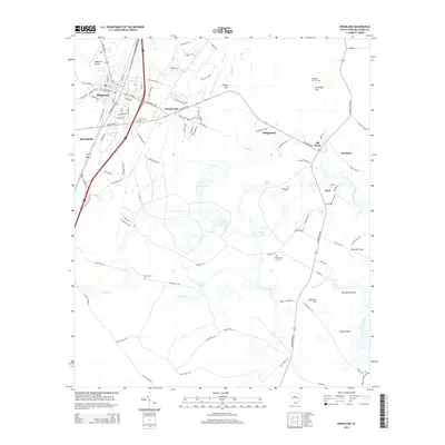
 2020 Ridgeland2020 Print · USGSCovers Ridgeland, including Nevadum, Grahamville, and other nearby areas
 - 2024 Map of Coosawhatchie, 2024 Print
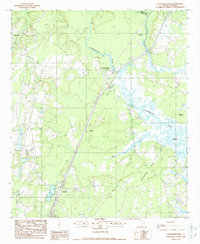
 2024 Coosawhatchie2024 Print · USGSJasper County's Lowcountry landscape is captured here in recent years, showing the traditional settlements of the Coosawhatchie River basin. You can trace the footprint of Moultrie Plantation, locate family-named landmarks like Grahams Neck, or explore the growth of Ridgeland.
 - 2024 Map of Ridgeland, 2024 Print
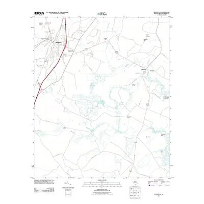
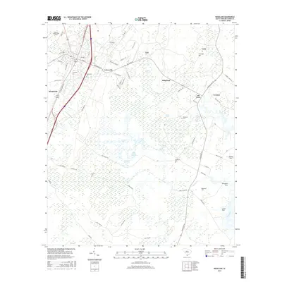
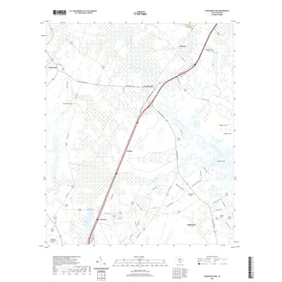
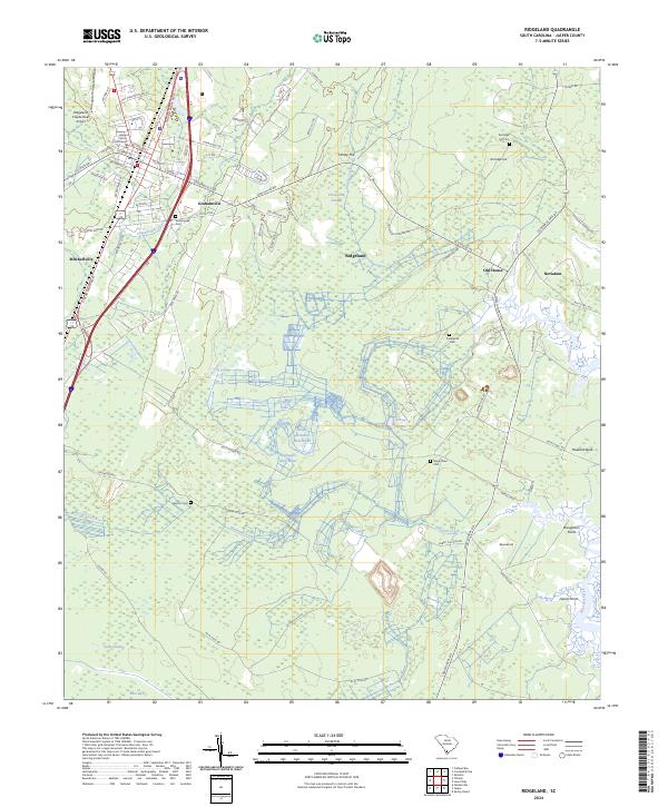 2024 Ridgeland2024 Print · USGSJasper County is captured here in the contemporary era, centered on the crossroads and rail infrastructure of Ridgeland. Family historians can trace local sites like Good Hope Plantation or several burial grounds including Wrightfield Cem and Berton Cem.
End of results
Showing maps 1-24 of 24
Top cities near Ridgeland
- Hilton Head Island historical maps
- Beaufort historical maps
- Port Royal historical maps
- Rincon historical maps
- Bluffton historical maps
- Hardeeville historical maps
See more
Top neighborhoods of Ridgeland
Frequently asked questions
- What are the different types of historical maps available for Ridgeland?
- What is the oldest map of Ridgeland?
- Where can I purchase historical maps of Ridgeland for my home or office?
- Where can I download high-res historical maps of Ridgeland?
- Are there historical topographic maps available for Ridgeland?
- Is there historical aerial imagery available for Ridgeland?
- Where are historical maps of Ridgeland sourced from?