Old Maps of Codington County, South Dakota
Explore 108 old maps of Codington County, spanning from 1953 to today. These high-resolution historic maps reveal how streets, neighborhoods, landmarks, and natural features evolved over time — perfect for genealogy, metal detecting, research, and local history exploration.
What you can do with these maps:
- See how Codington County changed over time: Compare historical maps to modern-day views to trace roads, homesites, rail lines & more.
- View detailed metadata: Each map includes creators, publishers, year, scale, and archive source.
- Overlay maps with satellite & LiDAR: Visualize the past alongside modern tools to explore terrain & human change.
- Trusted historical sources: Maps sourced from the USGS, Library of Congress, and other archives.
- Access maps your way: View online, download high-res files, or order prints for personal or research use.
Start exploring old maps of Codington County to uncover forgotten places, hidden landmarks, and the deep history beneath your feet.
Codington County, SD maps
(108)- 1953 Map of Milbank, 1958 Print
 1953 Milbank1958 Print · USGSThe tri-state border region of South Dakota, North Dakota, and Minnesota is shown here during the early fifties, a landscape defined by glacial lakes and the Sisseton Indian Reservation. Researchers can trace the legacy of the western railroads, locating old stops along the Great Northern and settlements like Milbank, Webster, and Sisseton.3 unique versions available
 - 1953 Map of Watertown, 1968 Print
 1953 Watertown1968 Print · USGSEastern South Dakota and the Minnesota borderlands are captured here during the mid-twentieth century as the region's agricultural and rail-service centers thrived. Genealogists and local historians can trace family-named sites across the Coteau des Prairies and find landmarks in Watertown, De Smet, and Brookings.3 unique versions available
 - 1958 Map of Milbank
 1958 Milbank1958 Print · USGSThe northern Great Plains in the late fifties show a landscape of glacial lakes and reservation lands shaped by the Great Northern railroad. Genealogists and local historians can trace the grid of settlements from Britton to Milbank and locate landmarks like Enemy Swim Lake and the Sisseton Indian Reservation.
 - 1958 Map of Watertown
 1958 Watertown1958 Print · USGSThe eastern South Dakota prairie and the Minnesota borderlands are captured here in the late fifties, showcasing a landscape of terminal moraine lakes and burgeoning rail hubs. Genealogists and historians can trace the early paths of the Chicago and North Western railroad or locate family roots in Watertown, Clark, or the Sisseton Indian Reservation.2 unique versions available
 - 1969 Map of Watertown West, 1971 Print
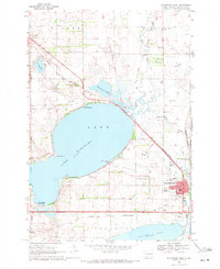 1969 Watertown West1971 Print · USGSThe glacial lakes of South Dakota's prairie country define this late-sixties landscape west of Watertown. Researchers can trace the legacy of the Old Indian Treaty Boundary or find local landmarks like McKinley Sch, the Zoo, and Camp Watymca.
 - 1969 Map of Pelican Lake, 1971 Print
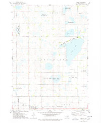
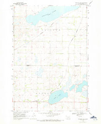 1969 Pelican Lake1971 Print · USGSThe glacial prairies of eastern South Dakota are captured here in the late sixties, showing the rural landscape of Codington and Hamlin Counties. Researchers can trace the Burlington Northern rail line through Foley and locate the Oxford Cem.
 - 1969 Map of Watertown SE, 1972 Print
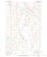 1969 Watertown SE1972 Print · USGSCodington County's agricultural heartland is captured here in the late sixties as the outskirts of Watertown expanded. Genealogists and local historians can trace the Chicago and North Western rail line past Appleby and Five Ponds.
 - 1969 Map of Watertown East, 1972 Print
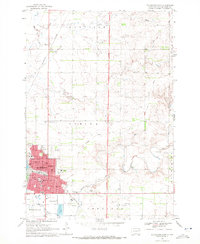 1969 Watertown East1972 Print · USGSThe city of Watertown expands across the Codington County landscape during the late sixties. Trace the city’s development and rail history through Mt Hope Cemetery, the Big Sioux River, and the Burlington Northern line.
 - 1970 Map of Kranzburg SW, 1972 Print
 1970 Kranzburg SW1972 Print · USGSEastern South Dakota’s agricultural landscape is documented here just as modern highway expansion was beginning to reshape the prairie in the early seventies. Genealogists can locate the local Townhall or trace the winding path of Stray Horse Creek through the townships of Kranzburg and Hamlin.2 unique versions available
 - 1970 Map of Kranzburg, 1972 Print
 1970 Kranzburg1972 Print · USGSCodington County was established as a productive farming region by the 1970s, as shown in this detailed survey of the prairie landscape. Researchers can trace the Old Railroad Grade and locate family landmarks like Holy Rosary Cem and St Josephs Cem.
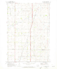
 - 1970 Map of Lonesome Lake, 1973 Print
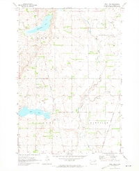
 1970 Lonesome Lake1973 Print · USGSThe rural landscape of eastern South Dakota in the early 1970s is meticulously captured here where Grant and Day counties meet. Genealogists and local historians can locate the Bergen Ch and Cem, alongside geographical markers like Lonesome Lake and the Big Sioux River.
 - 1970 Map of Still Lake SE, 1973 Print
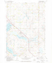
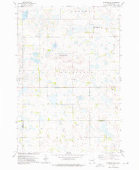
 1970 Still Lake SE1973 Print · USGSCodington County in the early 1970s is shown here as a landscape of grid-patterned townships and prairie drainage. Genealogists can locate family landmarks like St Johns Ch, Townhall, and the Henricks Landing Strip along the Burlington Northern line.
 - 1970 Map of Florence NE, 1973 Print
 1970 Florence NE1973 Print · USGSThe Coteau des Prairies of northeastern South Dakota is captured here in the early 1970s, showing a landscape of sprawling wetlands and high-prairie townships. Researchers can locate the Egeland Cem and Egeland Ch, or trace the Sisseton Indian Reservation Boundary near Goose Lake.
 - 1970 Map of Still Lake NE, 1973 Print
 1970 Still Lake NE1973 Print · USGSThe eastern South Dakota plains come into focus in the early 1970s, showing the rural townships of Grant and Codington counties. Researchers can trace the Sisseton Indian Reservation Boundary or locate the local St Johns Ch and Townhall.
 - 1970 Map of Still Lake, 1973 Print
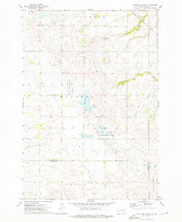
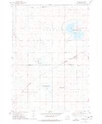
 1970 Still Lake1973 Print · USGSCodington County's prairie landscape is captured here in the early 1970s, showcasing a meticulously surveyed network of township sections and watercourses. Researchers can locate the Esterly Cem, trace the Sisseton Indian Reservation Boundary, and see the rural Townhall.
 - 1973 Map of Florence, 1976 Print
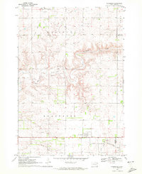
 1973 Florence1976 Print · USGSThe town of Florence and its prairie pothole landscape are captured here in the early 1970s. Local researchers can trace the Chicago and North Western rail line and locate family landmarks like Dexter Cem and Helger Cem.
 - 1973 Map of South Shore, 1976 Print
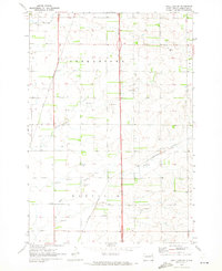
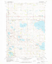
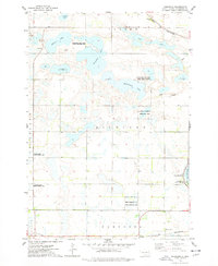
 1973 South Shore1976 Print · USGSThe prairie landscape of Codington County is captured here in the early 1970s, showcasing a region defined by its glacial lakes and railroad corridors. Researchers can trace the early layout of South Shore and Waverly or locate landmarks like Punished Womans Mound and the Old Railroad Grade.
 - 1973 Map of Antelope Valley, 1976 Print
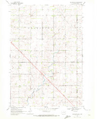
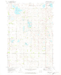
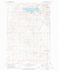
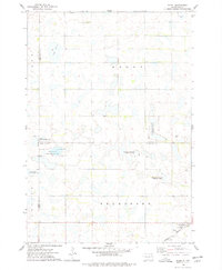
 1973 Antelope Valley1976 Print · USGSThe eastern South Dakota prairie comes into focus in the 1970s, showing a landscape of conservation and local townships. Trace family roots and rural infrastructure at the Antelope Valley Cem, the local Townhall, and the Chicago Milwaukee St Paul and Pacific rail line.
 - 1973 Map of Florence NW, 1976 Print
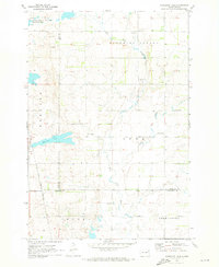
 1973 Florence NW1976 Print · USGSThe prairie wetlands of Day and Codington counties are captured in the early 1970s, showcasing a landscape of glacial potholes and remote township life. Researchers can locate vanished social centers like St Pauli Ch, the Townhall, and the Wheatland Cem.
 - 1973 Map of Wallace, 1976 Print
 1973 Wallace1976 Print · USGSNortheastern South Dakota's prairie potholes and rail-line settlements are meticulously captured during the early seventies. Genealogists and historians can locate the Telemarken Ch, the Lake Nicholson Cem, and the tracks of the Chicago and North Western at Wallace.
 - 1973 Map of Henry, 1978 Print
 1973 Henry1978 Print · USGSHenry and the surrounding Codington County prairie are shown here during the early 1970s, as the region balanced rail commerce with extensive wildlife conservation. Researchers can trace the Chicago and North Western rail line and locate rural sites like Graceland Ch Cem, Lorinda, and Boyd.
 - 1973 Map of Kampeska, 1978 Print
 1973 Kampeska1978 Print · USGSCodington County in the early seventies shows a landscape defined by glacial lakes and conservation areas west of the growing hub of Watertown. Genealogists and outdoor historians can trace old property lines and landmarks like Kampeska, Lynwood State Public Access Area, and the Chicago and North Western line.
 - 1973 Map of Grover, 1978 Print
 1973 Grover1978 Print · USGSCodington and Hamlin Counties were characterized by a vast network of glacial sloughs and rail lines in the 1970s. Researchers can locate specific rural landmarks like the Townhall, Emmanuel Church, and the tracks of the Chicago and North Western.
 - 1973 Map of Hazel, 1978 Print
 1973 Hazel1978 Print · USGSHamlin County and its surrounding prairie townships are captured here in the early 1970s as a hub for both rail transit and wildlife conservation. Genealogists and local historians can trace the community around Hazel, including Our Saviours Ch and the Hazel Cem near the Burlington Northern tracks.
 - 1985 Map of Clear Lake
 1985 Clear Lake1985 Print · USGSThe South Dakota and Minnesota borderlands are captured here in the mid-eighties as a landscape of prairie towns and wildlife refuges. Researchers can trace the legacy of regional transport through the Chicago and North Western tracks and the Old Railroad Grade.2 unique versions available
Showing maps 1-25 of 108
Top cities of Codington County
Frequently asked questions
- What are the different types of historical maps available for Codington County?
- What is the oldest map of Codington County?
- Where can I purchase historical maps of Codington County for my home or office?
- Where can I download high-res historical maps of Codington County?
- Are there historical topographic maps available for Codington County?
- Is there historical aerial imagery available for Codington County?
- Where are historical maps of Codington County sourced from?