Old Maps of Hilland, South Dakota
Explore 9 old maps of Hilland, spanning from 1954 to today. These high-resolution historic maps reveal how streets, neighborhoods, landmarks, and natural features evolved over time — perfect for genealogy, metal detecting, research, and local history exploration.
What you can do with these maps:
- See how Hilland changed over time: Compare historical maps to modern-day views to trace roads, homesites, rail lines & more.
- View detailed metadata: Each map includes creators, publishers, year, scale, and archive source.
- Overlay maps with satellite & LiDAR: Visualize the past alongside modern tools to explore terrain & human change.
- Trusted historical sources: Maps sourced from the USGS, Library of Congress, and other archives.
- Access maps your way: View online, download high-res files, or order prints for personal or research use.
Start exploring old maps of Hilland to uncover forgotten places, hidden landmarks, and the deep history beneath your feet.
Hilland, SD maps
(9)- 1954 Map of Pierre, 1968 Print
 1954 Pierre1968 Print · USGSThe Missouri River and the newly formed Oahe Reservoir define central South Dakota in the 1950s. Genealogists and local historians can trace early settlements and rail stops like Eakin Siding, Mission Ridge, and Ottumwa.2 unique versions available
 - 1958 Map of Pierre
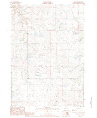
 1958 Pierre1958 Print · USGSCentral South Dakota is documented during the mid-fifties, just as the Missouri River valley was being transformed by the massive Oahe Dam project. Researchers can trace the early Oahe Reservoir shoreline and find remote outposts like Milesville, Onida, and Giddings Flat.
 - 1983 Map of Philip, 1984 Print
 1983 Philip1984 Print · USGSCentral South Dakota’s plains in the early eighties are mapped here, showing the rural communities and ranching landscape of Haakon County. Genealogists and historians can trace the Chicago and North Western rail corridor and find small locales like Milesville, Elevenmile Corner, and Nowlin.
 - 1983 Map of Hilland, 1984 Print
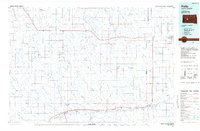
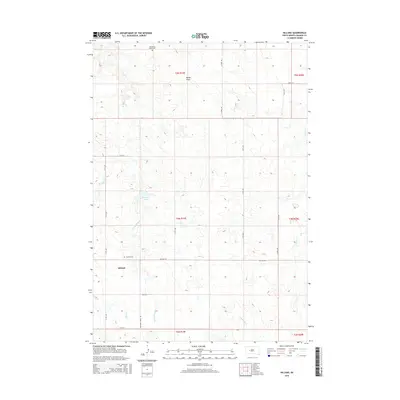
 1983 Hilland1984 Print · USGSHaakon County ranching country is captured here in the early eighties, showing the remote homesteads and prairie infrastructure of western South Dakota. Researchers can locate family landmarks like Ferguson Ranch, the Hilland Cem, and the path of the Steel Tower Trans Line.
 - 1984 Map of Philip, 1989 Print
 1984 Philip1989 Print · USGSHaakon County in the mid-eighties remains a landscape of rail-side towns and expansive rangeland. Genealogists and historians can trace the Chicago and North Western line through Philip and Nowlin or locate remote sites like Elevenmile Corner and Grindstone Butte.
 - 2012 Map of Hilland, 2012 Print
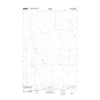 2012 Hilland2012 Print · USGSCovers Hilland, including Haakon County, United States, and other nearby areas
 - 2015 Map of Hilland, 2015 Print
 2015 Hilland2015 Print · USGSCovers Hilland, including Haakon County, United States, and other nearby areas
 - 2017 Map of Hilland, 2017 Print
 2017 Hilland2017 Print · USGSCovers Hilland, including Haakon County, United States, and other nearby areas
 - 2021 Map of Hilland, 2021 Print
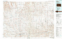
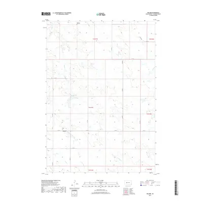
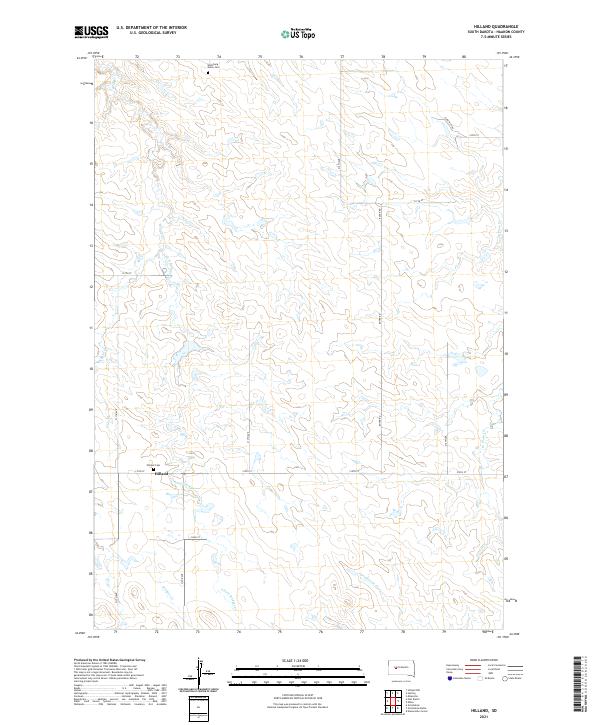 2021 Hilland2021 Print · USGSHaakon County plains life is centered around Hilland in this contemporary topographic record of western South Dakota. Researchers can pinpoint local landmarks and family burial sites like Wellsburg Union Cem or follow the paths of Bridger Cr and Grindstone Cr.
End of results
Showing maps 1-9 of 9
Frequently asked questions
- What are the different types of historical maps available for Hilland?
- What is the oldest map of Hilland?
- Where can I purchase historical maps of Hilland for my home or office?
- Where can I download high-res historical maps of Hilland?
- Are there historical topographic maps available for Hilland?
- Is there historical aerial imagery available for Hilland?
- Where are historical maps of Hilland sourced from?