Old Maps of Lincoln County, South Dakota
Explore 123 old maps of Lincoln County, spanning from 1897 to today. These high-resolution historic maps reveal how streets, neighborhoods, landmarks, and natural features evolved over time — perfect for genealogy, metal detecting, research, and local history exploration.
What you can do with these maps:
- See how Lincoln County changed over time: Compare historical maps to modern-day views to trace roads, homesites, rail lines & more.
- View detailed metadata: Each map includes creators, publishers, year, scale, and archive source.
- Overlay maps with satellite & LiDAR: Visualize the past alongside modern tools to explore terrain & human change.
- Trusted historical sources: Maps sourced from the USGS, Library of Congress, and other archives.
- Access maps your way: View online, download high-res files, or order prints for personal or research use.
Start exploring old maps of Lincoln County to uncover forgotten places, hidden landmarks, and the deep history beneath your feet.
Lincoln County, SD maps
(123)- 1897 Map of Canton, 1954 Print
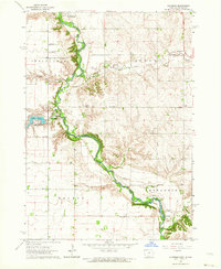
 1897 Canton1954 Print · USGSSoutheastern South Dakota and the Iowa borderlands were undergoing a railway-driven expansion during the 1890s. Genealogists and historians can trace early settlements like Beloit, Centerville, and Lennox as they grew along the Big Sioux River.
 - 1900 Map of Canton
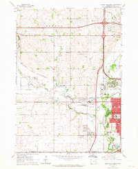
 1900 Canton1900 Print · USGSSoutheastern South Dakota and the Iowa borderlands are captured here at a peak of late-nineteenth-century rail expansion. Genealogists can trace the early foundations of towns like Canton, Centerville, and Beresford along the Big Sioux River.2 unique versions available
 - 1955 Map of Sioux Falls, 1967 Print
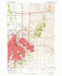
 1955 Sioux Falls1967 Print · USGSThe eastern South Dakota and western Minnesota borderlands come alive in the mid-fifties, showing the vital rail-to-river connections of the era. Genealogists can trace family footprints across townships like Madison and Pipestone, while following the paths of the Big Sioux River and the Chicago and North Western line.3 unique versions available
 - 1958 Map of Sioux Falls
 1958 Sioux Falls1958 Print · USGSThe tri-state borderlands of South Dakota, Minnesota, and Iowa are captured here during the mid-century peak of the regional rail network. Genealogists and historians can trace local landmarks like Augustana Academy, the St Marys Cem, and the path of the Illinois Central through Rock Rapids.
 - 1962 Map of Klondike, 1964 Print
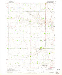
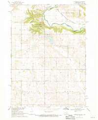
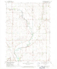
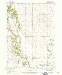
 1962 Klondike1964 Print · USGSThe Big Sioux River valley comes alive in the early sixties, showing the rural landscape where Iowa meets South Dakota. Trace family roots at Springdale Cem or locate old rail sidings in Granite and Klondike.
 - 1962 Map of Harrisburg, 1964 Print
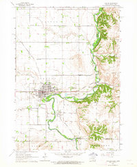
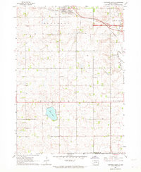
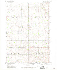
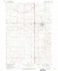
 1962 Harrisburg1964 Print · USGSHarrisburg and the surrounding Lincoln County townships are captured in the early 1960s, showing a prairie landscape still defined by rail lines and rural school districts. Researchers can find long-standing local landmarks like Pleasant View Cem, various country schoolhouses including Shindler Sch, and the recreation grounds at Lake Alvin.
 - 1962 Map of Canton, 1964 Print
 1962 Canton1964 Print · USGSThe South Dakota and Iowa border comes alive in the early sixties as the Big Sioux River winds past bustling prairie towns. Genealogists can locate several rural schools and cemeteries, including Augustana Academy, Beloit Cem, and York Sch.2 unique versions available
 - 1962 Map of Brandon, 1964 Print
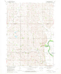
 1962 Brandon1964 Print · USGSThe South Dakota and Iowa borderlands come to life in this early sixties survey of the Big Sioux River valley. Genealogists and historians can trace the early layouts of Brandon and Rowena, or locate family sites at Beaver Valley Ch and local Quarries.2 unique versions available
 - 1962 Map of Sioux Falls East, 1964 Print
 1962 Sioux Falls East1964 Print · USGSMid-century Minnehaha County is captured during a period of significant growth as new interstates reach the city. Genealogists can trace family roots through numerous sites like Woodlawn Cemetery, Augustana College, and the State Prison Farm.3 unique versions available
 - 1962 Map of Tea, 1964 Print
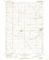
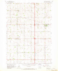
 1962 Tea1964 Print · USGSThe rural landscape of Lincoln County appears in the early sixties as a network of section roads and small-town commerce. Researchers can trace the heritage of local school districts at Dewey School and Rader School or follow the tracks of the Great Northern railroad.2 unique versions available
 - 1962 Map of Hartford South, 1964 Print
 1962 Hartford South1964 Print · USGSMinnehaha County in the early sixties shows a rural landscape on the cusp of change as the interstate highway system reaches the prairie. Researchers can trace dozens of family-named landmarks and country schools like Muchow Sch, Sunshine Sch, and Lakeview Sch.2 unique versions available
 - 1962 Map of Lennox NW, 1964 Print
 1962 Lennox NW1964 Print · USGSThe rural landscape of Turner County comes into focus in the early sixties, showing a region of dense family farms and township schools. Researchers can locate many local landmarks, from the Norwegian Cem and Chancellor Cem to the tracks of the Great Northern railroad.2 unique versions available
 - 1962 Map of Sioux Falls West, 1964 Print
 1962 Sioux Falls West1964 Print · USGSThe western edge of Sioux Falls was rapidly evolving in the early sixties as infrastructure expanded across the South Dakota prairie. Researchers can trace the development of suburban institutions like O'Gorman High Sch or locate rural landmarks such as Bethel Cem and Ellis.3 unique versions available
 - 1964 Map of Canton SW, 1965 Print
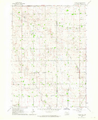
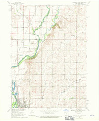
 1964 Canton SW1965 Print · USGSLincoln County townships such as Lynn and Dayton are shown here in the mid-1960s, still defined by a dense network of country schools and rail lines. Genealogists can locate family landmarks like Grand Valley Church, Forest Hill Cemetery, and Kerley School.
 - 1964 Map of Worthing, 1965 Print
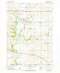
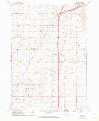
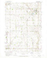
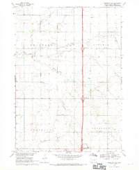
 1964 Worthing1965 Print · USGSLincoln County farmland is documented here in the mid-1960s as Interstate 29 began to reshape the local travel landscape. Genealogists and historians can locate numerous rural schools like Gedstad Sch and early landmarks including the Skie Air Service Landing Field.
 - 1964 Map of Lennox, 1966 Print
 1964 Lennox1966 Print · USGSThe rural prairie of Lincoln and Turner Counties comes alive in the 1960s, showing a well-established network of rail towns and country school districts. Researchers can trace family roots through sites like Delaware Ch, Lennox Cem, and several schoolhouses including Sunny Side Sch.
 - 1968 Map of Alcester NW, 1970 Print
 1968 Alcester NW1970 Print · USGSLincoln County farmland in the late sixties is defined by its dense network of rural schools and country churches. Genealogists can trace family footprints near the Tuntland Cem, Norway Center, and several local landmarks like Sundy Sch.2 unique versions available
 - 1968 Map of Alcester NE, 1970 Print
 1968 Alcester NE1970 Print · USGSThe Big Sioux River valley comes to life in the late sixties as it winds through Lincoln County. Genealogists can trace early rural life through family-named landmarks like Moe Sch, Bethany Cem, and the tracks of the Chicago Milwaukee St Paul and Pacific railroad.2 unique versions available
 - 1968 Map of Alcester, 1970 Print
 1968 Alcester1970 Print · USGSThe South Dakota prairie near the Union and Lincoln County line is captured here in the late sixties. Genealogists and local historians can trace the rural school system at Elmwood Sch and Silver Lake Sch or locate the Gothland Cem.
 - 1968 Map of Alcester SE, 1970 Print
 1968 Alcester SE1970 Print · USGSThe borderlands of Union County, South Dakota, are captured in the late sixties as the Big Sioux River snakes past the township of Alcester. Researchers can trace rural landmarks from the Nathanael Cem to the Chicago and North Western rail line.
 - 1968 Map of Beresford NW, 1971 Print
 1968 Beresford NW1971 Print · USGSSoutheast South Dakota's farm country comes alive in the late sixties, centered on the river valley and rail corridor near Centerville. Genealogists and historians can trace rural roots through landmarks like Mt Zion Cem, Ash Grove Sch, and the winding Vermillion River.
 - 1968 Map of Beresford, 1971 Print
 1968 Beresford1971 Print · USGSBeresford and the surrounding prairie townships are captured in the late sixties as modern highway interchanges began to reshape the rural landscape. Researchers can locate numerous country schools and cemeteries like Glenwood Sch, St Johns Cem, and Brooklyn Ch.
 - 1968 Map of Hawarden North, 1971 Print
 1968 Hawarden North1971 Print · USGSThe river valley at the Iowa-South Dakota border was a vital rail and agricultural corridor in the late sixties. Genealogists and local historians can trace the foundations of Hawarden and find specific landmarks like Calvary Cem and the old Townhall.
 - 1968 Map of Beresford NE, 1971 Print
 1968 Beresford NE1971 Print · USGSThe rural landscape of Lincoln County in the late sixties shows a traditional farming community at the dawn of the Interstate era. Researchers can trace the placement of local schoolhouses like Burney Sch and early burial sites including Skresfrud Cem.
 - 1968 Map of Fairview, 1971 Print
 1968 Fairview1971 Print · USGSThe Big Sioux River valley straddles the South Dakota and Iowa border in the late sixties, a landscape of river-bend farms and rail-line towns. Local historians can trace the Milwaukee Road tracks past Fairview and the Blanchard Sch.
Showing maps 1-25 of 123
Top cities of Lincoln County
Frequently asked questions
- What are the different types of historical maps available for Lincoln County?
- What is the oldest map of Lincoln County?
- Where can I purchase historical maps of Lincoln County for my home or office?
- Where can I download high-res historical maps of Lincoln County?
- Are there historical topographic maps available for Lincoln County?
- Is there historical aerial imagery available for Lincoln County?
- Where are historical maps of Lincoln County sourced from?