Old Maps of Scenic, South Dakota
Explore 7 old maps of Scenic, spanning from 1954 to today. These high-resolution historic maps reveal how streets, neighborhoods, landmarks, and natural features evolved over time — perfect for genealogy, metal detecting, research, and local history exploration.
What you can do with these maps:
- See how Scenic changed over time: Compare historical maps to modern-day views to trace roads, homesites, rail lines & more.
- View detailed metadata: Each map includes creators, publishers, year, scale, and archive source.
- Overlay maps with satellite & LiDAR: Visualize the past alongside modern tools to explore terrain & human change.
- Trusted historical sources: Maps sourced from the USGS, Library of Congress, and other archives.
- Access maps your way: View online, download high-res files, or order prints for personal or research use.
Start exploring old maps of Scenic to uncover forgotten places, hidden landmarks, and the deep history beneath your feet.
Scenic, SD maps
(7)- 1954 Map of Scenic, 1956 Print
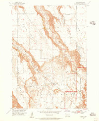 1954 Scenic1956 Print · USGSPennington County reveals its high tables and deep basins during the mid-fifties, just as the regional rail network still connected these isolated plains. Researchers can trace the Chicago Milwaukee St Paul and Pacific line to the settlement of Scenic or locate rural landmarks like Kube Sch and the Scenic Cem.4 unique versions available
 - 1955 Map of Hot Springs, 1958 Print
 1955 Hot Springs1958 Print · USGSThe Black Hills and South Dakota badlands are captured here in the mid-fifties, during a peak of military and industrial activity. Researchers can locate the Black Hills Ordnance Depot, early Uranium Mines, and historic rail stops like Pringle or Oglala.5 unique versions available
 - 1981 Map of Wall
 1981 Wall1981 Print · USGSWestern South Dakota in the early eighties reveals a landscape of high tables and deep draws where the prairie meets the Badlands. Researchers can trace the path of the Chicago and North Western rail line and locate rural outposts like Scenic, Conata, and Interior.
 - 2012 Map of Scenic, 2012 Print
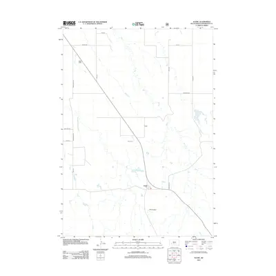 2012 Scenic2012 Print · USGSCovers Scenic, including Pennington County, United States, and other nearby areas
 - 2015 Map of Scenic, 2015 Print
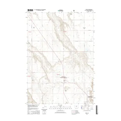 2015 Scenic2015 Print · USGSCovers Scenic, including Pennington County, United States, and other nearby areas
 - 2017 Map of Scenic, 2017 Print
 2017 Scenic2017 Print · USGSCovers Scenic, including Pennington County, United States, and other nearby areas
 - 2021 Map of Scenic, 2021 Print
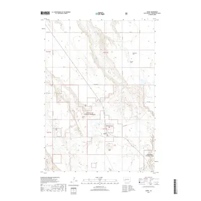
 2021 Scenic2021 Print · USGSPennington County's high plains and eroded breaks are captured here in the early 2020s. Researchers can trace local landmarks like Scenic Cem and the distinct geography of Kube Table and Scenic Basin.
End of results
Showing maps 1-7 of 7
Top cities near Scenic
Frequently asked questions
- What are the different types of historical maps available for Scenic?
- What is the oldest map of Scenic?
- Where can I purchase historical maps of Scenic for my home or office?
- Where can I download high-res historical maps of Scenic?
- Are there historical topographic maps available for Scenic?
- Is there historical aerial imagery available for Scenic?
- Where are historical maps of Scenic sourced from?