Old Maps of Burlington, Vermont
Explore 27 old maps of Burlington, spanning from 1894 to today. These high-resolution historic maps reveal how streets, neighborhoods, landmarks, and natural features evolved over time — perfect for genealogy, metal detecting, research, and local history exploration.
What you can do with these maps:
- See how Burlington changed over time: Compare historical maps to modern-day views to trace roads, homesites, rail lines & more.
- View detailed metadata: Each map includes creators, publishers, year, scale, and archive source.
- Overlay maps with satellite & LiDAR: Visualize the past alongside modern tools to explore terrain & human change.
- Trusted historical sources: Maps sourced from the USGS, Library of Congress, and other archives.
- Access maps your way: View online, download high-res files, or order prints for personal or research use.
Start exploring old maps of Burlington to uncover forgotten places, hidden landmarks, and the deep history beneath your feet.
Burlington, VT maps
(27)- 1894 Map of Plattsburg
 1894 Plattsburg1894 Print · USGSCovers Burlington, including South Burlington, Plattsburgh, and other nearby areas3 unique versions available
 - 1895 Map of Willsboro
 1895 Willsboro1895 Print · USGSCovers Burlington, including South Burlington, Shelburne, and other nearby areas7 unique versions available
 - 1906 Map of Plattsburg
 1906 Plattsburg1906 Print · USGSCovers Burlington, including South Burlington, Plattsburgh, and other nearby areas6 unique versions available
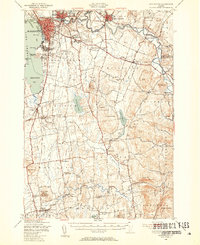
 - 1906 Map of Burlington
 1906 Burlington1906 Print · USGSCovers Burlington, including South Burlington, Colchester, and other nearby areas7 unique versions available
 - 1913 Map of Milton
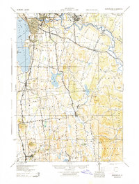
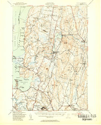
 1913 Milton1913 Print · USGSCovers Burlington, including South Burlington, Colchester, and other nearby areas
 - 1915 Map of Milton
 1915 Milton1915 Print · USGSCovers Burlington, including South Burlington, Colchester, and other nearby areas5 unique versions available
 - 1919 Map of Burlington
 1919 Burlington1919 Print · USGSCovers Burlington, including South Burlington, Colchester, and other nearby areas
 - 1939 Map of Plattsburg
 1939 Plattsburg1939 Print · USGSCovers Burlington, including South Burlington, Plattsburgh, and other nearby areas
 - 1941 Map of Plattsburg
 1941 Plattsburg1941 Print · USGSCovers Burlington, including South Burlington, Plattsburgh, and other nearby areas
 - 1941 Map of Willsboro
 1941 Willsboro1941 Print · USGSCovers Burlington, including South Burlington, Shelburne, and other nearby areas2 unique versions available
 - 1943 Map of Willsboro
 1943 Willsboro1943 Print · USGSCovers Burlington, including South Burlington, Shelburne, and other nearby areas3 unique versions available
 - 1943 Map of Plattsburg
 1943 Plattsburg1943 Print · USGSCovers Burlington, including South Burlington, Plattsburgh, and other nearby areas4 unique versions available
 - 1944 Map of Milton
 1944 Milton1944 Print · USGSCovers Burlington, including South Burlington, Colchester, and other nearby areas
 - 1944 Map of Burlington
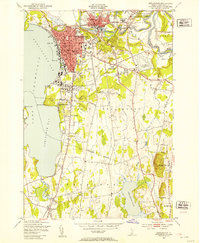
 1944 Burlington1944 Print · USGSCovers Burlington, including South Burlington, Colchester, and other nearby areas2 unique versions available
 - 1948 Map of Burlington, 1953 Print
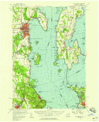
 1948 Burlington1953 Print · USGSCovers Burlington, including South Burlington, Colchester, and other nearby areas5 unique versions available
 - 1948 Map of Fort Ethan Allen, 1953 Print
 1948 Fort Ethan Allen1953 Print · USGSCovers Burlington, including South Burlington, Colchester, and other nearby areas4 unique versions available
 - 1948 Map of Burlington, 1954 Print
 1948 Burlington1954 Print · USGSCovers Burlington, including South Burlington, Colchester, and other nearby areas4 unique versions available
 - 1948 Map of Milton, 1954 Print
 1948 Milton1954 Print · USGSCovers Burlington, including South Burlington, Colchester, and other nearby areas4 unique versions available
 - 1950 Map of Lake Champlain
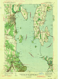
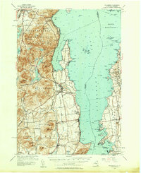
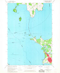
 1950 Lake Champlain1950 Print · USGSCovers Burlington, including South Burlington, Plattsburgh, and other nearby areas2 unique versions available
 - 1956 Map of Plattsburgh
 1956 Plattsburgh1956 Print · USGSCovers Burlington, including South Burlington, Plattsburgh, and other nearby areas3 unique versions available
 - 1956 Map of Willsboro, 1958 Print
 1956 Willsboro1958 Print · USGSCovers Burlington, including South Burlington, Shelburne, and other nearby areas4 unique versions available
 - 1958 Map of Lake Champlain
 1958 Lake Champlain1958 Print · USGSCovers Burlington, including South Burlington, Plattsburgh, and other nearby areas2 unique versions available
 - 1962 Map of Lake Champlain, 1975 Print
 1962 Lake Champlain1975 Print · USGSCovers Burlington, including South Burlington, Plattsburgh, and other nearby areas3 unique versions available
 - 1966 Map of Colchester Point, 1968 Print
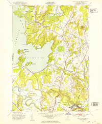
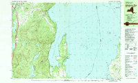
 1966 Colchester Point1968 Print · USGSCovers Burlington, including South Burlington, Colchester, and other nearby areas3 unique versions available
 - 1980 Map of Willsboro Bay, 1981 Print
 1980 Willsboro Bay1981 Print · USGSCovers Burlington, including South Burlington, Shelburne, and other nearby areas2 unique versions available
Showing maps 1-25 of 27
Top cities near Burlington
- South Burlington historical maps
- Plattsburgh historical maps
- Colchester historical maps
- Plattsburgh historical maps
- Essex historical maps
- Essex Junction historical maps
See more
Top neighborhoods of Burlington
- New North End historical maps
- Old North End historical maps
- South End historical maps
- Downtown historical maps
- Lakewood historical maps
- Van Patten historical maps
See more
Frequently asked questions
- What are the different types of historical maps available for Burlington?
- What is the oldest map of Burlington?
- Where can I purchase historical maps of Burlington for my home or office?
- Where can I download high-res historical maps of Burlington?
- Are there historical topographic maps available for Burlington?
- Is there historical aerial imagery available for Burlington?
- Where are historical maps of Burlington sourced from?